Benchmark Bagging - Peaks with Historic Survey Markers

vftt.org

Help Support vftt.org:

This site may earn a commission from merchant affiliate links, including eBay, Amazon, and others.

Papa Bear

New member
Joined
Sep 3, 2003
Messages
1,922
Reaction score
176
Location
New York City
Benchmark Bagging - Peaks with Historic Survey Markers

A few years ago when I finished several of the popular peak lists, I thought "Well, what next". I quickly decided that the more comprehensive lists, like the New England 3000s or the Northeast 3000s (the 458 and the 770) were out, due to my finite life time :) and other lists, like the Trailwrigjhts, Peaks with a Trail, Peaks with a View etc. didn't inspire me. I settled on "Benchmarks and Boundaries". That is to say,. find the peaks with survey markers and then actually find those markers when you bag the peak, or do the same for boundary monuments (which are often also Survey Markers). A lot of my hiking along the US Canadian border in Vermont, New Hampshire and Maine in the last 3 or 4 years has been in pursuit of these goals.

Starting last year I've concentrated on not just survey markers, but historic survey markers, loosely defined as those set in the 19th century, particularly in historically important surveys, such as the US Coast Survey's work from about 1830 - 1898 (from Calais Maine to New Orleans - most of the work on this survey for our area was done between about 1845 - 1860), or the Trigonometrical Survey of Massachusetts done in 1831 - 1836, (aka the "Borden Survey" the first survey of an entire state - and done by the Commonwealth, not the US Coast Survey).

In the last couple of months I've searched for a number of these peaks/markers in Massachusetts, New Hampshire and Maine, Some trips were with Roy, whose company and help I much enjoyed and appreciated, and some were solo. Here is the overall picture - details to follow. Dates indicate when a marker was set; two dates indicate two different markers were set. Where "everyone knows" where a peak is (like Monadnock) I've omitted the location.

June 16th:
Holt Hill (Andover, MA) 1833
Powow Hill (Amesbury, MA) 1834, 1849
Railcut Hill (Gloucester, MA) 1834
Various MA/NH State Line Monuments 1886
Salisbury Marsh Monument 1834

June 17th
Uncanoonuc (South Peak) 1848, 1959
Belknap Mt. 1860
Prospect Mt. (Waltham, MA) 1833

July 17th
Monadnock 1834, 1860
Mt. Watatick 1833, 1897
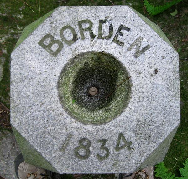
Borden Boundary Monument 1834

July 18th
Mt. Agamenticus 1847
Ossipee Hill (Waterboro, ME) 1858
Mt. Pleasant (Denmark, ME) 1847?, 1851?

A few notes:
1) Most of these stations are described in an on-line database maintained by NOAA. The 6 character ID in the Google Map link is for this database.
2) The original marks were usually a copper bolt, or just a hole in the rock. Later (in the 1930s - 1950s) some of these old marks were replaced with disks.
3) Most of these are also fire tower peaks (or one-time fire tower peaks)
4) The marks were often not on the highest point. Sight lines to other stations were more important.
5) There are some good sources of information on the net, but with some significant and frustrating gaps. Here are some of them (all but the first are fairly large):


NGS DATASHEET RETRIEVAL PAGE
CGS Special Publication No. 7 "Eastern Oblique Arc" (1902)
CGS Special Publication No. 46 "Triangulation in Maine" (1918)
CGS Special Publication No. 76 "Triangulation in Massachusetts" (1922)
Borden Survey of Massachusetts Map (1841) (on my web site)


Lastly, for each survey marker (or "Station" and they are often called), I have put in a link to a interactive Google Map that I have put together for that station. Use the map type selector in the upper right of the map to select Topo, Satellite, etc. and click the button under the title labeled "Show RMs" (if present) and all the reference marks around the station will be shown.
 
Last edited:
June 16: Holt Hill, Powow Hill, Railcut Hill

Holt Hill (Andover, MA) 1833

Holt Hill is in a lovely park known as Ward Reservation run by the Trustees of Reservations. Follow the direction on the web page and park at the end of Prospect Road. It's a short hike (5 - 10 minutes) to the top of Holt Hill.

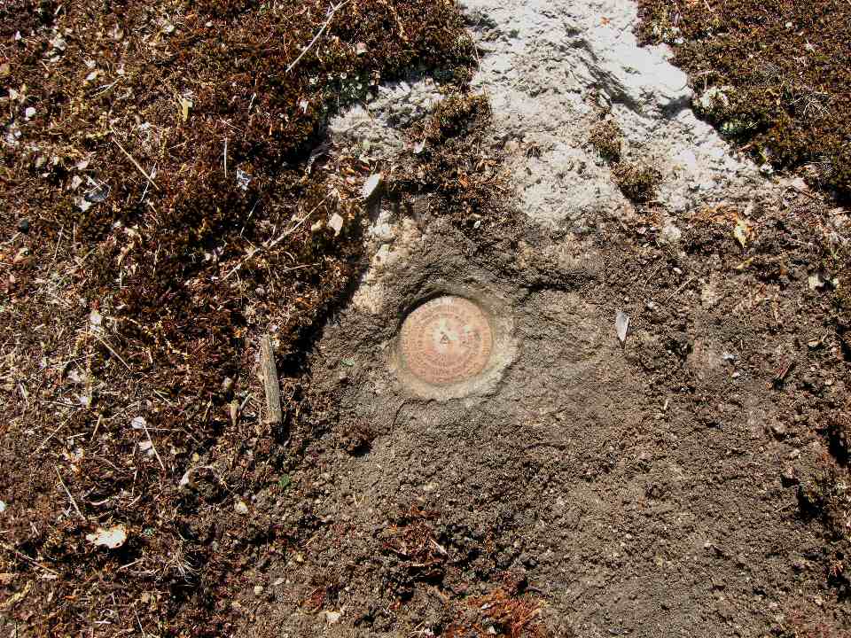
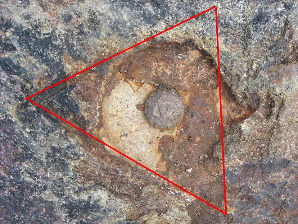
There is an interesting formation called the Solstice Stones (built in the 1940s) in the grass near the top of the hill. The survey marker is about midway between the stones and the fire tower. It's an 1833 copper bolt on an exposed piece of bedrock with a triangle chiseled around it. There are also 3 Reference disks set in 1934. Remember - the copper bolt is 101 years older than the disks!.

There was Trustees of Reservations ranger there when I arrived. He told me a bit about the area and I told him a bit about the survey markers. A delightful and productive visit.


Station MY2568 HOLT Google Map


My log on Geocaching.com


Powow Hill (Amesbury, MA) 1834, 1849

After leaving Andover, I drove further up I-495 to Amesbury. This is (I think) the most northerly town in Massachusetts. Oops! I just checked the map. The northernmost town in Massachusetts is Salisbury, the next town over. I soon gave up with the Google directions and just looked out the window and saw the hill with numerous ugly towers off to the west. So I just drove up various streets that led up in that directions, hit a few dead ends and finally got to the end of Powow Street where there was some parking for a radio tower maintenance building.

This seemed good to me so I went in and found myself in a small city owned park at the top of Powow Hill. It was rainy and hot and humid. The two stations were both on the southwest side of the park near a gate which was really just a gap in the fence. One mark (the 1834) is a copper bolt set in a boulder a "few inches" underground and the other (the 1849) is a disk, set in 1979 on a concrete post about 8 inches below the ground. The original 1849 mark was a bottle buried 2 1/2 feet below the ground. The current disk is the third marker for this station. The second was set in 1936 after the buried bottle was located. The 1936 disk was later found destroyed and was replaced in 1979 by the current disk. This type of station, where the marker is replaced by a new one, is called a "Reset". In such cases the exact location of the station is preserved.

There were also 3 disks set as reference marks, but I couldn't find any of them. I guessed the station marks were under a huge growth of vines and posion ivy (this later was found to be wrong) and I soon gave up, having a long agenda still ahead of me for the day. I returned on July 16th, and found two reference points, but was still unsuccessful in locating either station. I made a plan with my son that we would go there Thanksgiving weekend with several "real" shovels (I carried just a garden trowel) and have a third try at it.


Station MY5357 Powow Reset Google Map


Various MA/NH State Line Monuments 1886

I moved these monuments in the next note, so if you just do peaks and not monuments, you can skip that note. But please don't go away entirely, There are more peaks in the notes after that one. :)


Railcut Hill (Gloucester, MA) 1834

After "bagging" the last state line monument at the Salisbury Marsh. I got back on I-95, drove down to where Route 128 splits off towards Gloucester and followed 128. I got off at the Dory Traffic Circle and went into the Blackburn Industrial Park. I wove my way in and around to Heritage Way and parked in the last lot. You should see a big water tank sitting up on the hill next to the lot. Scramble up the hill, make your way about 100 yards along the ridge to the highest point and you'll find this point. There used to be a summer house on this hill known as the Babson Cottage. It is entirely gone now but for a cellar hole. Next to the hole where the Babson's front walk used to be is a large boulder with a copper bolt on it set there in 1834.

This bolt seems to have some magic preservation power. The station was undisturbed for about 90 years until the Babson's showed up in the 1920s. They built their "cottage" 6 feet from the boulder, but they left it undisturbed and integrated it into their front walkway due to it's value to science! Who, building a summer house overlooking a beautiful bay, would do that today!

By the 1960s, the house was in ruins and the land reverted to the town of Gloucester. The house slowly disappeared but the mark persevered 130, 140, 150, 160, 170 years and in 2008 I showed up and the mark is still sitting there, happy as can be, while all around it the town of Gloucester has turned the land into an industrial park with buildings, roads and parking lots here, there and everywhere - but not on that little spot behind the water tank. It somehow escaped the fate of the rest of the land.

Click on the next link which brings up a satellite map, and tell me that the continued existence of this mark is not a miracle. And tell me, how many of you have climbed Railcut Hill in Gloucester? Better go there quickly - it may not be there tomorrow!

Station MY4950 Railcut Google Map


My log on Geocaching.com

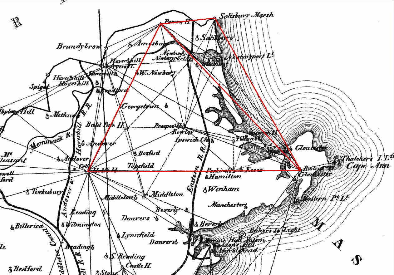
As a final illustration, here is a portion of Borden's 1841 map from the "Trigonometrical Survey of Massachusetts". I have outlined the links between the 4 stations searched for today. It shows clearly how important they were in the Essex County portion of the survey. If only the Salisbury Marsh Monument were not at sea level, I'm sure they would have surveyed a line from that monument to Holt.

To see the full size image, click on the thumbnail

 
Last edited:
June 16 - Various State Line Monuments

Various MA/NH State Line Monuments 1886

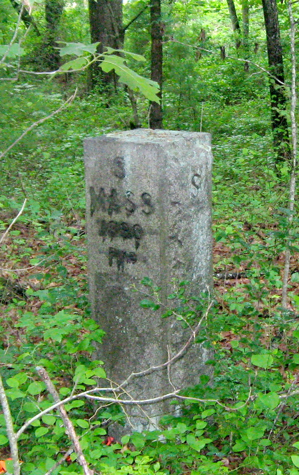
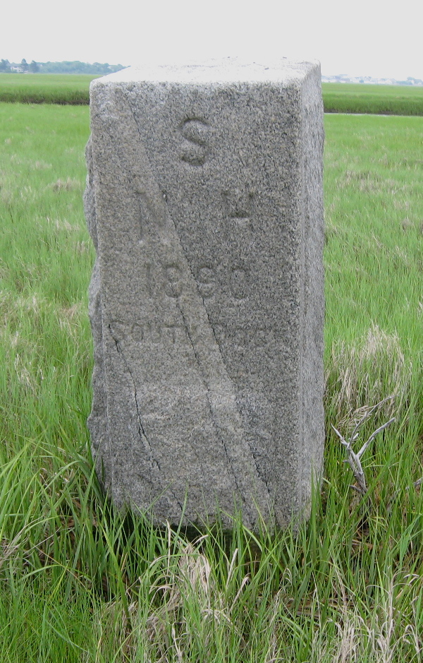
The next project was to make my way over to Salisbury Beach and try to find as many of the state boundary markers as I could along the way. The one at the end was a special one. Mostly by following my GPS over unmarked roads I managed to find 5 of them They were surveyed in 1896 and set in 1900 and each bears the name of some street, feature or perhaps the owner of the land. They are given on USGS topo maps, but with numbers rather than names. Here are the ones I found:


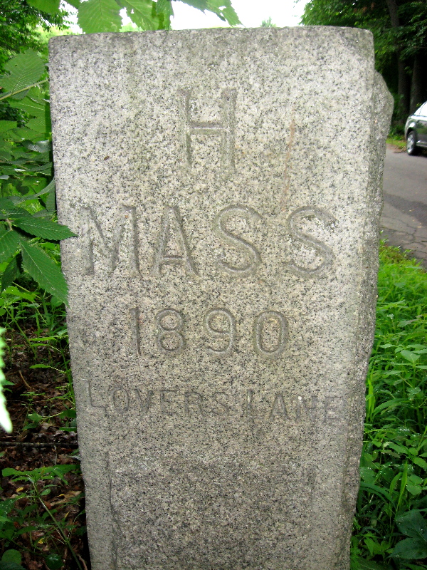
MY2517 Lovers Lane Monument (No. 137) Google Map
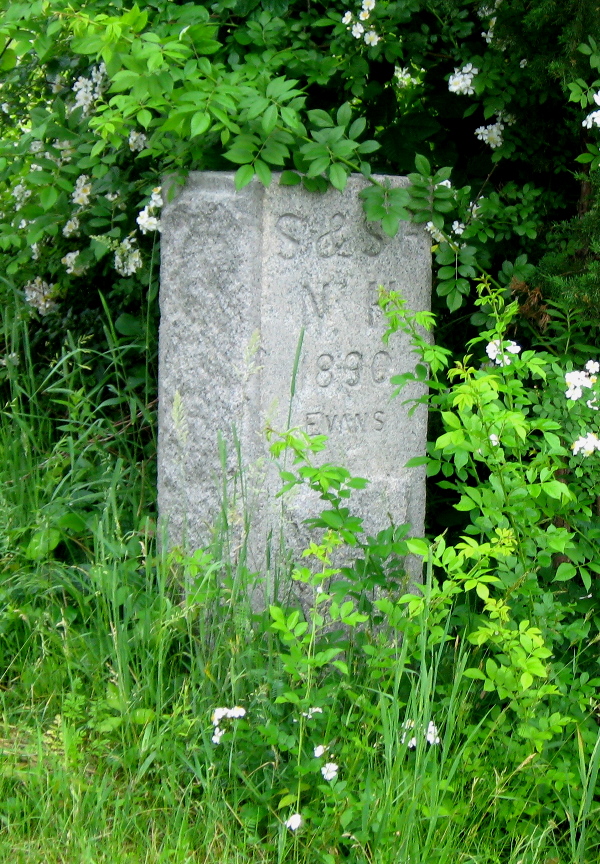
MY5381 Evans Monument (No 158) Google Map
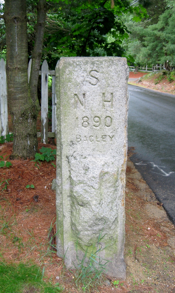
MY5375 Bagley Monument (No. 159) Google Map

For you extremity baggers - take note: Bagley Monument has the distinction of being the northernmost point in Massachusetts. On the topo map it might look like the line between the Evans and Bagley Monument is due east-west, but it actully rises slightly to the north so that Bagley's longitude is .4 seconds greater than Evans'.


MY5221 Pike Monument (No. 165) Google Map
MY5217 South Dock Monument (No. 167) Google Map

South Dock Monument was way out in the marsh. Luckily it was low tide, so I managed to keep my feet dry.


Salisbury Marsh Monument (MA/NH line) 1834

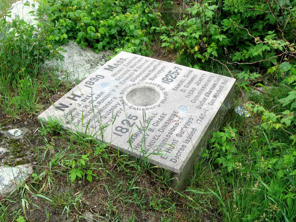
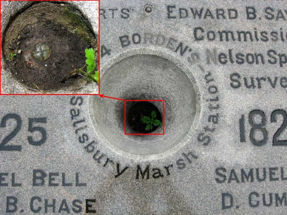
The last boundary monument was at the edge of the marsh just befor the last bridge over to the beach. (There's another one shown on the topo map at the beach, but there's no sign of that). This one is special. It pre-dates the others by over 50 years. It was set as part of the Borden Survey of Massachusettys in 1834. It's a copper bolt set in the one rock outcrop that sticks out of the marsh and that just happened to be on the state line. At the moment it's just past a house (I knocked on the door and got permission to prowl around).

In 1890, aparantly the NH / MA boundary commision wanted to preserve their names in stone, so they laid a huge granite stone (or maybe it's marble) over the copper bolt with all their names on it, and with a little hole in the middle so you could see the copper bolt. 1890 is when the other regular monuments were erected, so this stone was probably put in place as part of that project.

This station now has the distinction of being a "Federal Base Network Control Station", which is the highest level of accuracy for a station. The uncertainties in latitude and longitude are both about 1/2 a centimeter. Amazing! Simeon Border would have been very proud. This is the only 1830s mark in existence that I know of that has such a high degree of accuracy (I know of several others that are first order stations). Quite a mark.

So ... the guy who does the work sets a 3/4 inch copper bolt. The guys that don't do the work get a huge stone with their names on it. Things have not changed much in many years, have they?


MY5214 Salisbury Marsh Monument (No. 168) Google Map


My Log on Geocaching.com
 
Last edited:
June 17th - Oncanoonuc, Belknap & Prospect (Waltham)

Uncanoonuc Mountain, South Peak

On Tuesday morning the 17th I met up with Roy outside of Manchester and he hopped in my car and we were off to Uncanoonuc. The south peak is where all the radio towers are and it's where the survey markers are located. The north peak is, I believe, slightly higher but we weren't peak bagging today, we were chasing benchmarks so the south peak it was. And with that fact in mind, we had no qualms about driving straight to the top, there being a perfectly good road, so that's what we did.

There must be about 10 radio towers on this peak and Roy had scouted out the area a week or two back and determined that the survey markers were in a fenced off area around a particular tower at what seemed to be the highest area of this flat summit. I had emailed the company (whose name I found from the FCC listings) about access, but they didn't reply so we assumed it was OK to go in :).

We could see a reference marker through the fence, and an opening at one end, so we went in, made some measurements and soon we had found the reference mark and the station disk for the 1959 station. There was supposed to be a second reference mark but we determined it was under a small building on the site (or it may have been destroyed when the building was put there). This second RM is interesting in that it was set by the USGS (a separate government agency) in 1925, almost 35 years before the station! What happened, is that when they established the station in 1959, they simply used this pre-existing nearby disk for a reference and saved the time of putting in another disk.

Note the old spelling of the mountain used for the station name. And the "2" after the station name means this was the second station established on this peak, the first being the 1848 station we would also search for.

MY3799 Unkonoonuc 2 Google Map

If you click on "Show RMs" you will see the locations of the reference marks plus the 1848 station. Unfortunately the satellite imagery dissapears at that zoom level.


My log on Geocaching.com

Now the hard part.

I had calculated the distances and directions of the 1848 station from the 1959 station and it's reference marks. Unfortunately these calculations can be off by inches or more since there is uncertainty in the locations to begin with, which is compounded by the fact that the two marks were surveyed over 100 years apart. The one solid measurement, which was made in 1933, the last time the 1848 station was found, was from the disk that was now under the building. But the computed distance from that disk was within a couple of inches of the 1933 measurements, so this check of the computations (although we could not verify it on the ground) was reassuring. Basically it meant that the the process used to make the computations was sound.

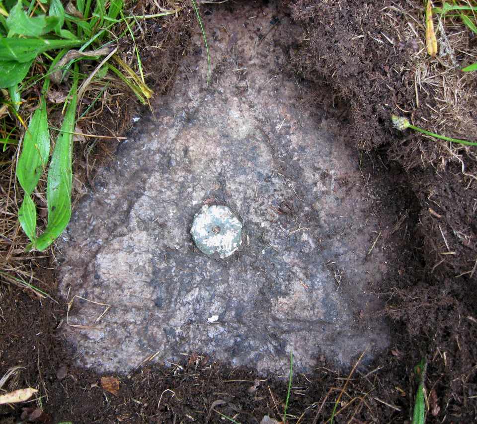
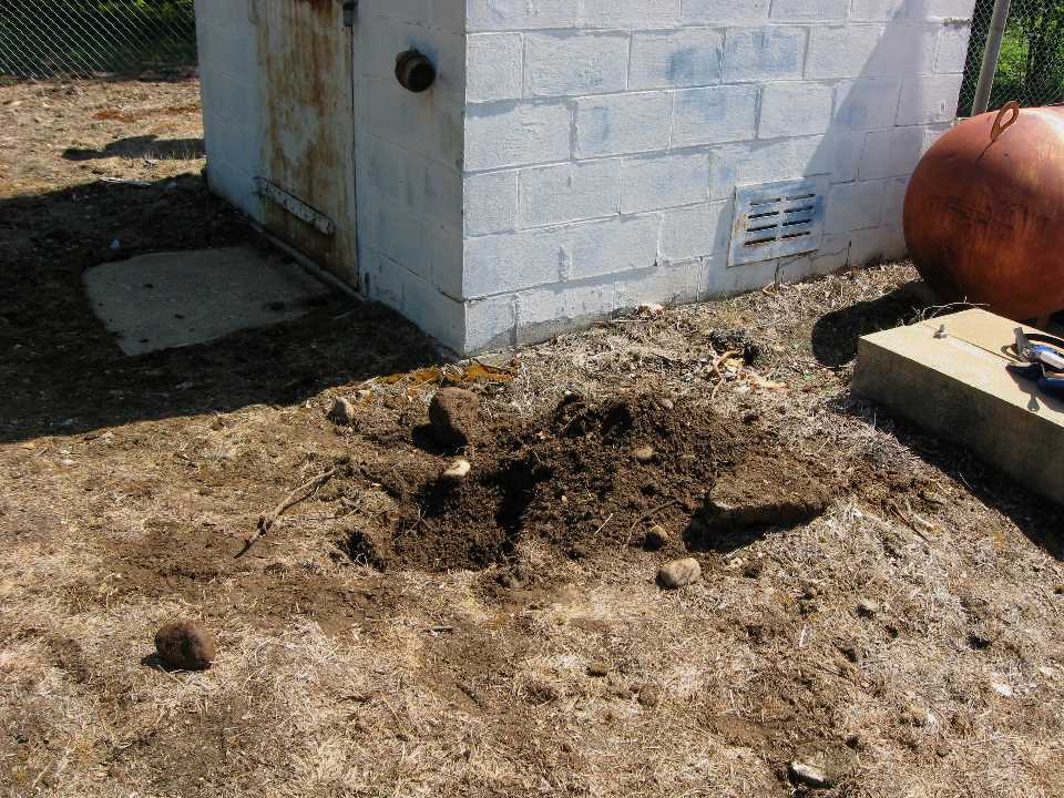
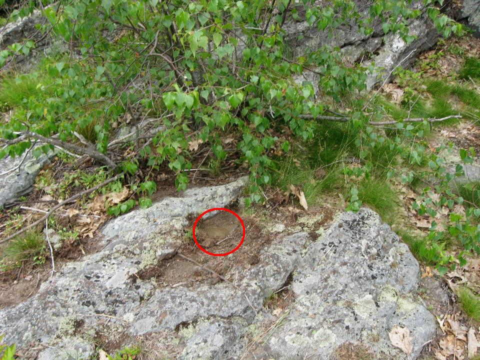
So we measured and dug. We had two points to measure from, so we could "triangulate" with two measuring tapes. We hit bedrock about 8 -10 inches down and expanded the hole to about a foot in diameter but found nothing. Perhaps someone else could go back and dig a bigger hoke, but I would say we gave it an honest try. Either the mark is off from the measurements by more than about 6 inches, or the ledge has eroded and the mark is gone. Sigh!

Here's our hole, also showing the building:


We also determined that the old fire tower is gone, a fact known to anyone who has gone there in the last 30 years or so.

Belknap Mountain

For this one we actually sucked it up and climbed the mountain :). Actually we were quite lucky - we had Belknap Mountain to ourselves. Last time I was here there were hoards of tourists.

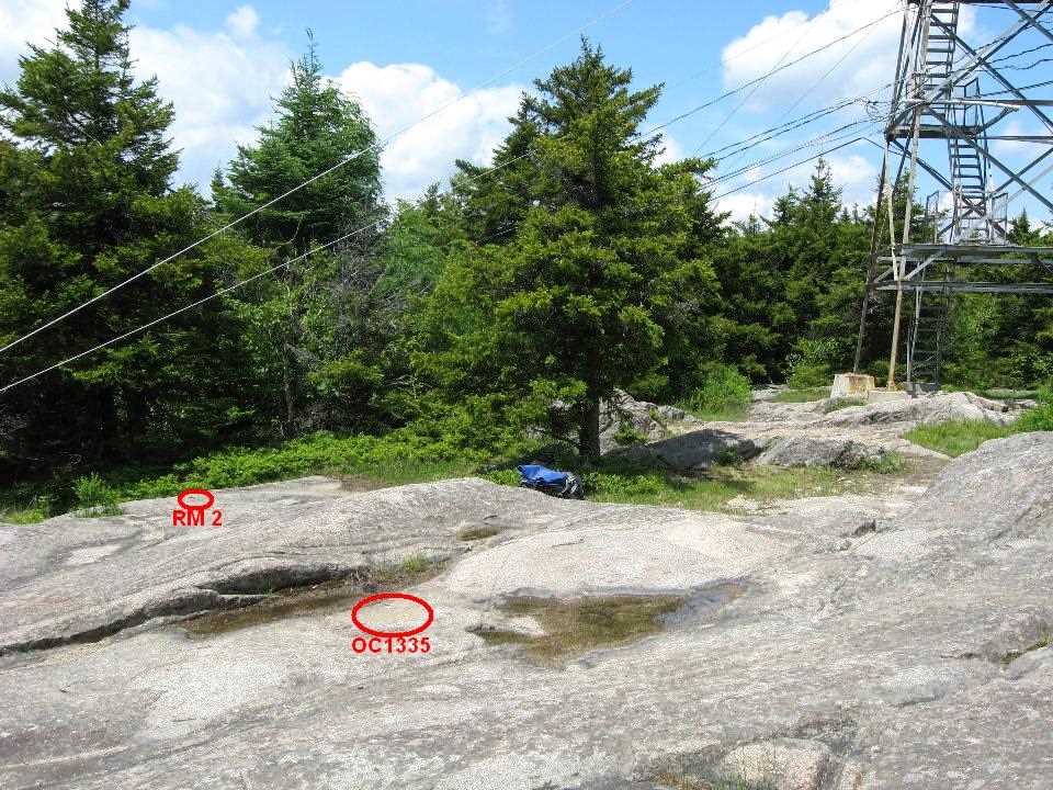
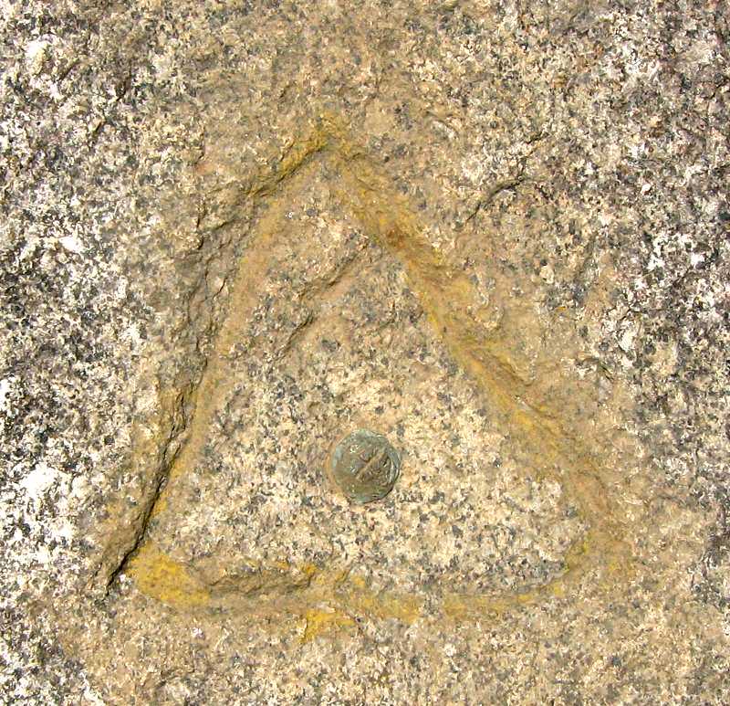
The name of the station on Belknap is "Gunstock". I know, I know, how could they? Actually the station was set in 1860 and I can only assume the names then were not what they are today. In any case, this is a genuine copper bolt in fine condition. And just about no one who climbs the peak notices it. There are several disks on the summit set in the 1950s and the average hiker will probably spot one of these and assume he/she has found "the benchmark". No, sorry. These are reference marks and the actual station marking the summit can be found using them (that's how we found it) but they are not "the benchmark". Anyway, wouldn't you rather find an 1860 bolt than a 1958 disk? There is also an unrelated disk under the tower

Interestingly, the NGS has now surveyed the station using high precision GPS, so the accuracy of the location is now know to a couple of centimeters. Not bad for a 148 year old copper bolt!

OC1335 Gunstock Google Map


My log on Geocaching.com


After recovering the mark, Roy showed me the old plane wreck down on the north slope of the mountain. Check it out, I never knew it was there before.

Mt. Prospect (Waltham) 1833

On the way home I decided to get off I-95 at rush hour and make a stop in Waltham, a couple of exits before mine.

This is a small hill in a city park with a couple of old water tanks and a peculiar looking radio tower at the top. But it also has is one of the few 1833 first order stations still in existence (luck would have it that I found 2 more of these rarities, Holt and Salisbury Marsh, yesterday). Thanks to the town of Waltham, it may last many more years. A 20 minute hike to the top brought me to the mark - an 1833 copper bolt in a triangle and it was quite a joy to find this gem in such a well developed part of Middlesex County.

MY3638 Prospect Waltham Google Map


Mt log on Geocaching.com
 
Last edited:
July 17th - Monadnock

Monadnock 1860, 1834

As the most-climbed mountain in the world (or is it the second most?) I need hardly describe how to get there or which trail to take. But I will say I got to the summit first (about 8 AM on a Thursday) and for about a half hour had the summit to myself. The "benchmark" is also well recognized and often found so that was no big deal. So to be "different" ("better", dare I say), I decided to try and find each and every reference mark or surrounding point ever put there. There are 10 documented in the past NGS logs. And find them all I did! Had a beautiful clear day to do it too. The following maps and photos tell the story.

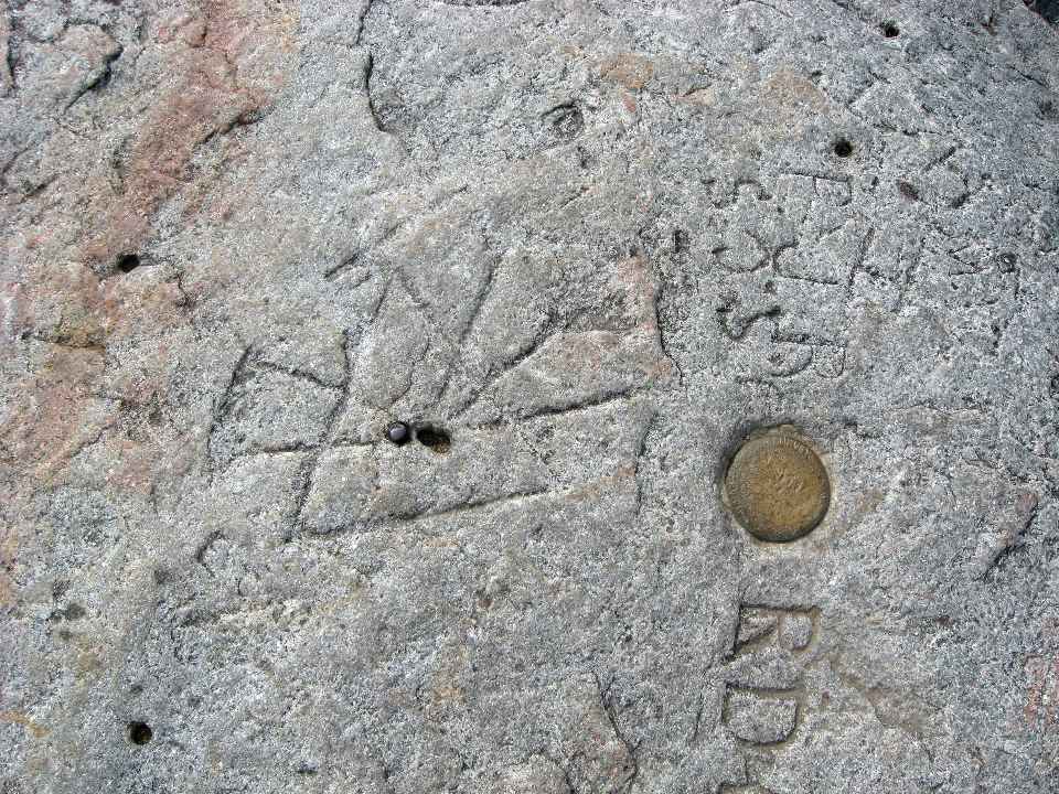
MZ1473 Monadnock Google Map

This station map presents a special problem.: there are so many RMs and they are so close together it's hard to see them even at the highest zoom. So I've made a special map type "Blank" for this problem - set the map type to "Blank" using the selector in the upper right. Then click on "Show RMs" and zoom it in until the RMs are all clear. There's no background imagery, but you have a nice diagram of all the marks and it's to scale. It's what I used to find them all and sort them all out

The main act:
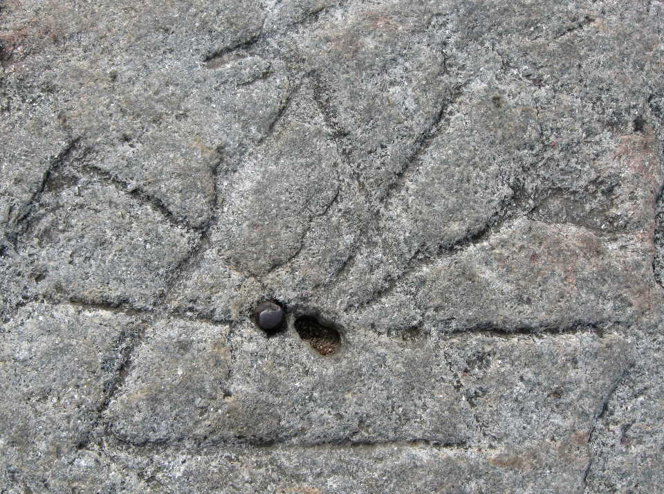
A drill hole in a triangle with 5 radiating lines and another hole and an iron bolt to either side. First showing the nearby USGS disk, and then just the station mark -


Next, the supporting cast - The 1860 drill holes RM1, RM2, RM3, RM4, & RM5 (with arrows)


And Finally: - the 3 disk RMs (RM6, RM7 & RM8), the 1834 Borden Drill Hole and the USGS Disk


The 1834 Borden Drill Hole is curved at the bottom This actually pre-dates the station by 26 years. And notice the typos on RM7 (2nd from left) - I bet they didn't re-hire that summer intern. The USGS disk is actually aa separate station (MZ1474) set in 1957 for map control.

My log on Geocaching.com


This station, like Gunstock, is now a precision GPS station, with the location known to an accuracy of a little over 1 cm.

And now it was down to the car and an easy drive down to Mount Watatick, the second goal of the day.
 
Last edited:
July 17th - Watatick

Mt. Watatick (1897, 1833) and the Borden State Line Mounment
(1834)


It was an easy drive down from Monadnock on Route 124 into Jaffrey and the US 202 and Route 119 into Massachusetts. Parking is on the left about 2 mioles past the state line. The trail follows a dirt road up the hill and the the Wapack Trail (yellow triangles) branches to the right and rises steeply to the summit, a bit over a mile from the parking lot. There you will find not one but two sets of concrete footings for long-gone fire tower. The station is called "Watatick 2 Reset". the "2" because it was the second station on the peak, and the "Reset" because the original mark was replaced by a disk in 1937. It was found near the highest point, next to a large cairn and marked by a damaged disk. Only the center triangle and dot remains, but that's enough for a surveyor, since the triangle with the dot defines the exact station point. A remnant of the chiseled triangle which enclosed the original copper bolt is visible. RM4 and RM5 were also found.

But what about the first station on the peak? That was another copper bolt set by Borden in 1833. The original information for Watatick 2 specifies it was "about 7 feet northwest" of Watatick 2. Calculating the location based on the positions of Watatick and Watatick 2 gave a distance of 2.236 m (7' 4") at an azimuth of 342 degrees true. So 7 feet northwest is close enough for me.

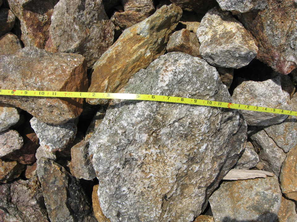
I measured it off and Oops! The old mark was under the side of the big cairn. So I started moving rocks and digging but soon gave up. Too many rocks, and if I was not careful the whole thing might come tumbling down on me. But definitely a future project.

MY6361 Watatick 2 Reset Google Map

The remnant of the chiselled is outlined:


And here's where the measurements puts the old station:


My log on
Geocaching.com


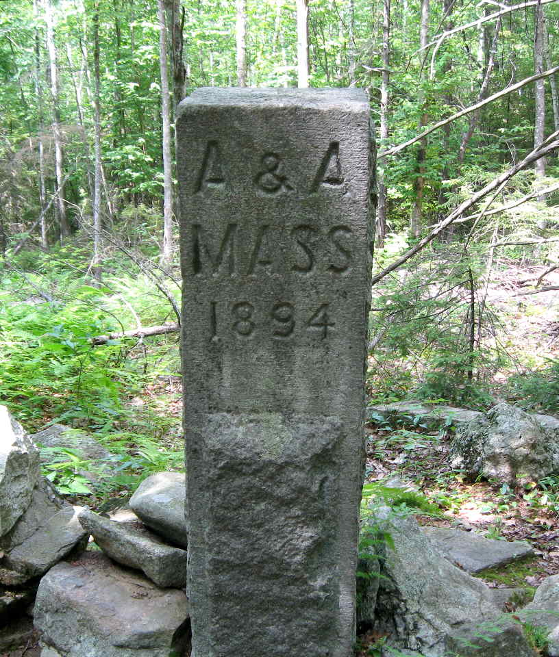
But wait, there's more. When Simeon Borden got through here he "hiked up" :) to the state line, did his surveyor stuff and erected a monument. This was the initial survey of the NH / MA state line, which wasn't completed until the 1890s.

So in his footsteps, so-to-speak, I continued on the Wapack Trail north along the gentle ridge for about a mile to the state line (marked by a stone wall). A few hundred yards up to the left stands the Borden 1834 monument and close beyond that, another monument marking the point where the line between towns of Ashburnham and Ashby (and incidentally the county line between Worcester and Middlesex) meet the state line.


Then it was back to the car home after another very productive day.
 
Last edited:
July 18th - Mt. Agamenticus, Ossipee Hill, Mt. Pleasant

Mt. Agamenticus 1847

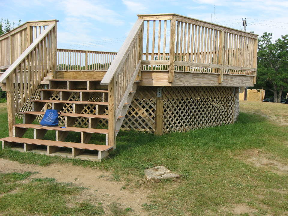
I met Roy at the Portsmouth NH Park and Ride and were were at Agamenticus inside of an hour. We expected two problems here: 1) the mark may be inaccessible - under the new observation platform built over the footings of the WWII Radar tower and 2) even if it was not under the pavilion, the station and both RMs were said to be 12 - 14" underground, and that's a lot of digging for my trusty garden trowel. (Note to self: next time bring a real shovel!)

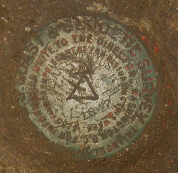
Once organized we saw that on problem #1, we were lucky: the old footing came practically to the edge of the platform (you could see it from the side of the pavilion), so the mark, which was almost 8 feet from the footing, would be clearly outside. Next we made a couple of measurements from the front door and from the corner of the ski lodge. We ended up near a curious looking split field stone, about 2' x 2', and about 4" thick. So we said to one another "What if ...". I got the jack handle from the car and we got the thing up and off, piece by piece, from where it was. What was there? Why a hole in the ground with a length of 6" PVC pipe going down. "No, it can't be ...". YES IT WAS! After digging out the dirt, a rusted can and a railroad spike, there was our disk sitting pretty about a foot under the surface. Someone had saved us one h*ll of a lot of work. We took the requisite photos, and put it all back together.

The RMs were a different story - no stone covers, nothing but hard packed soil. So I put my little garden trowel away and we said, "Who needs Reference marks when the station is sitting pretty in plain sight".

OC2305 Agamenticus Reset Google Map


My Log on Geocaching.com


Ossipee Hill 1858

Ater we we left Mount Agamenticus, we headed up to Ossipee Hill. We walked up the gated fire wardens road to a point near the Fire tower. Here we bushwhacked the short distance over to the northern peak where the mark was located.

This station has an interesting history, and you should read the old logs. It shows the advantage we have over past generations of searchers. In 1935 the crew briefly considered that the mark was on the wrong peak. With computerized databases we can now see the original description was clear that the station was not on that other (fire tower) peak. And the use of Google Maps and like products would be astounding to earlier generations of surveyors.

We found the station disk and the two RMs easily. The station is about 12 feet from and 6 feet lower than the highest point, which is a ledge.

After recovering the 3 disks, we bushwhacked the short distance over to the fire tower (OC2687) and the USGS disk (OC2686) on the main peak of the mountain.
MY2669 Ossipee Reset Google Map


My Log on Geocaching.com


Mt. Pleasant 1847?, 1851?

Mt Pleasant was the last stop of the day. It was just sprinkling when we got there, which was good since on a sunny day we would have roasted in the 90+ heat and humidity. We walked up the cell tower road and when we got to the ridge top took the trail over to the peak. To make things interesting there were two stations here, both set around 1850.

We had no trouble finding the mark (a copper bolt) for "Mt Pleasant Old" and 2 reference points (RM1 good, RM2 shank only). "Mt Pleasant New", the other station set just after the first one, was another story.

We measured from the "Old" station and it's reference mark and got to an area where some digging had apparently been done recently. Our measurements put us slightly north of those diggings. The first thing I noticed were several rocks that looked like they were not in their natural positions. This may be the remnants of the 1953 recovery: "COVERED WITH SEVERAL STONES, ABOUT LEVEL WITH THE SURFACE" so we were encouraged.

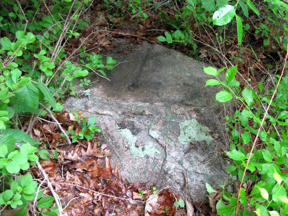
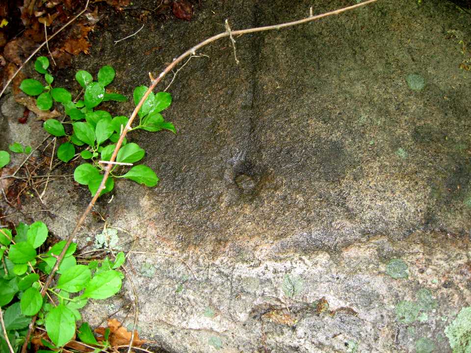
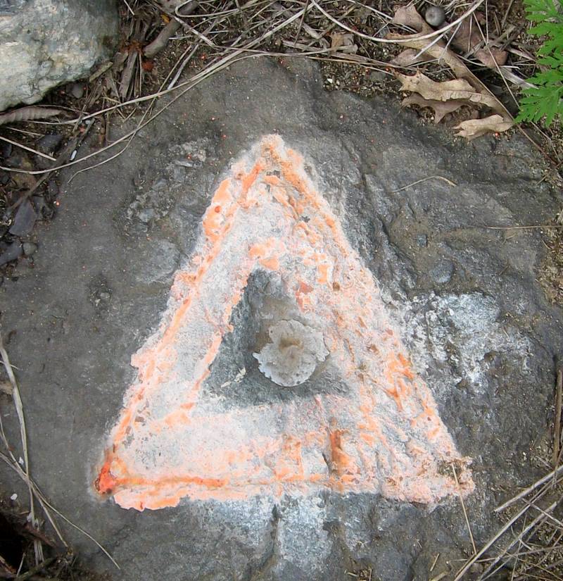
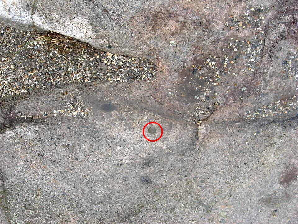
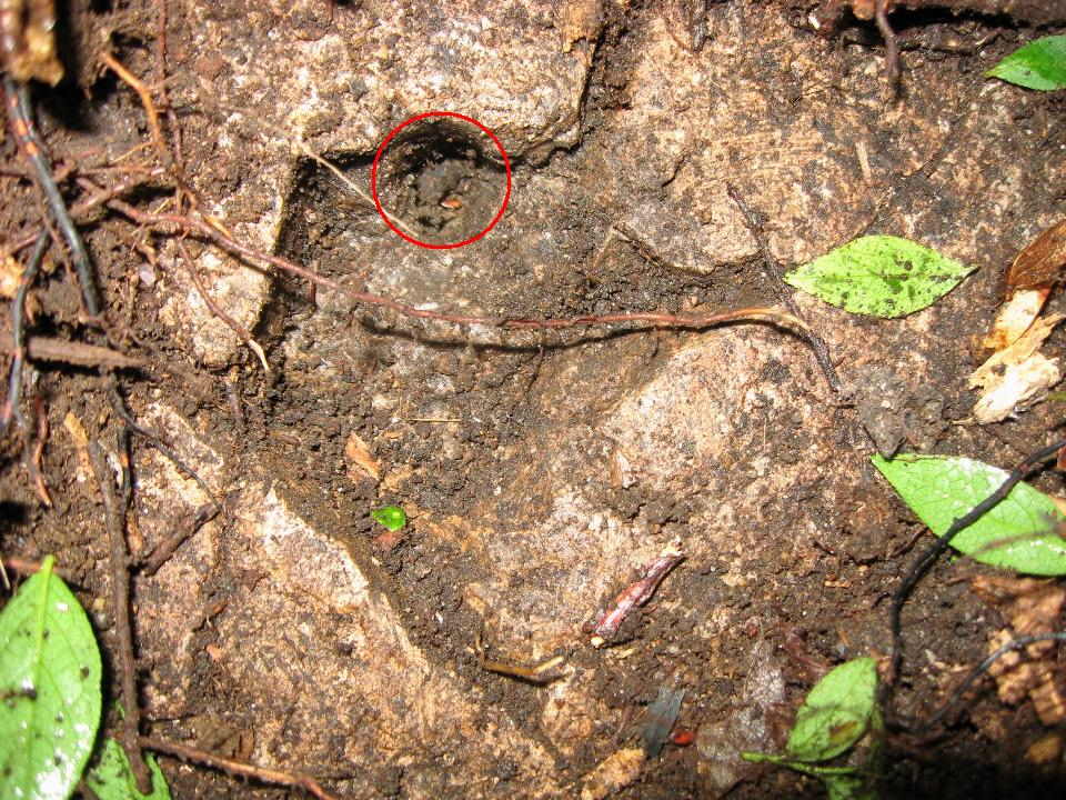
I moved the stones to the side and dug down near some other stones and found a rock ledge about 1 foot down. After brushing away the dirt I spotted a clear drill hole, about 3/8" in diameter which went along the side of an indentation and then went into the rock, perhaps 1 1/2 inches deep in all. The upper portion indicated the rock may have flaked away from the drill hole. See photos. The photos however do not do full justice to the drill hole. In reality the hole was very distinct. In the photos, due perhaps to the camera flash and dirt, it seems less distinct.

Nothing is 100% certain when you just find a drill hole in "about" the right place, but I think this is a probable find. I hope to come back later this season and dig some more and see if I can be more certain that this was indeed the station.


PF1145 Mt Pleasant Old Gogle Map

Mt Pleasant Old / Mt Pleasant New


Mt Pleasant Old Log on Geocaching.com
Mt Pleasant New Log on Geocaching.com

When we got back to Portsmouth so Roy could get his car, we got hit by the most violent thunderstorm ever. I thought the hail would break the windshield at one point. Lucky we were not on the mountain when it hit. But once I got into Massachusetts the roads were dry, and in an hour and a half I was back in Natick, my base camp. It was a great 3 days of hiking and benchmark hunting.
 
Last edited:
Top