
1HappyHiker
Well-known member
It’s always kinda fun to use the 7 Dwarfs “trailhead” a few times each winter for mild-mannered treks up to Hale via the Fire Warden Trail, or for more aggressive & time-consuming treks up to the Twins via the North Twin Trail. Since we had time limitations for today, Zman & I opted for the less time consuming and certainly less rigorous trek to Mt. Hale.
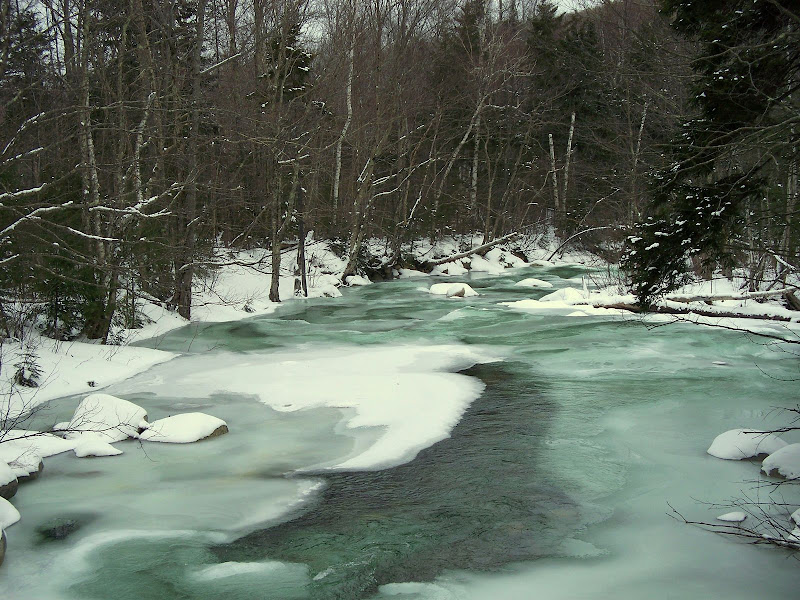
After paying our “dues” to Franz at 7 Dwarfs, Zman & I began our trek to the North Twin trailhead via the short hike on the snowmobile trail, and then onto the trail through the woods that follows the old railway grade. Upon arriving at the bridge on Haystack Road that crosses the Little River, we noted the brilliant green color of the water. Is it just me or is the “winter-color” of the water in some of the brooks & rivers quite different this year?
We arrived at the first crossing of the Little River in just under an hour from the time that we left the 7 Dwarfs. Even with the frigid temperatures, it appeared to us that the Little River was insufficiently frozen for a safe crossing. Regardless, our plan for the day did not involve a river crossing and so we didn’t have to worry about it. So after taking a few photos (and movies) of the river crossing, we were on our way to the “trailhead” for the Fire Warden Trail via the bootleg trail along the east bank of the Little River. (A photo and a short movie of the river crossing can be seen under the Q&A Forum.)
The Fire Warden Trail was broken out via a combination of backcountry skiers and folks on snowshoes. As might be expected, at the higher elevations the drifting snow had obliterated all traces of foot traffic. But as anyone knows who has travelled the Fire Warden Trail, the trail is very well defined and therefore easy to follow even without the benefit of tracks to follow.
For whatever reason, my “tank was empty” at the beginning of our climb up the Fire Warden Trail. Zman had to go at a snail’s pace in order for me to keep up. Then, something happened. Hopefully, this won’t gross anyone out, but I let out a huge belch. And then, other than terrifying every woodland critter within earshot, everything was OK! My usual energy level returned and all was right with the world again! Go figure!
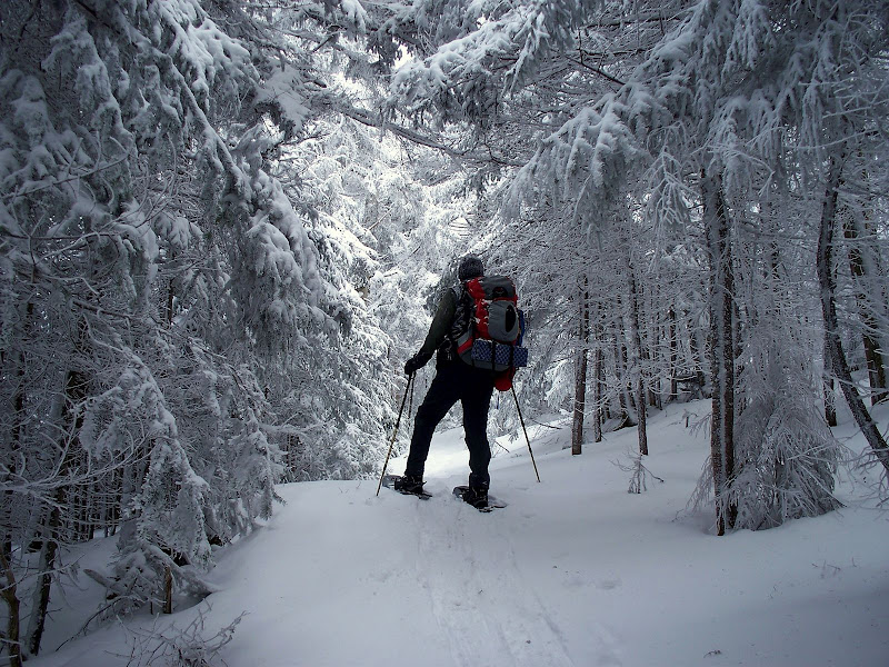
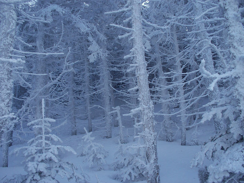
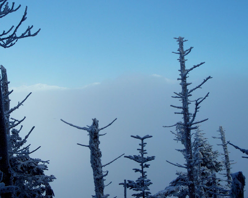
As we progressed up the trail, the winter scenery became increasingly beautiful. Below are two photos that show just a sampling of the winter splendor that we witnessed.
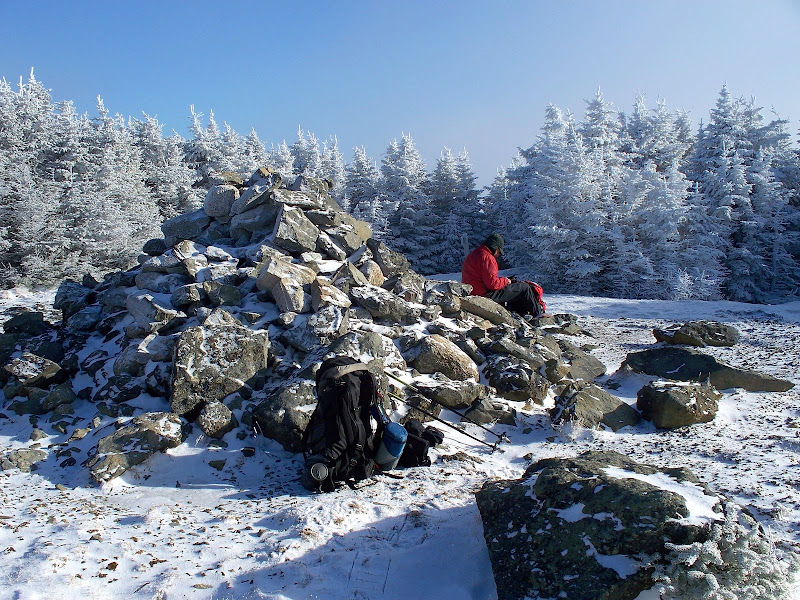
Due primarily to my initial pokiness at the beginning of our hike, it took us a bit over 3.5 hours to reach the summit. Upon our arrival, there was some intermittent blue sky. But more importantly, there was very little wind which enabled us to have an enjoyable and leisurely lunch on the mountaintop.
After our laid-back lunch we began to retrace our steps back down the mountain. As we approached that spot on the Fire Warden Trail where you get that northeast view of the Presidentials we hoped there might indeed be some views. We had none on the way up. There is a sailing term that comes to mind which is “becalmed” (i.e. rendered motionless for lack of wind). We were rendered viewless for lack of clear sky.
But, as we stood at this spot, every once in awhile the tops of the Prezies would come into view. We laughed our butts off trying to capture a photo of the “now you see them, now you don’t” Prezies. They would appear and disappear, literally in the wink of an eye. Below is the best shot I got, but maybe Zman managed to get something better.
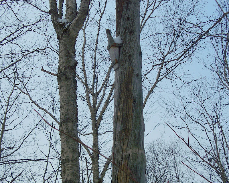
The only other thing of semi-noteworthiness that we encountered on the way down was to spot an old “telephone pole” along the trail. This obviously must have been part of the infrastructure associated with the fire tower that once stood on Mt. Hale.
So overall, Zman & I had a great trek up to Mt. Hale, and as an added bonus, Zman was able to check off this summit on his “Winter 48” list.
1HappyHiker
After paying our “dues” to Franz at 7 Dwarfs, Zman & I began our trek to the North Twin trailhead via the short hike on the snowmobile trail, and then onto the trail through the woods that follows the old railway grade. Upon arriving at the bridge on Haystack Road that crosses the Little River, we noted the brilliant green color of the water. Is it just me or is the “winter-color” of the water in some of the brooks & rivers quite different this year?
We arrived at the first crossing of the Little River in just under an hour from the time that we left the 7 Dwarfs. Even with the frigid temperatures, it appeared to us that the Little River was insufficiently frozen for a safe crossing. Regardless, our plan for the day did not involve a river crossing and so we didn’t have to worry about it. So after taking a few photos (and movies) of the river crossing, we were on our way to the “trailhead” for the Fire Warden Trail via the bootleg trail along the east bank of the Little River. (A photo and a short movie of the river crossing can be seen under the Q&A Forum.)
The Fire Warden Trail was broken out via a combination of backcountry skiers and folks on snowshoes. As might be expected, at the higher elevations the drifting snow had obliterated all traces of foot traffic. But as anyone knows who has travelled the Fire Warden Trail, the trail is very well defined and therefore easy to follow even without the benefit of tracks to follow.
For whatever reason, my “tank was empty” at the beginning of our climb up the Fire Warden Trail. Zman had to go at a snail’s pace in order for me to keep up. Then, something happened. Hopefully, this won’t gross anyone out, but I let out a huge belch. And then, other than terrifying every woodland critter within earshot, everything was OK! My usual energy level returned and all was right with the world again! Go figure!
As we progressed up the trail, the winter scenery became increasingly beautiful. Below are two photos that show just a sampling of the winter splendor that we witnessed.
Due primarily to my initial pokiness at the beginning of our hike, it took us a bit over 3.5 hours to reach the summit. Upon our arrival, there was some intermittent blue sky. But more importantly, there was very little wind which enabled us to have an enjoyable and leisurely lunch on the mountaintop.
After our laid-back lunch we began to retrace our steps back down the mountain. As we approached that spot on the Fire Warden Trail where you get that northeast view of the Presidentials we hoped there might indeed be some views. We had none on the way up. There is a sailing term that comes to mind which is “becalmed” (i.e. rendered motionless for lack of wind). We were rendered viewless for lack of clear sky.
But, as we stood at this spot, every once in awhile the tops of the Prezies would come into view. We laughed our butts off trying to capture a photo of the “now you see them, now you don’t” Prezies. They would appear and disappear, literally in the wink of an eye. Below is the best shot I got, but maybe Zman managed to get something better.
The only other thing of semi-noteworthiness that we encountered on the way down was to spot an old “telephone pole” along the trail. This obviously must have been part of the infrastructure associated with the fire tower that once stood on Mt. Hale.
So overall, Zman & I had a great trek up to Mt. Hale, and as an added bonus, Zman was able to check off this summit on his “Winter 48” list.
1HappyHiker
")