
1HappyHiker
Well-known member
“O Canada” is the title of the national anthem of Canada. And for several months, it has also been the “anthem” of my better half who has wanted to go to Canada to spend a night or two at a B&B. And although I’ve agreed this would be something fun to do, it wasn’t until this weekend that we found the time to make the trip. Going back and forth across the border for hiking adventures is “old hat” to many VFTT folks. However, it has been many long years since we’ve been to Canada. We had forgotten how simple it is to cross the border, even with the tighter regulations! It’s really not too much different than stopping to pay a toll.
So anyway, on this particular trip, we didn’t venture that far into Canada. We only went as far as Magog, Quebec. But, we’ll likely make some longer Canadian forays now that we’ve been reacquainted with how easy and quick it is. And speaking of “quick”, before going to Magog we stopped in the Coaticook/Barnston area to do a hike up to Mt. Pinacle. We were at the trailhead in about 1.5 hours after leaving our home in Bethlehem. That’s no longer than it takes us to get to some trailheads in NH, such as Wonalancet, etc!
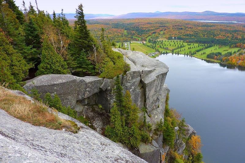
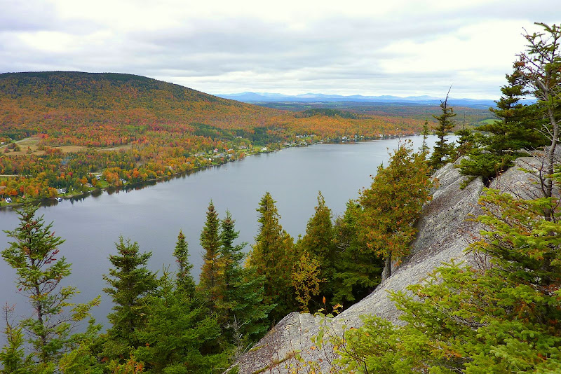
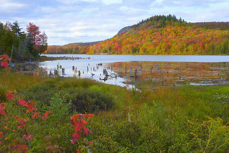
The hike to Mt. Pinacle is a very delightful walk through a well kept forest, and it can easily be done in 1.5 hours round trip. Below are two snapshots of Baldwin Pond which were taken from the open ledges on the top of Mt. Pinacle.
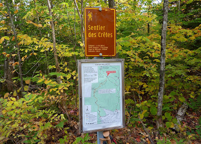
After doing the hike to Mt. Pinacle, we then drove north for about 30 minutes to Magog to check into our B&B which we had reserved before leaving NH. Next on the agenda was a short drive about 5 miles north of Magog to Parc National du Mont-Orford. There wasn’t enough time left in the day to do any long distance hikes. However, there was adequate time to go to a ledge which is reached via a short spur path off the trail named Sentier des Cretes.
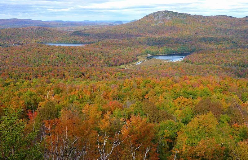
The view from this ledge was quite pleasant, and the autumn colors were simply brilliant.
View From Ledge Off Sentier des Cretes Trail
There were also a number of scenic spots within this national park that didn’t even require much of a hike. Below is an example of one such view that was nearly at roadside.
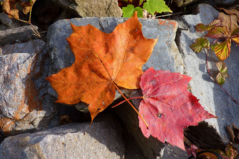
At one point, I bent over to re-tie a shoelace and saw two Maple leaves that seemed to be posing for a photo, as if to say: “It’s us guys and millions like us who’ve made this show possible!” So, as a reward for their fine showing, I snapped their photo.")
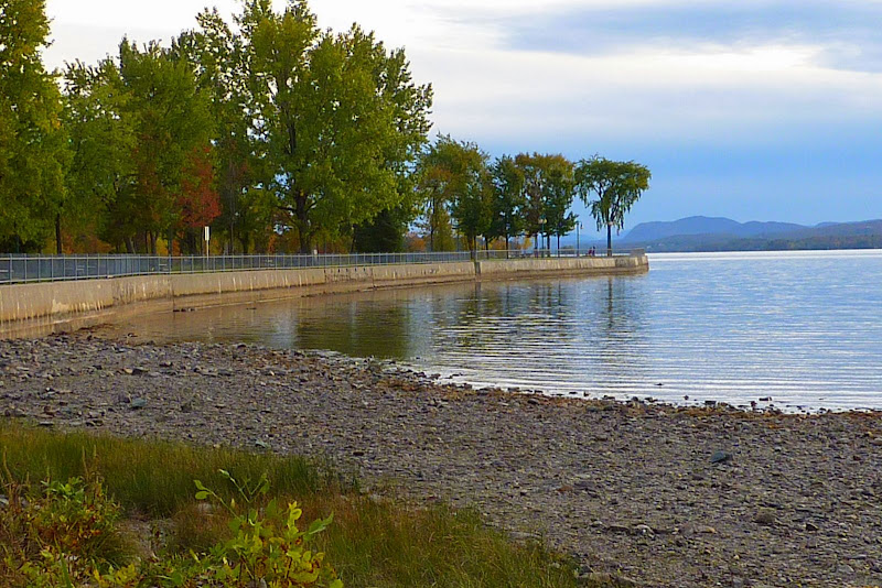
Regarding the town of Magog itself, it’s located on the northern end of Lake Memphremagog. It’s a picturesque town, and has a nice public park on the waterfront, a portion of which is shown in the photo below. I’m certain there are many other scenic spots within this lovely municipality, but the daylight hours were gone before we knew it.
Upon leaving Bethlehem, we were uncertain how long we’d spend in Canada during this particular trip. We decided to just play it by ear and sort of go with the flow. Well, speaking of “flow”, it rained all through the night, and when we stepped outside in the morning, it was very overcast and was threatening to rain again. So, we opted not to hike, but rather do some driving tours around the area. That didn’t last long! The weather simply wasn’t being cooperative for us to do the types of things we wanted to do, nor for seeing much in the way of scenery by driving around.
So, by early afternoon, we were headed back across the border to NH. However, based upon this short, but very enjoyable experience, I suspect that we will now be making more frequent journeys to explore that vast Canadian countryside which is literally right next door.
1HappyHiker
So anyway, on this particular trip, we didn’t venture that far into Canada. We only went as far as Magog, Quebec. But, we’ll likely make some longer Canadian forays now that we’ve been reacquainted with how easy and quick it is. And speaking of “quick”, before going to Magog we stopped in the Coaticook/Barnston area to do a hike up to Mt. Pinacle. We were at the trailhead in about 1.5 hours after leaving our home in Bethlehem. That’s no longer than it takes us to get to some trailheads in NH, such as Wonalancet, etc!
The hike to Mt. Pinacle is a very delightful walk through a well kept forest, and it can easily be done in 1.5 hours round trip. Below are two snapshots of Baldwin Pond which were taken from the open ledges on the top of Mt. Pinacle.
After doing the hike to Mt. Pinacle, we then drove north for about 30 minutes to Magog to check into our B&B which we had reserved before leaving NH. Next on the agenda was a short drive about 5 miles north of Magog to Parc National du Mont-Orford. There wasn’t enough time left in the day to do any long distance hikes. However, there was adequate time to go to a ledge which is reached via a short spur path off the trail named Sentier des Cretes.
The view from this ledge was quite pleasant, and the autumn colors were simply brilliant.
View From Ledge Off Sentier des Cretes Trail
There were also a number of scenic spots within this national park that didn’t even require much of a hike. Below is an example of one such view that was nearly at roadside.
At one point, I bent over to re-tie a shoelace and saw two Maple leaves that seemed to be posing for a photo, as if to say: “It’s us guys and millions like us who’ve made this show possible!” So, as a reward for their fine showing, I snapped their photo.
Regarding the town of Magog itself, it’s located on the northern end of Lake Memphremagog. It’s a picturesque town, and has a nice public park on the waterfront, a portion of which is shown in the photo below. I’m certain there are many other scenic spots within this lovely municipality, but the daylight hours were gone before we knew it.
Upon leaving Bethlehem, we were uncertain how long we’d spend in Canada during this particular trip. We decided to just play it by ear and sort of go with the flow. Well, speaking of “flow”, it rained all through the night, and when we stepped outside in the morning, it was very overcast and was threatening to rain again. So, we opted not to hike, but rather do some driving tours around the area. That didn’t last long! The weather simply wasn’t being cooperative for us to do the types of things we wanted to do, nor for seeing much in the way of scenery by driving around.
So, by early afternoon, we were headed back across the border to NH. However, based upon this short, but very enjoyable experience, I suspect that we will now be making more frequent journeys to explore that vast Canadian countryside which is literally right next door.
1HappyHiker