
1HappyHiker
Well-known member
At the northern end of the Kilkenny region there are three little mountains that are more or less aligned in a row, i.e. Rogers Ledge, Square Mountain, and Greens Ledge. Of the three, the one that I find most photogenic is Square Mountain. It's just my opinion, but I think it has some features that are as dramatic as that spot known as "The Captain" (located at the extreme south end of the Pemi).
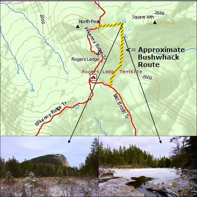
A few years ago I bushwhacked to Square Mountain. Therefore, I have photos of views FROM the mountain, but no close-up photos OF the mountain itself. So, to satisfy my craving for an unobstructed & close-up photo of Square Mountain, I concocted sort of a loop hike that involved the Mill Brook Trail, the Kilkenny Ridge Trail, and a bushwhack. The bushwhack portion took me to the area between Rogers Ledge and Square Mountain where there is a beaver meadow and pond. I felt that one (or possibly both) of these spots would provide an opportunity to get the photo that I was aiming for.
The photo below gives a rough idea of the bushwhack route (shown in yellow), as well as a sample of what was seen at the beaver meadow and pond.
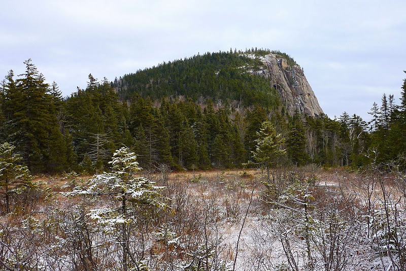
Below is a larger photo of Square Mountain as seen from the beaver meadow. This was exactly the view I was hoping to get!")
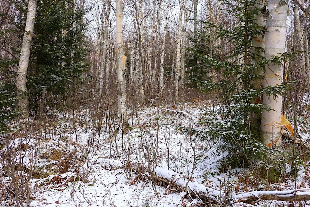
The bushwhack segment of this trek was easy going. It was what I'd call a typical Kilkenny whack, i.e. a predominately hardwood forest with some nice birch glades intermixed (such as shown in the photo below).
After visiting the beaver meadow and pond, I then bushwhacked westward to pick up the Kilkenny Ridge Trail (KRT) to lead me southward to Rogers Ledge, and then back to the Mill Brook Trail to complete my improvised loop.
No actual moose was seen, but immediately upon reaching the KRT, I saw a fresh set of moose prints in the snow which I followed all the way to the top of Rogers Ledge. It's almost as though this guy was on a mission to get some VFTT at Rogers Ledge! I sort of half expected to meet up with him/her at one of the viewpoints, but no such luck! However, had it been Forestgnome, then it would have been a different outcome, I'm certain!
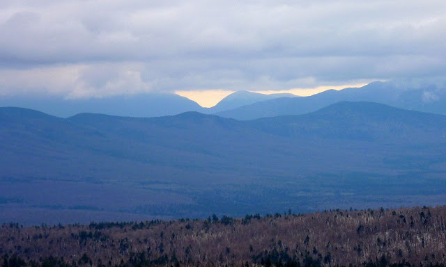
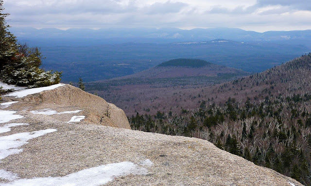
Although it was a very overcast day, there were still some decent views to be had from Rogers Ledge. I was able to experience the sweeping vista looking across a massive chunk of the Kilkenny Region with the picturesque Carter Notch on the horizon (zoomed shot shown below).
Also available was another view that I particularly admire. Looking eastward there is tiny Round Mountain (2,150 ft) in the foreground, and on the horizon is a collection of high peaks in the Mahoosuc Range.
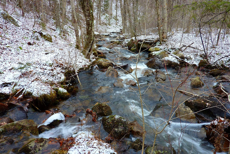
There were a lot of other scenes along the way that didn't involve sweeping vistas, but were interesting nonetheless. For example, there was plenty of brook scenery such as shown below.
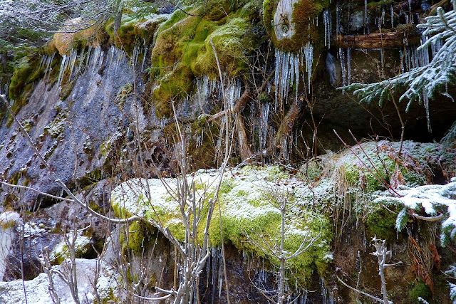
On the descent from Rogers Ledge, there was a weird collection of moss & icicles (perhaps a good name for a rock band?).
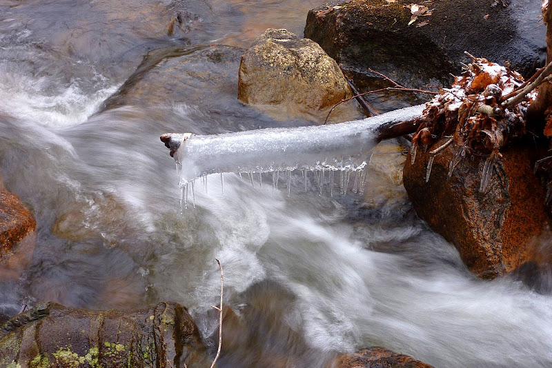
And speaking of icicles, I thought the "wrap-around" icicle shown below was worthy of a snapshot.
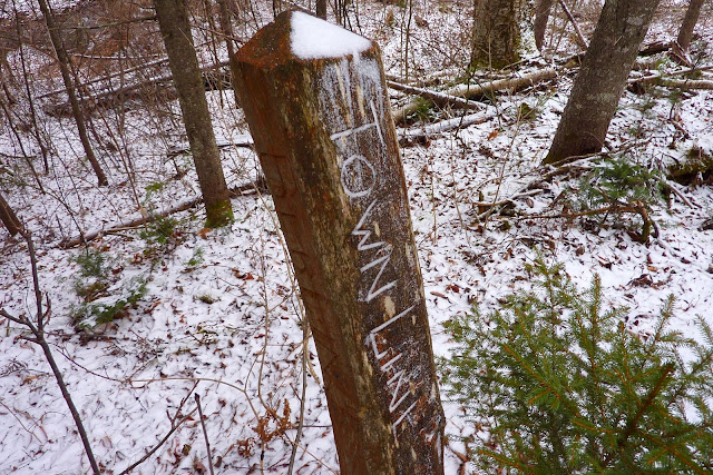
The last photo below shows a town-line marker. This 4-sided wooden post has "Town Line" carved into the front surface, and the word "Berlin" is imprinted on the left side, and "Milan" is on the right side. I don't know this for a fact, but I'd guess that this maker has possibly been in place since the time when folks used this corridor for travel between Stark village and York Pond about a half-century or so ago. Today, only the southern half of this route survives (between York Pond and the Kilkenny Ridge Trail). The northern end has been obliterated by beaver activity and logging.
Some explorations such as this can end in disappointment; however this particular adventure turned out to be a pleasant hike, and I got the snapshot of Square Mountain that I was hoping for. Yay!
1HappyHiker
A few years ago I bushwhacked to Square Mountain. Therefore, I have photos of views FROM the mountain, but no close-up photos OF the mountain itself. So, to satisfy my craving for an unobstructed & close-up photo of Square Mountain, I concocted sort of a loop hike that involved the Mill Brook Trail, the Kilkenny Ridge Trail, and a bushwhack. The bushwhack portion took me to the area between Rogers Ledge and Square Mountain where there is a beaver meadow and pond. I felt that one (or possibly both) of these spots would provide an opportunity to get the photo that I was aiming for.
The photo below gives a rough idea of the bushwhack route (shown in yellow), as well as a sample of what was seen at the beaver meadow and pond.
Below is a larger photo of Square Mountain as seen from the beaver meadow. This was exactly the view I was hoping to get!
The bushwhack segment of this trek was easy going. It was what I'd call a typical Kilkenny whack, i.e. a predominately hardwood forest with some nice birch glades intermixed (such as shown in the photo below).
After visiting the beaver meadow and pond, I then bushwhacked westward to pick up the Kilkenny Ridge Trail (KRT) to lead me southward to Rogers Ledge, and then back to the Mill Brook Trail to complete my improvised loop.
No actual moose was seen, but immediately upon reaching the KRT, I saw a fresh set of moose prints in the snow which I followed all the way to the top of Rogers Ledge. It's almost as though this guy was on a mission to get some VFTT at Rogers Ledge! I sort of half expected to meet up with him/her at one of the viewpoints, but no such luck! However, had it been Forestgnome, then it would have been a different outcome, I'm certain!
Although it was a very overcast day, there were still some decent views to be had from Rogers Ledge. I was able to experience the sweeping vista looking across a massive chunk of the Kilkenny Region with the picturesque Carter Notch on the horizon (zoomed shot shown below).
Also available was another view that I particularly admire. Looking eastward there is tiny Round Mountain (2,150 ft) in the foreground, and on the horizon is a collection of high peaks in the Mahoosuc Range.
There were a lot of other scenes along the way that didn't involve sweeping vistas, but were interesting nonetheless. For example, there was plenty of brook scenery such as shown below.
On the descent from Rogers Ledge, there was a weird collection of moss & icicles (perhaps a good name for a rock band?
).
And speaking of icicles, I thought the "wrap-around" icicle shown below was worthy of a snapshot.
The last photo below shows a town-line marker. This 4-sided wooden post has "Town Line" carved into the front surface, and the word "Berlin" is imprinted on the left side, and "Milan" is on the right side. I don't know this for a fact, but I'd guess that this maker has possibly been in place since the time when folks used this corridor for travel between Stark village and York Pond about a half-century or so ago. Today, only the southern half of this route survives (between York Pond and the Kilkenny Ridge Trail). The northern end has been obliterated by beaver activity and logging.
Some explorations such as this can end in disappointment; however this particular adventure turned out to be a pleasant hike, and I got the snapshot of Square Mountain that I was hoping for. Yay!
1HappyHiker
Last edited: