
IQuest
New member
Marlie and I arrived at the Livermore Tr parking lot in Waterville at about 6:15am. There was only 1 other car in the lot, but no one in sight. At 6:30 we had boots/paws on trail, actually pavement, and began our warm up walk on Tripoli Rd. The road gains about 700' to the height of land over 2.9 miles, but it was barely noticeable. It was already humid, but luckily very shady. Swarming gnats and mosquitos kept us motivated. Not one car passed during the road walk and I only saw one other car near a campsite. There was also a large rotten log that had fallen across the road about a half mile before the height of land. There was enough room to squeeze around and if I was driving I could have easily pulled it out of the way. By 7:30 we were headed up the Mt Osceola Tr. Everything was wet from the rain the night before and with the humidity the cool rocks were rather slick. We made our way up the switchbacks, the trail is never very steep, and made it to the summit of Mt Osceola at 9:10am.
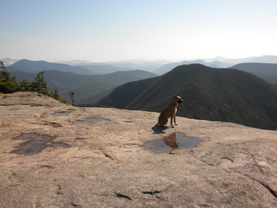
We then headed over to the large cliff and took in the views and had a snack. After about 20 minutes, we headed over to East Osceola then descended to the tip of the northern shoulder where we took another 20 minute rest. Near the bottom of the steep descent we met our first hikers of the day. In all we would only meet 10, the last of them at the junction of the Greeley Ponds Tr. Two of them had camped the night before near Greeley Ponds. They told me that they had to evacuate their tent twice in the middle of the night while it was raining. They were worried that the aluminum poles would attract the lightning.
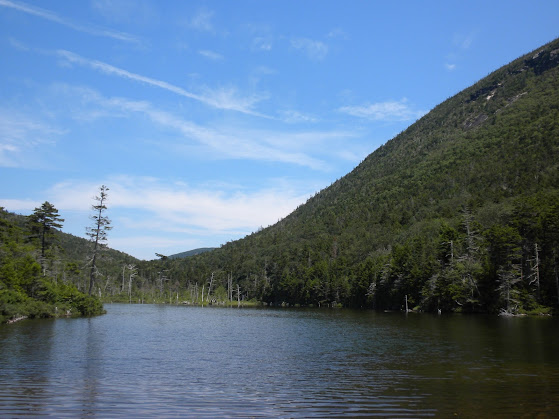
We then checked out both ponds and took in the surrounding views.
Upper Greeley Pond
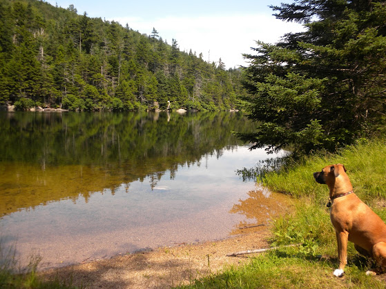
Lower Greeley Pond
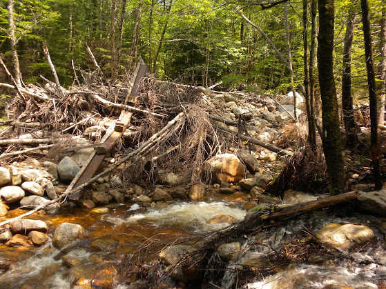
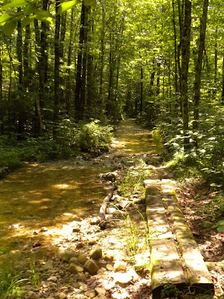
After the ponds we began our bushwhack south along the Mad River being very careful not to step on the red line. :wink: If I were to follow the old corridor it would have been very easy to still find but 3 bridges have been washed out, 2 of then completely destroyed.
There were also long sections where the old road has become a channel of the river. Marlie was walking through one spot where the water was only a couple inches deep when I hear a big splash. When I looked over she was submerged up to her collar. Part of me wished I could do that as it was about 82 degrees in the shade.
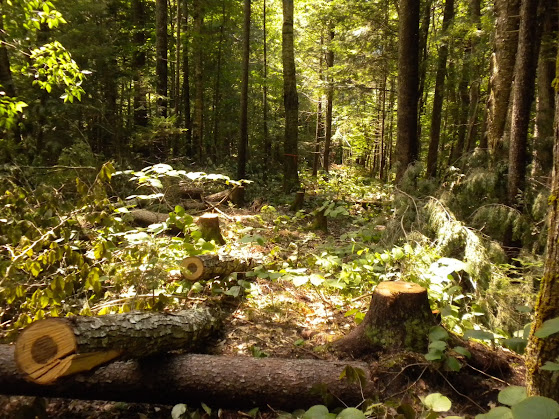
On the west side of the Mad River I could hear chainsaws and see lots of pink surveyors tape. They are currently working on a reroute but it will not have the gentle grades that the old trail did.
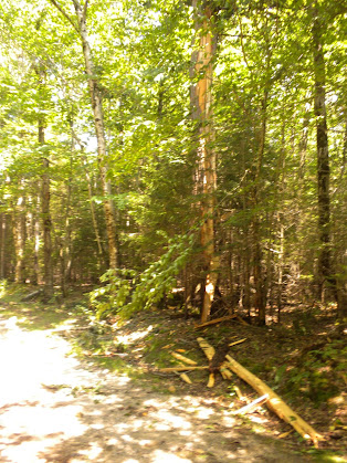
Just south of the Timber Camp Tr I ended my bushwhack and followed the open section of Greeley Ponds Tr back to the Livermore Tr and returned to my truck at 1:10pm. I had pondered the idea of adding a few more miles and redlining the Timber Camp and Goodrich Rock Trails but it was just too hot. I did see this tree that appeared to have been struck by lightning the night before just before reaching the parking lot.
A great day out none the less and good job to Marlie for handling the heat like a champ.")
Pics: https://plus.google.com/photos/1175...02089137813137985?gpsrc=gplp0&partnerid=gplp0
NETC: http://www.newenglandtrailconditions.com/nh/viewreport.php?entryid=13399
We then headed over to the large cliff and took in the views and had a snack. After about 20 minutes, we headed over to East Osceola then descended to the tip of the northern shoulder where we took another 20 minute rest. Near the bottom of the steep descent we met our first hikers of the day. In all we would only meet 10, the last of them at the junction of the Greeley Ponds Tr. Two of them had camped the night before near Greeley Ponds. They told me that they had to evacuate their tent twice in the middle of the night while it was raining. They were worried that the aluminum poles would attract the lightning.
We then checked out both ponds and took in the surrounding views.
Upper Greeley Pond
Lower Greeley Pond
After the ponds we began our bushwhack south along the Mad River being very careful not to step on the red line. :wink: If I were to follow the old corridor it would have been very easy to still find but 3 bridges have been washed out, 2 of then completely destroyed.
There were also long sections where the old road has become a channel of the river. Marlie was walking through one spot where the water was only a couple inches deep when I hear a big splash. When I looked over she was submerged up to her collar. Part of me wished I could do that as it was about 82 degrees in the shade.
On the west side of the Mad River I could hear chainsaws and see lots of pink surveyors tape. They are currently working on a reroute but it will not have the gentle grades that the old trail did.
Just south of the Timber Camp Tr I ended my bushwhack and followed the open section of Greeley Ponds Tr back to the Livermore Tr and returned to my truck at 1:10pm. I had pondered the idea of adding a few more miles and redlining the Timber Camp and Goodrich Rock Trails but it was just too hot. I did see this tree that appeared to have been struck by lightning the night before just before reaching the parking lot.
A great day out none the less and good job to Marlie for handling the heat like a champ.
Pics: https://plus.google.com/photos/1175...02089137813137985?gpsrc=gplp0&partnerid=gplp0
NETC: http://www.newenglandtrailconditions.com/nh/viewreport.php?entryid=13399