Our Winter In Review: Complete Photo-Supported Report, 12/28 - 3/19

vftt.org

Help Support vftt.org:

This site may earn a commission from merchant affiliate links, including eBay, Amazon, and others.

Intrepid

New member
Joined
Mar 4, 2014
Messages
5
Reaction score
0
First, a hello. This is my first post. Some of you know my dad, Mirabela. Here's what we did this winter:

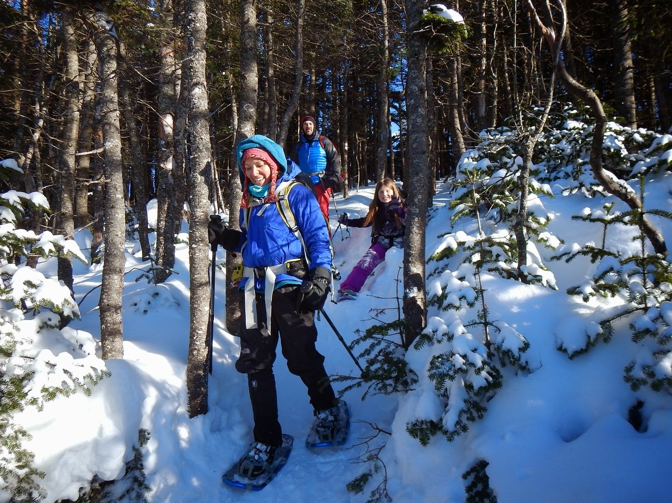
Liberty: December 28, 2013

The first hike of the season was going to be fun. Well, it probably would have been more fun if the good butt-sliding spots were not covered in slush. Huge slush chunks gathered on the Microspikes too. Our friends Greg and Liane came along with my mom, my dad, my brother Elmore, and me. We went up the Liberty Springs trail and up to Liberty and back. I had always wanted to go up that trail; now was the time! Since we had done the Pemi Loop a few years ago we had camped at the Liberty Springs campsite. It had been over-the-top full so we had been put in a “secret” campsite; I wanted to see the “secret” campsite again. We hiked up with Elmore in the lead. It was a steady steep grind up to the campsite, where we saw the secret campsite entrance which Dad said we should not go to because it was icy and there was a steep cliff on the path to it. We continued the steady grind and soon got to the junction. When we got there we had delicious Nutella sandwiches, took pictures and soon got on our way.

DSC_0326.jpg


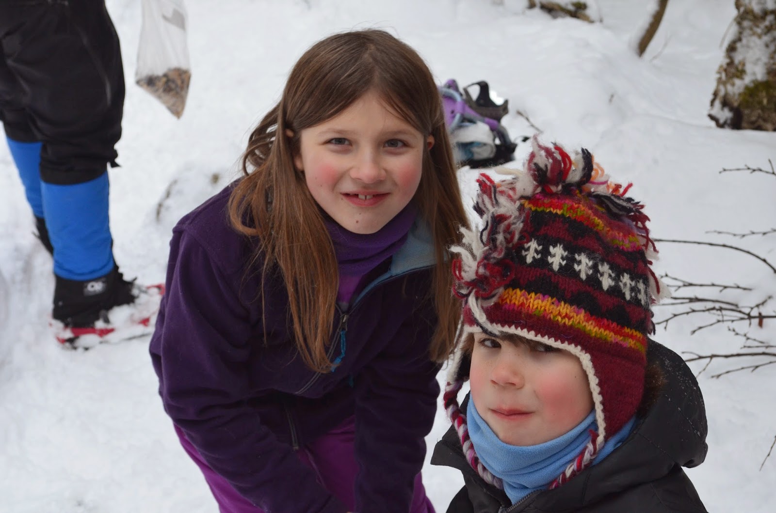
We got to where it seemed as if we were on the top but we really weren’t, so we continued to the real top, which was really foggy (so much for views!). We got some people to take some pictures of us.

Liberty+12-28-13.jpg


We did not hang out there very much because it was cold and there was nothing to see. We were soon on our way. Elmore and I were hiding behind trees and trying to scare everybody, but I don’t think we ever did. After that we bombed down the mountain, thinking about things like our poor little kitty at home who was probably wondering where his dinner was and where we were.

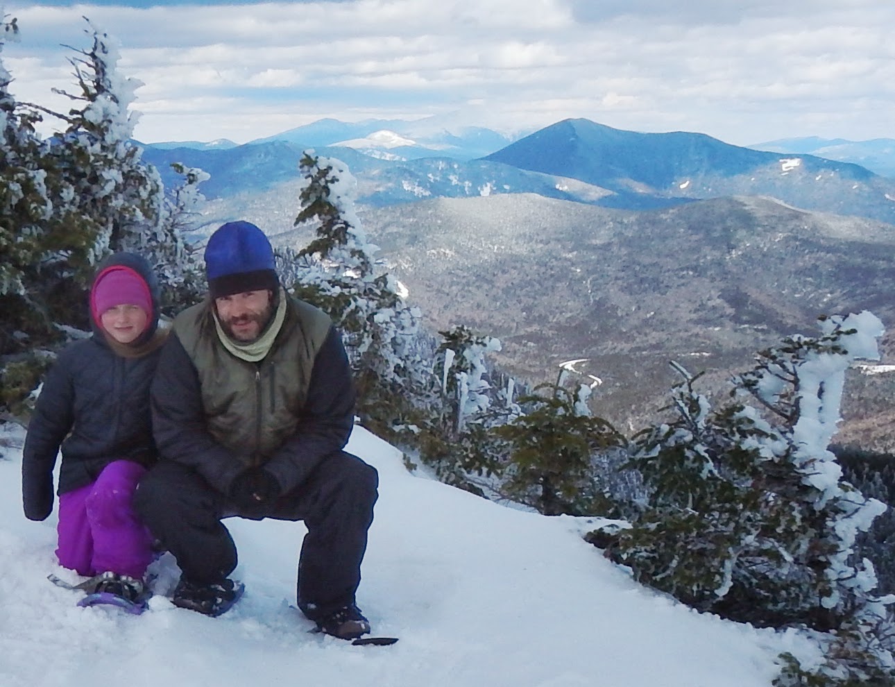
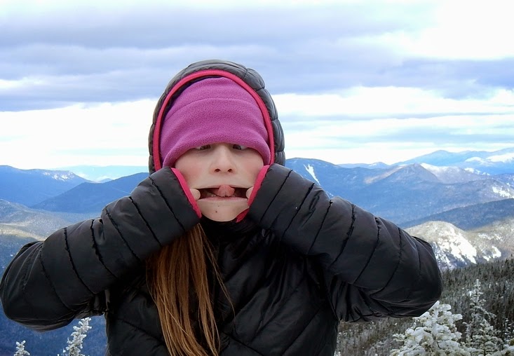
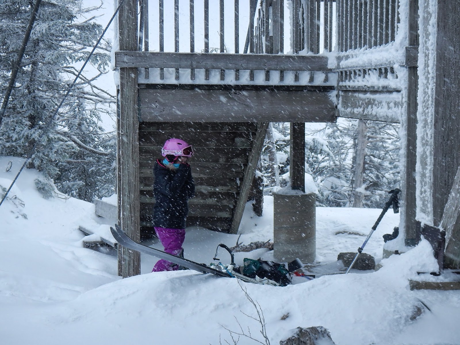
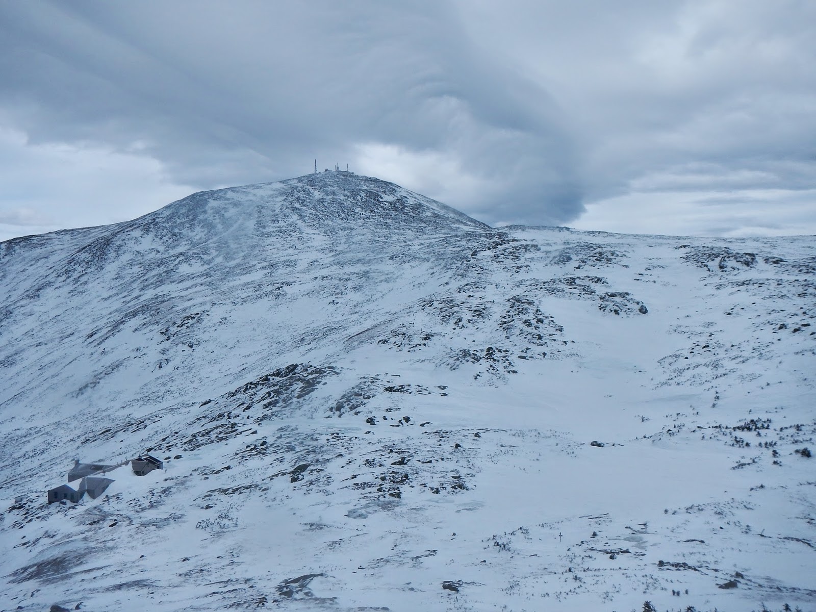
Jackson: January 4, 2014

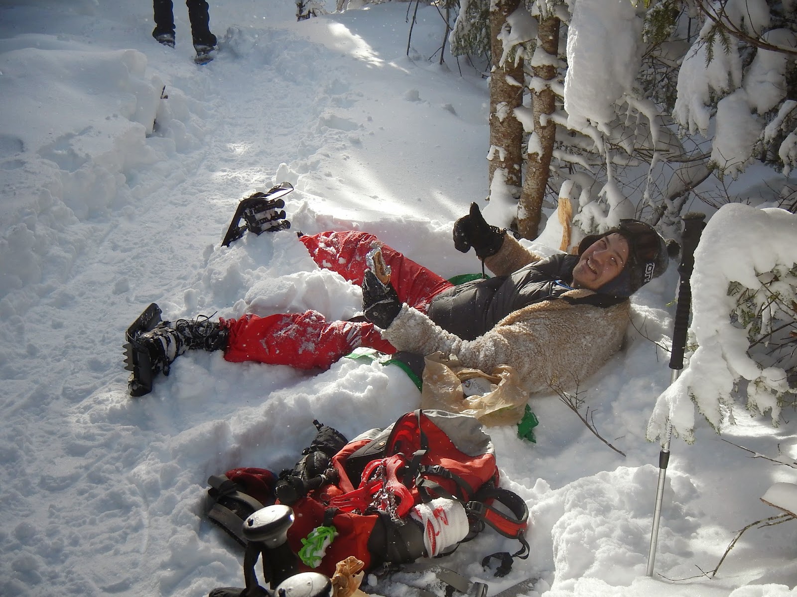
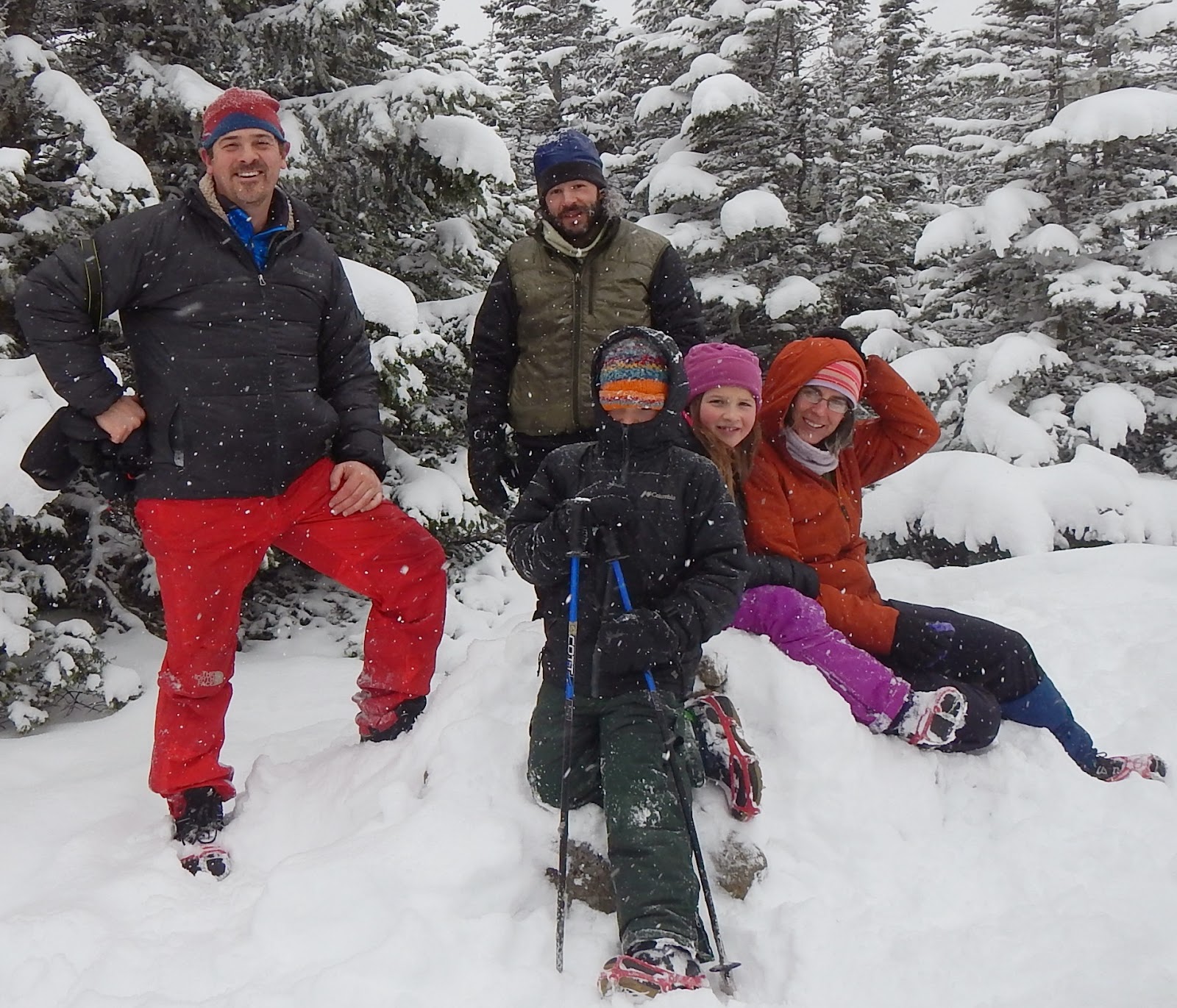
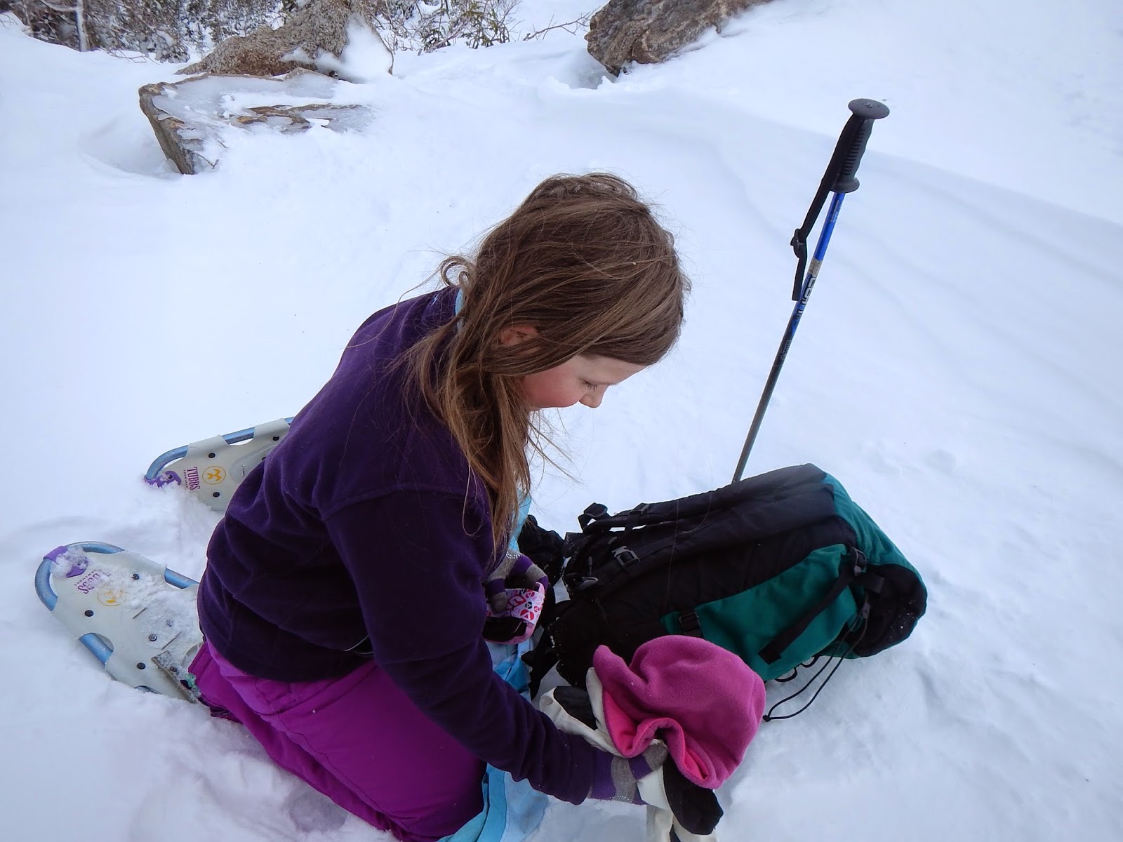
We also did this one with our friends Greg and Liane. We chose this hike because it was going to be a viciously cold morning and we liked the idea of a warm place to start and end. I was first on the trail. Elmore was having a bad “bumffle” problem (wrinkles in his socks) and was whining behind the line with Dad, who was doing his best to help. My mom was also along and was up ahead in the front with Greg, Liane, and I. We waited different places for them to catch up, all after hills so we could catch our breath too. My mom thought that one of the steep parts was “the steep part” as my dad said, but the main “steep part” was ahead. At the steep place before Bugle Cliff, Elmore broke down and would not go any further without getting his boots adjusted. He was fine after that. Liane led the way after that and I followed. I was starting to wonder where the junction with the Webster Cliff trail was when Tada!! There it was! We had big sugary “oatmeal” cookies and geared up to go. We climbed and saw more people who had been to the top already. It was hard work. We had a break before the steep pitch before the top, and Greg put on one of those fuzzy sweatshirt things and plopped down in the snow. Great idea for staying warm!

DSCN1257.jpg


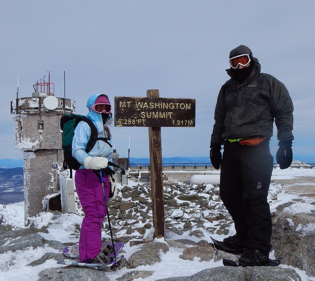
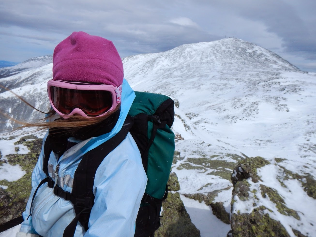
We all had awful salami wraps then got up and started up the summit rocks. Dad spotted us as we walked across a scary rock; then we went up to the top by ourselves and admired the view. Mt. Washington made Jackson seem like a bump in somebody’s backyard. Elmore and I played around in the snow drifts. After that we all got together for a group picture.

DSCN1262sm.jpg


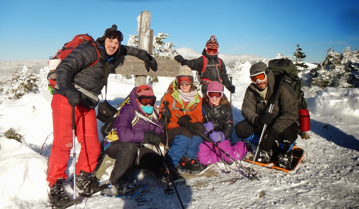
We walked until we got to the break place where Greg got his sweatshirt all wet and waited for him and Liane to come back down from their private time on the summit. Eventually they turned up, and Greg, Elmore, and I went in front with all the others in the back. We got down to the Webster junction and kept going. Elmore and I found lots of little butt sliding spots, the best one at the main “steep part”. We got down to the parking lot and got in to our cars and drove to the Highland Center where we hung out for a while in the fireplace room eating the free snacks that were served and playing with Greg’s iPad.

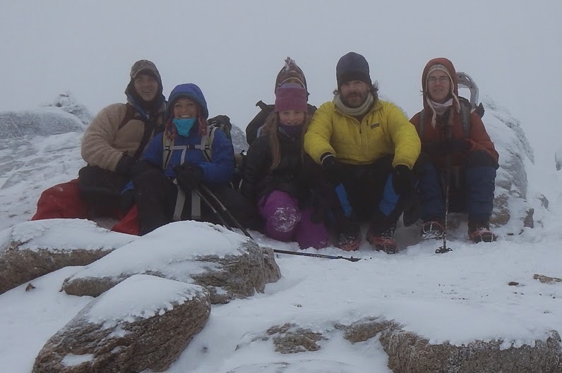
Carter Dome: January 14, 2014

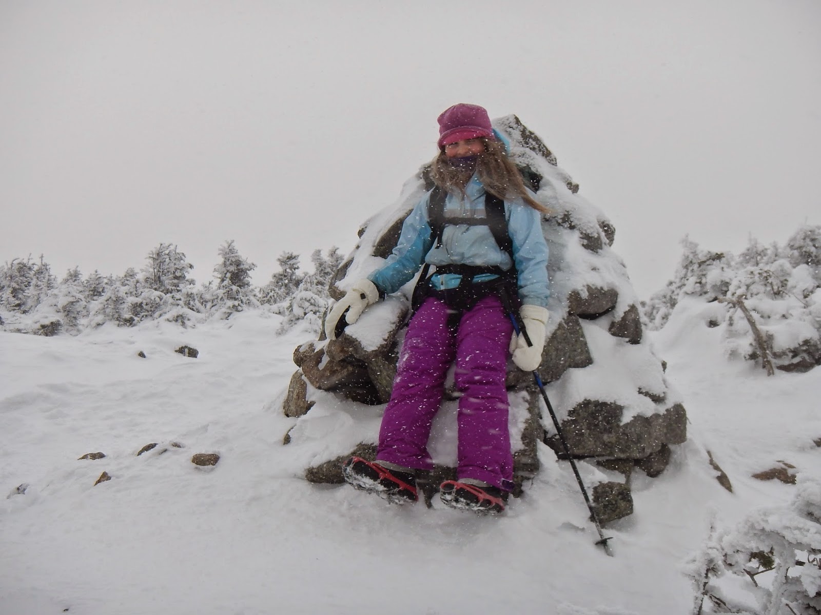
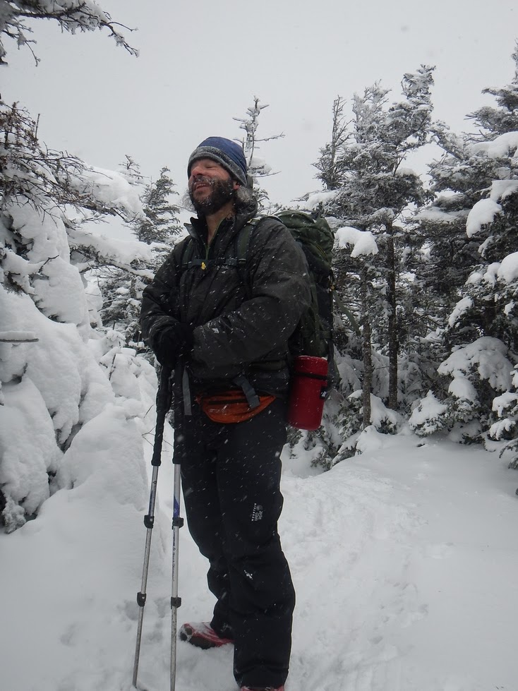
We hiked Carter Dome the way that lots of people do it -- start at 19 Mile and go up the Carter Dome trail, over Mt. Hight, and back down around Mt. Hight. Greg came along with us but not Liane. We got up to the junction pretty fast even thought it was a slow trudging day. We had a snack and then got going up the steady grind up the hillside. At one point when we crossed the brook we got off the trail. We found it after bushwhacking, going up and looking around. Up, up and up we went until we arrived at Zeta Pass. We had a lunch up there and looked around at the beautiful winter wonderland. It was soon time to go and summit the mountain. First we would go over Mt. Hight (even though there was not going to be a view) and then to the top. We did just that, Elmore and I marveling at the butt-sliding spots that we would sadly not be coming down. We got to the top of Mt. Hight and hung out for a second then started the wonderful down of the trail off Mt. Hight. We got to the top of Carter Dome where we hung out in the snowy weather and rolled on the ground until we were cold.

DSCN1280crop.jpg


We went down with cheerful faces and cracked jokes all the way down to the junction with the 19 Mile Brook trail. We got to the car and Elmore and I played Monopoly on Greg’s iPad all the way home.
 
Part 2 ...

North & South Kinsman: January 25, 2014

Dad and I did this one by ourselves from the west. We started at the parking lot pretty early, but when there already were lots of other cars there. We started, and I thought it was going to be boring but it turned out very fun. We started in this logged out area and trudged along in the snowy wonderland that people had skied. We walked next to each other and talked a little but mostly thought about things. Dad said that we might not make it to South Kinsman, which was a disappointment since when we were working on the 48 we had to try twice before we made it. I was determined that we would make it this time. Why not? They had said maybe bad weather right? We would make it. We got to a junction with a trail that led to some bump somewhere. We got bundled up more since it was beginning to get colder; we also had a snack. In the trees up there, I felt like I was in Narnia. We walked at a fast-for-us pace and time flew by like nothing it seemed on this very pretty day. I was soon wondering where the junction with the Fishin’ Jimmy trail was. We took a break on a hill below the junction and suited up for harsher weather. We walked past the junction and up toward the summit of North remembering all the other times we had been on that other stretch of trail. We got to the top. Yay! We decided that we would go over to the South peak to see how the weather was and if it was good do it and if it was bad not do it. We stopped in the little hollow between the two peaks to have some kind of disgusting salami or something. I was cold (but very excited to share the big Twix bar in Dad’s backpack). I was glad too when we got on our way and started to climb the short little bit up to South Kinsman. In the beginning of our hike a guy had said it was very windy up there, but when we popped out in the open, bracing ourselves, we realized that the wind had calmed down a lot since the morning.

DSCN1287.jpg


We took some pictures of ourselves and then got going because the wind was still cold. We went down into the hollow and started climbing what I had butt-slided when we had passed before. We got to the top of N. Kinsman again and took pictures of each other, including one funny and cute one of Dad.

DSCN1292sm.jpg


We bombed down the mountain and I was very happy. There was this really pretty ice stream that we stopped to take pictures at, and we stopped to eat the Twix bar. (At last!) We got to the parking lot and were surprised to see how little time the hike had taken us.

The Hancocks: February 8, 2014

Yet again, we went out with our friends Greg and Liane. I noted that a lot of the other hikers out there were wearing Microspikes; we wore snowshoes, and I did not think we needed to. One person we let by was the same guy who was up on Jackson the very same day we were there, who had taken our picture on the top. Greg kept us all entertained. I made up an imaginary character called Docta’ Stupid and told Greg stories about him. We just trudged on. There were some spots where I thought I saw the loop junction, but it wasn’t. At one of those spots we turned the corner and the actual junction came in to sight. We stopped and had lunch like we had planned. There was a guy who had just come down the North Hancock way. He said that there were some other kids up on the ridge. We started up. Elmore was having instant trouble. He could not kick his snowshoes in and was trying to walk flatfooted, which was not working out very well. Dad was frustrated with this, and told the rest of us to go and wait for them on the top. After that we went our own pace and left Elmore and Dad behind. We soon were at the top! We waited for Elmore and Dad for five minutes or so and soon they reappeared. Elmore had a very red face and he said that he was never doing something like that again. It turned out that it was not all his fault that he could not get up easily; his boots were not tightened, and they had a big hole in them! (They were only a year old! We sent them back after that! ß note, Lands End kids boots. Not recommended!) We had a refreshing break after that (with big gray jays included!).

DSCN1332crop.jpg


The walk across the ridge seemed like a stroll, not like the mile it was said to be. We arrived at South Hancock and I was excited to start the butt slide down.

DSCN1349sm.jpg


The butt slide was very fun and I was sad when the 0.7 mile was over. We trudged out. It was getting dark, and Elmore and I were instructed to lead a good pace -- which we did, but nobody kept up with it! We got to the parking lot just as we could not see anymore.

The Osceolas: February 22, 2014

It was the first day of February vacation; I really did not want to go hiking, but I wanted to revisit these mountains and I knew I would be regretting it if I did not go. On the way, we stopped at Shaws’ and I got a turnover. We got the last spot in the parking lot at the Greeley Ponds trailhead right before someone else took it. (Later we found why nobody had taken this spot.) We got ready and soon were on the trail. There was a group of guys just behind us that got to the first junction right after we did. We headed up right before them again. It was hot, and soon I was down to my base layer. In my mind we did not need snowshoes, but we wore them anyway. We climbed steadily up, and I found plenty of good butt-sliding spots and was looking forward for when we would be coming down and I would get to slide all of them. My brother Elmore would have hated this climb. He hates really steep stuff for instance the Hancocks … Up, up and up we went, but we stopped at a very steep and scary icy pitch. I could hear the group of guys behind us as we got up it. But we only saw them when we were at the slide taking pictures and admiring the view on the very pretty day. They were very impressed at me doing this, and had thought I had stayed at bottom of the valley with my dad. They were taking a break, so we continued in front of them. We got to the ridge soon and turned right to the little view at the side of the trail; there we had cheese and some gorp. We admired the view and then went up and visited East Osceola. There were a lot of people including the group of guys and a couple whom we met later. So we continued along the ridge. Down we went; Dad said there was a thing called the Chimney but neither of us had been over the ridge before, so we did not know what to expect; except that we had read that there was a Bypass of the original Bypass, which I thought was funny. We quickly got to the Chimney and started up the Bypass of the Bypass and almost ran into someone going down it! It was very narrow but we got through. We went up it quite easily and soon were on our way up the trail again; again, I heard the group of guys behind us ascending the Bypass of the Bypass. Up and down little bumps we went, marveling at the pretty scenery and wondering where the top of Osceola was. Ahead on the trail there was a big burst of light when we turned a corner and I knew we were on the top! We had Cliff bars up there and my “fan club,” as Dad called the big group of guys, came out on to the top a minute or two later. All of them were very impressed with me doing all 48 already. The leader of the group, the one that was paying the most attention to me, said that he had only done about ten. We took lots of pictures.

DSCN1361crop.jpg


DSCN1368crop.jpg


Soon we were getting cold so we went back across the ridge. On the Bypass of the Bypass I tried to jump down a steep rock and wound up falling but I got up ok and continued on. We continued over the top of East Osceola and stopped there and talked with the couple I had seen there before. Then the leader of my “fan club” said that he was going to race me to the bottom. The race was on! Wheee! It was fun sliding down all my butt sliding spots that I had seen on the way up. On the really steep part, the leader of my “fan club” was behind us and all his other buddies were in front of us. At the junction with the Greeley Ponds Trail they had a break; we bombed ahead and got to the parking lot first. Hah!! We started to take off our things, and about five minutes later the “fan club” came down. We started up the truck to find that we were stuck in a snow bank. Dad got out one of my snowshoes and started to dig with it; I did not know that you could use snowshoes as shovels, but I guess you can. After our tires spinning a great deal and getting pushed by the leader of my “fan club,” we got out.
 
Part 3 ...

Tom, Field and Willey: March 1, 2014

My dad and I had already done Field before in winter, so it was really only Tom and Willey that we had gone out there after, but for Elmore and my mom, they were all new winter peaks. We started at the Highland Center and crossed the windy field. On the steeps up toward Mt. Avalon Elmore was having some “bumffle” problems again, but he said he could do it. Mom and I continued in front talking a little, but I was thinking about non-related things. We passed lots of other people, all of whom were all very proud of us. Once again (and probably not for the very last time) I did not think we needed snowshoes. Dad told Mom and me to go on and they would follow after us. We went on kicking in every step enjoying the getting-prettier-by-the-moment scenery. We got up to very near the top of the junction with the spur to Avalon when this guy passed us and said the trail was not broken out all the way to the Avalon spur; he also had a pair of really cool red snowshoes. The trail was broken out to the spur, so I don’t know what the guy was talking about. We waited for Elmore and Dad; when they caught up we geared up for the wind; ditching our packs, we went up to the summit of Avalon. I guess when Mom and I were having fun going up the steeps, Dad and Elmore were not at all. Dad even considered going down to the Center to hang out for the rest of the day. We also tried to get pictures, but the camera said “battery depleted.” The real problem was that Elmore’s socks were too short. Mom fixed it by giving him her extras that were really long. That helped – soon Elmore and I were in the lead, leaving Mom and Dad behind. We trudged like that for a while, then went back to the order that we had before. We got up to Field and had lunch which included some not-so-good granola bars, and looked at the beautiful view. We continued down the ridge toward Willey. The climbing began again after that, and I got terribly hot. Since we were near the top, Mom said that we should wait until we got to the top before changing layers. The top seemed so far away, but really it was not. Soon we did get to the top, where I began to get colder anyways. We had good granola bars on that top, and then got going again. We went back across the ridge. Even though it was up, I did not really care -- I was now looking forward to the next day for our intended long trek to do Owl’s Head in one day (we never did that). We went down with smiling faces.

Cannon: March 2, 2014

We woke up very early since we had been thinking about going to do Owl’s Head as a one-day trip. However, we had already done Tom, Field and Willey the day before, and I had blisters, so we reconsidered and decided to go and climb Cannon. Our route went like this: up Kinsman Ridge trail (watch out for skiers!) with skis on our backs and in my case with huge ski boots and a ski helmet in my backpack. My dad had his mountaineering boots on that he could hike and ski in. We started from the parking lot at Cannon ski area at about seven thirty and hiked up. I had micro-spikes on, and my dad had his snowshoes on. There were some post-holes from someone who should have been wearing snowshoes. Up, up and up we went and only stopped once, to tighten Dad’s snowshoes. Up near where the trail gets into the open, Dad fell into a spruce trap; trying to avoid it, I fell into it too. It went to the top of my stomach! (Too bad for my plan to avoid it!) Not having snowshoes on made it even worse. It was hard to get out of, but yes, I did get out of it. We soon lost the trail out in the open. It was very windy and foggy. After looking around for where the trail was for a long time and narrowly avoiding more spruce traps we found it again. We were on the trail for about a minute when the huge shape of the ski lodge loomed out of the mist. We were almost there!

DSCN1427sm.jpg


We walked for about a minute on a ski trail that the trail goes on and then changed into ski gear underneath the summit tower, narrowly avoiding frostbitten hands.

DSCN1429.jpg


We started sliding down the mountain. We had only gone about a hundred yards when Dad said he had to tighten his boots, and when he was doing that, his bootlace snapped. Meanwhile all the people in the trams that were going up and down were looking down on us, probably wondering why both of us had huge backpacks on and why Dad had snowshoes strapped on his. He tied the broken bootlace part with the attached bootlace part and then tied the boot. We skied the rest without any stops, and got to the bottom way more early than any other mountain.
 
Part 4 (the end!)

Washington & Monroe: March 19, 2014

Last day of winter counts! It does not matter even if it means missing school because this is a lot more fun than doing math, writing and watching snowflakes fall on the mountains when you are not out there. Hooky here we come! We got up at quarter to four. We had breakfast trying to be quiet because it was a school day for Elmore. When we arrived at the Cog parking lot, we were the only car there. We were trying to find the cut off to the Jewell trail that had no sign. After we climbed about 200 feet and could not find the cut off, we decided that we would go straight up the cog railway. It looks real easy and quick but even though it is the easiest way up the mountain in winter it is still hard. It looked as if tree line was right there, but no -- it was hours away. Lots of people had skied it so the base was sort of packed down and we were not breaking our own trail. When we got to the Wambek Tank we saw the sign that said elevation 3,800 and realized how much more climbing we needed to do to climb the 6,288 foot mountain.

We had a 30 minute break were the switch track ended and then continued up the service road that was next to the tracks. We saw the Halfway House and the, “this is exactly flat” sign along with the elevation. We put our goggles and shell coats and big mittens on and stepped out into the wind and the wind-blown above tree-line world of the Presidentials.

DSCN1447.jpg


It was what you would call calm (well, for the Presidentials in winter that is) but there were some big gusts a time or two. There was a big drop off to the side down into Burt Ravine; some of the time Dad had me walk above him so that if I started sliding he could stop me. At one of these “walking above” times, I noticed a big crack alongside the cog in the snow. At some point an avalanche had started to slide. We got up to where there was a suitable place to cross the tracks and we crossed them (horrors! Black grease smears on my white mittens! No, I did not pick them out myself). But at least we were not going to have any chance of falling off into a ravine. We had been planning where the cog goes around by the head of the Great Gulf we would pick up the Gulfside trail and take that to the summit. We found the trail and followed it. The weird thing was, though, we did not seem to be climbing up to the summit or dropping. Then we realized that instead of Gulfside we had picked up Westside. We now had to angle our way through on snowfields to the summit. We left the big cairns of Westside and headed up where the towers on the top of the mountain were. All of the rocks looked like they had been frosted with a decorative frosting tip. We patched the snow fields together so we could walk with the big clunky snowshoes we had on our feet. We walked like that until we got to the summit, where we saw the really well marked, rocky Gulfside from where it actually comes to the top. It was not really windy at all (for Mt. Washington standards). I ran up the rock in snowshoes and Dad got pictures of me at the top. These two guys came along and took some pictures of Dad and me standing by the sign.

DSCN1460crop.jpg


Dad asked the guys which trail they had come up, and they said Lion’s Head; they also said they had gotten in over their heads with avalanche risk and that they were going to try to find a different way down. We had a chocolate bar in a corner outside of the lunchroom building. Both of us agreed that we did not want to go down the cog. So we decided that we would go down to Lakes of the Clouds, and if we wanted to we would climb to the top of Monroe. We got on to the trail and started walking. I was in front. There were some big gusts of wind that almost made me fall down. We met the Westside trail and saw the same notable pair of telemark boot prints that we had seen when we thought we were on Gulfside. Eventually, we got down to the Lakes of the Clouds hut. We saw the trail going up Monroe and we also saw the winter trail up Monroe that was, I guess, out of the wind more. Since it was what my dad called “a hop and a skip” we decided that we would go. We started climbing and we noticed that it was getting windier and windier as we climbed. We followed the winter trail and soon were on the little bump next to the top. There was a lot of bare rock that was not good for our snowshoes, but we managed. We got to the top but did not stay long except to take some pictures of each other and the very scary clouds that were on top of Franconia Ridge and that were traveling quickly and in our direction.

DSCN1471sm.jpg


We went down, and by the time we were back at the hut, the scary clouds were on top of Washington.

DSCN1480.jpg


We climbed up on to the roof of the hut and gazed at the view. We started down; I found a million butt-sliding spots and slid some of them. The trail was covered in snow and did not scratch the snow-shoes as the rocks had. We trudged on and talked about what it would be like living on the top in the observatory. We found the cut-off to the Cog parking lot at the end of the conversation, and soon were getting in the truck thinking about our very fun and interesting day.
 
Great pictures and story. Thanks so much for sharing! I ran into you and your Dad on top of Middle Carter. I'm so proud of your enthusiasm for the greater outdoors and I hope your schoolmates will catch the BUG also. :)
 
Thanks for all the kind words, Wardsgirl, Lefty E and Framerman. It took a long time and I appreciate all the enthusiasm all of you give.

I remember meeting you Rolling Rock on the top of Middle Carter too. I hope you had a good winter! :)
 
Top