Technetium
New member
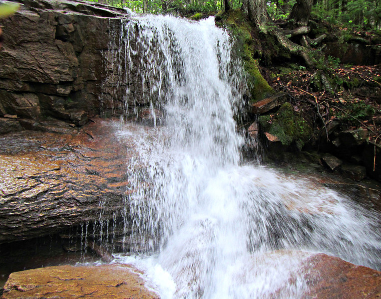
I want to plan a little mini-adventure to find this waterfall. However, it seems to be rather difficult to locate. I am trying to follow directions posted on several pages. They mention following High Street out of North Conway and eventually it turns into a dirt road, which I think is FR 379. However, finding this on Google Maps is proving difficult because Google Maps doesn't know what FR 379 (or Fire Road 379) is. There is a road that comes off of High Street before that ends which Google calls "Unnamed Road" which might be it. Interestingly, the waterfall itself is marked on Google Maps despite its obscurity.
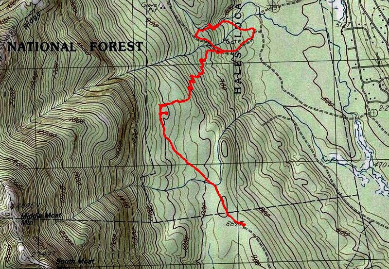
Here is the best I can figure it out. I'm hoping someone who has been there can confirm or correct me before I go getting myself lost. From North Conway, I take West Side Street, left onto Passaconway Rd, then right onto High Street. I continue on High Street and eventually it turns into a dirt road. It comes to a fork in the road, where going left continues on High Street and going right goes on the unnamed road (FR 379). If I continue on FR 379 for a while, I eventually pass a sign that indicates the trail for the Mineral Site. From there I take that trail which will go to the mineral site (which doesn't really look like anything more than some rocks in the woods), and there should be an unnamed trail somewhere around there that goes 1000 ft to the waterfall itself.
The other problem is that all of the directions I have found are from 2012, and they suggest that the AMC has just bought the land or whatever and is in the process of putting up signage to get to this waterfall. I'm assuming that's probably done by now, so the actual state of the trails is possibly very different from any of the reports I have read online.