Thoreau Falls Bridge Removal?

vftt.org

Help Support vftt.org:

This site may earn a commission from merchant affiliate links, including eBay, Amazon, and others.
Here's how that bridge looked when I crossed it last August 23:

011-L.jpg


Here's another photo I took from the middle of that bridge, looking northwest to Bondcliff and Bond:

012-L.jpg


I don't recall wondering how easy it would have been to get across if the bridge disappeared but as far as I recall, it was at a minimum safe-looking if you were willing to get your boots wet or change into watersocks. Of course, August 23 is dry season.

Edit: I just belatedly noticed JostJoe's photos on the first page of this thread, from July 2012, to which these add little. I'll leave them as another small info point.
 
Last edited:
This is my favorite bridge in the White Mountains. It's construction replicates the land in which it resides, rough, wild, and isolated. I like that the bridge is built on a foundation of two 60' long trees (pine? cedar?) adding to the wild feel of this bridge. Irene gave the bridge a good beating in 2011 but it still stands strong helping us cross the East Branch. It should be rebuilt and serve us for another 50 years.

Looking back through some old AMC White Mountain guides regarding the Thoreau Falls trail proved interesting. The 1940 edition stated that the Thoreau Falls trail will be closed in 1940. I guess we've been lucky enough to use this trail for the last 75 years.

There was no mention of the trail being closed in the 1946 guide but rather included a full description of the trail so the trail remained open. Probably due to public comment. :D This description also mentioned that all the bridges were down. These bridges would have been the old logging railroad bridges at that time.

The 1948, 1952, 1955, 1960 guides all had the same descriptor "all bridges down" which was a carryover description from the 1946 guide.

The 1966 guide mentions for the first time a 60' bridge crossing the East Branch. The other logging railroad bridges were still down.

It is now 2015 meaning the bridge must be close to if not over the 50 year mark. Is it over 50 years old or still just under? Does this bridge qualify for further detailed study by outside agencies before possible destruction?

P1290680.JPG


P1290683.JPG


P1290146.JPG


P1290185.JPG


P1290152.JPG


P1290157.JPG
 
I've seen projects modified and even canceled as a result of public comments. And there are lots of interesting issues here, for example, what are the alternate means of crossing the stream? What are their environmental impacts vs a bridge? What are the safety implications? Should an alternate crossing/ford be designated? It's all part of the planning and scoping process. Frankly, I think it's great that a public comment process even exists.

Let's try to stay positive and do the best we can.
 
Unfortunately unless you have a congressman on speed dial, the process is rigged to allow the forest service to do what they want to.

The last time around, I wrote my Senator and received a sympathetic reply that said about the same: they can do what they want and his hands were effectively tied. It looks like the removal of the Thoreau Falls Bridge is another fait accompli.
 
The last time around, I wrote my Senator and received a sympathetic reply that said about the same: they can do what they want and his hands were effectively tied. It looks like the removal of the Thoreau Falls Bridge is another fait accompli.

I could always take one for the team and chain myself to the bridge. ;) :)
 
Perhaps the bridge condition is hazardous enough they want to demolish it ASAP coupled with elevation above stream bed such that anyone who goes down with the bridge could sustain serious injury. Safety hazard could warrant demilition sooner rather than later.

What troubles me is proposal to break up the concrete abutments and scatter. What's up with that???Demolition of bridge is just temporary. Bridge could always be rebuilt at a later date. However removal of concrete abutments makes it highly unlikely it could be re-built at later date. Any replacement bridge would take 5 or more years to work through SOPA, design and plan and execute. Good example being the Dry River bridge replacement.

What's the big hurry to remove the concrete??? Plenty of logging RR abutments are still standing throughout Pemi. Doesn't this structure have any historical significance in history of outdoor recreation in NE US???

Someone ought to visit the bridge and get GPS fix on it and TFT above and below. I see much variation in published maps of TFT. They should bring a measuring tape and measure the span and widths of abutments and existing bridge. Exact measurements are important rather than guesstimates. Measure the elevation of existing bridge above stream bed. Make a profile. Any volunteers?
 
Last edited:
Someone ought to visit the bridge and get GPS fix on it and TFT above and below. I see much variation in published maps of TFT. They should bring a measuring tape and measure the span and widths of abutments and existing bridge. Exact measurements are important rather than guesstimates. Measure the elevation of existing bridge above stream bed. Make a profile. Any volunteers?
Don't need a GPS...

From http://mapper.acme.com/?ll=44.11867...le MA&marker2=44.03801,-71.67251,lincoln\, nh
Center of the bridge: N 44.11867 W71.50375 (WGS 84?)
Length: ~20m (66 ft) (by visual inspection)

You can back out the view and/or switch to Topo to view the context.

BTW, the above location agrees pretty closely with the WMNF GPS trail tracks announced in http://www.vftt.org/forums/showthread.php?38643-WMNF-GIS-trails-data-GPX--I plotted the TFT track and the above waypoint over the Garmin 24K topo map. (The track file has been moved--see the final few posts in the thread to find a currently accessible copy.)

Doug
 
What's the big hurry to remove the concrete??? Plenty of logging RR abutments are still standing throughout Pemi. Doesn't this structure have any historical significance in history of outdoor recreation in NE US???

Well, if it was built in 1966 as John suggested above, then it is rapidly approaching the 50 year mark after which it becomes a historical landmark. And we know what happened the last time a bridge had its 49th birthday :(

Tim
 
You are welcome.

On May 8, 2006 District Ranger Terry Miller issued a Decision Memo justifying the replacement of the Dry River suspension bridge. The stated criteria was satisfaction that "this project is beneficial, and can safely proceed with no significant adverse environmental effects to the National Forest or Presidential Range-Dry River Wilderness."

From the Decision Memo:

"The Dry River is a volatile, entrenched channel surrounded by steep, bedrock slopes. The stream responds quickly to storm events throughout the year, not solely during spring runoff. Despite the fact that boulders of all sizes are found throughout the channel, these options for a rock crossing disappear with significant rainfall. The Appalachian Mountain Club’s White Mountain Guide (1998) describes the river crossings: “When water levels are high, the few Dry River crossings that remain on this trail – and on the trails that diverge from it – are at best difficult and can be very dangerous.
This Dry River Trail is used by diverse visitors with a range of skill levels. The trailhead is located along a highway in Crawford Notch State Park which facilitates access. Removing the existing structure would not provide the improvements that many of the traditional user groups accept and rely upon. Many users travel a long distance and their trip planning may not account for storm events that make the Dry River impassable even by skilled wilderness visitors."

On September 11, 2009 District Ranger Molly Fuller issued a Decision Memo justifying the removal of the Pemigewasset Wilderness Bridge suspension bridge. The stated criteria was satisfaction that "this project is beneficial, and can safely proceed with no significant adverse environmental effect to the National Forest, the Pemigewasset Wilderness or the surrounding area."

From the Decision Memo:

"I believe the presence of a man-made bridge, particularly a 180-foot suspension bridge with towers and cables, is a non-conforming structure and is not consistent with the ideal state intended by the authors of the Wilderness Act. Further direction is provided in the White Mountain National Forest (WMNF) Land and Resource Management Plan (the Forest Plan), which zones areas within each Wilderness into four possible wilderness management zones.
White Mountain National Forest Land and Resource Management Plan (2005) p. 3-14, G-6: “The number and type of improvements, such as trails, footbridges and signs should be kept to a minimum and be consistent with zone designations.”
"The Wilderness Trail and the suspension bridge are in Zone D, which the Forest Plan describes as the most heavily used and most highly developed trails and areas within the WMNF Wilderness. It goes on to state that bridges may exist for public safety or resource protection. Consequently, the presence a bridge is not expressly forbidden; however, a determination must be made as to whether or not the bridge is necessary to meet the minimum requirements necessary for the administration of the area."
"The decision to replace the Dry River Bridge on the Saco District considered public safety in light of the bridge’s role in providing access along a single trail into the Dry River Wilderness and the historic use that has occurred along that trail. On the Androscoggin District, the decision to repair the Madison Gulf Bridge, which is part of the Appalachian Trail, considered public safety on a high use trail that provides access through the Great Gulf Wilderness. In both of these cases, the bridges were determined to be essential trail features in order to continue to afford reasonable and safe access to or through the wilderness. In neither of these cases was there a parallel trail that followed the river on the opposite side of the river. It is important to recognize that wilderness management decisions are not meant to set precedents for future decisions; rather each case will be analyzed separately to consider its specific circumstances."

THEREFORE the most effective argument will be:

The Thoreau Falls Trail bridge is an essential trail feature required in order to continue to afford reasonable and safe access to or through the wilderness.
 
https://cara.ecosystem-management.org/Public//CommentInput?Project=46602

Thoreau Falls Bridge Removal #46602
Commenting on This Project

Comments, including anonymous comments, will be accepted at any time. However, comments posted after the close of a designated comment period may not be able to be given full consideration. Anonymous comments and comments submitted after the close of the final designated comment period will not provide the commenter standing for administrative review.

The Forest Service values public participation. Communications from the public regarding this project, including commenter’s names and contact information, will become part of the public record.

Comments, or in some cases other expressions of interest, along with respondent’s contact information, submitted during the comment period may be necessary to establish a respondent’s eligibility to participate in an administrative review for this proposed action. Interested members of the public should review the proposal’s information to determine the applicable administrative review process and the eligibility requirements for that process. The date of the legal notice of opportunity to comment on this proposed action is the exclusive means for calculating the comment period. For proposals to be documented with an Environmental Assessment and for Categorical Exclusions where the decision is documented in a Decision Memo, the legal notice announcing the comment period appears in the Newspaper of Record . For Draft Environmental Impact Statements, the Notice of Availability announcing the comment period appears in the Federal Register.
Submitting Comments
If you wish to submit a comment, please send it to:

John Marunowski
Pemigewasset Ranger District
Forest Headquarters 71 White Mountain Drive, Campton, NH, 03223
[email protected]
 
Good info Tom - Thanks for posting.

Just remember that the proposal hasn't actually been published yet, so we don't have any of the details, other than the brief project summary. It's easier to draft effective comments once you know exactly what's being proposed, and the full rationale behind the project.
 
Thanks, Tom.

The Thoreau Falls Trail bridge is an essential trail feature required in order to continue to afford reasonable and safe access to or through the wilderness.

Maybe I don't understand this but if I do, a more popular and less wild zoned bridge was removed despite support for keeping it. There is less justification since far fewer people (apparently) use the TFT bridge. I want to be certain I understand how to word any comments I might make.


Field Trip anyone? Maybe to document the bridge and to document the state of the Shoals Pond Trail?

Tim
 
Maybe I don't understand this but if I do, a more popular and less wild zoned bridge was removed despite support for keeping it. There is less justification since far fewer people (apparently) use the TFT bridge. I want to be certain I understand how to word any comments I might make.
IMO, justification should be based upon more than just the number of users--an absence of good safe alternative routes is also important. Removal of the TFT bridge will leave no path down the valleys from Zealand Notch to Lincoln Woods that does not require potentially dangerous river crossings.

In the minds of some, the East Side Road was a good alternative to the Lincoln Woods Trail. (Comment: but only if you were coming from Lincoln Woods... It also killed a very popular loop.)

IMO the Pemi River Bridge should be replaced and the TFT bridge should be repaired or replaced.

Doug
 
Thanks, Tom.
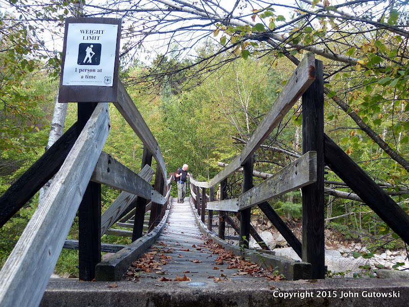
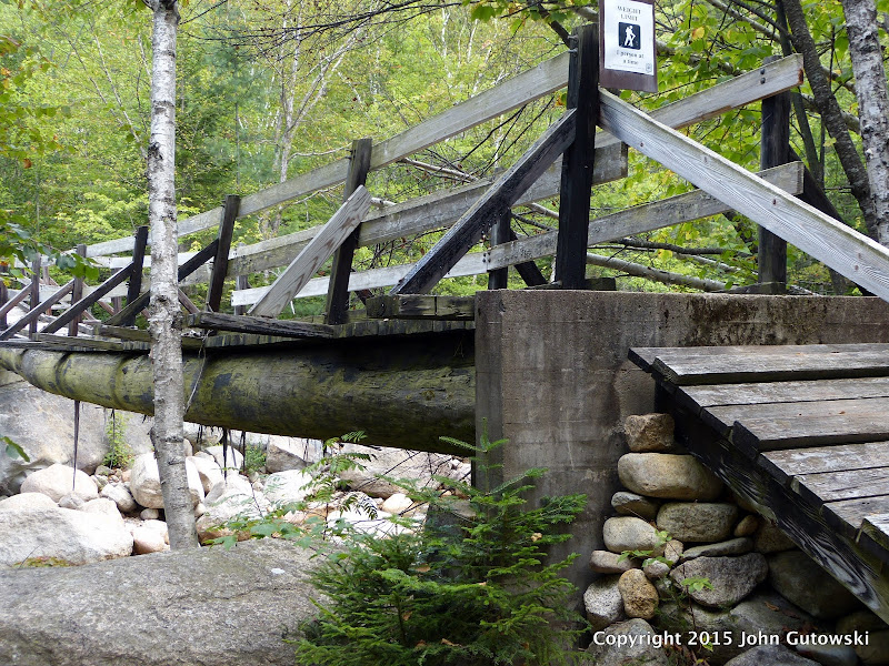
The Thoreau Falls Trail Bridge is an essential trail feature required in order to continue to afford reasonable and safe access to or through the wilderness.
Maybe I don't understand this but if I do, a more popular and less wild zoned bridge was removed despite support for keeping it. There is less justification since far fewer people (apparently) use the TFT bridge. I want to be certain I understand how to word any comments I might make.
Tim
After reading the two Decision Memos again last night, I believe there is enough leeway granted to the District Ranger by the Forest Plan that that either replacement or removal can be justified.

I think the Dry River Bridge decision was helped by that route being the primary access point to that area and by being very close to the trail head.

The fact that the loop LWT/East Side loop was a popular route was acknowledged by District Ranger Fuller. She picked the competing interest of minimizing the number and type of man-made improvements. As you noted, the Zone D designation for that part of the Pemi could easily had been used by her as a justification for keeping the bridge if that is the outcome she wanted

"The Wilderness Trail and the suspension bridge are in Zone D, which the Forest Plan describes as the most heavily used and most highly developed trails and areas within the WMNF Wilderness. It goes on to state that bridges may exist for public safety or resource protection. Consequently, the presence a bridge is not expressly forbidden; however, a determination must be made as to whether or not the bridge is necessary to meet the minimum requirements necessary for the administration of the area."

"During the scoping period, I read and heard passionate arguments for keeping the bridge and to preserve the eleven mile loop that connects the Lincoln Woods, Wilderness, Cedar Brook, and Eastside trails. The fact that it follows railroad grades that lined the banks of the East Branch has made this a very popular and relatively easy day hike and cross-country ski route in winter. Its gentle grade affords access to a wider range of abilities and its convenient trailhead access at Lincoln Woods along the Kancamagus Highway adds to its popularity. One of the implications of this decision was a compromise of visitor convenience and comfort by removing the loop possibilities. However, as outlined in The Wilderness Act, Forest Plan, and Forest Service Manual, in a conflict such as this, between wilderness values and visitor convenience and comfort, preserving the wilderness resource is the overriding value."

District Ranger Fuller tells you the REAL reason she decided to remove the Pemi Bridge in her Decision Memo:

“I can recall my first visit to the bridge, after hiking almost six miles, three of those miles in wilderness, and arriving at the site. It does take one back for a moment to have such a large and substantial structure before you. This experience is out of context with a wilderness experience, both from the visual impacts of the presence of the bridge to the experience of making a long, dry crossing on a man-made structure over the East Branch of the Pemigewasset River.”

“I believe the presence of a man-made bridge, particularly a 180-foot suspension bridge with towers and cables, is a non-conforming structure and is not consistent with the ideal state intended by the authors of the Wilderness Act.”

The presense of the bridge offended her idea of what a Wilderness Area should look and feel like.
 
Last edited:
The basic struture of my letter will be:

Main Idea: The Thoreau Falls Trail bridge is an essential trail feature required in order to continue to afford reasonable and safe access to or through the wilderness.

1. Acknowledge it is a man-made structure.

2. Idenitify the zone designation per the WMNF Forest Plan.

3. State the section(s) of the Wilderness Act and WMNF Forest Plan that allows man-made strutures in that zone and what the acceptance criteria is.

4. Develop argument that a Bonds Traverse is not a reasonable alternative due to elevation gain/loss & weather exposure and that the Shoal Pond Trail is inherently unsafe during high water condtions since it requires a river crossing.

Therefore the TFT bridge enables the only safe and reasonable north-south path through the Pemi Wilderness.

I intend to use as much of the text from the two previous bridge decision memos as possible.

I am under no illusions that my letter will change the decision.
 
Last edited:
After reading the two Decision Memos again last night, I believe there is enough leeway granted to the District Ranger by the Forest Plan that that either replacement or removal can be justified.

And just like that, we're back to "whatever the ranger wants", I think.

“I believe the presence of a man-made bridge, particularly a 180-foot suspension bridge with towers and cables, is a non-conforming structure and is not consistent with the ideal state intended by the authors of the Wilderness Act.”

I will paraphrase, as I have before, (then congressman) Jeb Bradley who once told me (while we were hiking) that they (they = "the authors") never intended for the Wilderness Act to keep people out - only logging and development. Maybe the angle here is that the bridge is not 180 long with towers and cables. Have to wait for the justification once the proposal is written up for review, I guess.

Tim
 
Last edited:
Devil's advocate: TFT is already an "inherently unsafe during high water conditions" N-S Pemi route due to the crossing at the north end of the trail unless you want to whack to/from the EPT bridge.
 
The 1963 A.M.C. White Mountain Guide (page 204) states, "At 4.7 m. the trail crosses the East Branch on a new (1962) 60-ft bridge and soon joins the Wilderness Trail at North Fork Junction,..."

So it would seem that the bridge is already more than 50 years old.

????? ?????? ??????
 
Last edited:
Top