
Ken MacGray
Active member
This was a double attempt to climb Peak Above The Nubble (3813') via the infamous "Double Trouble Nubble Trail", an unofficial route to the summit cut in 1991.
(Disclaimer: This is an unofficial and unauthorized route. If you are climbing PAtN for the official New England Hundred Highest list, please be aware that least one member of the AMC 4K Committee frowns upon it and urges you to not apply for the patch if you climb this route. The traditional bushwhack route starts 0.3 mi. up FR 304A from Haystack Road, and is marked with a small cairn and flagging. This is the route that is recommended if you are counting it for the list and want to absolutely stick to the "rules".)
About a mile in along FR 304A, I spotted the DTNT, which is obvious, and marked with a rock.
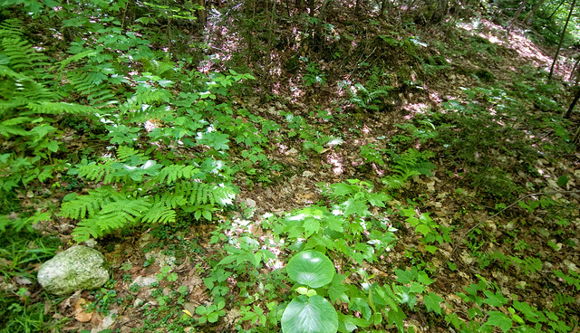
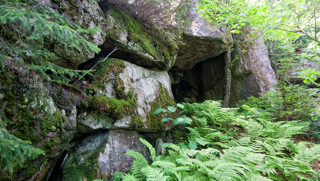
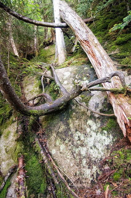
It was easy enough to follow at first, except for one obscure section where I lost it at a drainage. Backtracking, I picked it up again. It pretty much climbs straight up the slope with no real significant turns. I eventually ended up at a large, very cool cave, where the trail seemed to dead-end at some cliffs. I poked around for a bit to see if it skirted around the cliffs, but it just seemed to stop there.
At that point, I decided to backtrack out and do my Plan B hike. As I got back to FR 304A, I ran into the person who actually built the trail in 1991 (now 74 years old) who was with a friend. What are the odds? They were were going to head up the trail a bit to check on conditions and do a little maintenance.
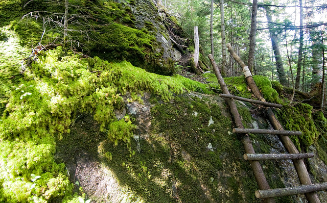
After chatting for a while, I asked if I could tag along. They said sure, so I turned around and headed back up the DTNT with them. It turns out there is a bypass around the cave/cliffs, but it's nearly invisible and very difficult to see. The junction is marked with a small cairn. The footway on this bypass is super obscure and very easy to lose. I lost it several times on the return. At the top of this bypass is a homemade ladder which was built by these guys, which climbs a nasty wet mossy ledge. This is where the steeper climbing begins.
Above the ladder, the trail is more defined and easier to follow, but gets very steep as it pretty much climbs in a straight-ish line up the side of the ridge. In the words of the trail builder, "I pretty much just built it in the shortest direction I could. I only went around things if I had to." There are several challenging scrambles along the way and footing is rough and eroded is many places.
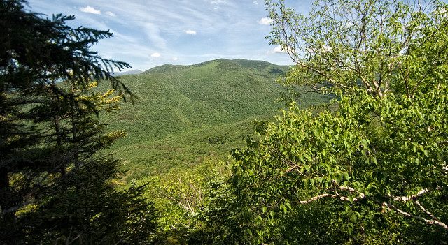
A view of Mt. Hale from an off-trail lookout:
At around 2900', they went as far as they were going to go, so I expressed my appreciation for the guidance and continued to head on up. The trail got steeper and rougher. It was also wetter and mossier, with sections of slick ledge. At around 3300', I encountered a 10-foot high ledge that didn't really have any way up except for grabbing onto roots.
It was nearly 4pm at this point (I got a late - for me - start), and knowing I still had a way to go to reach the top of the ridge, I decided to call it and head back down. I was already losing daylight on this side of the mountain and I didn't want to risk coming down all this in the dark. I think I may have been close to the one section of the trail which has a rope assist up and down a 20 foot ledge, but I'm not sure.
Coming down the steeps was challenging, as the footing was rough, mossy and wet. But I got back down to the ladder where the terrain got easier. The cave/cliffs bypass took some time, as I kept losing the trail. I eventually found my way back to the main trail and followed that back down to FR 304A. from there, it was an easy walk back to my car.
I'd like to attempt this again, but it's clear to me now that this is an all day affair, despite the 5-ish mile distance. This is a beast of a route, and was more difficult than I expected even after thoroughly researching it. Thanks to R and B for their guidance, I wouldn't have made it as far as I did without them!
(Disclaimer: This is an unofficial and unauthorized route. If you are climbing PAtN for the official New England Hundred Highest list, please be aware that least one member of the AMC 4K Committee frowns upon it and urges you to not apply for the patch if you climb this route. The traditional bushwhack route starts 0.3 mi. up FR 304A from Haystack Road, and is marked with a small cairn and flagging. This is the route that is recommended if you are counting it for the list and want to absolutely stick to the "rules".)
About a mile in along FR 304A, I spotted the DTNT, which is obvious, and marked with a rock.
It was easy enough to follow at first, except for one obscure section where I lost it at a drainage. Backtracking, I picked it up again. It pretty much climbs straight up the slope with no real significant turns. I eventually ended up at a large, very cool cave, where the trail seemed to dead-end at some cliffs. I poked around for a bit to see if it skirted around the cliffs, but it just seemed to stop there.
At that point, I decided to backtrack out and do my Plan B hike. As I got back to FR 304A, I ran into the person who actually built the trail in 1991 (now 74 years old) who was with a friend. What are the odds? They were were going to head up the trail a bit to check on conditions and do a little maintenance.
After chatting for a while, I asked if I could tag along. They said sure, so I turned around and headed back up the DTNT with them. It turns out there is a bypass around the cave/cliffs, but it's nearly invisible and very difficult to see. The junction is marked with a small cairn. The footway on this bypass is super obscure and very easy to lose. I lost it several times on the return. At the top of this bypass is a homemade ladder which was built by these guys, which climbs a nasty wet mossy ledge. This is where the steeper climbing begins.
Above the ladder, the trail is more defined and easier to follow, but gets very steep as it pretty much climbs in a straight-ish line up the side of the ridge. In the words of the trail builder, "I pretty much just built it in the shortest direction I could. I only went around things if I had to." There are several challenging scrambles along the way and footing is rough and eroded is many places.
A view of Mt. Hale from an off-trail lookout:
At around 2900', they went as far as they were going to go, so I expressed my appreciation for the guidance and continued to head on up. The trail got steeper and rougher. It was also wetter and mossier, with sections of slick ledge. At around 3300', I encountered a 10-foot high ledge that didn't really have any way up except for grabbing onto roots.
It was nearly 4pm at this point (I got a late - for me - start), and knowing I still had a way to go to reach the top of the ridge, I decided to call it and head back down. I was already losing daylight on this side of the mountain and I didn't want to risk coming down all this in the dark. I think I may have been close to the one section of the trail which has a rope assist up and down a 20 foot ledge, but I'm not sure.
Coming down the steeps was challenging, as the footing was rough, mossy and wet. But I got back down to the ladder where the terrain got easier. The cave/cliffs bypass took some time, as I kept losing the trail. I eventually found my way back to the main trail and followed that back down to FR 304A. from there, it was an easy walk back to my car.
I'd like to attempt this again, but it's clear to me now that this is an all day affair, despite the 5-ish mile distance. This is a beast of a route, and was more difficult than I expected even after thoroughly researching it. Thanks to R and B for their guidance, I wouldn't have made it as far as I did without them!