Rattle River Trail And Shelburne Moriah

vftt.org

Help Support vftt.org:

This site may earn a commission from merchant affiliate links, including eBay, Amazon, and others.

DayTrip

Well-known member
Joined
May 13, 2013
Messages
3,709
Reaction score
125
I've never been to Shelbourne Moriah and was hoping to hit this Fall. I was going to blow it off until next year but the continued good weather and lack of ice have me thinking about hitting again soon. Plan is to take Rattle River Trail, go over to SM via Kenduskeag and cut back over to Moriah and back down same way I go up. Few questions on the route:

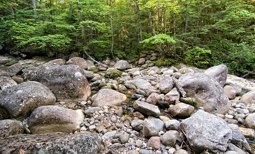
1) Looks like several river crossings (4-5 IIRC from Guide), one noted as difficult in high water in AMC guide. Would these crossings be an issue at all at this time of year due to water levels, icy rocks or awkward footing?
2) Is Middle Moriah worth a bushwhack and/or does it have herd paths to summit? Looks pretty close to trail but no idea what the woods are like on it or if it had any views from ledges, bald top, etc? On the satellite image it looks like an outcropping of rock on top in NW corner of summit area that could potentially have unique views.
3) Are lower parts of this trail an issue with hunting season? I read an AMC article somewhere and I think it referenced this area as getting a lot of hunters.

Any info on the trail or area would be appreciated. If I wind up doing it would likely be this weekend or next, weather permitting. Thanks.
 
I did this hike earlier in the year, it's remote and beautiful. Here are my photos from the trip if you want to get an idea of the terrain: https://www.flickr.com/gp/kmacgray/056wo1

To answer your questions:

1. Yes, the crossings could be problematic if high. I only recall two or three when I did it. Water was very low when I was there:


2. I thought about checking out Middle Moriah but ran out of time. I've heard conflicting reports about whether there's a herd path or not, but this old peakbagger.com report from 2010 mentions a flagged route to the summit: http://peakbagger.com/climber/ascent.aspx?aid=127574

3. I can't speak to the hunting situation.
 
Coincidentally, this peak fell on my radar within the last month, after catching a photo from someone on the summit. Don't know if I'll get it this year, but next summer for sure.
 
Unbelievable view of the Wild River Wilderness/Carters/Baldfaces etc... Highly recommended. Lightly used.

Kendueskeg from the AT to summit got a brushing over the summer season at some point, so the going is less scratchy than in years past.
 
A general comment, the Rattle River isn't a river, its a stream that really doesn't have much flow except during spring runoff.
 
Wound up doing this on Saturday. Was going to do a loop of Spur Trail/Lowes Path but weather was still lousy when I got up there so I did Shelburne instead. Probably should have waited for a better day. It was supposed to clear up and there were some patches of blue sky well North so I gave it a shot but it stayed in the fog and actually snowed most of the way out. This trail seems like it would be a great hike on a dry late Summer or early Fall day with clear skies. Kenduskeag Trail has some very interesting and varied terrain. I would also point out that the section coming from Rattle River does not appear to be the section I've seen in so many photos. Gonna have to try it from the other side one of these days.

To answer my own question for others, there are two significant river crossings. Both are shortly after the Rattle River shelter and fairly close together. The first is wider and probably the harder of the two. The second was much narrower but the actual crossing goes over some very large and smooth sloped boulders and a deep channel. Just upstream of the channel is a much easier crossing in a flat section (with a well worn side path so it is likely the preferred area to cross). Neither was particularly tough today but water was higher than I was expecting. The AMC Guide notes to pay careful attention to markings at crossings. I thought they were very obvious, with stone steps leaving the stream bed on both crossings. The only other crossing of note was the first one at about 0.6 miles. It is only a brook but most of the crossing is actually on a smooth sloping ledge with some moss. In higher water or on an icy day it could be a little interesting.

The section of Kenduskeag Trail from Rattle River junction to summit was also a surprise. Had a ton of PUD that had many sections of exposed ledge, mud and small scrambles with steep drops and climbs amidst the flat sections. Far more tedious than I was expecting. The wet conditions and black ice made the scrambles tricky. At least the mud was frozen and could be walked on.

Didn't appear to be a big hunting area. I saw a lot of trucks parked along most sections of Rte 2 but there was no one in the lot or general area when I arrived. There is a house across the street and some snowmobile trails in the area so possibly hunting is not allowed or it is just not a desirable hunting area.

Last comment I'd make is that all the bog bridges are rarely flat and have fewer supports underneath so they bow quite a bit crossing. They all had a thin sheen of ice today. I had my IceBreakers and even so slipped a few times on the side sloping and inclined planks. In a lot of places walking alongside the planks would have been very tedious or impossible.
 
Last edited:
Top