
1HappyHiker
Well-known member
The evening before this trek, I wasn't certain if I'd be hiking the following day since I was feeling too disorganized to get organized for a hike! Well, finally by very late morning I eventually got my act together. However, with the late start and the shorter daylight hours, I had a very compressed time frame for hiking.
So, with the time available, I guesstimated that I might be able to do two short bushwhacks in the Crawford Notch area that have been on my mind for awhile. As it turns out, I was able to complete both whacks, but with only an ounce of daylight to spare!
Here are two mini-reports for each of these bushwhacks.
Whack #1: Ledge Near Sawyer Rock Picnic Area
This was a somewhat steep whack. However, it was very short (about 1.0 mile round-trip) and it was through very open woods the entire distance. From this ledge (about 1,860 feet elevation), there are some unique perspectives.
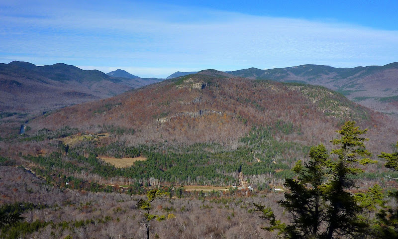
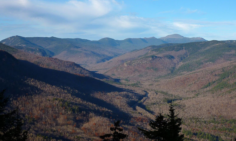
The first snapshot is looking northward. Hart Ledge is prominent in the foreground, and the Crawford Notch area is in the background.
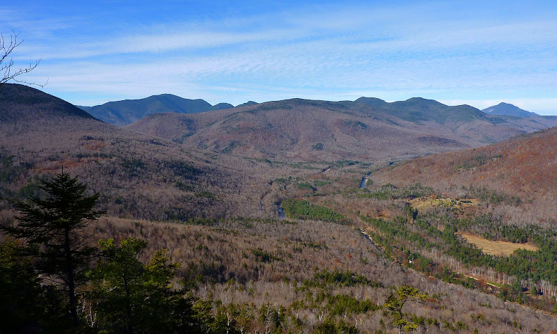
This next snapshot is looking northwesterly, and just to name a few, Mt. Carrigain is the high peak to the far left, and Mt. Willey is on the far right.
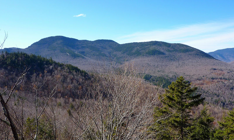
The next photo features an up-close view of the entire mass of Mt. Tremont.
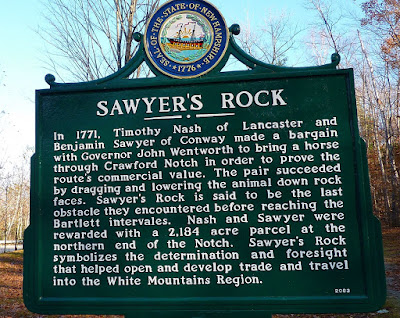
The photo below is pretty much self-explanatory. This sign is at the spot where I parked, and it provides a brief history of Sawyer Rock.
 -------------------------------------------------
Whack #2: Rockslide on North End of Mt. Tremont
For this second bushwhack of the day, I pulled out of the Sawyer Rock Picnic area and drove a very short distance up Route 302 and parked at the Fourth Iron Tentsite.
This whack was not as steep as the first whack, but it was twice the distance, i.e. about 2 miles round-trip. And like the first bushwhack, this trek was also through very open woods for the entire distance.
The rockslide is massive. I was only on the lower portion of it at about 2,100 feet elevation. However, the top of the slide is at about 2,200 feet. I was totally bummed when I realized that I forgot to take a snapshot of the slide itself. Oh well! Since it's such an easy bushwhack, I suspect I'll return there at some point in time.
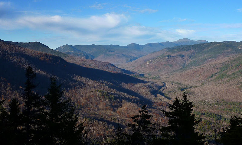
From this rockslide there is a somewhat unique viewing angle for the Crawford Notch area. The two snapshots below were taken from the rockslide looking northward. The first one is slightly zoomed, and the second shot is not zoomed.
Slightly Zoomed
Not Zoomed
1HappyHiker
So, with the time available, I guesstimated that I might be able to do two short bushwhacks in the Crawford Notch area that have been on my mind for awhile. As it turns out, I was able to complete both whacks, but with only an ounce of daylight to spare!
Here are two mini-reports for each of these bushwhacks.
Whack #1: Ledge Near Sawyer Rock Picnic Area
This was a somewhat steep whack. However, it was very short (about 1.0 mile round-trip) and it was through very open woods the entire distance. From this ledge (about 1,860 feet elevation), there are some unique perspectives.
The first snapshot is looking northward. Hart Ledge is prominent in the foreground, and the Crawford Notch area is in the background.
This next snapshot is looking northwesterly, and just to name a few, Mt. Carrigain is the high peak to the far left, and Mt. Willey is on the far right.
The next photo features an up-close view of the entire mass of Mt. Tremont.
The photo below is pretty much self-explanatory. This sign is at the spot where I parked, and it provides a brief history of Sawyer Rock.
Whack #2: Rockslide on North End of Mt. Tremont
For this second bushwhack of the day, I pulled out of the Sawyer Rock Picnic area and drove a very short distance up Route 302 and parked at the Fourth Iron Tentsite.
This whack was not as steep as the first whack, but it was twice the distance, i.e. about 2 miles round-trip. And like the first bushwhack, this trek was also through very open woods for the entire distance.
The rockslide is massive. I was only on the lower portion of it at about 2,100 feet elevation. However, the top of the slide is at about 2,200 feet. I was totally bummed when I realized that I forgot to take a snapshot of the slide itself.
Oh well! Since it's such an easy bushwhack, I suspect I'll return there at some point in time. From this rockslide there is a somewhat unique viewing angle for the Crawford Notch area. The two snapshots below were taken from the rockslide looking northward. The first one is slightly zoomed, and the second shot is not zoomed.
Slightly Zoomed
Not Zoomed
1HappyHiker