Bombadil
Active member
I recall the satisfaction of reaching the various NEHH peaks a few years back and for many less interesting peaks figured it'd be one and done. Yet this fall I decided I'd start working on the NEHH-W list to mix things up a bit and motivate me to go back to see some of the nicer and less frequented peaks. The lousy ones? Well I can always put those off til later...
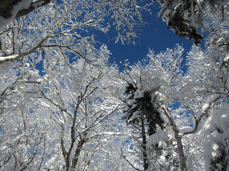
Sunday, 1-6-13 Jay and Big Jay via LT. Trail conditions: http://www.vftt.org/forums/showthread.php?47512-jay-big-jay-1-6-12
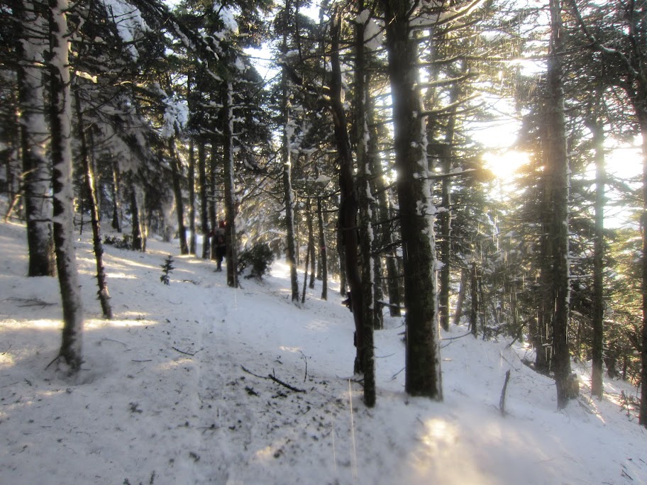
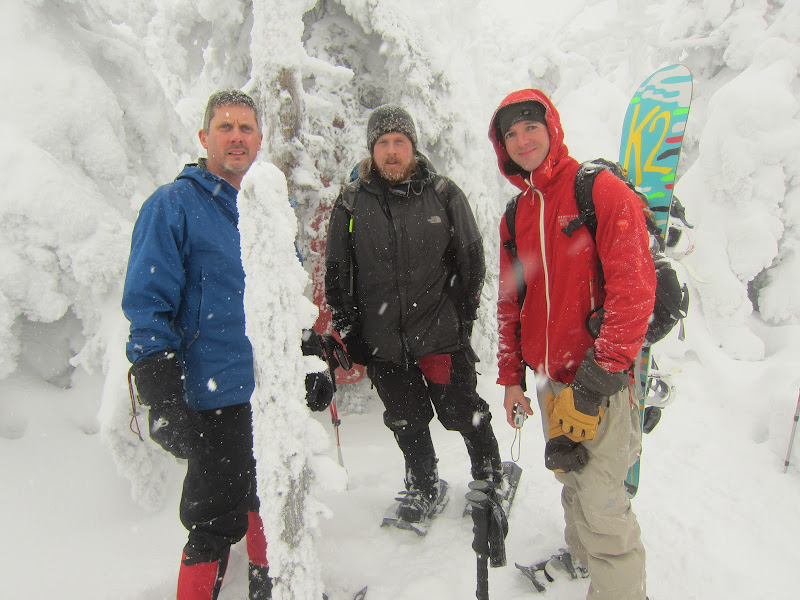
Tom Caldwell shot me a message just as I was landing in Boston Friday night letting me know a small group was headed up to the Jays on Sunday so I jumped on board. I love Jay, but man that drive. I used to think it was long when I lived in Thetford, VT. Now it's just extra large coffee from dunks and a redbull territory and I get up there on caffeine fumes. Snow the whole drive up in 2WD didn't help but somehow the 10am start was the earliest of the week for me. Thanks to all the pow up there the LT is well broken out by skiiers and we made it up to Jay in no time. The snowboard on my pack was most excellent at clearing all the snow from the leaners for Tom who's fairly tall. The herdpath to Big Jay was pretty well broken out and here we split up. I had been itching to board the bowl for some time so I dropped in while the others hiked back out. All the powder made for a great run until I got to the bottom of the bowl where being a single planker in powder meant it was easier and faster to switch over to snowshoes and hoof it back to the road. Thanks to very good early season up there the hikers beat me out, but it was worth it for the steep fresh stuff. Even with the trail breaking to 242 it was just a 4.5h hike.
canister-free Big Jay
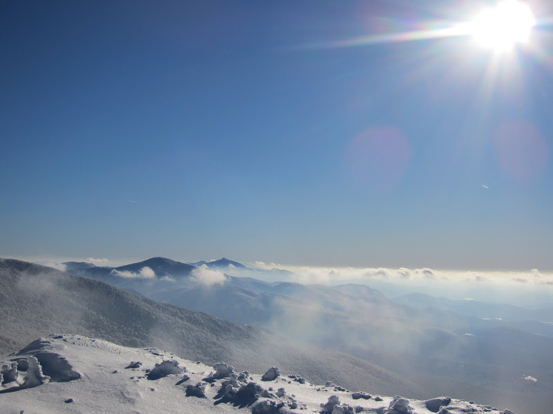
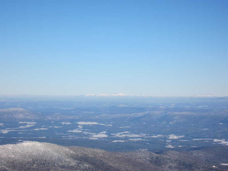
Monday, 1-7-13 Mansfield via Sunset Ridge. Trail conditions: http://www.vftt.org/forums/showthread.php?47569-Mansfield-1-7-13
I left Hanover, NH sometime around 10:30 thinking it was going to be a late evening on the mountain. Far from it. I started up the CCC Road around 12:30 to a pristine blue sky with snow-covered trees. Great day for Mansfield. The trail was pretty well broken out and at treeline I caught up to a pair of hikers that were doing their share of trailbreaking. They seemed a bit taxed so I went off in front and broke out the knee deep powder more or less straight up the ridge since only a couple small cairns were noticeable. The wind picked up just below the summit where til then the single digit temps felt quite comfortable with not even a breeze and a blue sky. I made some slurred small-talk with a skiier at the summit thanks to the cold and decided I ought to get further back down the ridge--well or at least put on a jacket. I opted to retreat to a nice sunny spot lower on the ridge to soak up the late afternoon sun. I had hoped to catch the sunset from the ridge but being at treeline at 3pm I decided I could come back some other time and stay at one of the lean-to's down at the summer trailhead. It was a pretty solid drive back to Hanover, NH where I'd meet up with friends again. I was back at the car by about 4 pm and on my way...
blue sky eye candy
a fine winter day on sunset ridge...looking south
old friends in NH
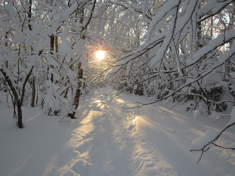
not quite sunset from the bottom of sunset ridge
Tuesday, 1-8-13 Ellen and Abraham via ski trails. Trail conditions: http://www.vftt.org/forums/showthread.php?47570-Ellen-amp-Abe-1-8-13
The worst part about winter hiking is the need to start early. I soaked up every last ounce of enjoyment from sleeping in yet again and left the parking lot at Ellen at 12:45. Yesterday I thought I'd finish in the dark, today I was quite certain of it. Apparently I was supposed to buy a snowshoe pass and follow designated trails to the top. Ski patrol gave recommendations on trails and it wasn't until I was at the summit that I was asked if I had a pass. I told him I didn't know about it and no one had asked, plus I was heading to Abraham with my snowboard and he shrugged it off since I was already at the top. I stashed my board a few hundred yards into the woods since the LT up there was chock full of blowdowns and leaners. Sidecountry skiiers broke out some sections of the ridge but a few of the miles were well drifted in with no sign of any traffic. Shortly before dusk I ran into a couple just coming from Abraham and we each smiled a bit since we had done work to make each others respective hike a little easier. I popped out on Abraham just before dusk but was pretty miffed at myself that I had neglected to leave the Heady Topper in the car which would have been a delight for watching the sunset. I pushed hard on the way back hoping to have some light left for the descent to no avail. I definitely didn't snowboard down by headlamp. And I definitely didn't do mogul runs for sure.

the one and only blaze I saw en route to Abraham

looking towards Abraham from Lincoln Peak

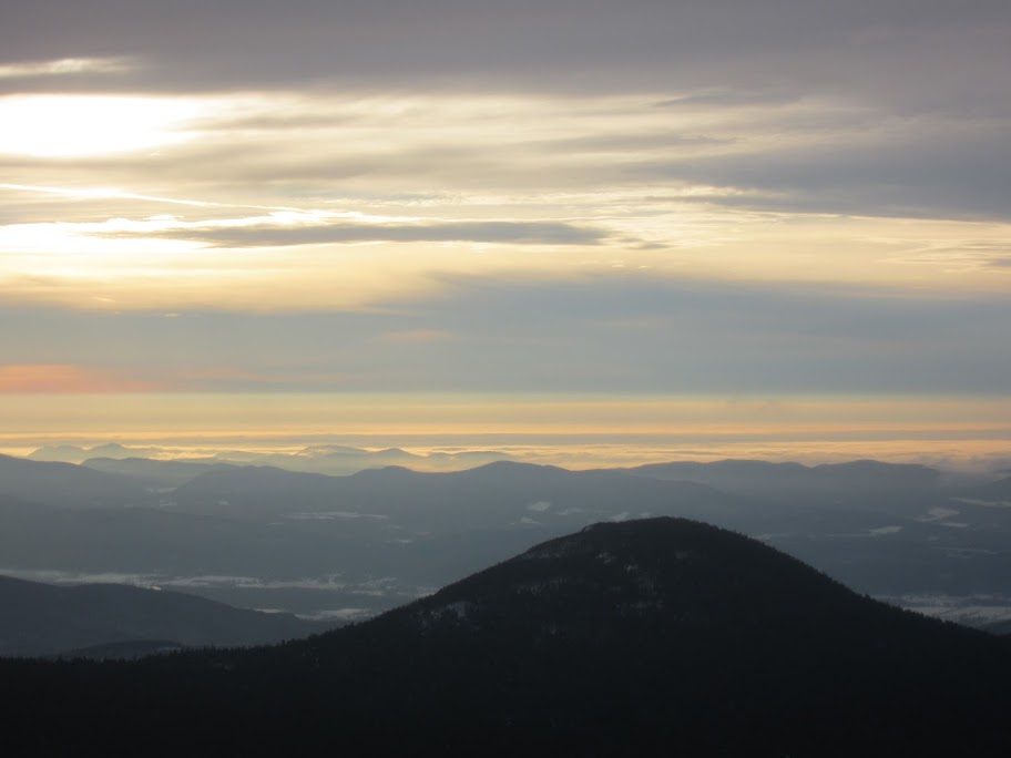
nearing sunset from Abraham with Ellen off in the distance
Wednesday, 1-9-13 Equinox via Blue Summit Trail. Trail conditions: http://www.vftt.org/forums/showthread.php?47571-Equinox-1-9-13
After a rather fun evening at karokee night in Hanover I got a rather late start on Equinox and my plan to get 2 peaks today was evaporating. I hadn't realized when I did Equinox in summer just how much traffic the mountain gets. The packed trail was 5' wide until the trail left the old logging road up around 3k feet--pretty neat. I liked the grade on this one, gets up to where it's going in a hurry and it's easy to gain altitude quickly. The wind was quite fierce up on top and I was only wearing a baselayer since it was in the 30s for much of the hike so I quickly snapped a few pics by the no longer abandoned summit building and headed down. Despite finishing the hike in a little over 2 hours I didn't feel like pressing on for Dorset or Stratton with the wind being so fierce and having an awfully long drive back to eastern Mass. I'm pretty sure given another day or two of hiking I would have been starting up hiking around the time the evening news was coming on, but with the smaller Vermont mountains it's best to soak up those opportunities when you can get away with it.
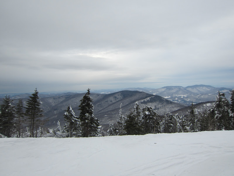
overcast and windy day on Equinox
Pat
Sunday, 1-6-13 Jay and Big Jay via LT. Trail conditions: http://www.vftt.org/forums/showthread.php?47512-jay-big-jay-1-6-12
Tom Caldwell shot me a message just as I was landing in Boston Friday night letting me know a small group was headed up to the Jays on Sunday so I jumped on board. I love Jay, but man that drive. I used to think it was long when I lived in Thetford, VT. Now it's just extra large coffee from dunks and a redbull territory and I get up there on caffeine fumes. Snow the whole drive up in 2WD didn't help but somehow the 10am start was the earliest of the week for me. Thanks to all the pow up there the LT is well broken out by skiiers and we made it up to Jay in no time. The snowboard on my pack was most excellent at clearing all the snow from the leaners for Tom who's fairly tall. The herdpath to Big Jay was pretty well broken out and here we split up. I had been itching to board the bowl for some time so I dropped in while the others hiked back out. All the powder made for a great run until I got to the bottom of the bowl where being a single planker in powder meant it was easier and faster to switch over to snowshoes and hoof it back to the road. Thanks to very good early season up there the hikers beat me out, but it was worth it for the steep fresh stuff. Even with the trail breaking to 242 it was just a 4.5h hike.
canister-free Big Jay
Monday, 1-7-13 Mansfield via Sunset Ridge. Trail conditions: http://www.vftt.org/forums/showthread.php?47569-Mansfield-1-7-13
I left Hanover, NH sometime around 10:30 thinking it was going to be a late evening on the mountain. Far from it. I started up the CCC Road around 12:30 to a pristine blue sky with snow-covered trees. Great day for Mansfield. The trail was pretty well broken out and at treeline I caught up to a pair of hikers that were doing their share of trailbreaking. They seemed a bit taxed so I went off in front and broke out the knee deep powder more or less straight up the ridge since only a couple small cairns were noticeable. The wind picked up just below the summit where til then the single digit temps felt quite comfortable with not even a breeze and a blue sky. I made some slurred small-talk with a skiier at the summit thanks to the cold and decided I ought to get further back down the ridge--well or at least put on a jacket. I opted to retreat to a nice sunny spot lower on the ridge to soak up the late afternoon sun. I had hoped to catch the sunset from the ridge but being at treeline at 3pm I decided I could come back some other time and stay at one of the lean-to's down at the summer trailhead. It was a pretty solid drive back to Hanover, NH where I'd meet up with friends again. I was back at the car by about 4 pm and on my way...
blue sky eye candy
a fine winter day on sunset ridge...looking south
old friends in NH
not quite sunset from the bottom of sunset ridge
Tuesday, 1-8-13 Ellen and Abraham via ski trails. Trail conditions: http://www.vftt.org/forums/showthread.php?47570-Ellen-amp-Abe-1-8-13
The worst part about winter hiking is the need to start early. I soaked up every last ounce of enjoyment from sleeping in yet again and left the parking lot at Ellen at 12:45. Yesterday I thought I'd finish in the dark, today I was quite certain of it. Apparently I was supposed to buy a snowshoe pass and follow designated trails to the top. Ski patrol gave recommendations on trails and it wasn't until I was at the summit that I was asked if I had a pass. I told him I didn't know about it and no one had asked, plus I was heading to Abraham with my snowboard and he shrugged it off since I was already at the top. I stashed my board a few hundred yards into the woods since the LT up there was chock full of blowdowns and leaners. Sidecountry skiiers broke out some sections of the ridge but a few of the miles were well drifted in with no sign of any traffic. Shortly before dusk I ran into a couple just coming from Abraham and we each smiled a bit since we had done work to make each others respective hike a little easier. I popped out on Abraham just before dusk but was pretty miffed at myself that I had neglected to leave the Heady Topper in the car which would have been a delight for watching the sunset. I pushed hard on the way back hoping to have some light left for the descent to no avail. I definitely didn't snowboard down by headlamp. And I definitely didn't do mogul runs for sure.
the one and only blaze I saw en route to Abraham
looking towards Abraham from Lincoln Peak
nearing sunset from Abraham with Ellen off in the distance
Wednesday, 1-9-13 Equinox via Blue Summit Trail. Trail conditions: http://www.vftt.org/forums/showthread.php?47571-Equinox-1-9-13
After a rather fun evening at karokee night in Hanover I got a rather late start on Equinox and my plan to get 2 peaks today was evaporating. I hadn't realized when I did Equinox in summer just how much traffic the mountain gets. The packed trail was 5' wide until the trail left the old logging road up around 3k feet--pretty neat. I liked the grade on this one, gets up to where it's going in a hurry and it's easy to gain altitude quickly. The wind was quite fierce up on top and I was only wearing a baselayer since it was in the 30s for much of the hike so I quickly snapped a few pics by the no longer abandoned summit building and headed down. Despite finishing the hike in a little over 2 hours I didn't feel like pressing on for Dorset or Stratton with the wind being so fierce and having an awfully long drive back to eastern Mass. I'm pretty sure given another day or two of hiking I would have been starting up hiking around the time the evening news was coming on, but with the smaller Vermont mountains it's best to soak up those opportunities when you can get away with it.
overcast and windy day on Equinox
Pat