
Jazzbo
Well-known member
- Joined
- Jan 1, 2005
- Messages
- 1,197
- Reaction score
- 163
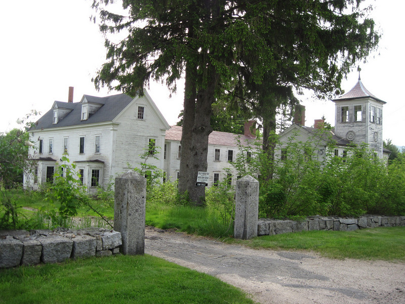
Algonquin Trail has been on my to-do list for years. Since I'm contemplating re-doing a bushwack to Sachem Peak I really wanted to hike Algonquin to get the best view of Sachem Peak and it's marvelous cliffs. I was not dissapointed. Skies were hazy for the awesome views this hike offers, but conditions weren't bad either. I approached Sandwich Notch Road from Rt 109 which passes over this hill in village of Sandwich which offers a splendid views of the Sandwich Range. This hill top has some very interesting architectural gems. This place is up for sale. With it's awesome views maybe VFTT should buy it for a clubhouse.
I was expecting solitude, but it soon became apparent a meetup group had planned a hike using just this route. It sounded like a pretty big group so I set off in a hurry to beat them to the top. Blackflies were out in force at 1400' elevation of the TH. They weren't bad at all if you kept moving.
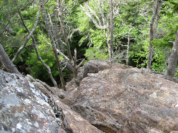
The famous scrambles were located between Black Mountain and the 3200' elevation. None of them were too tricky.
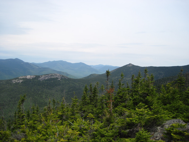
The views were grand. The ridge walk begins in scrubby spruce zone with many open ledges with fine views. I disposed of many minor blow downs or cut side branches to enable easy step-overs. The 1.8 mile long ridge trail between junction of Black Mountain Pond Trail and Sandwich is very clear and features a beautiful organic tread way. No need of brushing out at all. Hee is the view of cliffs of Sachem Peak and Jennings Peak.
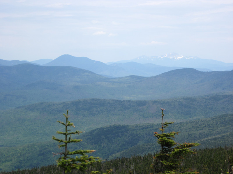
I covered the 4.5 miles to the summit in 3.5 hours. I spent 30 minutes enjoying the hazy but long range views all around me. BTW I celebrated by eating an egg salad sandwich. This zoom shot shows Washington still has partial mantle of snow.
I headed out just as the meet up group reached the summit. I stopped at a ledge to enjoy views of Welch & Dickey, Tecumseh, and Sachem Peak and more. Two women from the meet up group passed by and we exchanged a few words and they proceeded along the trail.
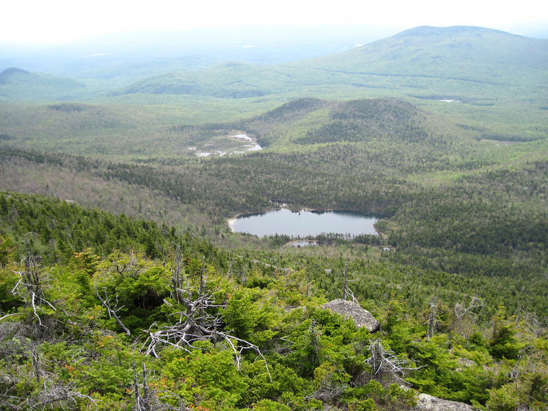
I contemplated descending via Black Mountain Pond Trail to check out the pond and investigate taking a possible abandoned trail to return to the trail head. I came to the junction with Black Mountain Pond Trail and turned left to descend down to Back Mountain Pond. Here is view of Black Mountain Pond and the Beebe River Valley.
The trail descends at first quite steeply. The map and the views indicated the mountainside was just as steep if not steeper than the Algonquin Trail so I wasn’t surprised when I resorted to butt sliding many times. I passed over one interesting stretch where it looked like huge slivers of rock had calved off the mountain side. This trail features some interesting scrambles of it’s own.
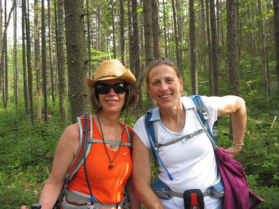
I reached the ponds at 3:00. I was surpised to encounter the same two women who I saw back up on the ridge who were part of the meetup group. They should not have been at the ponds and informed me they had missed the trail junction sign and had descended down the wrong trail. They asked about how to get back to the Algonquin Trail. I pointed up to steep mountainside and said it would entail 1000’ elevation gain to regain Algonquin Trail. I said I was heading back to the trail head too, but was going to try to find an abandoned trail that I suspected was there and take it back to the trail head. I showed them my National Geographic’s Topo which showed the trail, but I cautioned them I wasn’t actually sure if the trail existed and if it proved to not be there then they would have to accompany me on a bush whack. Not having any better options they agreed so we exchanged introductions. They were Linda and Jayne.
To reassure them I knew what I was doing I told them I was an experienced bushwhacker and a trip leader with NH chapter AMC. I showed them my map which show the trail starting right bythe little pond. We started out navigating through some thick woods. I had long pants, but Kathy and Linda had shorts. I wasn’t seeing the trail and was becoming a bit concerned about doing a long whack with two complete strangers. I decided to venture out into the flats which I was avoiding because I thought it might be swampy. This proved to be the right move as I right away stumbled on a very obvious and well tended trail.
We followed the trail (which eventually turned into a long fallow logging road) all the way to a junction at 1600’ elevation with the Algonquin Trail. Linda and kathy were very pleased to finally be on the right trail and avoid the 1000’ climb back up to the summit ridge. We returned to the trail head at 5:00. Linda and Kathy’s friends were sitting in their car waiting and were very happy to be re-united. I was able to help them recover from a navigational error and I have a neat story to tell.
I was expecting solitude, but it soon became apparent a meetup group had planned a hike using just this route. It sounded like a pretty big group so I set off in a hurry to beat them to the top. Blackflies were out in force at 1400' elevation of the TH. They weren't bad at all if you kept moving.
The famous scrambles were located between Black Mountain and the 3200' elevation. None of them were too tricky.
The views were grand. The ridge walk begins in scrubby spruce zone with many open ledges with fine views. I disposed of many minor blow downs or cut side branches to enable easy step-overs. The 1.8 mile long ridge trail between junction of Black Mountain Pond Trail and Sandwich is very clear and features a beautiful organic tread way. No need of brushing out at all. Hee is the view of cliffs of Sachem Peak and Jennings Peak.
I covered the 4.5 miles to the summit in 3.5 hours. I spent 30 minutes enjoying the hazy but long range views all around me. BTW I celebrated by eating an egg salad sandwich. This zoom shot shows Washington still has partial mantle of snow.
I headed out just as the meet up group reached the summit. I stopped at a ledge to enjoy views of Welch & Dickey, Tecumseh, and Sachem Peak and more. Two women from the meet up group passed by and we exchanged a few words and they proceeded along the trail.
I contemplated descending via Black Mountain Pond Trail to check out the pond and investigate taking a possible abandoned trail to return to the trail head. I came to the junction with Black Mountain Pond Trail and turned left to descend down to Back Mountain Pond. Here is view of Black Mountain Pond and the Beebe River Valley.
The trail descends at first quite steeply. The map and the views indicated the mountainside was just as steep if not steeper than the Algonquin Trail so I wasn’t surprised when I resorted to butt sliding many times. I passed over one interesting stretch where it looked like huge slivers of rock had calved off the mountain side. This trail features some interesting scrambles of it’s own.
I reached the ponds at 3:00. I was surpised to encounter the same two women who I saw back up on the ridge who were part of the meetup group. They should not have been at the ponds and informed me they had missed the trail junction sign and had descended down the wrong trail. They asked about how to get back to the Algonquin Trail. I pointed up to steep mountainside and said it would entail 1000’ elevation gain to regain Algonquin Trail. I said I was heading back to the trail head too, but was going to try to find an abandoned trail that I suspected was there and take it back to the trail head. I showed them my National Geographic’s Topo which showed the trail, but I cautioned them I wasn’t actually sure if the trail existed and if it proved to not be there then they would have to accompany me on a bush whack. Not having any better options they agreed so we exchanged introductions. They were Linda and Jayne.
To reassure them I knew what I was doing I told them I was an experienced bushwhacker and a trip leader with NH chapter AMC. I showed them my map which show the trail starting right bythe little pond. We started out navigating through some thick woods. I had long pants, but Kathy and Linda had shorts. I wasn’t seeing the trail and was becoming a bit concerned about doing a long whack with two complete strangers. I decided to venture out into the flats which I was avoiding because I thought it might be swampy. This proved to be the right move as I right away stumbled on a very obvious and well tended trail.
We followed the trail (which eventually turned into a long fallow logging road) all the way to a junction at 1600’ elevation with the Algonquin Trail. Linda and kathy were very pleased to finally be on the right trail and avoid the 1000’ climb back up to the summit ridge. We returned to the trail head at 5:00. Linda and Kathy’s friends were sitting in their car waiting and were very happy to be re-united. I was able to help them recover from a navigational error and I have a neat story to tell.
Last edited:
")