Seek the Peak Weekend '13 Part 1: Pine Mountain? 7-20-13

vftt.org

Help Support vftt.org:

This site may earn a commission from merchant affiliate links, including eBay, Amazon, and others.

Kevin Judy and Emma

Well-known member
Joined
Jul 8, 2007
Messages
1,641
Reaction score
430
Location
Kingston, NH.
20130720-20130720-_DSC0036.jpg

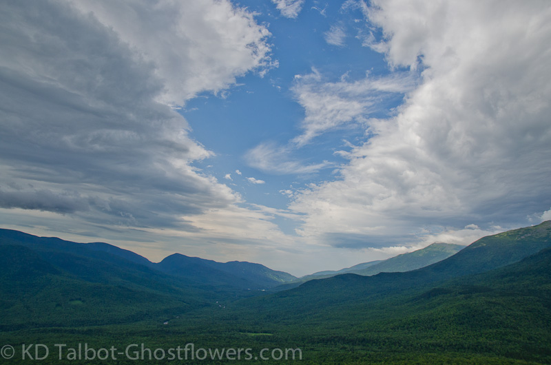
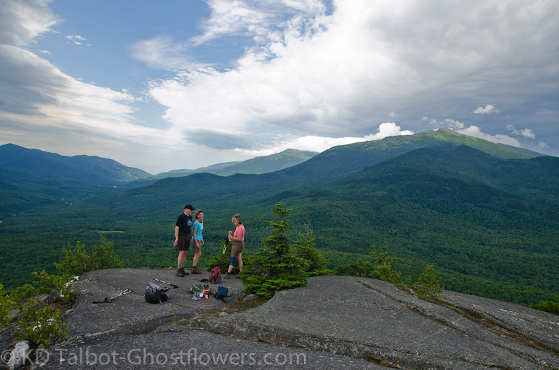
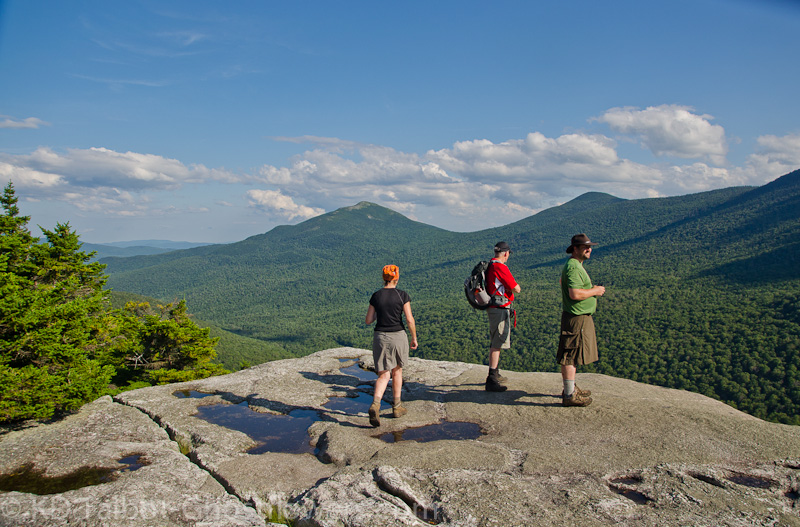
View South to Carter and Pinkham Notches from Pine Mountain
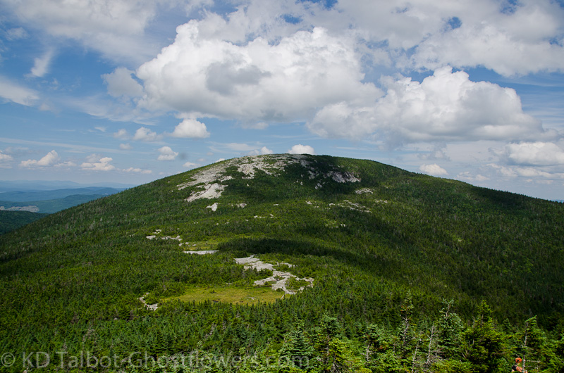
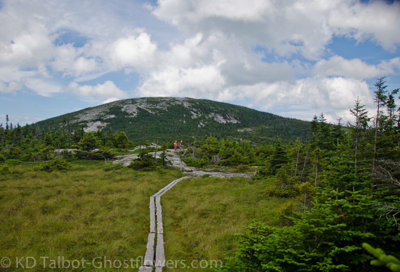
Pine Mountain 2405'

Pine Mountain Road/Ledge Trail

4+ Miles 800' +/- Elevation gain

Kevin, Judy Mark and Nat


This would be a bittersweet Seek the Peak year, the first we would attend without one of the stars of the show, Emma. We had waited in nervous anticipation for this event, knowing full well that it would be emotionally draining, seeing so many friends and people who loved Emma who we had not seen since her passing, and who would be giving their heartfelt and sincere condolences. We know it is all part of the process, part of the healing, but this knowledge did not stop us from shedding some tears.

20130720-20130720-_DSC0012.jpg

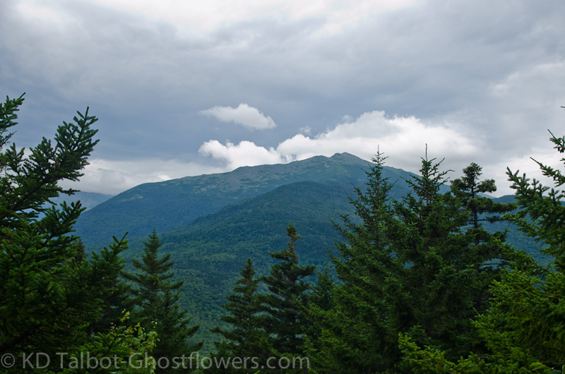
First view of Mount Madison

As always, we arrived Friday to camp at Moosebrook where we would be with friends. Due to my feet dragging getting things together this year we missed out on our favorite site at the shelter for the 2nd year in a row. This time we camped in the main CG close to several good friends, most of whom we never would have met if not for this annual event. Mutual love for the mountains, Mount Washington and the Observatory in particular had brought us all together over the years through their forum, and through this annual hike-a-thon. Many of you have donated to our cause over the years and we are very grateful.

20130720-20130720-_DSC0023.jpg

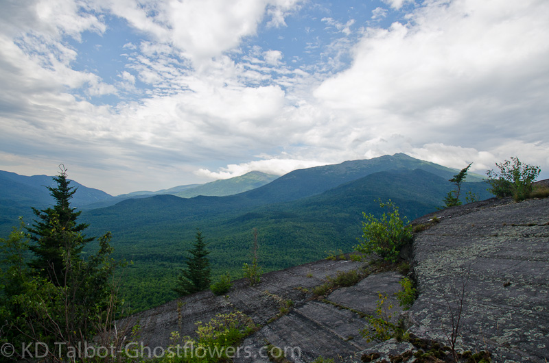
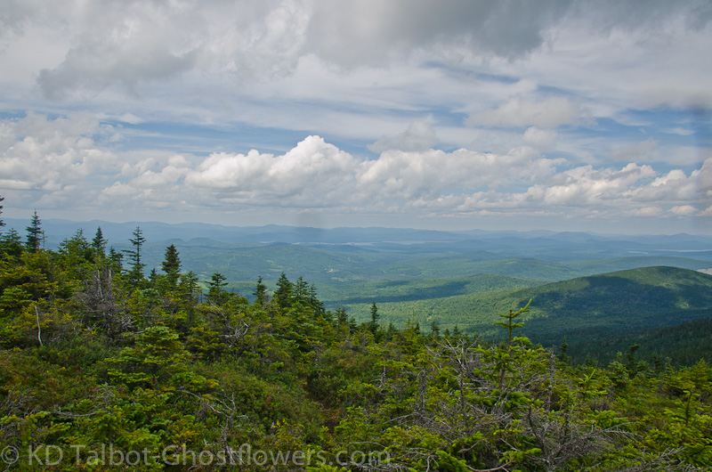
Skies over the Presidential Range

The weather gods threw a monkey wrench in the gears this year. The forecast for Saturday, the day of the planned hike was scary. This, I'm sure, made for some sleepless nights for those trying to pull off the largest fundraising event of the year for their non-profit organization. After all, if you are going to invite 500 people to hike your favorite mountain, you want to be able to tell them they will be relatively safe from the weather, especially when your organization is just that, a weather data gathering facility on the top of the highest point in the northeast, responsible for giving up to date weather forecasts for the high peaks of New Hampshire.

20130720-20130720-_DSC0027.jpg

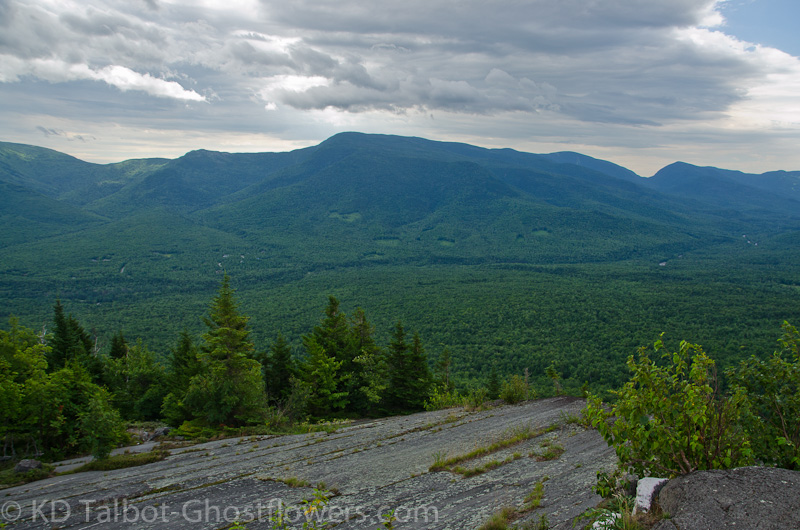
The Imp, North Carter and Carter Notch

One of the meteorologists on Friday quipped, "The forecast numbers for the next 24 hours are the kind of model runs you do as a first day freshman to show a worst case scenario for severe weather. Comically scary." With that in mind we planned an easy day for Saturday, at a safe distance away from the rockpile. As it turned out we had an excellent view of the event as it engulfed the Northern Presidentials and brought a quick moving rain shower across Pinkham Notch at around 11am. This surely would have soaked any hikers on the slopes, and the potential for lightning and hail were too high to risk going above tree line. Kudos to the Obs for making it clear that people should stay off Mount Washington on this day. It was the right call and the simplest of logic, better safe than sorry.

20130720-20130720-_DSC0032.jpg

Pinkham Notch

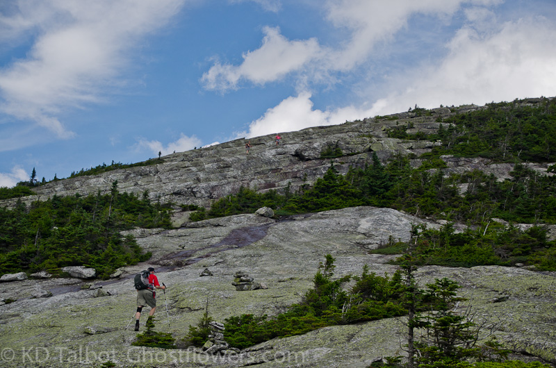
The promise from the Observatory was that Sunday would be a beautiful hiking day, so with that in mind we planned an easy day with our friends Mark and Nat, and we would hike Pine Mountain in Gorham, minutes from our campsites. We decided to hike in from Pinkham B Road which may not have been the best choice for a Saturday, as it seems that Saturday is pick-up day for the parents of kids attending camp at the Horton Center. The first mile or so in is along the driveway to the HC, and we had to contend with some traffic on the way in. We were soon however off the road and onto the trail which quickly rises up to the southern ledges which offers incredible views south to Pinkham and Carter Notches, as well as the surrounding Carter/Wildcat Ridge to the east, and the Northern Presidentials to the west.
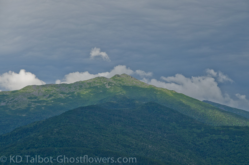
20130720-20130720-_DSC0034.jpg

Mount Madison

From this southern ledge we watched the predicted rain storm engulf the high peaks as it spread across Pinkham Notch and unleashed its drenching rain. This can make hiking in the Presidential Range treacherous even without lightning as it makes the lichen coated rocks slippery as ice. I have taken many a tumble on such rocks, they are unforgiving. The mica schist make up of these has an extremely rough surface which can tear skin and leave unprotected limbs as well as paws torn and bloody. Pondering this as we stood on the ledges and watched the rain pass I thought of how lucky we were to have been able to hike these mountains with Emma, her light weight saving her pads from injury on these bony trails.
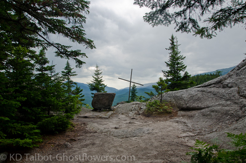
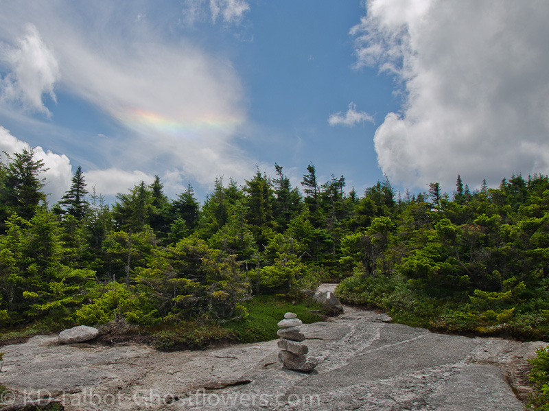
20130720-20130720-_DSC0041.jpg

The Pulpit

From the ledges we headed north, taking in the views to be had along the way towards the northern hump of Pine Mountain known as Pulpit Rock. Here there is a wonderful, roofless church where there are Sunday morning sermons for the campers. The mountains have always been my church, and hiking with wife, dog and good friends my fellowship. On the way back we passed through the Horton Center where the child in me could not resist ringing the huge church bell. Apparently this is frowned upon in this establishment. My mortified wife and companions looked on trying to figure out just what the hell is wrong with me as I was scolded by the counsellor that was on duty.
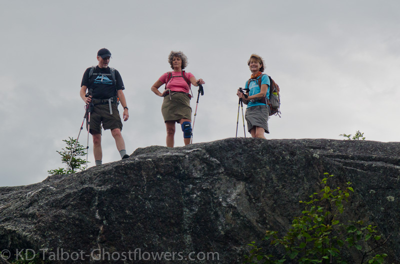
20130720-20130720-_DSC0044.jpg

Mark, Jude and Nat

"Can I help you people? We only use that bell for emergencies!" Damn, I didn't think there was anyone around, doh! "I didn't know that, sorry. There wasn't a sign." "Well, there's no sign because not everyone needs to touch everything they see." Damn, I do... "OK, sorry! Just leaving now!" I shuffled off in my best Quasimodo impersonation. Remember, if you're ever there: Don't ring the bell, no matter what your inner child says...


Fast moving rain showers engulf Pinkham Notch


We went back to camp and got ready for the Seek the Peak after party, held in the huge circus tent at the base of the MW Auto Road. As always it was great to see old friends, and make a few new ones, and as always Hart turkey farm outdid themselves. Pulling off a catered turkey dinner for 3-400 people cannot be an easy feat. There is just something about having a Thanksgiving Dinner in July after a good hike that I find appealing. Is it just me?


Under the Big Top at Seek the Peak!

Complete set of pics HERE:

KDT
 
Seek the Peak Weekend Part 2:The Baldpates in Grafton Notch 7-21-13

20130721-20130721-_DSC0071.jpg

East Baldpate

Baldpate Mountain West Peak 3662' and Baldpate Mountain East Peak 3780'

Appalachian Trail

7.6 Miles 3448' Elevation gain

Kevin, Judy, Mark, Nat, Erich, Gloria

We had chosen this destination with the Truman's some time back and had decided to try to work it in this weekend. With the washout of Seek the Peak the day before we could have changed our plans and gone ahead and hiked Mount Washington on this day, but decided to stick to our original plan of hiking the Baldpates in Grafton Notch. Moosebrook was a pretty good base camp for this hike although there was still close to fifty miles of driving each way to get there. Judy and I had first visited here last fall with Emma, one of the last "new" places we hiked with her. Today we would miss her, but we had the Truman's and friends Erich and Gloria for company.

20130721-20130721-_DSC0061.jpg

Great Spangled Fritillary (Speyeria cybele) at the trailhead

I am using the excuse of not having much sleep at all the previous two nights to explain my pitiful poor performance on this hike. I allowed myself to get dehydrated and cramp up as we hiked back to West Baldpate. Chugging two Gatorades and a half a liter of water allowed me to continue despite my exhaustion. Honestly, I am way out of hiking shape as we have done little since Emma's passing and because of our hatred of humidity and biting insects. The insects were bad, but not terrible, mostly only bothersome when we stopped. Despite it being a nicer, much cooler day than it had been in some time, the humidity was still topping the charts and I felt as though I had sweat off several pounds. A quick look in the mirror corrected me on that.

20130721-20130721-_DSC0065.jpg

View Northwest to Lake Umbagog

Luckily for me the first couple of miles are pretty easy and I had a good warm up before the difficult ascent of many steep stairs to the summit of West Baldface. I struggled up these, stopping only to be stung by a Yellow Jacket before reaching the level of the summit and continuing on to the northern ledges where the first views appear. Looking out across the saddle between East and West Baldpate I thought of our trip here last fall with Emma and what a wonderful place we had all thought it was. Exhausted I flopped down and rummaged in my pack for something to eat. I thought of how Emma would paw me to share whatever I had with her. Sandwich in hand I looked over my shoulder to see if the others were coming yet, then I saw it.

20130721-20130721-_DSC0067.jpg

Iridescent Clouds

In the sky above West Baldpate was a rainbow. Well, not really a rainbow, a phenomenon known as Iridescent Clouds. Now there is the explanation of how the light is refracted by ice crystals in the upper atmosphere and all that science to explain away what I know in my heart it was. There are dog owners who believe in the place known as the Rainbow Bridge where they will meet their beloved pets again on the other side. There are those that believe that rainbows are a sign from heaven that we are being smiled down on from above. Well, I could try to rationalize what it was with some science, or I could choose to believe what I know it to have been. Judy and I embraced as the sign from heaven faded.

20130721-20130721-_DSC0068.jpg

Bog Laurel (Kalmia polifolia)

I'm sure at this point there is plenty of head wagging and eye rolling going on, but you know what? No one is telling you what to believe or not to believe. I choose to believe in what I know to be true, I am sure my truths are not the same as yours, nor yours mine, though many will share these same truths. I believe that conscious energy continues to exist outside this earthly form and there is but a thin veil between this world and the next, you don't have to believe that if you don't want to, this is also a truth. I believe there is communication from the other side, though not everyone recognizes it for what it is.

20130721-20130721-_DSC0072.jpg

Trail Between Summits

We were now standing at the beginning of the fun section of trail between West and East Baldpate. Somewhat refueled I managed to hike down the trail and over a couple of sets of ladders to where there are puncheons laid across an alpine bog in the saddle between the summits. There were patches of Mountain Sandwort just coming into bloom all along the trail through this section. We were soon headed up along the ledges on the southern flank of East Baldpate, amazingly reminiscent of the ledges above Baldface Shelter on South Baldface.

20130721-20130721-_DSC0075.jpg

Puncheons Across Alpine Bog

We gathered again on the summit of East Baldface where I lay down to die. I wanted to do it where a helicopter could land easily so no one had to carry my ass out of the woods. I was however not allowed to do so by my fellow companions, who were all too soon for me ready to leave the beautiful surroundings. I had hoped to catch a couple of hours nap then and there. As I stand to don my pack I can hardly name any mountains as I look to the north and east and I find it refreshing to look upon vistas less familiar. We begin the hike across the summit back to the ledges and down, talking about using my body as a way-point on East Baldface if I should not make it. After the cramping incident as we returned up West Baldpate it was a pretty good walk out considering how I felt.

20130721-20130721-_DSC0079.jpg

Ledges on East Baldpate

We discussed visiting Table Rock on the way out and I decided that it would be ridiculous not to since we were here. I had forgotten the short rock scramble near the top, and was wondering what I had been thinking when taking this side trip instead of hiking straight out. The view from the top made it well worthwhile as I knew it would, and I enjoyed seeing the others reactions to being there. We retraced our steps from there as neither Judy nor I wanted to revisit the spot along the trail below the cliffs where Emma had gotten stuck last fall, for an account of that check http://ghostflowers.smugmug.com/Whi...11-12/25359908_QMgtk5#!i=2085828854&k=t3ScfMG We were soon down and on our way back to Moosebrook. Back at camp we put together a potluck dinner and had some well deserved food and conversation/relax time around the fire. I was the first one to turn in.

20130721-20130721-_DSC0089.jpg

Approaching East Baldpate Summit

20130721-20130721-_DSC0102.jpg

Table Rock

Full set of pics HERE:

KDT
 
We gathered again on the summit of East Baldface where I lay down to die. I wanted to do it where a helicopter could land easily so no one had to carry my ass out of the woods.

HA HA. As somber and reflective as your report is in parts, this made me laugh - probably b/c I recognized the mindset but hadn't the foresight to choose a spot for heli retrieval.

:)
 
LOVE Pine Mtn. but have never been to the Pulpit. We will have to check it out on our next trip - but I will be sure to NOT ring the bell.

How were the blueberries?
 
Top