HikerDoc
New member
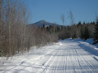
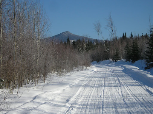
 The five of us, Docross, Al, Darrell, and Georg waited at the station in Groveton for Alex who was to meet us at 8am. Most of us had actually been there since about 7:30 because it was a beautiful day and we were excited to get going. It was -6 F when Darrell left his house in Bedford but it had warmed up to +3 F by the time he picked me up at exit 28 and we had driven up to Groveton. By 8:15 and no Alex, I figured something had gone wrong so we headed up to Stratford Bog for what could be a very long day. The report from Al and Docross was that the snow on Hutchins was not consolidated the day before and there were interminable spruce traps, so I wanted to get going. Docross and I had scouted out McMann Brook Road and knew it was plowed up to snowmo corridor 7 which was our route. We got 2 vehicles in and parked at a spot which gave a good shot of Sugarloaf, the highest peak in the north country, standing by itself north of us. Four of elected to ski in the snowmo trail. Al who had injured his shoulder the day before decided to snowshoe in. One the trail by 8:45, we made quick work of the 4.3 miles on the groomed trail up to the southwest slope of Sugarloaf where we had planned our bushwack route. We would be gaining about 1800' in about 1 mile. I had done this before on consolidated snow, but under these conditions, it seemed like a daunting task. Plan B was to keep on the snowmo trail which wound around to the southeast side of the mountain to join the old firewarden trail. There was a chance snowmobiles would have broken out that trail. An hour later we found to our delight that was true. Skis off and snowshoes on, up we went, only to be passed by about 10 sleds zooming up the narrow trail that sent us plunging off the trail into the woods 10 times. Not all of them made it up to the old firewarden clearing; some got stuck in the steep powder and they were envious of us walking past on snowshoes. We finally topped out at about 2pm, with a most glorious 360' VFTT. Northern Prezis to the south, past Percy Peaks. Savage, Goback, and Teapot just to the west. West Castle just to the north and Old Speck/Mahoosics way off in the east. Just fantastic. Back down and out to the cars by 5:45.http://picasaweb.google.com/hikerdoc/Sugarloafphotos