
1HappyHiker
Well-known member
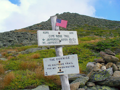
This was another hike where I intended to do one thing and ended up doing another. My original plan was to personally commemorate September 11 by hiking up Mt. Jefferson via the Caps Ridge Trail. And, as part of my plan, I packed a small American flag to display in some of the photos that I took during the course of my trek.
The hike up the Caps Ridge Trail went well. This is one of my favorite trails in the Whites! I love the challenge of the rock scrambles over the Caps, and the fact that you can be on Mt. Jefferson within about 2 hours from the trailhead.
Taking a few photos with my small American Flag also went well (for the most part). The only problem was the wind simply would not cooperate and therefore in some photos the canton is in the upper right corner, rather than in the upper left corner.
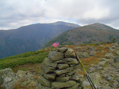
As I was approaching the summit of Jefferson, the clouds began to roll in. I sat there for awhile waiting for it to clear, but soon grew impatient. Other than clouds clinging to the high peaks, it was a beautiful day with pleasant temperatures and a relatively calm wind (but yet strong enough to occasionally blow my flag in the wrong direction!). Since it was such a fabulous day, I didn’t want to start back down the mountain. I wanted more!! I wanted to keep going & going & going!
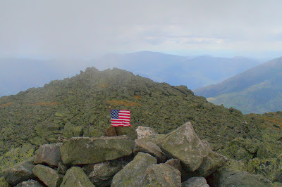
So, I made a snap decision to alter my original plan (which was to ascend and descend via the Caps Ridge Trail). My newly concocted plan was to extend my trek by doing a loop. I descended Mt. Jefferson and took the Jefferson Loop Trail to the Gulfside Trail, and from there, I took the Jewell Trail to the Boundary Line Trail. And, from the end of the Boundary Line Trail, I road-walked the remaining distance back to the Caps Ridge Trailhead via the Jefferson Notch Road.
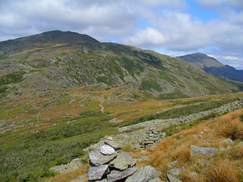
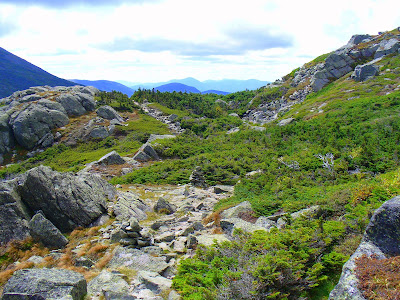
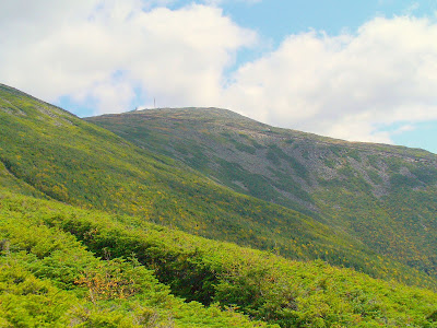
It could easily have had a different outcome, but changing my plans was a good decision!! The clouds eventually lifted and I had a marvelous trek along the Gulfside Trail and down the Jewell Trail to the point where it dips into the trees. The photo-ops were plentiful, and shown below are a few photos from this portion of the trek.
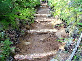
Near the bottom of the Jewell Trail I met a Forest Service crew who were doing some trail work (1st photo below). Hats off to Glen & his crew for their fine work!
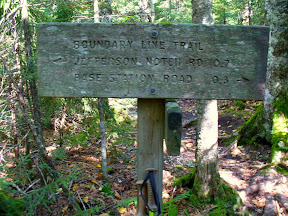
Regarding the Boundary Line Trail (2nd photo below), this was my first time on this trail. Although it’s well maintained, it’s little more than a herd path, and there’s nothing wrong with that. The narrow corridor through the woods provides sort a cozy feeling. And, since it’s such a low-use trail, the treadway is not worn down to rock & roots, and therefore it’s soft underfoot. As a bonus, it’s basically level, and so it’s nearly flat walking all the way!
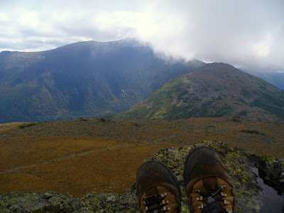
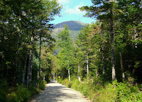
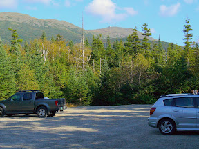
The Boundary Line Trail eventually terminates on the Jefferson Notch Road, and then you need to do a 1.4 mile uphill roadwalk to the Caps Ridge trailhead. However, this isn’t as unpleasant as it might sound. You are on a surface that has no rocks or roots to contend with, and so you can basically go on autopilot. Also, you’re still in the woods, plus there’s very little car traffic, and there are views along the way (1st photo below). There’s even a decent view from the trailhead parking lot (2nd photo below). And, of course, this will vary by personal hiking speed, but it took me only a half an hour to do this road-walk.
Bottom Line to All This: All politics aside, September 11 is a date in American history that is noteworthy. Bringing an American flag with me and photographing it in our beautiful White Mountains was my personal gesture to observe this event. And in the process, while sitting atop Mt. Jefferson, I concocted a loop hike that I really enjoyed, and will likely do this loop again in the future. The entire loop took just slightly over 6 hours, and that includes the time taken for lunch, photo taking, talking with other hikers along the way, etc.,
1HappyHiker
The hike up the Caps Ridge Trail went well. This is one of my favorite trails in the Whites! I love the challenge of the rock scrambles over the Caps, and the fact that you can be on Mt. Jefferson within about 2 hours from the trailhead.
Taking a few photos with my small American Flag also went well (for the most part). The only problem was the wind simply would not cooperate and therefore in some photos the canton is in the upper right corner, rather than in the upper left corner.
As I was approaching the summit of Jefferson, the clouds began to roll in. I sat there for awhile waiting for it to clear, but soon grew impatient. Other than clouds clinging to the high peaks, it was a beautiful day with pleasant temperatures and a relatively calm wind (but yet strong enough to occasionally blow my flag in the wrong direction!). Since it was such a fabulous day, I didn’t want to start back down the mountain. I wanted more!! I wanted to keep going & going & going!
So, I made a snap decision to alter my original plan (which was to ascend and descend via the Caps Ridge Trail). My newly concocted plan was to extend my trek by doing a loop. I descended Mt. Jefferson and took the Jefferson Loop Trail to the Gulfside Trail, and from there, I took the Jewell Trail to the Boundary Line Trail. And, from the end of the Boundary Line Trail, I road-walked the remaining distance back to the Caps Ridge Trailhead via the Jefferson Notch Road.
It could easily have had a different outcome, but changing my plans was a good decision!! The clouds eventually lifted and I had a marvelous trek along the Gulfside Trail and down the Jewell Trail to the point where it dips into the trees. The photo-ops were plentiful, and shown below are a few photos from this portion of the trek.
Near the bottom of the Jewell Trail I met a Forest Service crew who were doing some trail work (1st photo below). Hats off to Glen & his crew for their fine work!
Regarding the Boundary Line Trail (2nd photo below), this was my first time on this trail. Although it’s well maintained, it’s little more than a herd path, and there’s nothing wrong with that. The narrow corridor through the woods provides sort a cozy feeling. And, since it’s such a low-use trail, the treadway is not worn down to rock & roots, and therefore it’s soft underfoot. As a bonus, it’s basically level, and so it’s nearly flat walking all the way!
The Boundary Line Trail eventually terminates on the Jefferson Notch Road, and then you need to do a 1.4 mile uphill roadwalk to the Caps Ridge trailhead. However, this isn’t as unpleasant as it might sound. You are on a surface that has no rocks or roots to contend with, and so you can basically go on autopilot. Also, you’re still in the woods, plus there’s very little car traffic, and there are views along the way (1st photo below). There’s even a decent view from the trailhead parking lot (2nd photo below). And, of course, this will vary by personal hiking speed, but it took me only a half an hour to do this road-walk.
Bottom Line to All This: All politics aside, September 11 is a date in American history that is noteworthy. Bringing an American flag with me and photographing it in our beautiful White Mountains was my personal gesture to observe this event. And in the process, while sitting atop Mt. Jefferson, I concocted a loop hike that I really enjoyed, and will likely do this loop again in the future. The entire loop took just slightly over 6 hours, and that includes the time taken for lunch, photo taking, talking with other hikers along the way, etc.,
1HappyHiker
Last edited:
")