Papa Bear
New member
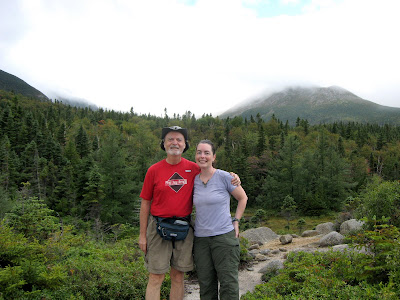
Last week my daughter and I stayed in Baxter State Park for 4 days - 2 days at Chimney Pond and 2 at South Branch Pond.
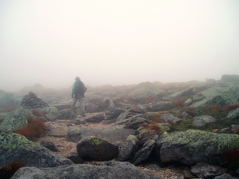
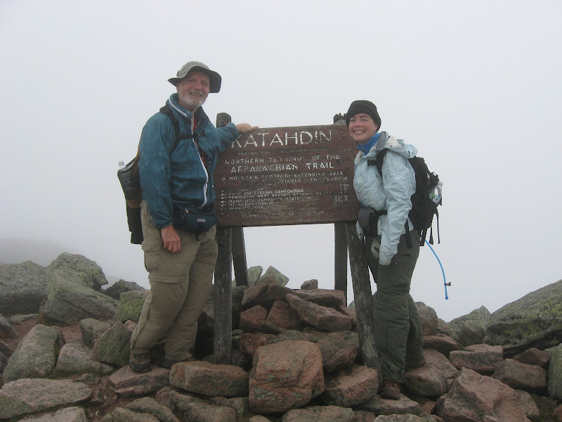
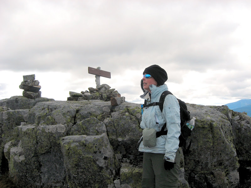
Our goal was to climb Katahdin and The Traveler. The first a must-do on everyone's list and the later one of the most under appreciated gems in the park. I highly recommend you place The Traveler on your own must-do list.
We lucked out as far as rain is concerned. It rained Sunday morning and most of Tuesday. Luckily our summit days were Monday and Wednesday.
Sunday Sept. 7th - Up to Chimney Pond
We stayed in Millinocket Saturday night at the Hotel Terrace. We arrived in the late afternoon and were delighted to find out that they have a live band on Saturday night's at the attached restaurant. It was an oldies group (trio of singers with guitar) and an oldies crowd, but we were feeling old") , so that suited us fine.
, so that suited us fine.
Sunday morning it was lightly raining, and since we knew we weren't going farther than Chimney Pond that day, we were in no hurry. We breakfasted at the AT Cafe and I had excellent raspberry pancakes. The waitress apologized for a delayed order - she said she didn't like the look of my pancakes so she made the cook do them over. Only in Maine!
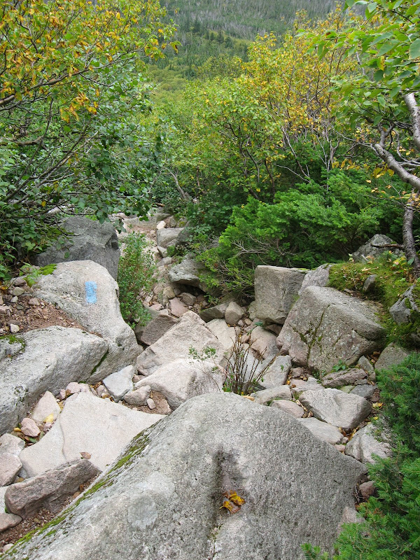
We got to the Gate by 9:30 and to Roaring Brook Camp Ground by a little after 10:00. It was still raining, but it seemed to be tapering off, so we hung around a bit and finally started up the trail a little before 11:00. Good choice. I finished the hike up with totally dry hiking shoes.
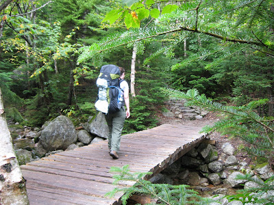
The trail is well known to many VFTTers, but it was a first time for my daughter. I first made this trek in 1963 - just before starting my senior year of college. The trail is in better shape now than it was in the 1960s. I think the recent emphasis on preservation and conservation shows results. And not just this trail, but Chimney Pond Camp Ground itself - I'll get to that shortly. As for the trail, there are multiple bridges over the stream it follows up the valley. I asked the ranger what all this bridge construction was doing in a wilderness park? Simple - the stream fed the water supply for Roaring Brook Camp Ground and they didn't want umpteen thousand hikers per year tramping through it.
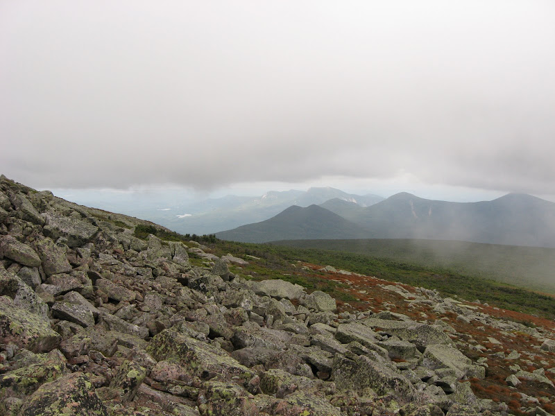
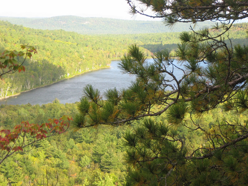
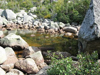
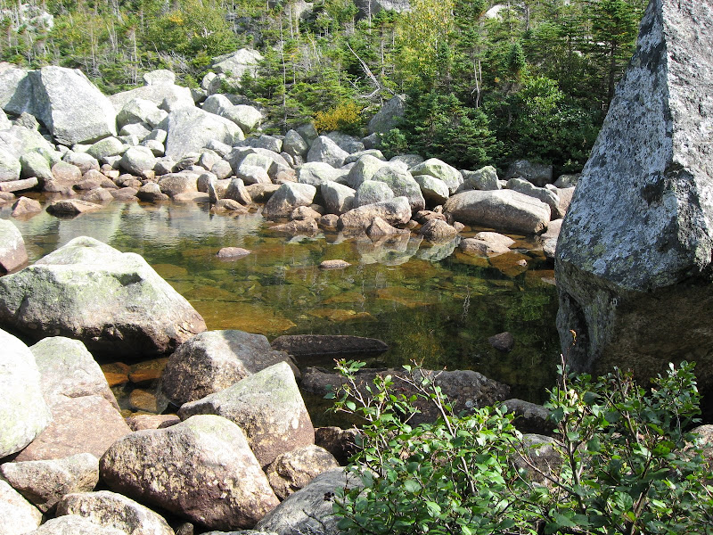
Chimney Pond Trail - one of the many bridges. . . . . . . . At the viewpoint - the North Basin is in the distance
Click for larger image
The trek was uneventful. We were not fast since we had day packs (for tomorrow) stuffed into our overnight packs, which made up for not having to bring a tent.
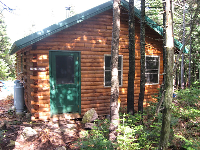
We decided to try the Bunk House. Wow! My daughter claimed it was nicer than her apartment. Brand new, with propane lamps and a wood stove. You winter Chimney Pond campers will like this place a lot. And it was rodent proof (or so the ranger said) so we didn't have to hang our food on that silly Bear Line. Here's some inside pictures: Bed Room, Living Room (note the propane lamp on the wall), Stove and cooking area.
The Bunk House . . . . . . . . . . . . . . . . . . . . . . . . . . . . . . . . North Basin view from Blueberry Knoll

Click for larger image
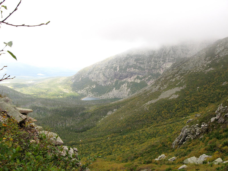
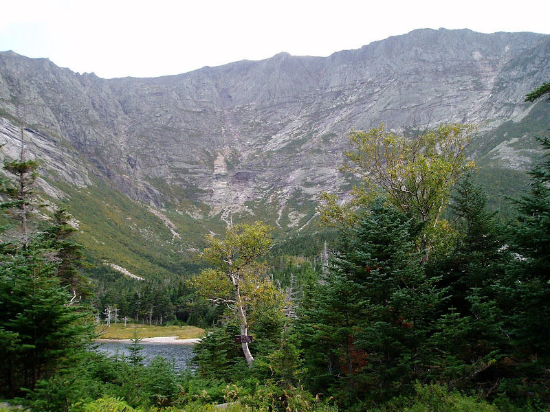
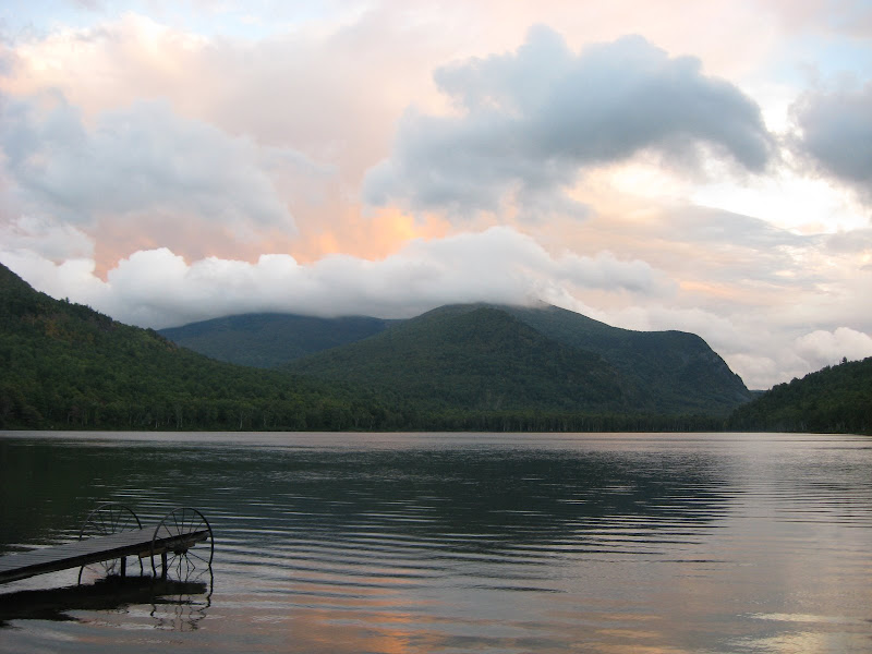
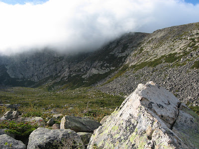
And the Camp Ground was as beautiful as ever. One of the most dramatic views east of the Mississippi - believe it!
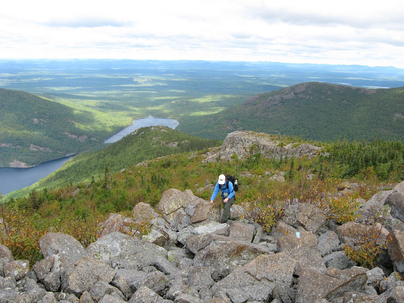
After settling in, and since it was still early afternoon, we did the 1 mile trek over to Blueberry Knoll, another under appreciated gem. As usual, it was the windiest spot around, with winds probably over 40 MPH. Something about the shape of the North Basin seems to just funnel the wind to this spot. Hey! another item for you must-do list. If you go to Chimney Pond and have a couple of hours to spare - check this spot out.
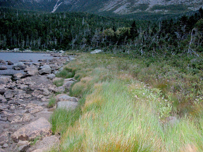
After supper we did some exploring and I walked along the beach of the Pond. In 1963, the lean-tos were in a line along the beach facing the pond. Beautiful view when you wake up, but not so good for the pond environment. Now all the lean-tos are back in the woods and this area has regrown and reforested. The same goes for the area around the outlet - that's where you are supposed to go to wash anything (but no soap please). That's practically hidden in the forest now. In the 1960s it was like an open pit. Yes, over the long run, things really can get better with proper care. Many of the trees in the campground area are younger than 40 years old so this is a vastly different place from what it once was.
Chimney Pond beach - This was once a line of lean-tos . The Outlet - Once an open pit
Click for larger image
Tomorrow was our summit day for the big K so we got to bed early. The ranger said a family group of 8 had also reserved the Bunk House (it holds 10) but he thought they might not show up. Thank goodness he was right and we had a very quite bunk house all to ourselves for the night.
Album for Sunday Sept 7th: Album
(Continued on next note)
Our goal was to climb Katahdin and The Traveler. The first a must-do on everyone's list and the later one of the most under appreciated gems in the park. I highly recommend you place The Traveler on your own must-do list.
We lucked out as far as rain is concerned. It rained Sunday morning and most of Tuesday. Luckily our summit days were Monday and Wednesday.
Sunday Sept. 7th - Up to Chimney Pond
We stayed in Millinocket Saturday night at the Hotel Terrace. We arrived in the late afternoon and were delighted to find out that they have a live band on Saturday night's at the attached restaurant. It was an oldies group (trio of singers with guitar) and an oldies crowd, but we were feeling old
, so that suited us fine.Sunday morning it was lightly raining, and since we knew we weren't going farther than Chimney Pond that day, we were in no hurry. We breakfasted at the AT Cafe and I had excellent raspberry pancakes. The waitress apologized for a delayed order - she said she didn't like the look of my pancakes so she made the cook do them over. Only in Maine!
We got to the Gate by 9:30 and to Roaring Brook Camp Ground by a little after 10:00. It was still raining, but it seemed to be tapering off, so we hung around a bit and finally started up the trail a little before 11:00. Good choice. I finished the hike up with totally dry hiking shoes.
The trail is well known to many VFTTers, but it was a first time for my daughter. I first made this trek in 1963 - just before starting my senior year of college. The trail is in better shape now than it was in the 1960s. I think the recent emphasis on preservation and conservation shows results. And not just this trail, but Chimney Pond Camp Ground itself - I'll get to that shortly. As for the trail, there are multiple bridges over the stream it follows up the valley. I asked the ranger what all this bridge construction was doing in a wilderness park? Simple - the stream fed the water supply for Roaring Brook Camp Ground and they didn't want umpteen thousand hikers per year tramping through it.
Chimney Pond Trail - one of the many bridges. . . . . . . . At the viewpoint - the North Basin is in the distance

Click for larger image
The trek was uneventful. We were not fast since we had day packs (for tomorrow) stuffed into our overnight packs, which made up for not having to bring a tent.
We decided to try the Bunk House. Wow! My daughter claimed it was nicer than her apartment. Brand new, with propane lamps and a wood stove. You winter Chimney Pond campers will like this place a lot. And it was rodent proof (or so the ranger said) so we didn't have to hang our food on that silly Bear Line. Here's some inside pictures: Bed Room, Living Room (note the propane lamp on the wall), Stove and cooking area.
The Bunk House . . . . . . . . . . . . . . . . . . . . . . . . . . . . . . . . North Basin view from Blueberry Knoll

Click for larger image
And the Camp Ground was as beautiful as ever. One of the most dramatic views east of the Mississippi - believe it!
After settling in, and since it was still early afternoon, we did the 1 mile trek over to Blueberry Knoll, another under appreciated gem. As usual, it was the windiest spot around, with winds probably over 40 MPH. Something about the shape of the North Basin seems to just funnel the wind to this spot. Hey! another item for you must-do list. If you go to Chimney Pond and have a couple of hours to spare - check this spot out.
After supper we did some exploring and I walked along the beach of the Pond. In 1963, the lean-tos were in a line along the beach facing the pond. Beautiful view when you wake up, but not so good for the pond environment. Now all the lean-tos are back in the woods and this area has regrown and reforested. The same goes for the area around the outlet - that's where you are supposed to go to wash anything (but no soap please). That's practically hidden in the forest now. In the 1960s it was like an open pit. Yes, over the long run, things really can get better with proper care. Many of the trees in the campground area are younger than 40 years old so this is a vastly different place from what it once was.
Chimney Pond beach - This was once a line of lean-tos . The Outlet - Once an open pit

Click for larger image
Tomorrow was our summit day for the big K so we got to bed early. The ranger said a family group of 8 had also reserved the Bunk House (it holds 10) but he thought they might not show up. Thank goodness he was right and we had a very quite bunk house all to ourselves for the night.
Album for Sunday Sept 7th: Album
(Continued on next note)
Last edited: