
1HappyHiker
Well-known member
At my home “above the notch” it was overcast with off and on “snizzling” (a mixture of snow flurries & drizzling rain). Others feel differently, but for me, it’s not worth it to hike to a summit on a day such as this. For this type of weather, I’d simply prefer to do a low-elevation hike to someplace like a waterfall, or a pond or through a notch, etc.
In years past, one of my favorites for a “snizzling” day was to do a long hike along the Dry River Trail beyond the suspension bridge that spans the Dry River. But lately, this has not been an option since the suspension bridge is out of commission, and fording the river at this time of year is risky (to say the least!). So, in view of these river crossing issues, an idea occurred to me. At the point where the trail normally crosses to the east side of the Dry River via the suspension bridge, why not just stay on the west side of the river?
On the west side of the river, it’s sort of a cross between a bushwhack and a herd path. Someone with a better knowledge of history can correct me on this, but I think that long stretches along the west side of the river were used in the late 1800’s by a logging railroad, and parts of this old rail bed were once part of the Dry River Trail before it was relocated to its present location on the east side of the river (beyond the suspension bridge).
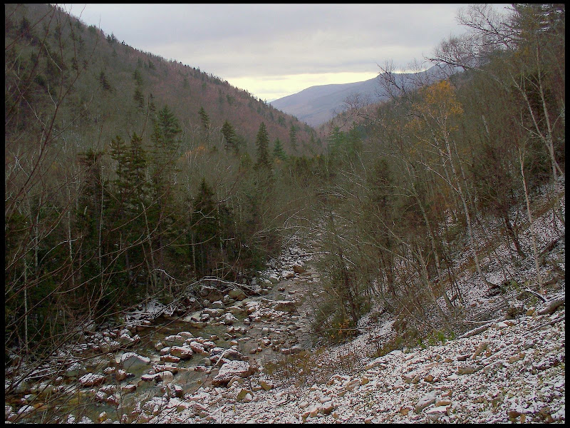
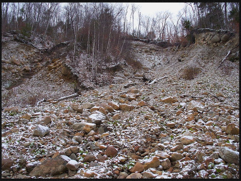
Anyway, enough about history and my personal preferences! On the west side of the river (about a half mile from the suspension bridge) is a slide that provides sort of a unique southeasterly view down the Dry River valley toward Crawford Notch in the general vicinity of Mt. Bemis. It barely qualifies as a destination, but as you might have guessed by now, hiking to that slide is what I ended up doing on this “snizzling” day! Nothing spectacular, just something different!
Below is a photo taken from a point about mid way up the slide, plus a photo looking up the slide from a point near where the slide meets the Dry River.
1HappyHiker
In years past, one of my favorites for a “snizzling” day was to do a long hike along the Dry River Trail beyond the suspension bridge that spans the Dry River. But lately, this has not been an option since the suspension bridge is out of commission, and fording the river at this time of year is risky (to say the least!). So, in view of these river crossing issues, an idea occurred to me. At the point where the trail normally crosses to the east side of the Dry River via the suspension bridge, why not just stay on the west side of the river?
On the west side of the river, it’s sort of a cross between a bushwhack and a herd path. Someone with a better knowledge of history can correct me on this, but I think that long stretches along the west side of the river were used in the late 1800’s by a logging railroad, and parts of this old rail bed were once part of the Dry River Trail before it was relocated to its present location on the east side of the river (beyond the suspension bridge).
Anyway, enough about history and my personal preferences! On the west side of the river (about a half mile from the suspension bridge) is a slide that provides sort of a unique southeasterly view down the Dry River valley toward Crawford Notch in the general vicinity of Mt. Bemis. It barely qualifies as a destination, but as you might have guessed by now, hiking to that slide is what I ended up doing on this “snizzling” day! Nothing spectacular, just something different!
Below is a photo taken from a point about mid way up the slide, plus a photo looking up the slide from a point near where the slide meets the Dry River.
1HappyHiker
Last edited:
