
Kearsarge North Mountain, Bartlett Mountain via Kearsarge North Trail and Bartlett Path, 01/01/2009
I'm not big on posting trip reports per se here, but I do like to post lesser known stuff that might be of interest. Considering Kearsarge North is such a popular mountain, it's interest to see how little known Bartlett Mountain is - I have not seen a single mention of what it's like or how to get there in any of the AMC Guides, 1960 to present - there are trail descriptions in the 1934 guide, however.
The legendary forestgnome bushwhacked to Bartlett Mountain last spring - http://www.vftt.org/forums/showthread.php?p=226609. Other than that thread, my old guidebooks, and the topographic maps, I didn't have much to go on.
Overview:
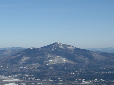
Bartlett Mountain is the subpeak to the left of Kearsarge North Mountain
It was a cold New Year's morning, but nonetheless it was a nice day to hit the trails - that is, if there's shelter at the top of them! With the beautiful fire tower on top, Kearsarge North is one of my favorite cold day hikes.
I had the distinct honor of being the first person to ascend the mountain in 2009. I believe I can put that on my resume under 'Miscellaneous Rocket21 Trivia' between 'Does a spot on Bill Cosby dance (or at least strives to)' and 'Actually enjoyed Weekend at Bernie's II.'
The views were decent from the summit, though the extreme cold certainly helped knock down the visibility a bit.
Now, one would think that a beautiful peak in a very popular area would have marked trails leading to it. Looking at the ledges when in Conway and at forestgnome's photos, one would wonder why the 3-4 trails to Bartlett Mountain seemingly disappeared between 1934 and 1960.
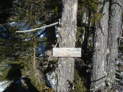
One can wonder all they want, because there are still trails there! What I believe to be the 'Bartlett Path' starts at this familiar sight on the Kearsarge North Trail, just above the ledges:
The Kearsarge North Trail goes right and the Bartlett Path goes left.
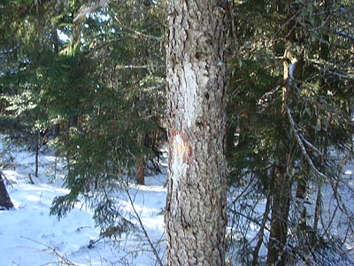
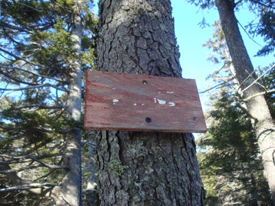
The path is marked by a variety of things, including axe blazes, old painted blazes...
...and illegible old signs:
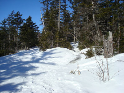
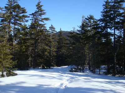
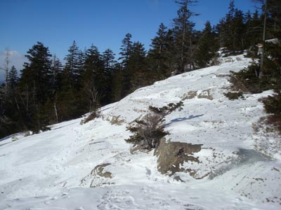
The trail itself crossings some beautiful terrain:
If you squint closely, you can see the 10 or so pixels that make up the Kearsarge North Fire Tower
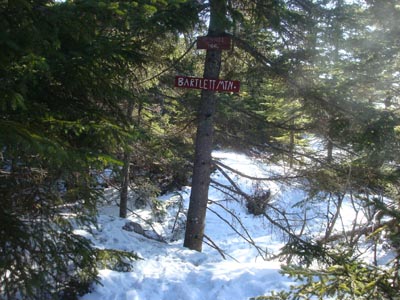
The true summit of Bartlett Mountain features signs:
Adjacent to it, there are vast ledges. Only a small sample:
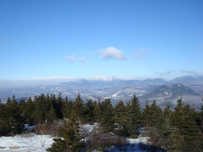
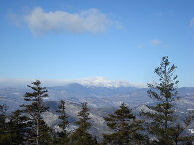
And a sample view of the Presidentials from one of the ledges:
Perhaps even more surprising for me, beyond finding the old Bartlett Path still being used and maintained (recent blowdown clearing!) was another discovery - it looks like there are a good 3-4 more trails leading to that peak! I saw tracks leading north from near the col, a parallel trail a bit to the south marked with cairns, a trail southwest of the summit (which I suspect may be the top access to the long gone CCC alpine ski trail), and possibly a trail from the northwestern ledges. None are particularly well marked, but all appear to have been used at some point in the past few weeks!
Sorry in advance if I ruined anyone's secret in Bartlett Mountain - what a neat peak!
Additional photos & approx. map:
http://www.franklinsites.com/hikephotos/NewHampshire/kearsargenorthmtn-2009-0101.php
I'm not big on posting trip reports per se here, but I do like to post lesser known stuff that might be of interest. Considering Kearsarge North is such a popular mountain, it's interest to see how little known Bartlett Mountain is - I have not seen a single mention of what it's like or how to get there in any of the AMC Guides, 1960 to present - there are trail descriptions in the 1934 guide, however.
The legendary forestgnome bushwhacked to Bartlett Mountain last spring - http://www.vftt.org/forums/showthread.php?p=226609. Other than that thread, my old guidebooks, and the topographic maps, I didn't have much to go on.
Overview:
Bartlett Mountain is the subpeak to the left of Kearsarge North Mountain
It was a cold New Year's morning, but nonetheless it was a nice day to hit the trails - that is, if there's shelter at the top of them! With the beautiful fire tower on top, Kearsarge North is one of my favorite cold day hikes.
I had the distinct honor of being the first person to ascend the mountain in 2009. I believe I can put that on my resume under 'Miscellaneous Rocket21 Trivia' between 'Does a spot on Bill Cosby dance (or at least strives to)' and 'Actually enjoyed Weekend at Bernie's II.'
The views were decent from the summit, though the extreme cold certainly helped knock down the visibility a bit.
Now, one would think that a beautiful peak in a very popular area would have marked trails leading to it. Looking at the ledges when in Conway and at forestgnome's photos, one would wonder why the 3-4 trails to Bartlett Mountain seemingly disappeared between 1934 and 1960.
One can wonder all they want, because there are still trails there! What I believe to be the 'Bartlett Path' starts at this familiar sight on the Kearsarge North Trail, just above the ledges:
The Kearsarge North Trail goes right and the Bartlett Path goes left.
The path is marked by a variety of things, including axe blazes, old painted blazes...
...and illegible old signs:
The trail itself crossings some beautiful terrain:
If you squint closely, you can see the 10 or so pixels that make up the Kearsarge North Fire Tower
The true summit of Bartlett Mountain features signs:
Adjacent to it, there are vast ledges. Only a small sample:
And a sample view of the Presidentials from one of the ledges:
Perhaps even more surprising for me, beyond finding the old Bartlett Path still being used and maintained (recent blowdown clearing!) was another discovery - it looks like there are a good 3-4 more trails leading to that peak! I saw tracks leading north from near the col, a parallel trail a bit to the south marked with cairns, a trail southwest of the summit (which I suspect may be the top access to the long gone CCC alpine ski trail), and possibly a trail from the northwestern ledges. None are particularly well marked, but all appear to have been used at some point in the past few weeks!
Sorry in advance if I ruined anyone's secret in Bartlett Mountain - what a neat peak!
Additional photos & approx. map:
http://www.franklinsites.com/hikephotos/NewHampshire/kearsargenorthmtn-2009-0101.php
Last edited:

")