Traveling ON and OFF the Abandoned Black Brook Trail (09-Feb-2009)

vftt.org

Help Support vftt.org:

This site may earn a commission from merchant affiliate links, including eBay, Amazon, and others.

1HappyHiker

Well-known member
Joined
Jan 18, 2007
Messages
1,973
Reaction score
405
Location
Bethlehem, NH
In days gone by, the Black Brook Trail began at a trailhead off Route 302 about a half mile west of Zealand Road. The trail headed nearly due north to intersect with the current-day Cherry Mountain Trail to Mt. Martha.

There’s still a short access road off of Route 302 to the former trailhead, but of course it’s unplowed in winter. So for my trek, I parked at the Zealand Road winter lot and did a short two minute bushwhack from the parking lot up to the railroad bed (also a snowmobile route). After about a ten minute westward walk, I arrived at the old trail.

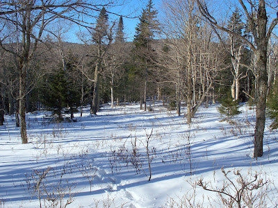
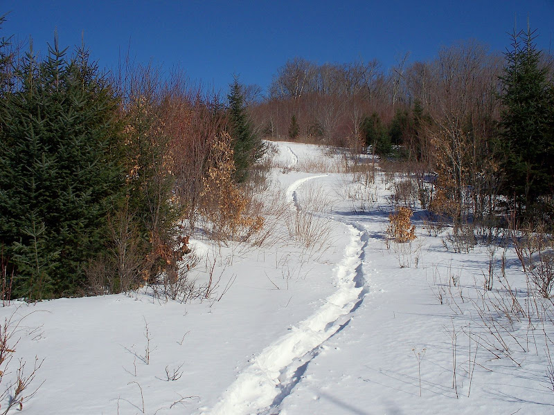
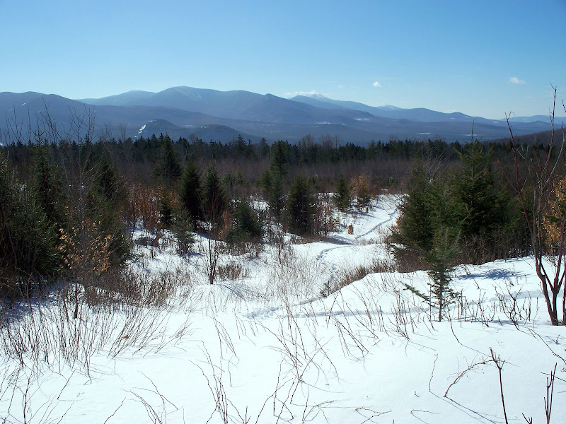
For about the first 2 miles, I followed the former route of the old trail. It goes through some beautiful forest as seen in the photo below.
100_0923.JPG

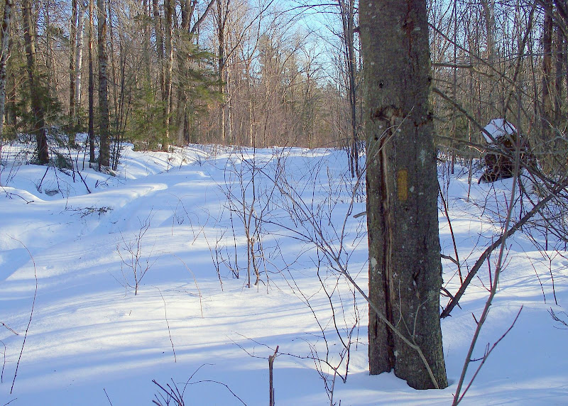
And occasionally, an old trail-blaze can be spotted.
100_0963.JPG

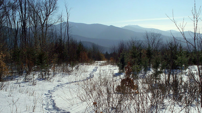
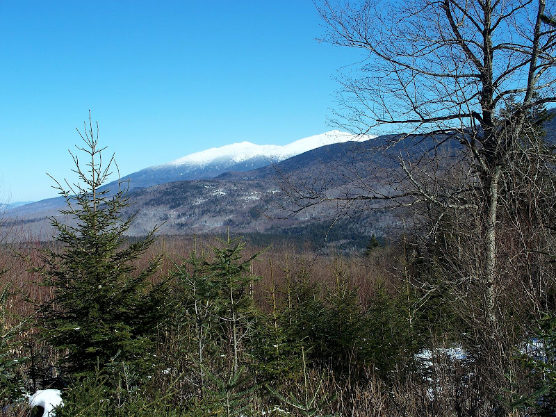
Besides going through an attractive forest, there are also some nice mountain-views. The next two photos were taken from slightly different vantage points, but both show the southward view toward the Twins and Franconia Range.
100_0959.JPG


100_0926.JPG

After enjoying the views shown in the photos above, I then opted to go off-trail to follow a hunch that there might be some views toward the Presidentials by bushwhacking off the old trail in an easterly direction.

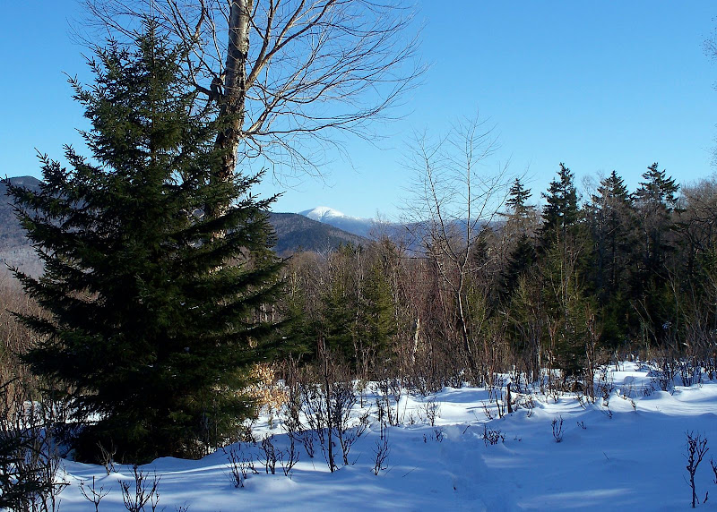
After about a mile of whacking, it so happened that my hunch paid off (this doesn’t always happen!!). I did get a bit of a view toward Adams & Jefferson, plus a bit of a view toward Eisenhower. These views are shown in the next two photos.
100_0934.JPG


100_0945.JPG

So there you have it. That was my day on this 9th day of February 2009!

1HappyHiker
 
Great day out today - I watched with envy through the windows at work!

I didn't realize the Black Brook trail was abandoned, as it still shows on the map I have. It looks like a very nice, open trail.

Great photos and report as always, John! :)
 
Wow, John! We need you to help us find abandoned Ossipee trails!
 
I didn't realize the Black Brook trail was abandoned, as it still shows on the map I have. It looks like a very nice, open trail.
Hey Chris . . . thanks for your reply! Concerning the Black Brook Trail still showing up on your maps, there was a recent VFTT thread that discussed the fact that most maps are generated from USGS maps which often have not been updated in years. Therefore, it’s not uncommon to see abandoned trails still show up on maps.
CLICK HERE to be linked to that VFTT thread.

Wow, John! We need you to help us find abandoned Ossipee trails!
If the abandoned Ossipee trails are as obvious as the Black Brook Trail, then I might be of some help . . . otherwise . . . not so much!;)
 
In days gone by, the Black Brook Trail began at a trailhead off Route 302 about a half mile west of Zealand Road. The trail headed nearly due north to intersect with the current-day Cherry Mountain Trail to Mt. Martha.

There’s still a short access road off of Route 302 to the former trailhead, but of course it’s unplowed in winter. So for my trek, I parked at the Zealand Road winter lot and did a short two minute bushwhack from the parking lot up to the railroad bed (also a snowmobile route). After about a ten minute westward walk, I arrived at the old trail.
As I have noted before, the fact that USGS maps (on which the Garmin maps are based) still show abandoned trails is a blessing for those who want to explore them. The Garmin Mapsource TOPO US 2008 shows both the railroad bed and the Black Brook trail.
 
Wow, John! We need you to help us find abandoned Ossipee trails!

Jeepers Rocket!!! Aren't there enough trails on Ossippee map? Abandoned Black Brook Trail has been on my to do list. Thanks for checking it out a little more thoroughly John. Those views are really fine. The forest you've pictured looks somewhat on the young side. If you visit Black Brook on Google Earth you'll see the area has been heavily logged and has very odd looking patchwork of cutting. Not that that's a bad thing. Makes great wildlife habitat for mammals and birds. And greatly improves the views as you've just verified. Did you make it up to the summit ridge where the birch/spruce glades are? I came across the other end of theBlack Brook Trail last summer when I hiked the Cherry Mt Trail from Old Cherry Mt Rd.
 
The forest you've pictured looks somewhat on the young side. If you visit Black Brook on Google Earth you'll see the area has been heavily logged and has very odd looking patchwork of cutting.
Yes, you’re absolutely correct. And actually, it almost looks like parts of the trail might have been widened at some point by loggers, or perhaps by a local snowmobile club. For the first part of this trail, there was evidence of a lone snowmobiler who had headed up the trail. However, a few tenths of a mile up the trail, the tracks made an abrupt U-turn where a large blowdown had fallen over the trail.
Did you make it up to the summit ridge where the birch/spruce glades are? I came across the other end of the Black Brook Trail last summer when I hiked the Cherry Mt Trail from Old Cherry Mt Rd.
I veered off the old Black Brook Trail probably a few tenths of a mile prior to the point where it begins to climb the ridge. But east of the trail, I did enjoy some mighty handsome open forest (see photo below). These open woods are great for winter whacking, but don’t know how great it might be in summer. There could be a lot of blowdown debris and/or hobble bush lurking beneath the deep snow up there!
100_0949.JPG
 
Last edited:
I hiked the Black Brook Trail a few decades ago when it was still maintained, as I recall it was a woods road used as a snowmobile route so it has remained obvious longer than those that were only faint footpaths to begin with.
 
Rediscovering abandoned trails can be such a pleasure. I've not done any such rediscovering in New Hampshire but have in California; the experience was always a joy (and a little scratchy at times from uncut brush!).

Any ideas why the Black Brook route was abandoned? Sometimes there are really interesting stories attached to forgotten paths.
 
Pure speculation on my part is that the WMNF has been doing a lot of logging in the areas to either side of Cherry Mountain road and north of the Dartmouth Deception ridge for many years. It seems to be quite productive forest and tends to stay off folks "radar" regarding anti logging sentiment. Beyond the occasional bushwhacker bagging a few peaks, this area escapes a lot of notice and abandoning trails is probably a good way to keep it off the "radar". Considering that Black Brook is on a south facing slope, that is usually some prime tree growing territory.

Black Brook trail like the the east leg of Cherry Mtn trail didnt appear to be used often and most likely were abandoned to allow the area to be harvested more easily. These are definitely not the first trails in this area to be closed as there used to be a ridge line hike across from Cherry Mountain all the way to Caps ridge trail long ago. Several years ago the trail was real obvious on at least part of the ridge.
 
Any ideas why the Black Brook route was abandoned? Sometimes there are really interesting stories attached to forgotten paths.
Doubt that's true here. It was temporarily closed a couple times due to logging (see 1HH photo) and never reinstated the last one, probably due to low use. The AMC map shows private property S of the RR track so that's another possibility.
 
Top