
1HappyHiker
Well-known member
Currier Mountain is that little 2,750 ft mountain that is located to the west of Mt. Jefferson and east of Cherry Mountain. From about 1916 to 1934, there was an operating fire tower atop Currier Mountain (once known as Pine Peak). As I understand it, the tower was built to keep watch over the major logging slash on the northern slopes of the Presidential Range.
There are no longer any maintained trails to Currier Mountain. However you can hike to the base of its north facing slope via snowmobile trail (Route #11), and then reach the summit via a 30 minute bushwhack off the snowmobile trail.
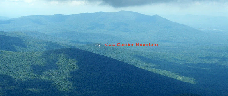
Clearly seen from various locations on the Presidential Range is the small white cliff-face on Currier Mountain. Although the quality isn't great, the snapshot below shows this mountain as seen on a recent trek up the Castle Trail. (The large mass of Cherry Mountain is looming in the background.)
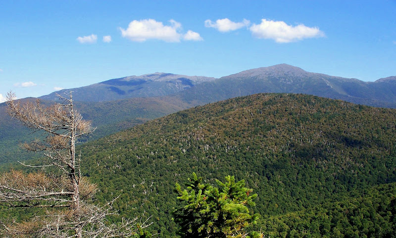
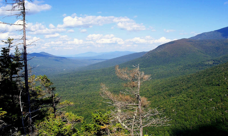
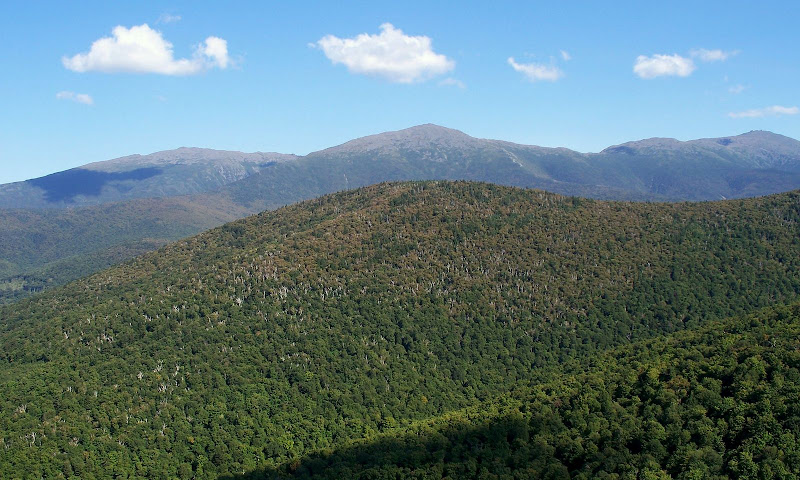
The views from the old fire tower must have been stunning. However, even without the benefit of a tower, Currier Mountain still has some good vistas from its east-facing cliff. On a recent bushwhack to Currier Mountain with Zman, I took several photos. The three snapshots below provide a sampling of the views available from this little peak.
View of Adams and Jefferson
Randolph Valley in Foreground with Crescent Range on Left & Mahoosucs on the Horizon
View of Adams, Jefferson, Clay & Washington
So, in summary . . . little mountain, little bushwhack . . . BIG views!
1HappyHiker
There are no longer any maintained trails to Currier Mountain. However you can hike to the base of its north facing slope via snowmobile trail (Route #11), and then reach the summit via a 30 minute bushwhack off the snowmobile trail.
Clearly seen from various locations on the Presidential Range is the small white cliff-face on Currier Mountain. Although the quality isn't great, the snapshot below shows this mountain as seen on a recent trek up the Castle Trail. (The large mass of Cherry Mountain is looming in the background.)
The views from the old fire tower must have been stunning. However, even without the benefit of a tower, Currier Mountain still has some good vistas from its east-facing cliff. On a recent bushwhack to Currier Mountain with Zman, I took several photos. The three snapshots below provide a sampling of the views available from this little peak.
View of Adams and Jefferson
Randolph Valley in Foreground with Crescent Range on Left & Mahoosucs on the Horizon
View of Adams, Jefferson, Clay & Washington
So, in summary . . . little mountain, little bushwhack . . . BIG views!
1HappyHiker
Last edited:
")