Whitcherville: Abandoned Village off Western End of the KANC (29-SEP-09)

vftt.org

Help Support vftt.org:

This site may earn a commission from merchant affiliate links, including eBay, Amazon, and others.

1HappyHiker

Well-known member
Joined
Jan 18, 2007
Messages
1,973
Reaction score
405
Location
Bethlehem, NH
A relatively short hike (perhaps a little over 4 miles round trip) will bring you to an area where there are remnants of an abandoned village that was called Whitcherville. This hike is briefly described in the WMG. The route involves hiking the Cobble Hill Trail for a short distance and then hanging a left onto the abandoned South Landaff Rd (a snowmobile trail in winter).

This particular hike was tailor-made for my circumstances today. I only had a short amount of time for hiking, plus there was a forecast for rain later in the day.

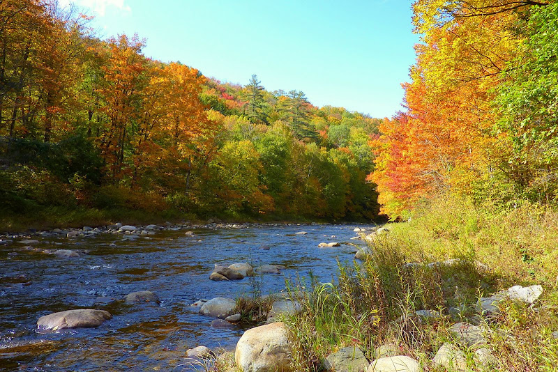
Although the hike begins on the north side of Route 112, after parking my car at the trailhead, I crossed over to the south side of the road to snap a photo of the Wild Ammonoosuc River.
P1010227.JPG

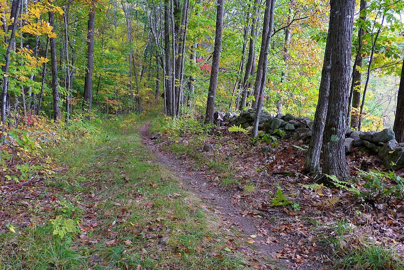
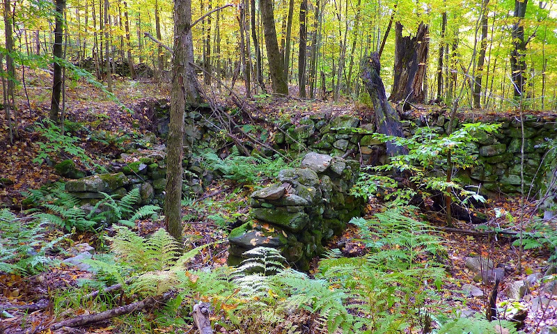
After snapping the photo, I re-crossed the road and headed up the Cobble Hill Trail. Within 10 minutes I was making my left turn to head west along the old South Landaff Road. This old road takes you through a beautiful forest. And, at numerous points along the way, there are stone walls lining the road.
P1010265.JPG

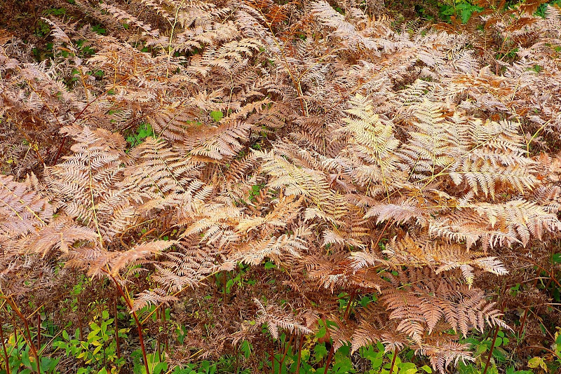
And at this time of year, not only is there colorful tree foliage to please the eye, but there are other colorful delights as well, such as ferns that have been “bronzed” from frost bite.
P1010254.JPG

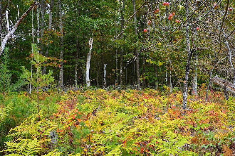
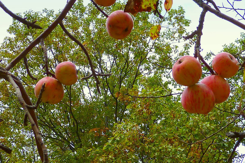
And it’s stunning to see that many of the old apple orchards in Whicherville are still there to this day! They now co-exist with ferns and the surrounding forest which makes for a unique and colorful display. (I seem to recall being told that the orchards receive some maintenance from the National Forest Service to preserve them as a deer browse yards.)
P1010258.JPG


P1010268.JPG

If you poke around off to the sides of the old road, you will find old cellar holes here and there.
P1010234.JPG

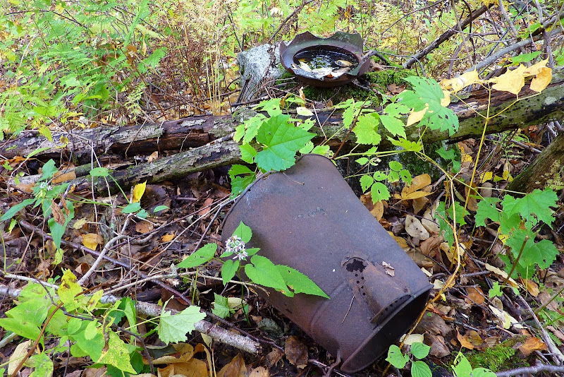
And you might run across some artifacts as well (and it is illegal to remove artifacts from a site such as this!)
P1010271.JPG

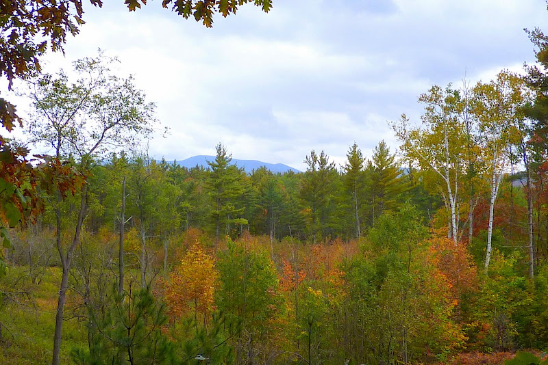
In addition to the other eye-catching views on this hike, there is also an area where you can get a small view of some mountains.
In the photo below, I think it might be Howe Hill and Black Mountain (Benton) that are peeking through the trees.
P1010298.JPG

Perhaps others on this Forum can add some historical facts about Whicherville. All I know for certain is that the current day town of Landaff was originally named Whicherville back in 1764. And although I’m not completely certain, I think that the southern part of Landaff township retained the name of Whitcherville up to the time that the village was abandoned. But, I don’t know any other facts that would be interesting to learn, such as when it was abandoned, etc.

1HappyHiker
 
That's awesome!! Great pics. I love to see shots from old towns. I can't remember the name of the town...but have you hiked up the Mt Cilley Trail near Elbow Pond? I've wanted to check that out some time.
 
Cool Stuff!

I don't know if its related or not, but my daughter is reading a book about Sarah Whitcher, a child from Warren, NH, who becomes lost and is watched over by a bear until she is found by her family. It's based on a true story apparently.http://www.librarything.com/work/360274

Also, one of the towns in Daniel Doan's book "Amos Jackman" is called Whitchertown, but I assumed he was just changing the name of Quinttown.

Very interesting stuff out there in the woods!
 
Great report, John! I love historical sites like this one - even better with the great autumn colors!

That's awesome!! Great pics. I love to see shots from old towns. I can't remember the name of the town...but have you hiked up the Mt Cilley Trail near Elbow Pond? I've wanted to check that out some time.

Hope you don't mind me answering grouseking on this, John.... that's the old Peeling settlement, which was later moved eastward to the river to become Woodstock. Exploring there last year I was able to find a few old cellar holes as well as a stone wall... nothing quite as clear as those in John's photos of Whitcherville, however!

On a little side note... there's an interesting diversion up an old path to the top of Grandview, where there is no "grand" view that I could find, other than a giant blowdown. Someone also told me they found an old abandoned tower up on Mt Cilley off this trail, but I haven't been up since to confirm it.
 
Last edited:
A Word of Caution

Hey, many of you might already be aware of this, but PLEASE wear your “hunter-orange” if you should happen to venture up the Cobble Hill Trail and then on over to Whitcherville via the South Landaff Rd. That area is definitely frequented by hunters during ALL the various game seasons.

OK, now on to a different topic, i.e. THANK YOU to Phil, Jason, and Chris for your kind words. And here are some responses to your individual questions/comments:

Grouseking: Phil, I think NeoAkela’s response answered your question about the name of the abandoned town near Elbow Pond.

Jason Berard: Jason, thanks for the link to the book your daughter is reading about a true story regarding Sarah Whitcher from Warren, NH. Yes, I have no idea either as to whether that particular Whitcher family has any connection to Whitcherville. I cannot find any information as to how the village name of Whitcherville came to be. One can only presume that it was probably named after the Whitcher family-name.

The time frame for the book about Sarah Whitcher would certainly be about right in terms of the founding of Whitcherville. And, as I presume you know, there is a small 2,565 peak named Whitcher Hill that is just a couple miles due east of Warren (where Sarah Whitcher resided). This peak is just a short distance off the Three Ponds Trail.

NeoAkela: Chris, I have no problem with you fielding the response to Grouseking’s question. Also, thanks for your “side note” about Grandview Mountain.
 
Last edited:
On a little side note... there's an interesting diversion up an old path to the top of Grandview, where there is no "grand" view that I could find, other than a giant blowdown. Someone also told me they found an old abandoned tower up on Mt Cilley off this trail, but I haven't been up since to confirm it.
The tower was not on Mt Cilley but on the northerly bump of Grandview. There are concrete footings there and some debris in the col as if they started to haul pieces out and quit. I guess the view was grander with the tower.

One of my hikes to Peeling there were cardboard signs identifying owners of the cellar holes, presumably left over from some event as I doubt they were intended to be permanent.
 
Those apples look good!

What an interesting report! Along with the other replies the history mystery is fascinating! Great photos as always.
Grumpygran
 
Should I admit it? About 35 years ago I rode that road on my Bultaco 250 cc Alpina enduro-style motorcycle. (Or was it my Ossa Pioneer? I forget). I loved riding it then, would love to walk it now.
 
Roy and Mary: Many thanks for taking time to reply to my posting.

Ellen: I thank you also for your reply, plus I’m wondering if there were the same drainage issues on the old South Landaff Road when you rode your motorcycle on it a few years back? In wet weather, there are now a few spots where I think there might be some issues with riding a motorcycle.

To All: My friend Joanne, a librarian at Phillips-Exeter Academy, was able to uncover some additional information about Whitcherville from an article that appeared in a March 13, 2001 edition of The Union Leader. According to this article, Whitcherville was initially a farming community. But through the mid-1800s, the lumber industry was on the rise. Sawmills flourished in the area that is now Wildwood Campground and in an area that was known as Bunga. In the Easton Valley, bisected today by Routes 116 and 112, there were at least eight mills. However, the lumber industry in that area ceased abruptly. After the last log drive down the Wild Ammonoosuc River in 1911, those who lived in Whitcherville simply moved on.

For anyone interested in reading the entire article, the complete reference is as follows:

Colquhoun, Lorna “Fists, gun made points at wild Whitcherville meeting back in 1860.” The Union Leader March 13, 2001: Section A, Page 1

Contained in the complete article are some interesting anecdotes about early town meetings in Whitcherville, as well as some shenanigans about building the Bunga Road which was located in the Whitcherville area.
 
We most often rode in from the north, then turned right at the height of land onto the section of road with the cellar holes. That was our route to Bath. I just remember how magical that area felt, and I loved the sign at the beginning (north) of the road that read, Road Closed. Subject to Gates and Bars. An elderly friend of mine had written poems about the North Country, and that was the subject of one of them. All I can remember of it was her wish that "may friendship's road we build today/be saved from such a gate or bar." I've tried to live by that, not always successfully.
 
Sawmills flourished in the area that is now Wildwood Campground and in an area that was known as Bunga.
Now-deceased Plymouth State professor William Taylor featured Wildwood in the "Abandoned Places of NH" lecture he used to give.
 
In honor and memory of "Aunt" Frances Johnson Hancock, I share the complete poem:

Roads
We started up a little road
Long desolate, with not a stone
Wheel-scarred by any homing load
It waited there, unused, alone.

A sign attempted to explain -
"Subject to Gates and Bars." We sent
A thoughtful gaze along the lane
Where nothing came and nothing went.

Somewhere, beyond the curving hill,
There had been homes. How long ago
The little road had grown so still
And empty, we could never know.

May friendship's road we build today
Be saved from such a gate or bar,
And may it never lead away
From where I am or where you are.

For whether it's a trail of earth
Or path of thoughts between two friends,
A road can never lose its worth
If someone greets us where it ends.
 
Last edited:
Top