MTNRUNR
Active member
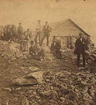
Just aquired a 1855-1865 stereoview of the Summit House on Mount Lafayette. It shows about 9 people, 2 women in large skirts, and half a dozen horses. I've been told it was only in use for those 10 years? I find it hard to believe the horses could have made it up the Bridal Path! Maybe the present trail was located a bit differently then?
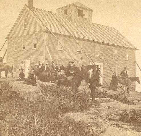
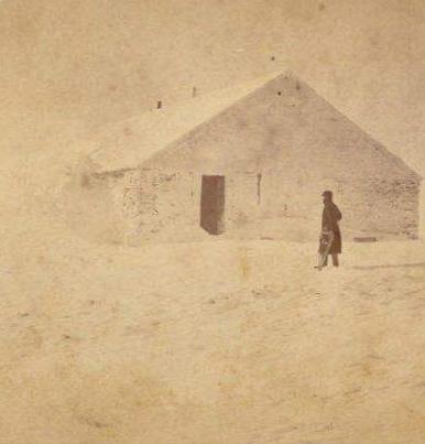
I have another of the Summit House on Mount Moosilauke which I'd guess was taken about 1860-1865. This view shows at least 2 dozen people around and on the roof.
There are many of the Summit & Tip Top Houses on Mount Washington. I also find it amazing a horse could make it up Mt Washington over the Crawford Path!
Then there were the Burro's that folks could ride for a fee from the Crawford House.
Not being a horse person, I'm guessing the old time horses that did this were quite different from present day horses?
Anyone have stereoviews/pictures of other Summit Houses and/or books on the subject or know of others?
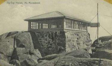
There was a small stone building on Mt Monadnock from about 1912 to sometime in the '60's or so. This was originally built as a forest fire lookout, which took the place of a small wooden earlier one.
I think I remember hearing of one on Mt Moriah?
I have another of the Summit House on Mount Moosilauke which I'd guess was taken about 1860-1865. This view shows at least 2 dozen people around and on the roof.
There are many of the Summit & Tip Top Houses on Mount Washington. I also find it amazing a horse could make it up Mt Washington over the Crawford Path!
Then there were the Burro's that folks could ride for a fee from the Crawford House.
Not being a horse person, I'm guessing the old time horses that did this were quite different from present day horses?
Anyone have stereoviews/pictures of other Summit Houses and/or books on the subject or know of others?
There was a small stone building on Mt Monadnock from about 1912 to sometime in the '60's or so. This was originally built as a forest fire lookout, which took the place of a small wooden earlier one.
I think I remember hearing of one on Mt Moriah?
 Maybe Andrew will chime in on this one.