The players: Bob & Geri (thanks!), LRiz, Rocket21, me, Bill and Lucy-the-Jack-Russell-Terrier, Tom, Diane
The plan: Zealand / Bonds traverse, 19.5 miles, 3700' in "9 hours" (Bob & LRiz pulled out a 9:30, and 10 for everyone else...)
The weather: "mostly sunny" ha ha ha... must be a holiday weekend in a tourist state to rate that forecast. It was cold and windy and we got rained on at the start, and rime-iced up high.
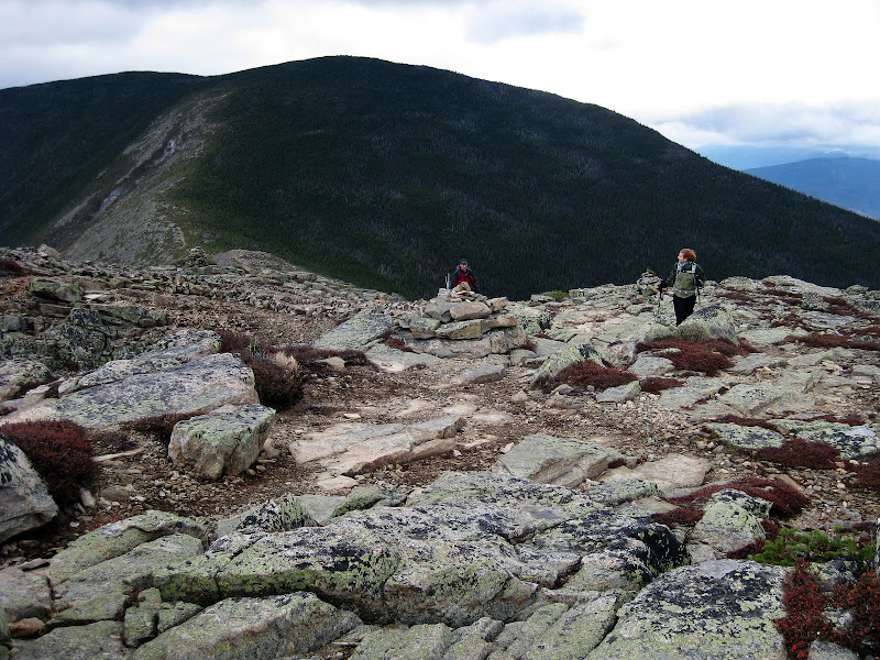
At 8am we gathered at Zealand, with Bob & Geri's SUV and Hiker Bob's van waiting at Lincoln Woods. I had never been to the Zealand Trailhead before, as I did Hale, Zealand and the Twins as loop when I bagged Zealand, so this was new to me. Hiker Bob was hiking northbound and we were heading south. We got moving in pursuit of Zealand Falls and the hut which we managed in just over an hour. The cold pancakes did not look too appetizing but I could see it if one was hungry enough. Jeremy sprung $2 for 2 pieces of apple cake though. It figures that the lady's room was being cleaned and so that delayed us for a few minutes.


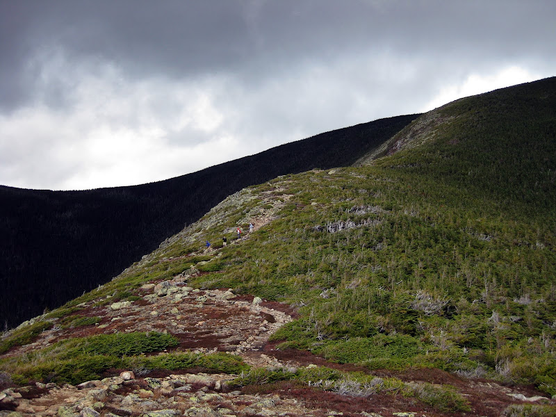
Zealand Ponds, Zealand Notch
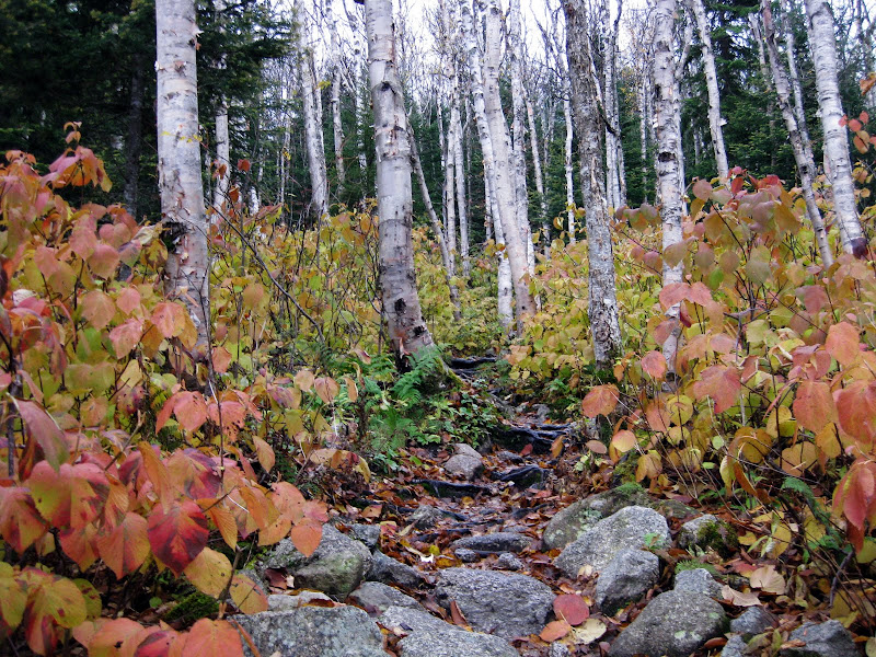
Down low, the ground was covered with leaves. While there is still plenty of color, it appears to be past peak up north. Some areas certainly still have some color, but many are either bare or are yellow and gold of the birches and aspens. There was a good amount of mud around but not enough to completely engulf one's boots. The rain seemed to have stopped, although the cloud cover was still pretty thick.


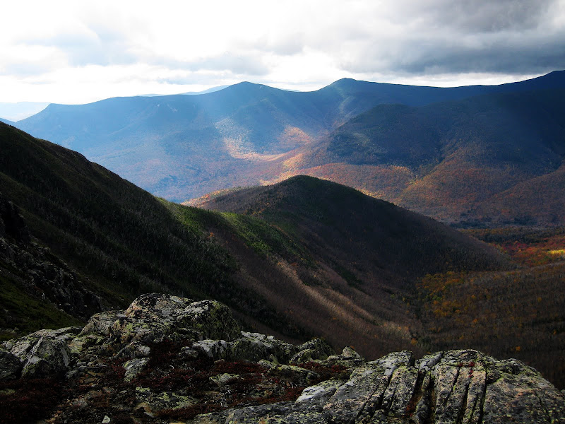
Carrigain, LRiz and the Hancocks from Zeacliff, A burst of fall colors
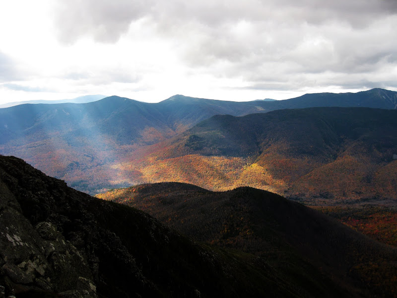
At T+2 hours we found ourselves at Zeacliff. Cloudy, but high enough that all the nearby higher peaks were visible. Not much sunshine to illuminate the foliage down in the valley, but it looked like it wasn't the best foliage around either. The bog bridges on the way back to the Twinway were partially submerged so be careful if you are going this way. Somewhere in this neighborhood were the first bits of ice and sleet on the ground. Zealand came and went. Geri skipped the side trip, which was muddy as usual. Nothing to see here... move along.


The Twinway/Bondcliff Trail Jct., West Bond (clockwise from center: Tim, Jeremy, Geri, Diane, Tom)
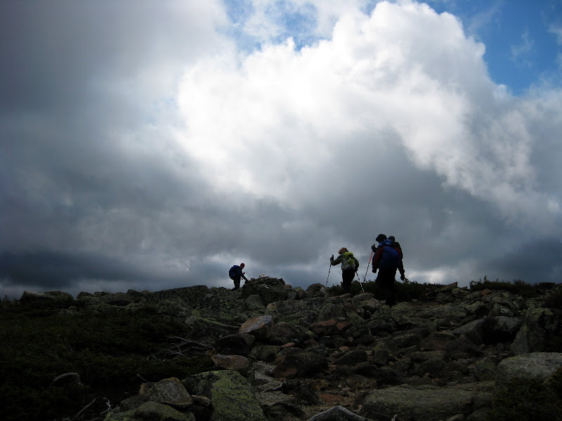
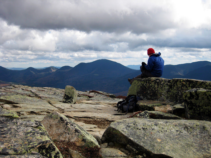
I had been to the Bondcliff Jct., but continued on to the Twins on my last time through. Guyot was a spectacular peak, but it was also spectacularly windy. Luckily it was the windiest spot of the day. Lingering was not going to be pleasant and we regrouped at the Guyot campsite spur, before continuing on to West Bond. Here I learned that Diane was getting all new peaks today. West Bond was remarkably calm, especially considering the wind speed on Guyot. On the way out, we met Hiker Bob and swapped keys, completing one of the two car spots (Thanks Hiker Bob!) Back at the Bondcliff Jct., some of us sat down and ate, before heading up to Bond.


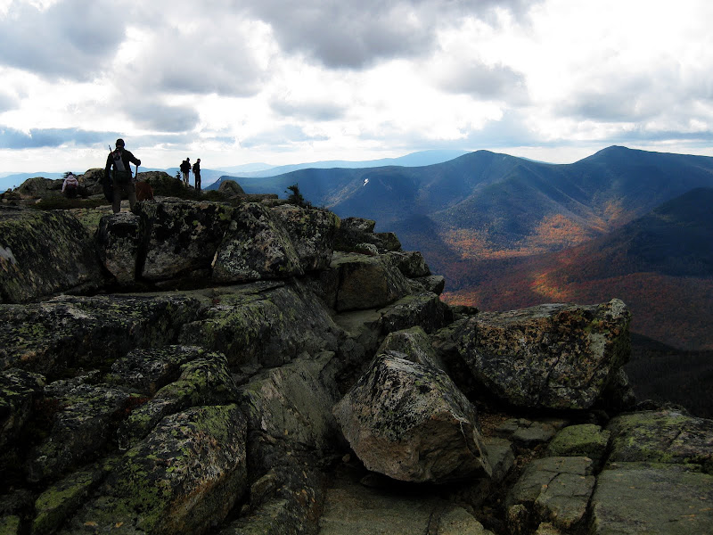
Bondcliff (from Bond), Owl's Head, Franconia Ridge behind Owl's Head (from Bondcliff)
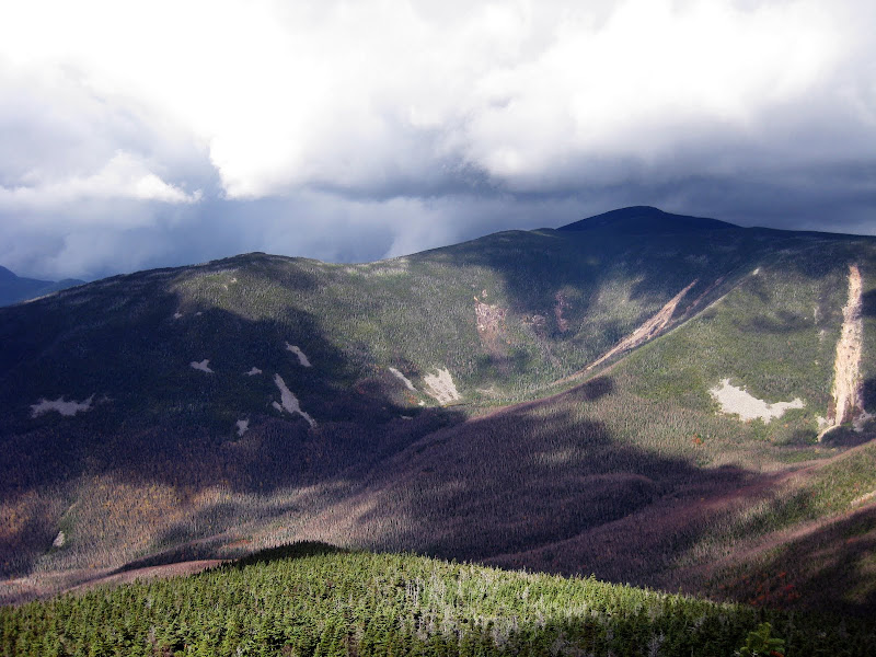
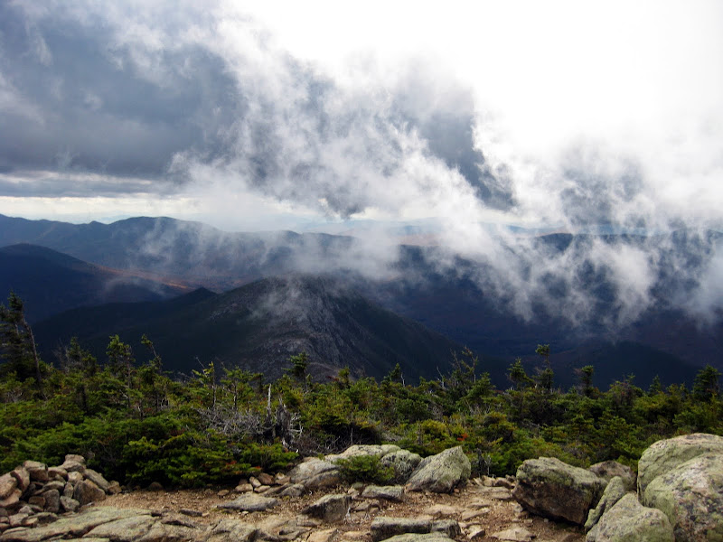
Upon leaving West Bond, it looked as though Lafayette and company were sending the clouds our way. In fact you could seem them rolling downhill towards Owl's Head. I was semi-resigned to no views on Bond or Bondcliff, but instead we got some interesting cloud views, undercasts, and moments of clarity, including all the way to Ascutney, some 66 miles away (so says TOPO! 4.5.) It's strange to think that Bondcliff is just past the halfway point, but it really is, distance-wise anyway. Of course it is 9+ miles, downhill and flat, back to Lincoln Woods. We sat on the summit, just out of the wind, for a final chat and some food before heading out. Perhaps the bluest skies of the day were seen on the way down Bondcliff. At the jct with the Wilderness Trail, we went and examined the historic trestle and the perfectly good bridge over Black Brook. The Wilderness Trail was as pleasant as it could be, covered with plenty of leaves, with many more falling all the time. Crossing the suspension bridge I look up at the bridge on the Kanc which of course was full of stopped cars It took a good 30 minutes to make it into Lincoln, and probably 50+ to get back to Zealand Road. By then it was pitch black and the skies were clear, revealing more stars than one ordinarily sees.
All photos
Enjoy,
Tim
The plan: Zealand / Bonds traverse, 19.5 miles, 3700' in "9 hours" (Bob & LRiz pulled out a 9:30, and 10 for everyone else...)
The weather: "mostly sunny" ha ha ha... must be a holiday weekend in a tourist state to rate that forecast. It was cold and windy and we got rained on at the start, and rime-iced up high.
At 8am we gathered at Zealand, with Bob & Geri's SUV and Hiker Bob's van waiting at Lincoln Woods. I had never been to the Zealand Trailhead before, as I did Hale, Zealand and the Twins as loop when I bagged Zealand, so this was new to me. Hiker Bob was hiking northbound and we were heading south. We got moving in pursuit of Zealand Falls and the hut which we managed in just over an hour. The cold pancakes did not look too appetizing but I could see it if one was hungry enough. Jeremy sprung $2 for 2 pieces of apple cake though. It figures that the lady's room was being cleaned and so that delayed us for a few minutes.
Zealand Ponds, Zealand Notch
Down low, the ground was covered with leaves. While there is still plenty of color, it appears to be past peak up north. Some areas certainly still have some color, but many are either bare or are yellow and gold of the birches and aspens. There was a good amount of mud around but not enough to completely engulf one's boots. The rain seemed to have stopped, although the cloud cover was still pretty thick.
Carrigain, LRiz and the Hancocks from Zeacliff, A burst of fall colors
At T+2 hours we found ourselves at Zeacliff. Cloudy, but high enough that all the nearby higher peaks were visible. Not much sunshine to illuminate the foliage down in the valley, but it looked like it wasn't the best foliage around either. The bog bridges on the way back to the Twinway were partially submerged so be careful if you are going this way. Somewhere in this neighborhood were the first bits of ice and sleet on the ground. Zealand came and went. Geri skipped the side trip, which was muddy as usual. Nothing to see here... move along.
The Twinway/Bondcliff Trail Jct., West Bond (clockwise from center: Tim, Jeremy, Geri, Diane, Tom)
I had been to the Bondcliff Jct., but continued on to the Twins on my last time through. Guyot was a spectacular peak, but it was also spectacularly windy. Luckily it was the windiest spot of the day. Lingering was not going to be pleasant and we regrouped at the Guyot campsite spur, before continuing on to West Bond. Here I learned that Diane was getting all new peaks today. West Bond was remarkably calm, especially considering the wind speed on Guyot. On the way out, we met Hiker Bob and swapped keys, completing one of the two car spots (Thanks Hiker Bob!) Back at the Bondcliff Jct., some of us sat down and ate, before heading up to Bond.
Bondcliff (from Bond), Owl's Head, Franconia Ridge behind Owl's Head (from Bondcliff)
Upon leaving West Bond, it looked as though Lafayette and company were sending the clouds our way. In fact you could seem them rolling downhill towards Owl's Head. I was semi-resigned to no views on Bond or Bondcliff, but instead we got some interesting cloud views, undercasts, and moments of clarity, including all the way to Ascutney, some 66 miles away (so says TOPO! 4.5.) It's strange to think that Bondcliff is just past the halfway point, but it really is, distance-wise anyway. Of course it is 9+ miles, downhill and flat, back to Lincoln Woods. We sat on the summit, just out of the wind, for a final chat and some food before heading out. Perhaps the bluest skies of the day were seen on the way down Bondcliff. At the jct with the Wilderness Trail, we went and examined the historic trestle and the perfectly good bridge over Black Brook. The Wilderness Trail was as pleasant as it could be, covered with plenty of leaves, with many more falling all the time. Crossing the suspension bridge I look up at the bridge on the Kanc which of course was full of stopped cars
It took a good 30 minutes to make it into Lincoln, and probably 50+ to get back to Zealand Road. By then it was pitch black and the skies were clear, revealing more stars than one ordinarily sees.All photos
Enjoy,
Tim
Last edited: