
Guthook
New member
- Joined
- Jan 19, 2009
- Messages
- 401
- Reaction score
- 28
Second to last trip report for this trip. This one goes from Mount Monadnock in New Hampshire to the Connecticut border.
Here's the photo gallery for the whole trip.
And here are the trip reports for the Cohos Trail, White Mountains, and Monadnock-Sunapee Greenway parts of the trip.
And here's the Metacomet-Monadnock Trail. I hope you enjoy this...
If the Southern New Hampshire section of the New England Trail was a little weird, the trend just continued as we got closer to the coast. After a relaxing zero day, we got back on the trail at the base of Monadnock, another cold morning for what would be our last day in New Hampshire. From now on we would deal with frequent trail relocations, harder-to-follow paths, and very ambiguous camping restrictions. But there were a few restaurants and stores near the trail that made life a little easier. And the terrain was generally easier.
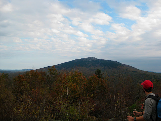
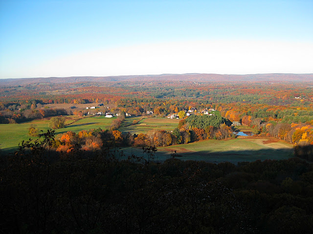
From the hills on that first day, Monadnock dominated the horizon again, but this time it was capped in snow. We counted ourselves lucky to be in relatively warm conditions, and continued on through the small town of Troy, where we stopped at the newly opened Eva's Bakery for the first of many on-trail feasts.
The rest of the day was hot-- without a doubt the hottest day of the entire trip at about 60 degrees. We left Troy on an old road or ATV trail, and soon went over Little Monadnock with more views of Monadnock, and then dropped into the lower woods for most of the next several days. The trail was very well blazed, but the lack of traffic meant that we couldn't see the trail at all in most places without searching for blazes. Most trails further north are pretty obvious when you look at the ground, so this was a little extra challenge.
After Little Monadnock, the views were sparse until we hit the Holyoke Range near Amherst. Instead of going over mountains, the trail stuck to deep woods and secluded streams. We figured this would mean easy hiking, relaxing days, and big miles. What we hadn't bargained for was the miles of relocations ahead. Due to uncooperative landowners along the trail, several sections had been replaced with lengthy relocations, or the blazes had simply been painted over to hide the trail. In a few cases this meant we took wrong turns and had no idea where we were, but where the relocations were well blazed (most everywhere) the only downside was that we had no idea how far we had come, or how much was left-- we just had to keep following the blazes and hope that they put us in the right place.
Despite the frustration with the relocations, the trail had just enough high points to keep us satisfied. On one long relocation we came to the top of a cleared hillside where we could see Mount Grace and Monadnock in the distance. Later, we came to a power line with some large boulders arranged in a kind of Stonehenge. We never did figure out just where we were, but the blazes didn't lie.
As we approached the Holyoke Range we found a bit more traffic on the trails. A local and his dog helped us find the trail in one area where it had been de-blazed, and we ran into several walkers just after setting up our tents the night before we walked over the Holyoke Range. That night we had yet another tremendous rain storm, which lasted throughout the day. We ended up hurrying over Holyoke to get to our friend Angela's house to dry out. No views from the mountains that day.
After showers and laundry at Angela's house, we went out on the town for ice cream and dinner (in that order). During all of this, the rain fell harder and harder, practically flooding the area. Lucky us! To add a little excitement to the night, during our tasty Indian food feast in Springfield an unexpected belly-dancer routine started up for about half an hour, distracting us from our dinner. It takes a lot to take hikers' minds off of their food-- apparently a pretty young lady with some serious belly-dancing moves is more than enough.
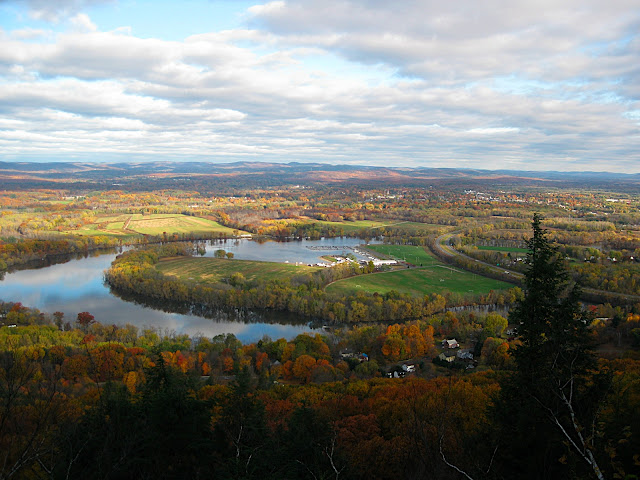
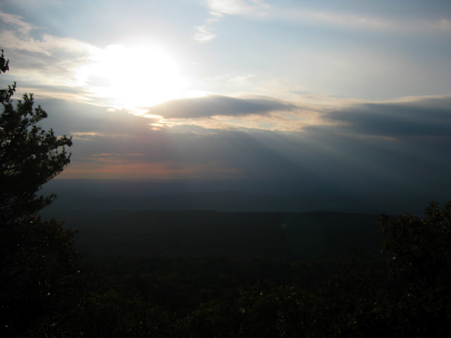
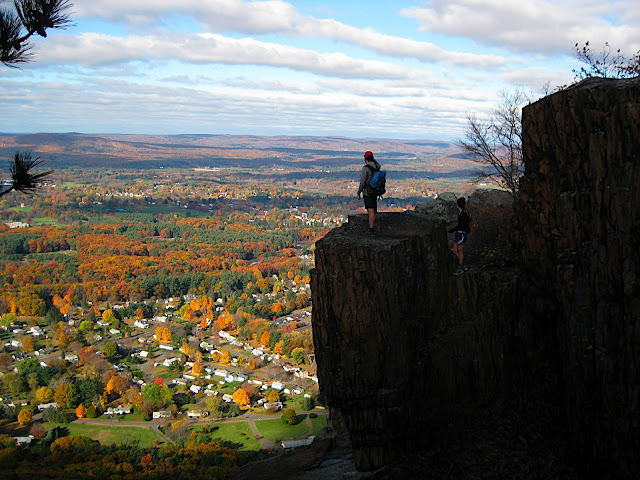
The next day was the polar opposite of the rain and cold we had over the Holyoke Range. Despite missing the first turn from the Connecticut River up to Mount Tom, we had a windy, cool, clear day with views of the entire region from the steep cliffs over Northampton. And once we left Mount Tom behind, we had more cliffs on much less-traveled mountains west of Springfield. The trail wasn't as easy to follow in these areas, where in some places it was totally overgrown or obscured by old blowdown, but it was still the highlight of the M-M.
We spent another night at Angela's place, figuring the best of the trip was now behind us. The next day we would pass into Connecticut and breeze through four more days of hiking, easy as pie.
On our final morning in Massachusetts, we got an early-morning ride with Angela's mother across the Westfield River and started hiking. It was another icy morning, but it was the last of those, since Connecticut was quite a bit warmer. We had a few nice cliff views, but nothing quite as spectacular as the Mount Tom vistas the day before. There was a bit of excitement about a mile from the end of the trail, where a beaver dam had just barely flooded a set of bog bridges (again, the beavers). By this point we were sick of wet feet, and we had no intention of wading through the water, so we found some palettes near the bog and made our own bridge. Dry feet and sunny skies on our way into Connecticut!
Here's the photo gallery for the whole trip.
And here are the trip reports for the Cohos Trail, White Mountains, and Monadnock-Sunapee Greenway parts of the trip.
And here's the Metacomet-Monadnock Trail. I hope you enjoy this...
If the Southern New Hampshire section of the New England Trail was a little weird, the trend just continued as we got closer to the coast. After a relaxing zero day, we got back on the trail at the base of Monadnock, another cold morning for what would be our last day in New Hampshire. From now on we would deal with frequent trail relocations, harder-to-follow paths, and very ambiguous camping restrictions. But there were a few restaurants and stores near the trail that made life a little easier. And the terrain was generally easier.
From the hills on that first day, Monadnock dominated the horizon again, but this time it was capped in snow. We counted ourselves lucky to be in relatively warm conditions, and continued on through the small town of Troy, where we stopped at the newly opened Eva's Bakery for the first of many on-trail feasts.
The rest of the day was hot-- without a doubt the hottest day of the entire trip at about 60 degrees. We left Troy on an old road or ATV trail, and soon went over Little Monadnock with more views of Monadnock, and then dropped into the lower woods for most of the next several days. The trail was very well blazed, but the lack of traffic meant that we couldn't see the trail at all in most places without searching for blazes. Most trails further north are pretty obvious when you look at the ground, so this was a little extra challenge.
After Little Monadnock, the views were sparse until we hit the Holyoke Range near Amherst. Instead of going over mountains, the trail stuck to deep woods and secluded streams. We figured this would mean easy hiking, relaxing days, and big miles. What we hadn't bargained for was the miles of relocations ahead. Due to uncooperative landowners along the trail, several sections had been replaced with lengthy relocations, or the blazes had simply been painted over to hide the trail. In a few cases this meant we took wrong turns and had no idea where we were, but where the relocations were well blazed (most everywhere) the only downside was that we had no idea how far we had come, or how much was left-- we just had to keep following the blazes and hope that they put us in the right place.
Despite the frustration with the relocations, the trail had just enough high points to keep us satisfied. On one long relocation we came to the top of a cleared hillside where we could see Mount Grace and Monadnock in the distance. Later, we came to a power line with some large boulders arranged in a kind of Stonehenge. We never did figure out just where we were, but the blazes didn't lie.
As we approached the Holyoke Range we found a bit more traffic on the trails. A local and his dog helped us find the trail in one area where it had been de-blazed, and we ran into several walkers just after setting up our tents the night before we walked over the Holyoke Range. That night we had yet another tremendous rain storm, which lasted throughout the day. We ended up hurrying over Holyoke to get to our friend Angela's house to dry out. No views from the mountains that day.
After showers and laundry at Angela's house, we went out on the town for ice cream and dinner (in that order). During all of this, the rain fell harder and harder, practically flooding the area. Lucky us! To add a little excitement to the night, during our tasty Indian food feast in Springfield an unexpected belly-dancer routine started up for about half an hour, distracting us from our dinner. It takes a lot to take hikers' minds off of their food-- apparently a pretty young lady with some serious belly-dancing moves is more than enough.
The next day was the polar opposite of the rain and cold we had over the Holyoke Range. Despite missing the first turn from the Connecticut River up to Mount Tom, we had a windy, cool, clear day with views of the entire region from the steep cliffs over Northampton. And once we left Mount Tom behind, we had more cliffs on much less-traveled mountains west of Springfield. The trail wasn't as easy to follow in these areas, where in some places it was totally overgrown or obscured by old blowdown, but it was still the highlight of the M-M.
We spent another night at Angela's place, figuring the best of the trip was now behind us. The next day we would pass into Connecticut and breeze through four more days of hiking, easy as pie.
On our final morning in Massachusetts, we got an early-morning ride with Angela's mother across the Westfield River and started hiking. It was another icy morning, but it was the last of those, since Connecticut was quite a bit warmer. We had a few nice cliff views, but nothing quite as spectacular as the Mount Tom vistas the day before. There was a bit of excitement about a mile from the end of the trail, where a beaver dam had just barely flooded a set of bog bridges (again, the beavers). By this point we were sick of wet feet, and we had no intention of wading through the water, so we found some palettes near the bog and made our own bridge. Dry feet and sunny skies on our way into Connecticut!
 ). I know there are many untold stories you must have about trying to find your way along.