
Jazzbo
Well-known member
- Joined
- Jan 1, 2005
- Messages
- 1,197
- Reaction score
- 163
As part of the annual Mother’s Day Trailwork Weekend at Mount Cardigan, I was favored with the task of leading a trail crew to a relatively remote area around Mount Cardigan in New Hampshire. We were to hike out the Woodland Trail to the junction with Skyland Trail, follow the Skyland Trail to juntion iwth Vistamont Trail at Orange Mountain. From there we would take the Vistamont Trail back to Grand Junction and back to Cardigan Lodge via the Holt Trail.
Our objective was to remove or mitigate blowdowns we found on the outer reaches of Woodland Trail and Skyland Trails. It was raining most of the day and we got very wet. Our route passed by an area of incredibly interesting beaver ponds which everyone found fascinating. We all came away satisfied with our day having gotten to see one of the less visited areas of Cardigan and making many improvements to make travel and navigating these trails easier for future visitors.
At one point two members of our party became pretty chilled, but we were able to address the problem by adding some layers and continuing to move. Most of the blowdowns were pretty routine, but we found and delt with some pretty complex blowdown that required some care to remove or at least mitigate so that the trail was passable. I should have taken more pictures because we dealt with some pretty interesting and massive blowdowns but picture taking was secondary to my responsibilities as leader and rainy conditions weren't condusive to photography.
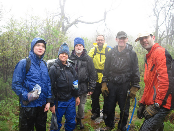
What an energetic & motivated crew! Josanna, David, Scott, Andy, Susan, Jeff.
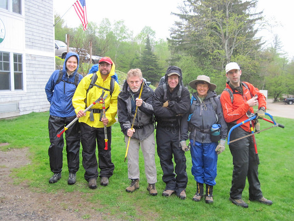
It's a good thing they are because my post hike GPS track download indicates this will be 8.7 mile round trip with plenty of blowdown clearing action along the way. I was especially pleased to have Jeff, Joanna, and Andy who accompanied me last year in 2009 for another blowdown patrol in the north side of Cardigan.
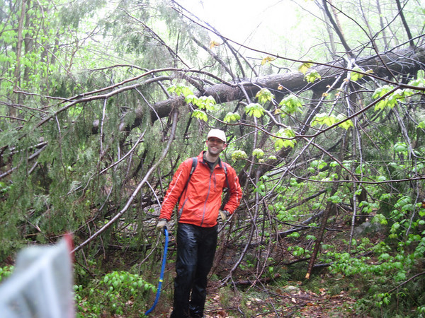
Jeff poses by big spruce blow down which we decided to leave in place. I considered it too high off the ground for safe removal. The side branches became firmly planted in the ground when it fell. It was quite rigidly planted.
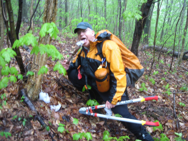
It was decided this was a bit too technical for our group, so we elected to brush out a bypass trail. The trail beyond this consisted of at some 30 yards of boot sucking mud so it was decided to extend the bypass to a point just beyond this mucky section to where the trail was well drained and provided better footing. It may be a good idea to leave the blowdown since it provides natural barrier discouraging passage through this mucky section of trail.
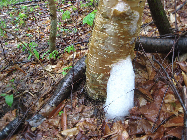
We observed many peculiar looking clouds of foam like this one at bases of yellow birches.
A true scientist risks everything in the pursuit of truth.
When it started to rain more heavily it became apparent water cascading down birch tree trunks was causing these clouds of foam.
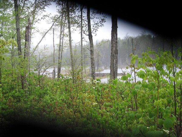
This forest road this trail follows has many wet swampy spots. We came to the beaver ponds. My camera lens wouldn't open all the way perhaps on account of the rain. It's a pity, but one can still make out a very tall beaver dam.
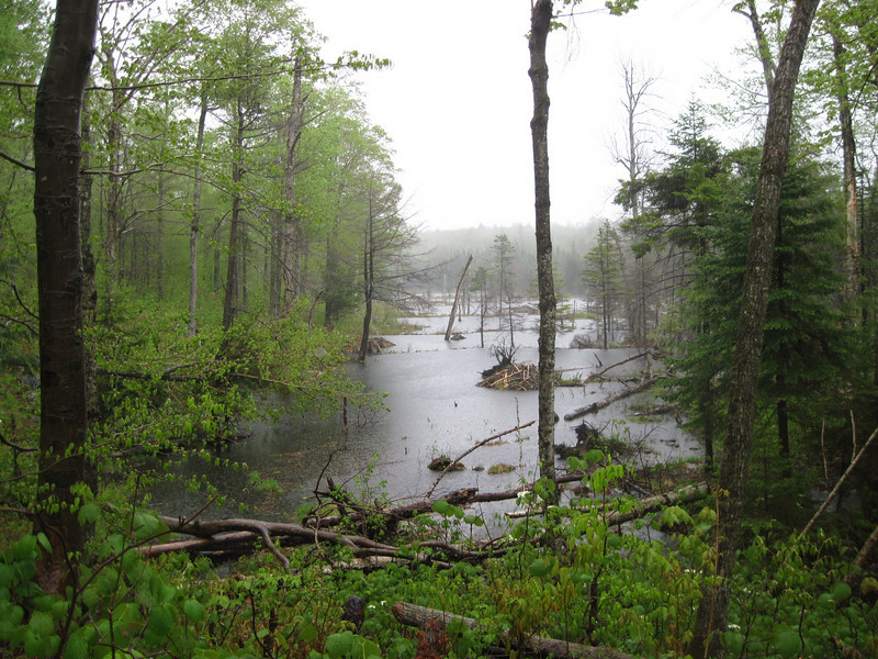
We're near the head of the beaver dams. I'm trying to capture the many terraced water pools created by this enterprising colony of beavers. Must be a pretty large population.
The uppermost beaver pond was this one located where the trail attempts to skirt the ponds. Looks like another relocation is needed here in order to skirt the beaver ponds. We work our way up stream to cross the brook feeding the beaver ponds. We found a crossing place that featured a downed log we used as handrail. A 20" diameter American Ash has been gnawed more than half way through.
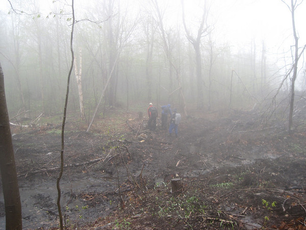
We passed through an area that was logged last year in 2009. This is private land. Shouldn't judge this too harshly. This may look ugly now, but in a few years lush new bushes and berries will be growing here and provide important food sources for moose, deer, bears, birds not otherwise found in straight forest. Contributes to more diverse habitat.
Random photo taken on the Skyland Trail. They're still smiling!
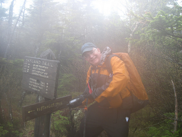
Heading up steep slope of what we thought was Orange Mountain. However there's no sign of the Vistamont Trail. We waste 30 minutes trying to figure out where the Vistamont Trail is until we figure out we must not yet be on Orange and we need to keep on going. GPS Track later determines this to have been Crane Mountain. Intrepid leader uses GPS to find trail sign for Vistamont Trail.
We arrive safely back at the lodge at 5:30 after almost 8 hours on the trail just in time for a very hearty dinner with other happy trail workers. Life is good! End of Story.
Our objective was to remove or mitigate blowdowns we found on the outer reaches of Woodland Trail and Skyland Trails. It was raining most of the day and we got very wet. Our route passed by an area of incredibly interesting beaver ponds which everyone found fascinating. We all came away satisfied with our day having gotten to see one of the less visited areas of Cardigan and making many improvements to make travel and navigating these trails easier for future visitors.
At one point two members of our party became pretty chilled, but we were able to address the problem by adding some layers and continuing to move. Most of the blowdowns were pretty routine, but we found and delt with some pretty complex blowdown that required some care to remove or at least mitigate so that the trail was passable. I should have taken more pictures because we dealt with some pretty interesting and massive blowdowns but picture taking was secondary to my responsibilities as leader and rainy conditions weren't condusive to photography.
What an energetic & motivated crew! Josanna, David, Scott, Andy, Susan, Jeff.
It's a good thing they are because my post hike GPS track download indicates this will be 8.7 mile round trip with plenty of blowdown clearing action along the way. I was especially pleased to have Jeff, Joanna, and Andy who accompanied me last year in 2009 for another blowdown patrol in the north side of Cardigan.
Jeff poses by big spruce blow down which we decided to leave in place. I considered it too high off the ground for safe removal. The side branches became firmly planted in the ground when it fell. It was quite rigidly planted.
It was decided this was a bit too technical for our group, so we elected to brush out a bypass trail. The trail beyond this consisted of at some 30 yards of boot sucking mud so it was decided to extend the bypass to a point just beyond this mucky section to where the trail was well drained and provided better footing. It may be a good idea to leave the blowdown since it provides natural barrier discouraging passage through this mucky section of trail.
We observed many peculiar looking clouds of foam like this one at bases of yellow birches.
A true scientist risks everything in the pursuit of truth.
When it started to rain more heavily it became apparent water cascading down birch tree trunks was causing these clouds of foam.
This forest road this trail follows has many wet swampy spots. We came to the beaver ponds. My camera lens wouldn't open all the way perhaps on account of the rain. It's a pity, but one can still make out a very tall beaver dam.
We're near the head of the beaver dams. I'm trying to capture the many terraced water pools created by this enterprising colony of beavers. Must be a pretty large population.
The uppermost beaver pond was this one located where the trail attempts to skirt the ponds. Looks like another relocation is needed here in order to skirt the beaver ponds. We work our way up stream to cross the brook feeding the beaver ponds. We found a crossing place that featured a downed log we used as handrail. A 20" diameter American Ash has been gnawed more than half way through.
We passed through an area that was logged last year in 2009. This is private land. Shouldn't judge this too harshly. This may look ugly now, but in a few years lush new bushes and berries will be growing here and provide important food sources for moose, deer, bears, birds not otherwise found in straight forest. Contributes to more diverse habitat.
Random photo taken on the Skyland Trail. They're still smiling!
Heading up steep slope of what we thought was Orange Mountain. However there's no sign of the Vistamont Trail. We waste 30 minutes trying to figure out where the Vistamont Trail is until we figure out we must not yet be on Orange and we need to keep on going. GPS Track later determines this to have been Crane Mountain. Intrepid leader uses GPS to find trail sign for Vistamont Trail.
We arrive safely back at the lodge at 5:30 after almost 8 hours on the trail just in time for a very hearty dinner with other happy trail workers. Life is good! End of Story.