
1HappyHiker
Well-known member
Over the past few weeks, I've done some bushwhacking (surprise!).
It's all been interesting to me, but to many folks, maybe not so much!") Below are a few words and a few photos about two of my recent adventures.
Below are a few words and a few photos about two of my recent adventures.
Cape Horn (Groveton, NH):
If New Hampshire has a geologic claim to fame, then it is probably related to ring dikes. As I understand it, these are remnants of ancient volcanoes. When seen on a topographic map the dikes are conspicuous formations with a circular outline. Although there are several ring dike locations throughout NH, it's my understanding that the most complete ring dike is in the Ossipees. Cape Horn (located in Groveton NH) is classified as ring dike, but all that remains today of the once circular formation is a crescent shaped mountain.
Much of Cape Horn resides on public land within the boundaries of the Cape Horn State Forest. As far as I know, there are no official hiking trails, but there is one small section of this State Forest that abuts Lost Nation Road. From there, a hike/bushwhack can be launched. There are some corridors that can be helpful. I don't know if they are old logging roads, snowmobile trails, or whatever.
There's an excellent online scientific report about the geology, and flora of the Cape Horn State Forest (click HERE). Among other things, this report contains some really nice photos of wildflowers and other flora located within this forest area.
Below are a few snapshots that I took.
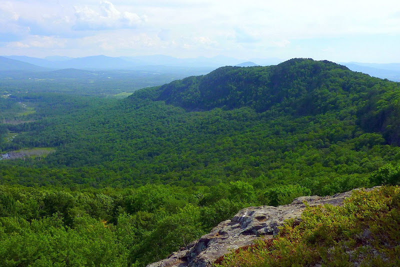
View Southward (In foreground, note forested rim of ring-dike curving from center of photo to right side)
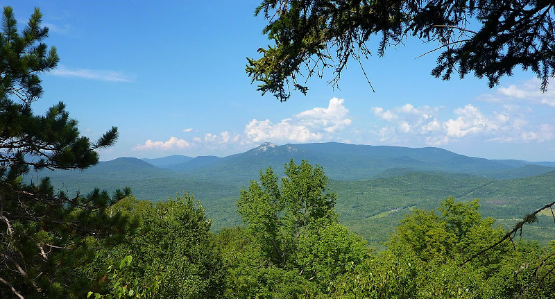
View Northward (note Percy Peaks in center of photo)
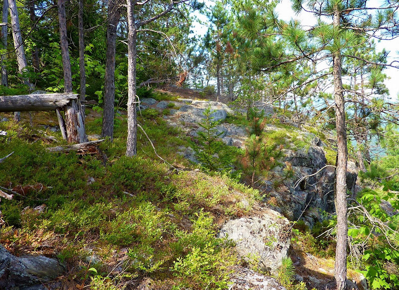
Ledge Areas at Top of the Ring Dike
 --------------------------------------------------------------
Duck Pond:
Duck Pond is another spot that I recently visited. There are no trails, and so this was a bushwhack. I launched this trek from a point off the Nancy Pond Trail in the vicinity of Nancy Pond itself. It was not one of the easier whacks I've done, and if I had to do it all over again, I'd probably launch the whack from the Signal Ridge Trail and follow the Whiteface Brook corridor.
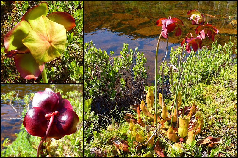
Although Duck Pond doesn't have the same mystic of an ancient volcano (such as Cape Horn), nonetheless it does have sort of a prehistoric feel to it. The shoreline is generally swampy and I spotted a number of amphibians (frogs) and reptiles (snakes). Also, carnivorous plants (Purple Pitcher plants to be exact) were spotted along the shoreline. I think there is something wonderfully prehistoric about carnivorous plants. They can conjure up images of dinosaurs lurking about!
Below is a collage of photos of the carnivorous Purple Pitcher plants which were taken from different vantage points.
Purple Pitcher Plant
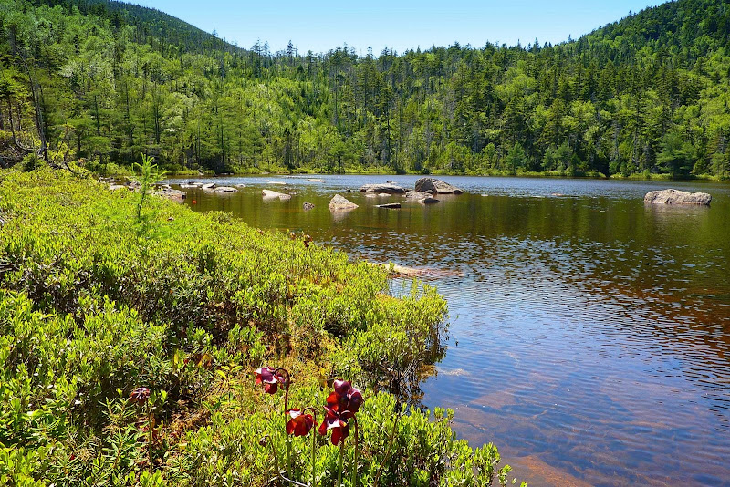
And, the photo below shows a view of the Duck Pond itself. It was taken from the eastern shore looking westward toward the col between Mt. Lowell and Mt. Anderson. Although the pond isn't all that large, I couldn't find a vantage point where I could capture an image of the entire pond. Perhaps if I wasn't being consumed by carnivorous insects, then I might have taken more time to try to find an all encompassing vantage point!
Duck Pond (looking westward toward col between Mt. Lowell and Mt. Anderson)
1HappyHiker
It's all been interesting to me, but to many folks, maybe not so much!
Below are a few words and a few photos about two of my recent adventures.Cape Horn (Groveton, NH):
If New Hampshire has a geologic claim to fame, then it is probably related to ring dikes. As I understand it, these are remnants of ancient volcanoes. When seen on a topographic map the dikes are conspicuous formations with a circular outline. Although there are several ring dike locations throughout NH, it's my understanding that the most complete ring dike is in the Ossipees. Cape Horn (located in Groveton NH) is classified as ring dike, but all that remains today of the once circular formation is a crescent shaped mountain.
Much of Cape Horn resides on public land within the boundaries of the Cape Horn State Forest. As far as I know, there are no official hiking trails, but there is one small section of this State Forest that abuts Lost Nation Road. From there, a hike/bushwhack can be launched. There are some corridors that can be helpful. I don't know if they are old logging roads, snowmobile trails, or whatever.
There's an excellent online scientific report about the geology, and flora of the Cape Horn State Forest (click HERE). Among other things, this report contains some really nice photos of wildflowers and other flora located within this forest area.
Below are a few snapshots that I took.
View Southward (In foreground, note forested rim of ring-dike curving from center of photo to right side)
View Northward (note Percy Peaks in center of photo)
Ledge Areas at Top of the Ring Dike
Duck Pond:
Duck Pond is another spot that I recently visited. There are no trails, and so this was a bushwhack. I launched this trek from a point off the Nancy Pond Trail in the vicinity of Nancy Pond itself. It was not one of the easier whacks I've done, and if I had to do it all over again, I'd probably launch the whack from the Signal Ridge Trail and follow the Whiteface Brook corridor.
Although Duck Pond doesn't have the same mystic of an ancient volcano (such as Cape Horn), nonetheless it does have sort of a prehistoric feel to it. The shoreline is generally swampy and I spotted a number of amphibians (frogs) and reptiles (snakes). Also, carnivorous plants (Purple Pitcher plants to be exact) were spotted along the shoreline. I think there is something wonderfully prehistoric about carnivorous plants. They can conjure up images of dinosaurs lurking about!
Below is a collage of photos of the carnivorous Purple Pitcher plants which were taken from different vantage points.
Purple Pitcher Plant
And, the photo below shows a view of the Duck Pond itself. It was taken from the eastern shore looking westward toward the col between Mt. Lowell and Mt. Anderson. Although the pond isn't all that large, I couldn't find a vantage point where I could capture an image of the entire pond. Perhaps if I wasn't being consumed by carnivorous insects, then I might have taken more time to try to find an all encompassing vantage point!
Duck Pond (looking westward toward col between Mt. Lowell and Mt. Anderson)
1HappyHiker
Last edited: