1HappyHiker
Well-known member
So, what DO you call someone who hikes nearly 11 miles to see a waterfall? Well, in this case, I'd call this person a friend! I'm guessing that there are not many folks (other than a friend) who would be willing to indulge me by agreeing to hike 10.8 miles round trip to see a waterfall.")
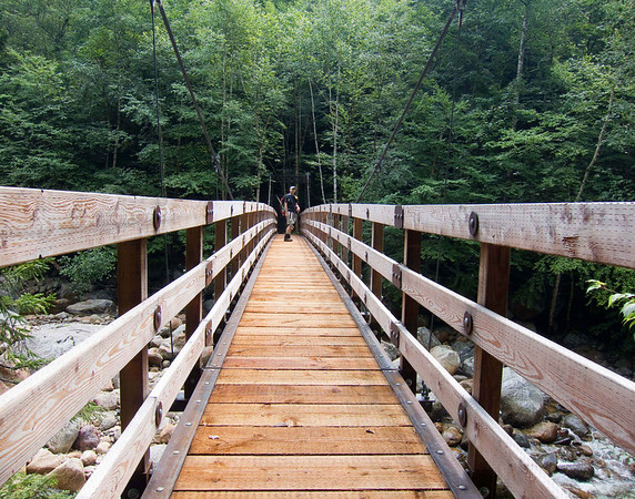
My friend Zman agreed to join me on a trek to satisfy what many would consider to be a warped desire to visit Dry River Falls. And although it's a long hike, there's nothing particularly difficult about it. It doesn't even involve a bushwhack! It's just a straight shot up, and then back down, the Dry River Trail.
I don't consider myself as a "bagger" of any sort, i.e. not a peak-bagger, nor a pond-bagger, nor a waterfall-bagger. However, it is sometimes nice to complete a set of something (like in a card game, etc). Dry River Falls was the only named waterfall in the Crawford Notch that I'd never visited. So, for that reason I wanted to visit this waterfall, plus I was intrigued by photos that I'd seen of this place.
As anyone knows who has hiked the Dry River Trail for any significant distance, there are some roller-coaster PUDs along the way. Although PUD stands for "pointless ups & downs", perhaps in this case the word "pointless" isn't completely appropriate.
As I understand it, the original trail was a smoother trek since it followed the old logging railroad bed. However, to maintain a gentle gradient up the valley, the railroad crossed the Dry River 13 times to take advantage of whichever bank of the river provided the smoothest & flattest corridor to lay the tracks. For a hiking trail to cross a river 13 times is inviting problems. After several hiker drownings in the 1970s, the trail was relocated to eliminate the multiple crossings. This relocation resulted in the trail running along terrain that is more undulating than the original trail, but it's now a much safer corridor for hikers.
Okay . . . I got off-track (no pun intended) about our trek to Dry River Falls. Even with the PUDs that are interspersed here & there, there are still many long stretches of trail that follow the old railroad grade, and therefore you can make pretty good time. After deducting the time taken for various stops along the way (and for a long lunch break at the waterfall), the total actual hiking time was just under 5.5 hrs for the nearly 11 mile journey.
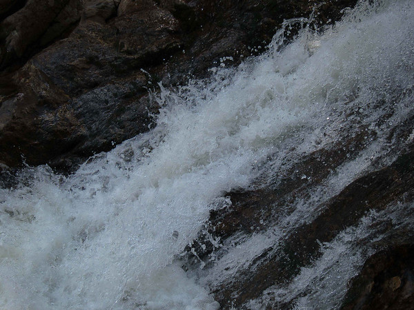
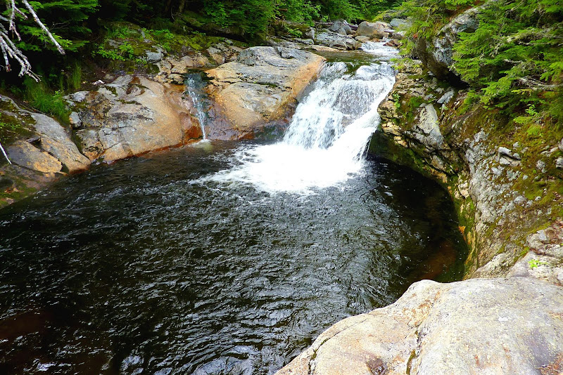
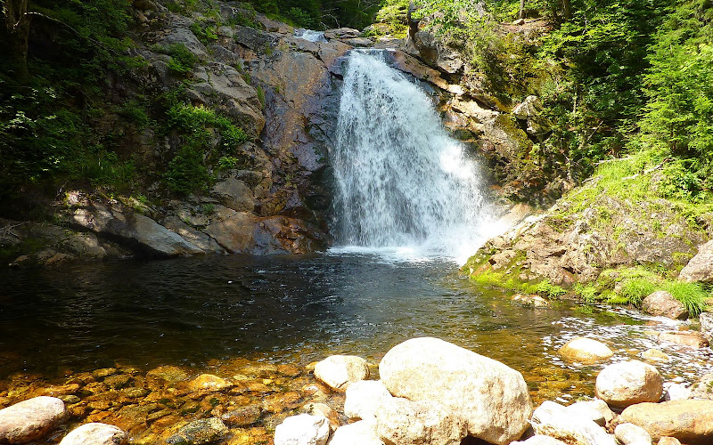
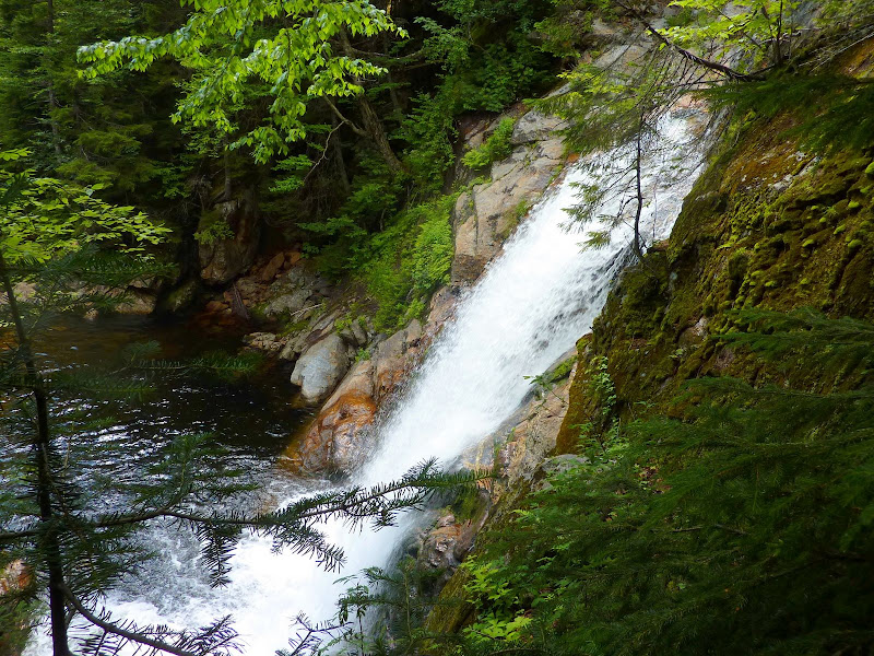
We were both impressed with the beauty of Dry River Falls. Many folks on this Forum have been to this spot and likely have their own photos. Nonetheless, shown below are a few snapshots of the falls taken from a few different viewing locations.
Approaching the Falls from the Spur Path off the Dry River Trail
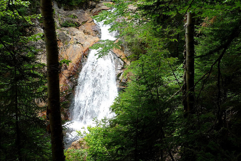
Frontal View of Falls
Side View of Falls
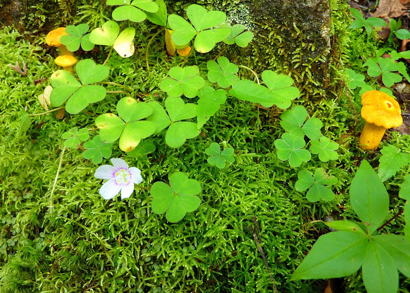
As said earlier, this trek is a bit on the long-side. However, it's not like you're walking through a bleak and barren landscape! The trail takes you through the very heart of the Presidential Dry River Wilderness. There's plenty of natural beauty to keep you entertained. For one thing, the river is in view for most of the journey. And besides the vast forest all around you, there are numerous vignettes of plant life on a much smaller scale. Scattered here & there along the trail are little groupings of vegetation such as shown in the snapshot below.
And so, this was a nice trek to a nice spot, and even nicer yet was that Zman opted to join me on this waterfall escapade!
1HappyHiker
My friend Zman agreed to join me on a trek to satisfy what many would consider to be a warped desire to visit Dry River Falls. And although it's a long hike, there's nothing particularly difficult about it. It doesn't even involve a bushwhack!
It's just a straight shot up, and then back down, the Dry River Trail.I don't consider myself as a "bagger" of any sort, i.e. not a peak-bagger, nor a pond-bagger, nor a waterfall-bagger. However, it is sometimes nice to complete a set of something (like in a card game, etc). Dry River Falls was the only named waterfall in the Crawford Notch that I'd never visited. So, for that reason I wanted to visit this waterfall, plus I was intrigued by photos that I'd seen of this place.
As anyone knows who has hiked the Dry River Trail for any significant distance, there are some roller-coaster PUDs along the way. Although PUD stands for "pointless ups & downs", perhaps in this case the word "pointless" isn't completely appropriate.
As I understand it, the original trail was a smoother trek since it followed the old logging railroad bed. However, to maintain a gentle gradient up the valley, the railroad crossed the Dry River 13 times to take advantage of whichever bank of the river provided the smoothest & flattest corridor to lay the tracks. For a hiking trail to cross a river 13 times is inviting problems. After several hiker drownings in the 1970s, the trail was relocated to eliminate the multiple crossings. This relocation resulted in the trail running along terrain that is more undulating than the original trail, but it's now a much safer corridor for hikers.
Okay . . . I got off-track (no pun intended) about our trek to Dry River Falls. Even with the PUDs that are interspersed here & there, there are still many long stretches of trail that follow the old railroad grade, and therefore you can make pretty good time. After deducting the time taken for various stops along the way (and for a long lunch break at the waterfall), the total actual hiking time was just under 5.5 hrs for the nearly 11 mile journey.
We were both impressed with the beauty of Dry River Falls. Many folks on this Forum have been to this spot and likely have their own photos. Nonetheless, shown below are a few snapshots of the falls taken from a few different viewing locations.
Approaching the Falls from the Spur Path off the Dry River Trail
Frontal View of Falls
Side View of Falls
As said earlier, this trek is a bit on the long-side. However, it's not like you're walking through a bleak and barren landscape! The trail takes you through the very heart of the Presidential Dry River Wilderness. There's plenty of natural beauty to keep you entertained. For one thing, the river is in view for most of the journey. And besides the vast forest all around you, there are numerous vignettes of plant life on a much smaller scale. Scattered here & there along the trail are little groupings of vegetation such as shown in the snapshot below.
And so, this was a nice trek to a nice spot, and even nicer yet was that Zman opted to join me on this waterfall escapade!
1HappyHiker
Last edited: