1HappyHiker
Well-known member
Probably most would agree that the views from Mt. Crawford are fabulous. Because of these excellent views, many folks make this their sole destination for the day. There is really only one practical way to get there, which is to do the 5.0 mile round-trip hike from the Davis Path trailhead on Route 302. You go in and come out the same way. There is no loop-option available.
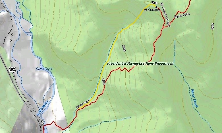
So, with the above in mind, I decided to create my own loop. Please understand from the outset that I'm not touting this to be the greatest idea ever! I'm simply saying that it provided a different way to hike to Mt. Crawford. I really had no idea whether my plan would even work. However, I rationalized that it would be something fun to try, regardless of whether or not I succeeded.
I began my improvised loop by hiking a short distance on the Davis Path and then left the trail to follow the nameless brook up the nameless ravine to the headwall of Mt. Crawford. I then planned to climb to the top of the headwall and aim to arrive at a point just slightly to the west of the Mt. Crawford summit. Then from there, I'd follow the bare ledges to the top of Mt. Crawford. I'd then descend from Mt. Crawford via the Davis Path to complete the loop.
The map below illustrates the plan described above. My approximate route is shown in yellow, and the traditional route to Mt. Crawford is shown in red.
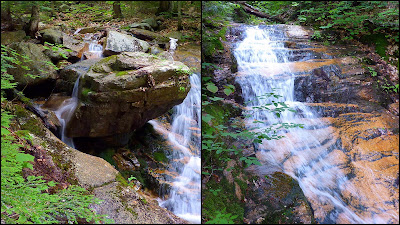
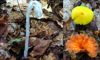
The hike along the nameless brook was quick & easy since it was open hardwoods and the grade was very gentle. Along the way, there were some cascades and colorful fungi. (See two photo collages below.)
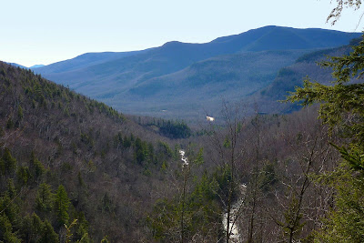
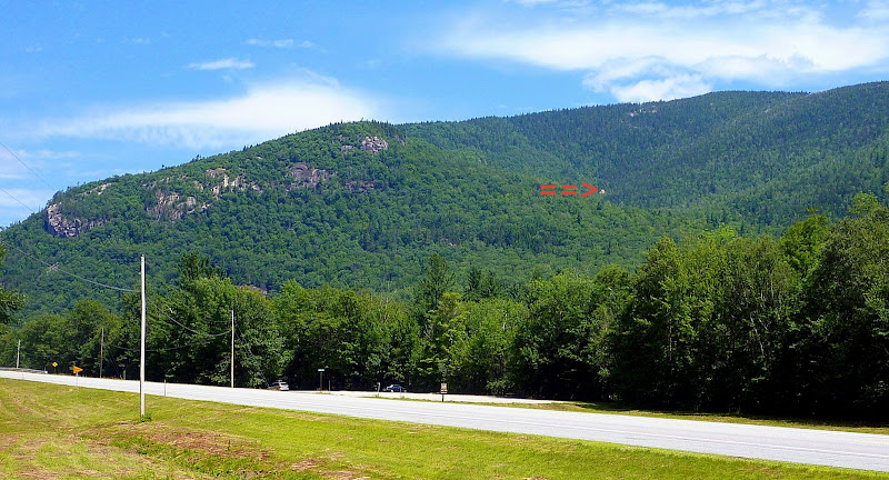
I don't know, but perhaps I'm the only person on the planet who has noticed, let alone been curious about something that can be seen from Route 302 as you look up the nameless ravine that I described above. I'm talking about the tan spot at the bottom of the headwall.
In the photo below, a red arrow points to this spot.
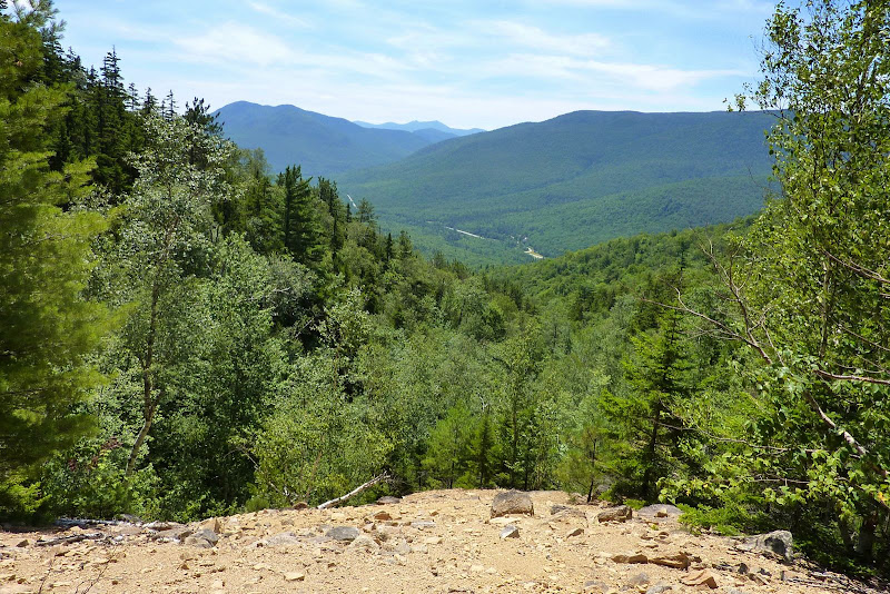
Anyway, I made it to that tannish-colored spot. It is nothing more than a large scree field, which was pretty much what I expected.
The photo below shows the view from this scree field.
Once I reached the scree field, I had a decision to make. Should I "GO ALL THE WAY" for a touchdown! Or, should I simply call it a day? Although it was readily apparent that the headwall was steep, it was also apparent that there were still plenty of nice open woods.
So, I decided what the heck! Before setting out on this trek, I had calculated that it was only 0.3 mile from the top of the scree field to the top of the headwall. It turned out to be a good decision since the woods and the terrain for that 0.3 mile were very conducive to bushwhacking. And although it was steep, I really don't think it was any steeper than portions of the Davis Path.
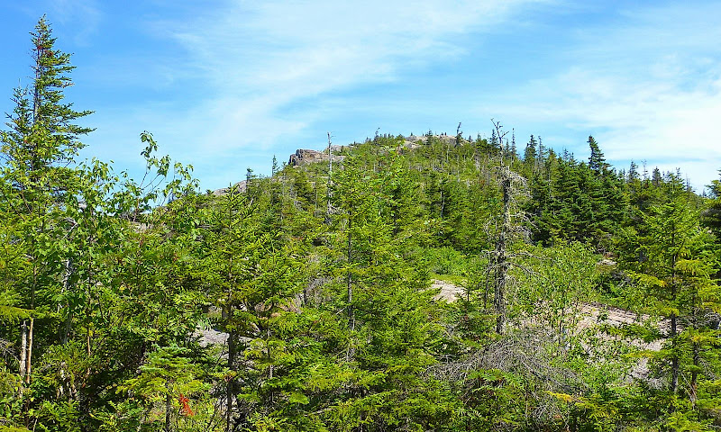
Upon reaching the top of the headwall, it wasn't long before I could see the summit of Mt. Crawford (see photo below). It was very odd to be approaching this peak from this direction!
Approaching the Top of Mt. Crawford
As I travelled the remaining short distance to the top, I began to experience the fabulous views that Mt. Crawford provides.
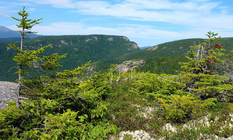
For what it's worth, some of my personal favorite views are shown in the photos below.
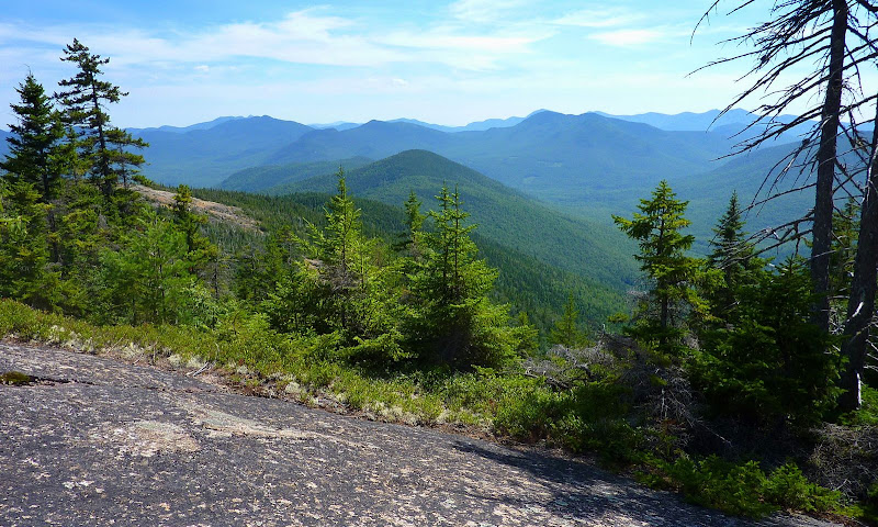
Stairs Mountain (of course!)
Mt. Washington and Southern Presidential Range
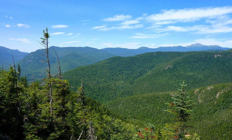
All the Many Peaks and Bumps & Lumps When Looking Southward
You might ask how long it took to do this loop. Well, if I deduct the chunk of time spent while stopping to look at stuff, take photos, snacks, etc., then I'd guesstimate it took slightly less than 4 hours total hiking time.
This adventure was one heck of a lot of fun!
I would definitely consider doing this improvised loop again the next time I plan to visit Mt. Crawford.
1HappyHiker
So, with the above in mind, I decided to create my own loop. Please understand from the outset that I'm not touting this to be the greatest idea ever! I'm simply saying that it provided a different way to hike to Mt. Crawford. I really had no idea whether my plan would even work. However, I rationalized that it would be something fun to try, regardless of whether or not I succeeded.
I began my improvised loop by hiking a short distance on the Davis Path and then left the trail to follow the nameless brook up the nameless ravine to the headwall of Mt. Crawford. I then planned to climb to the top of the headwall and aim to arrive at a point just slightly to the west of the Mt. Crawford summit. Then from there, I'd follow the bare ledges to the top of Mt. Crawford. I'd then descend from Mt. Crawford via the Davis Path to complete the loop.
The map below illustrates the plan described above. My approximate route is shown in yellow, and the traditional route to Mt. Crawford is shown in red.
The hike along the nameless brook was quick & easy since it was open hardwoods and the grade was very gentle. Along the way, there were some cascades and colorful fungi. (See two photo collages below.)
I don't know, but perhaps I'm the only person on the planet who has noticed, let alone been curious about something that can be seen from Route 302 as you look up the nameless ravine that I described above. I'm talking about the tan spot at the bottom of the headwall.
In the photo below, a red arrow points to this spot.
Anyway, I made it to that tannish-colored spot. It is nothing more than a large scree field, which was pretty much what I expected.
The photo below shows the view from this scree field.
Once I reached the scree field, I had a decision to make. Should I "GO ALL THE WAY" for a touchdown! Or, should I simply call it a day? Although it was readily apparent that the headwall was steep, it was also apparent that there were still plenty of nice open woods.
So, I decided what the heck! Before setting out on this trek, I had calculated that it was only 0.3 mile from the top of the scree field to the top of the headwall. It turned out to be a good decision since the woods and the terrain for that 0.3 mile were very conducive to bushwhacking. And although it was steep, I really don't think it was any steeper than portions of the Davis Path.
Upon reaching the top of the headwall, it wasn't long before I could see the summit of Mt. Crawford (see photo below). It was very odd to be approaching this peak from this direction!
Approaching the Top of Mt. Crawford
As I travelled the remaining short distance to the top, I began to experience the fabulous views that Mt. Crawford provides.
For what it's worth, some of my personal favorite views are shown in the photos below.
Stairs Mountain (of course!)
Mt. Washington and Southern Presidential Range
All the Many Peaks and Bumps & Lumps When Looking Southward
You might ask how long it took to do this loop. Well, if I deduct the chunk of time spent while stopping to look at stuff, take photos, snacks, etc., then I'd guesstimate it took slightly less than 4 hours total hiking time.
This adventure was one heck of a lot of fun!
I would definitely consider doing this improvised loop again the next time I plan to visit Mt. Crawford.
1HappyHiker
Last edited:
")