
1HappyHiker
Well-known member
In fairly rapid succession, this was yet another day when I was able to join Steve on one of his adventures. This exploit involved a trek that was a pure bushwhack from start to finish. It's difficult to pin down the exact mileage, but I guesstimate the round-trip was a minimum of 5 miles. The destination was Hutchins Mountain (sometimes referred to a Mt. Pilot). This peak tops out at 3,730 ft, and it's included on the NH 100 Highest list. It's also included on the list of 124 peaks in all of New England to have an altitude of greater than 3700 ft. (with at least 160 ft of clean prominence)
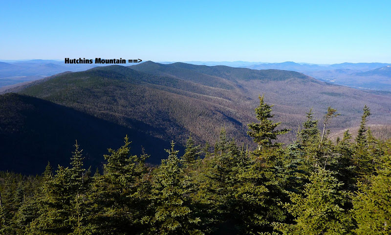
Below is a view looking northward along the Pilot Range toward Hutchins Mountain (snapshot taken in mid-November from The Horn).
A thumbnail sketch of our route is as follows. We started from the end of Mill Brook Road and began heading westerly toward the east end of the ridge that curves up to meet the main ridge of the Pilot Range at a point about 0.3 mile southeast of the summit of Hutchins. Upon reaching the main ridge, we headed northwesterly toward the summit of Hutchins. Just for variety, we descended via a route that varied a bit from our ascent route. However, we did follow the same ridge, and we used a roughly similar course from the end of the ridge back to the road.
Overall, we encountered mainly open woods for the entire trek. Speaking purely for myself, I found this to be totally amazing! Admittedly, during our ascent, we did hit one short-lived patch of thick stuff near the point where we joined the main ridge. However, by tweaking our course to trek slightly more east of the main ridge, we found the woods to be much more open.
The title of this report indicates that our trek involved some assistance from moose and loggers.") This was not just an attempt to grab attention, but actually has a factual basis. Purely by luck during our ascent, we came upon what appeared to be an old tote road used by loggers many decades ago. We were able to follow this corridor for several tenths of a mile which made for some fast and easy trekking. There was plenty of evidence to indicate that the moose made frequent use of this corridor as well. And speaking of moose, during our descent (at about 2,950 ft) we stumbled upon a well-defined & well-used moose path that ran right down the spine of the ridge. As with the logging tote road mentioned earlier, this corridor continued for quite a long distance, and made for effortless trekking down some of the steeper parts of the ridge.
This was not just an attempt to grab attention, but actually has a factual basis. Purely by luck during our ascent, we came upon what appeared to be an old tote road used by loggers many decades ago. We were able to follow this corridor for several tenths of a mile which made for some fast and easy trekking. There was plenty of evidence to indicate that the moose made frequent use of this corridor as well. And speaking of moose, during our descent (at about 2,950 ft) we stumbled upon a well-defined & well-used moose path that ran right down the spine of the ridge. As with the logging tote road mentioned earlier, this corridor continued for quite a long distance, and made for effortless trekking down some of the steeper parts of the ridge.
It was very interesting to read some historic reference material supplied to me by Steve. Particularly fascinating was the fact that the area around the summit of Hutchins was cleared of all trees in the late 19th century in order to make way for a signal station. In the Sweester's 1876 guidebook there's a comment which states: "The summit is nearly bare". He goes on to provide a detailed description of all the views from the bare summit. And, in an old edition of Appalachia (Volume IV), it was interesting to read a report that provides details of an early exploration of the Pilot Range around 1886. It's mind-boggling to think that explorations such as this were ongoing during the same general time-frame as Custer's Last Stand at the Little Bighorn!
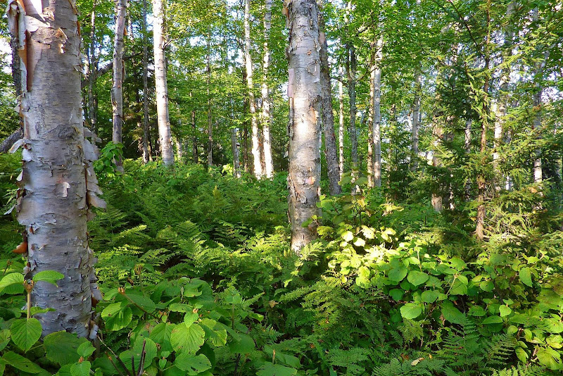
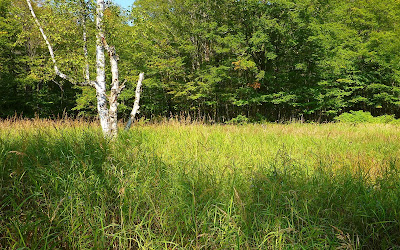
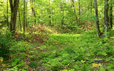
Well, as with many hikes, it's as much about the journey as it is the actual destination. Here are a few snapshots of some nice scenery we saw along the way.
Beautiful Birch Glade
A Meadow About to Turn Golden; and a Vignette of Fern and Hobble Bush with Leaves Already Turned Red
From the summit of Hutchins, we whacked through really thick stuff (but for just a very short distance) to reach some small ledges that face generally southward. The fog/haze was too thick for the distant views of peaks in the Presidential Range, and many other major peaks to the south in the Twin and Franconia Range. However, there was a terrific view of the many lumps & bumps in the Pilot Range, including the major peaks of this Range (The Horn, The Bulge, Mt. Cabot).
Peaks in Pilot Range as Seen from Hutchins Mountain
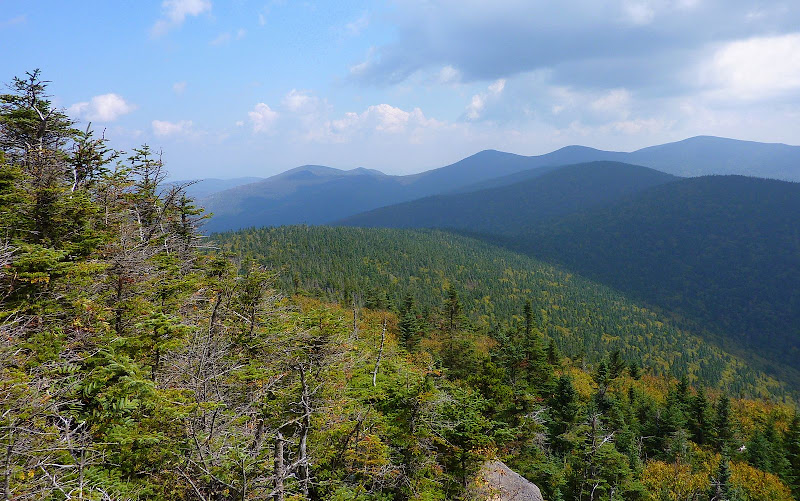
Perhaps it's simply due to the limitations of my "point & shoot" camera, but regardless, the snapshot below is the best I was able to capture of what I feel is a rather unique view from Hutchins.
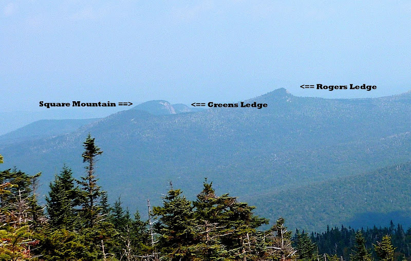
The zoomed shot below shows the profile of Rogers Ledge, Square Mountain, and Greens Ledge.
Profile of Rogers Ledge, Square Mountain, and Greens Ledge
The Kilkenny is certainly a beautifully wild and remote region that provides some excellent trekking regardless of whether you're doing an on-trail hike, or bushwhacking.
1HappyHiker
Below is a view looking northward along the Pilot Range toward Hutchins Mountain (snapshot taken in mid-November from The Horn).
A thumbnail sketch of our route is as follows. We started from the end of Mill Brook Road and began heading westerly toward the east end of the ridge that curves up to meet the main ridge of the Pilot Range at a point about 0.3 mile southeast of the summit of Hutchins. Upon reaching the main ridge, we headed northwesterly toward the summit of Hutchins. Just for variety, we descended via a route that varied a bit from our ascent route. However, we did follow the same ridge, and we used a roughly similar course from the end of the ridge back to the road.
Overall, we encountered mainly open woods for the entire trek. Speaking purely for myself, I found this to be totally amazing! Admittedly, during our ascent, we did hit one short-lived patch of thick stuff near the point where we joined the main ridge. However, by tweaking our course to trek slightly more east of the main ridge, we found the woods to be much more open.
The title of this report indicates that our trek involved some assistance from moose and loggers.
This was not just an attempt to grab attention, but actually has a factual basis. Purely by luck during our ascent, we came upon what appeared to be an old tote road used by loggers many decades ago. We were able to follow this corridor for several tenths of a mile which made for some fast and easy trekking. There was plenty of evidence to indicate that the moose made frequent use of this corridor as well. And speaking of moose, during our descent (at about 2,950 ft) we stumbled upon a well-defined & well-used moose path that ran right down the spine of the ridge. As with the logging tote road mentioned earlier, this corridor continued for quite a long distance, and made for effortless trekking down some of the steeper parts of the ridge.It was very interesting to read some historic reference material supplied to me by Steve. Particularly fascinating was the fact that the area around the summit of Hutchins was cleared of all trees in the late 19th century in order to make way for a signal station. In the Sweester's 1876 guidebook there's a comment which states: "The summit is nearly bare". He goes on to provide a detailed description of all the views from the bare summit. And, in an old edition of Appalachia (Volume IV), it was interesting to read a report that provides details of an early exploration of the Pilot Range around 1886. It's mind-boggling to think that explorations such as this were ongoing during the same general time-frame as Custer's Last Stand at the Little Bighorn!
Well, as with many hikes, it's as much about the journey as it is the actual destination. Here are a few snapshots of some nice scenery we saw along the way.
Beautiful Birch Glade
A Meadow About to Turn Golden; and a Vignette of Fern and Hobble Bush with Leaves Already Turned Red
From the summit of Hutchins, we whacked through really thick stuff (but for just a very short distance) to reach some small ledges that face generally southward. The fog/haze was too thick for the distant views of peaks in the Presidential Range, and many other major peaks to the south in the Twin and Franconia Range. However, there was a terrific view of the many lumps & bumps in the Pilot Range, including the major peaks of this Range (The Horn, The Bulge, Mt. Cabot).
Peaks in Pilot Range as Seen from Hutchins Mountain
Perhaps it's simply due to the limitations of my "point & shoot" camera, but regardless, the snapshot below is the best I was able to capture of what I feel is a rather unique view from Hutchins.
The zoomed shot below shows the profile of Rogers Ledge, Square Mountain, and Greens Ledge.
Profile of Rogers Ledge, Square Mountain, and Greens Ledge
The Kilkenny is certainly a beautifully wild and remote region that provides some excellent trekking regardless of whether you're doing an on-trail hike, or bushwhacking.
1HappyHiker
Last edited: