Interesting Boundary Monument Wapack Trail

vftt.org

Help Support vftt.org:

This site may earn a commission from merchant affiliate links, including eBay, Amazon, and others.

Jazzbo

Well-known member
Joined
Jan 1, 2005
Messages
1,197
Reaction score
163
Location
Waltham, MA Jazzbo & Marty meet Bigfoot on Kenne
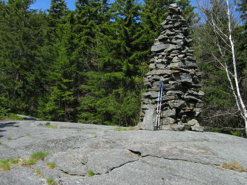
Papa Bear where are you? My wife and I celebrated New Years Day by hiking mighty Mt Watatic (1832') via portions of Mid State and Wapack Trails. Prior to summiting, we wandered north up to the border between Mass and NH to look for some monuments I'd heard about. We found two very interesting monuments on the spur trail at the border.

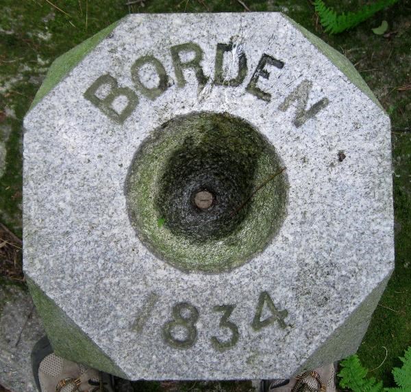
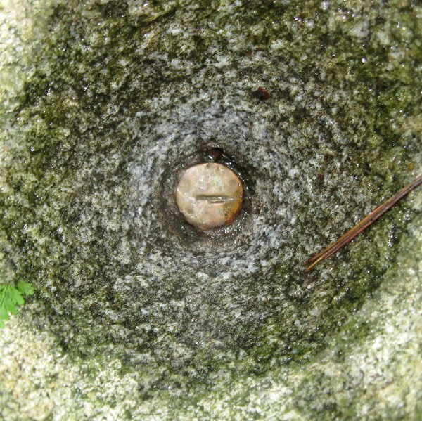
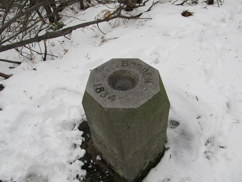
The first one monument features a hollow depression that appeared to have a pointed bottom probably for lining up the surveyor's transit. The pointy bottom doesn't show up very well in this picture, but it is there. The text reads "BORDEN 1834". the monument is on high point along the boundary. I wonder why BORDEN? Could they have spelled BORDER incorrectly?

1144482646_pZKrx-L.jpg


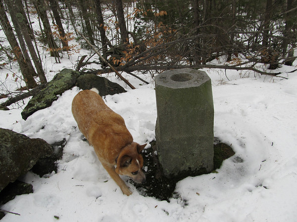
Here's a cute dog we met who has designs on this monument. Marking his territory for the dog world I suppose. He's about the size of an Aussie.

1144483059_apK3L-M.jpg


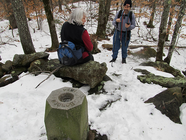
A stone wall follows the state boundary in this area. My wife is sitting on it.

1144472179_M5nVU-M.jpg


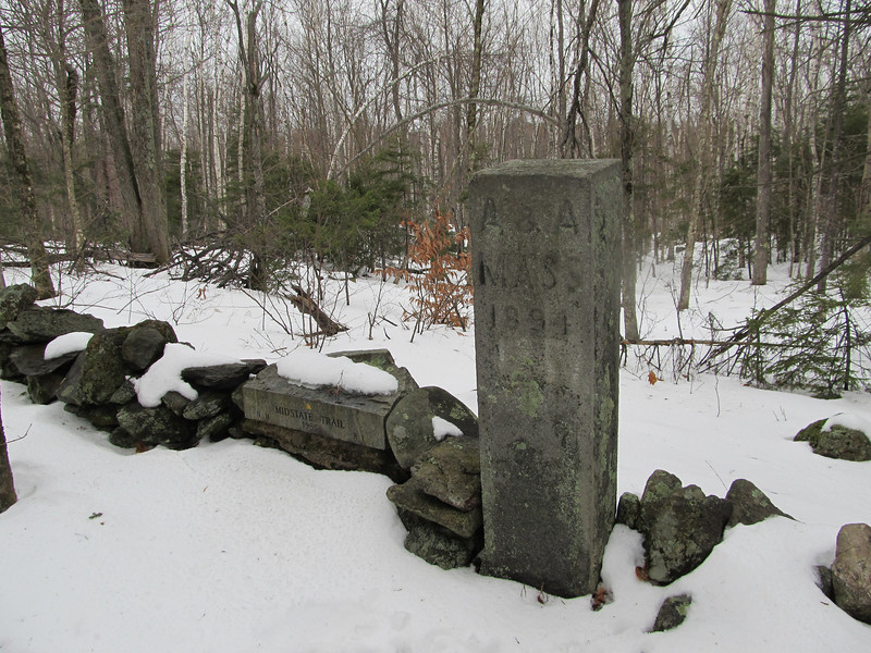
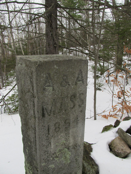
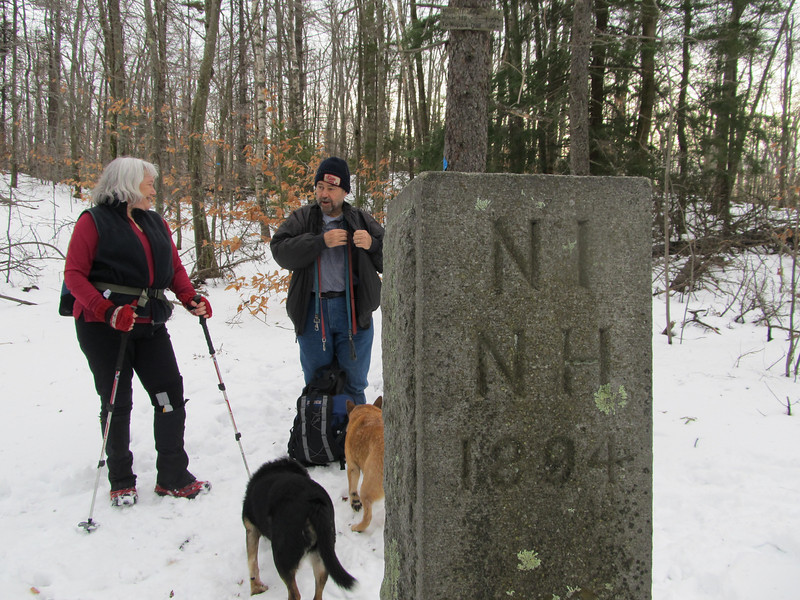
Here is the second monument. This one is located 50 yards or so downhill from the first. It is dated 1894.

1144472703_fpJqA-L.jpg


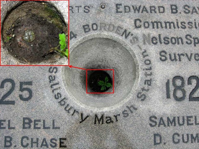
Close up of engravings on the Mass side.

1144473187_WepX8-L.jpg


Close up of engravings on the NH side.

1144473583_54Ab7-L.jpg
 
Last edited:
I think that your last pictures show the boundary marker between the towns of Ashby and Ashburnham, MA and New Ipswich, NH. Not sure about the "Borden" one.

In the area south of the stone wall, there are old cellar holes. They are pretty easy to see in the spring, less so when there is a lot of vegetation.

Looks like you had a nice time. This is one of my favorite hikes.

Have you tried www.wapack.org for more information about the area?

Pat T
 
Thanks for stating the obvious!

Thanks for stating the obvious! Of course the tri-town corner is shown right there on the Wapack Trail map.

That area has all sorts or interesting artifacts like this tall and well crafted cairn. It's located just below view ledges of North Pack Monadnock. It's only short distance off the trail, but I doubt most hikers ever see it. I used to think it had to be something like a town boundary corner but my study of antique maps never turned up anything.

1144996883_uoXMF-L.jpg


Here is view looking up to the view ledges from the monument. You can see the monument from the view ledge if you know where to look.

1144996728_p4jvX-L.jpg
 
The monument is in honor of Simeon Borden, who surveyed extensively in Massachusetts. http://en.wikipedia.org/wiki/Simeon_Borden

There are some other great cairns along the Wapack on Temple Mt., and a number of places where town line markers are embedded in stone walls. I love hiking through the remnants of well-worked land, that feeling is so much stronger on the Wapack than it is in (for example) the WMNF.
 
Last edited:
Thanks for the Wikipedia link!

Thanks for the Wikipedia link to the very interesting article on Simeon Borden! The date on the monument definitely coincides with the period given in the article when they did the boundary survey.
 
The monument was set by Simeon Borden in 1834. He was hired by Massachusetts to survey the state and it's boundaries. What you found is called "Watatick State Line". At that point the border was still somewhat in dispute, and was later realigned to correspond to the various town corners. That is why the Borden monument is a few feet north of the accepted line (which is the stone wall).

Here's his map: Borden Map

The other one is on the accepted line. The letters are for the towns. It is also the corner of Middlesex/Worcester Counties.

The hollow you mention actually has a copper bolt in it with a line indicating the state line. Here's a picture where you can see that:

d9035c52-a24f-44b9-97a1-4b72d71406d7.jpg


Here's a closeup:

5c303cd8-a987-4ad4-907a-16a25c21c1c5.jpg
 
Last edited:
Thanks Papa Bear

Thanks PB! I started Googling Borden and came across your many posts on Geocaching site. The Pine Tree Monument sounds and looks intriguing. Thanks for the link to the Borden Map too. I've visited the bench mark on top of Prospect Hill in my home town you've mentioned in the past. It would be interesting to see what his remarkable instrument looks like. Have you ever come across anything like that?
 
Thanks PB! I started Googling Borden and came across your many posts on Geocaching site. The Pine Tree Monument sounds and looks intriguing. Thanks for the link to the Borden Map too. I've visited the bench mark on top of Prospect Hill in my home town you've mentioned in the past. It would be interesting to see what his remarkable instrument looks like. Have you ever come across anything like that?
He used a 12" theodolite on loan from the Coast Survey (which he had to repair himself). With that, he got better results than lesser men got with fancier theodolites. Here an excerpt from his report:

The instrument used in measuring horizontal angles was a twelve-inch repeating Theodolite, made by Troughton for Mr. Hassler at the commencement of the coast survey, and fully described in the second series of the Transactions of the American Philosophical Society, published at Philadelphia in 1825, page 328. I would refer to that paper for a description of it, and will merely add, that I found it necessary to supply the instrument with a firmer clamping apparatus, and with a more powerful telescope to be used in measuring the azimuth angles. This telescope was forty-six inches in focal length. It is now in the hands of Major Graham, upon the north-eastern boundary survey.

You may also want to check out the Salisbury Marsh Monument:

d1d9294a-c645-4575-810e-12e7e8d85b7e.jpg


See my log here: http://www.geocaching.com/mark/details.aspx?PID=MY5214
 
Last edited:
The 1894 marker must have been installed by the state of Massachusetts during a survey of the northern border. I can think of one near identical marker installed on the border between Vernon,VT and Bernardston, MA


It would be interesting for somebody with a GPS to check both markers and see if they are in a line .
The northern boundary of Massachusetts (west of where it swings up at the east end) is NOT a straight line. It was originally surveyed in the 18th century as "due west of of such and such ..." but immediately the states started arguing that the compass declination used was wrong and the line tended towards the north, thus shortchanging NH (there was no Vermont at that point in time). After about a century, they settled it by accepting each town's northern boundaries and town corners as historically accepted by the towns. So it does wiggle this way and that. On most maps you don't see the difference, but the very monument that opened this thread (the one set by Border for the State of Massachusetts in 1834) is now about 4 feet north of the accepted line (it's now entirely in NH). And Borden was just trying to use the original axe blazes and cairns or whatever, that were set by the surveyors a hundred odd years earlier - which weren't in a line either.

There is a rule about boundaries which says "It is what it is, not what it's supposed to be". In other words, when it's laid out and monumented and accepted by both parties, that's it, even if it doesn't follow the original instructions.

See for example the northern boundary of VT and NY with Canada - which was supposed to be along the 45th parallel. On the map it goes every which way, sometimes north and sometimes south of the intended line. They fought over that for 75 years and finally the treaty just said, "follow the old line as originally surveyed".
 
Last edited:
Top