Tunnel Brook-Mt. Clough - Sunday 7/17/11 - Easy going hike

vftt.org

Help Support vftt.org:

This site may earn a commission from merchant affiliate links, including eBay, Amazon, and others.

billski

Member
Joined
May 27, 2009
Messages
307
Reaction score
16
Location
Tunbridge, Vermont
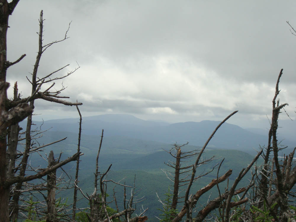
This is a laid back hike for those that like to poke around, stop and enjoy the great outdoors. For various reasons, there will be no great speed and we have the common sense to turn back if necessary. We'll start out from the north on Tunnel Brook Trail, then proceed 3 miles on the relatively flat trail alongside the brook to three wonderful ponds. You can either sit and enjoy the ponds or join two of us as we attempt to bushwhack to the top of Mt. Clough.

It will be a mid morning start. Plan on 5-6 hours.

This is part of the Benton mountain range, in the western whites.
 
Yup, Bill and I are going to attempt a bushwhack to the summit. 1HappyHiker and Rocket21, along with others, have explored this area in the past and have all praised it highly so I can't wait to explore this area. Should be another fun day in the woods. :cool:
 
whats the beta on mt clough? how high how long a bushwhack?
Trailhead Elevation: 1,880'
Summit Elevation: 3,561'
Vertical Gain: 1,861'

Elevation gain on the trail portion of the hike is negligible so most of the 1,861' will be bushwhacking. It is probably three miles of flat trail walking before the bushwhack. Not sure of how many miles the whack will add, we are still discussing the whacking route.

How about the views?
 
How about the views?
Never been but judging by others efforts, we should have nice views if the weather cooperates. The ponds and woods along the way are very nice as well.

Check out 1HappyHiker's blog entry from one month ago. He didn't summit and still found nice views.

Smarts and Mt. Cube taken from near the summit. Photo courtesy of rocket21

mtcloughsummitbig-2011-0626a.jpg
 
view

How about the views?

Hi FTrain,

This hike is not about views. This is more about appreciating the the woods, what lives there and being there. It's the challenge of a new explore. The scenery in the valley is gorgeous. If we get to the anticlimactic wooded peak and find some views off of ledges, then we get lucky. If we don't summit, that's OK. Being stealth give you the opportunities a noisy group would not. (nothing wrong with noisy groups in the right time and place.) There have been surprises in most of the hikes I've been on. It's all about being out of doors.

Each person has their own reason for being out of doors and I respect that. I want to add some balance to the very ambitious and rewarding TR's I've read here.

If you get back to the trail head with a smile on you face, that's all that matters!

Bill
 
final arrangements

Details. Meet up, 7am at Hooksett NH tolls park and ride to carpool. Or meet at north trailhead at 830-9am.

Directions to trailhead: Take Route 112 west from Woodstock over Kinsman Notch. Tunnel Brook Road will eventually be on the left. The Tunnel Brook Trail starts at the far end of the road.
 
Directions to trailhead: Take Route 112 west from Woodstock over Kinsman Notch. Tunnel Brook Road will eventually be on the left. The Tunnel Brook Trail starts at the far end of the road.
I'm not sure if Jeremy's directions are entirely correct when I look at google maps. It does not appear that Tunnel Brook Road comes out to meet Route 112, we may actually be looking for Hummingbird Lane as shown on the map section below. In any event, following Hummingbird Land/Tunnel Brook Road south until Tunnel Brook Road ends.

2eap7jc.jpg
 
Go to google maps and put the man down at the intersection. It has a signpost that reads "hummingbird". That said, if you go up the road NW where googlemaps says its Tunnel brook road. It's actually Tunnel BROOK! I use the "man on the street" to visualize where I'm going anyways. I hate automobile GPS.

Good catch!
:D

Thanks!
We would have been lost for a little while. Then again, I'm not used to such fancy schmantzy paved road access! I'm more used to gravel roads with no signposts at intersections!
 
That turn can be easy to miss. There is a Wildwood historic marker sign that is easier to spot than the road sign right at the correct intersection.
 
That turn can be easy to miss. There is a Wildwood historic marker sign that is easier to spot than the road sign right at the correct intersection.

The road sign was very bizzare. It now reads "Tunnel Brook Road". We saw the hysterical marker, but it's really getting pretty obfuscated by all the brush. Anyway, no big deal. Actually a very easy find compared to some of the hunting I've had to do for other trailheads.
 
You think that is weird? Once when I went out to do a trip in the Belknaps with Steve I found Google Maps had the road we wanted listed as one name, my DeLorme Gazetteer had it a different name, and when we got there the road sign was a third completely different name! You know us New Hampsherites....why do anything easy when the hard way is much more fun. :D

Brian

Bizarre. Some day, some day. Maybe the google maps camera could to OCR on every street sign, instead of relying on some silly database.
 
Top