
Damselfly
New member
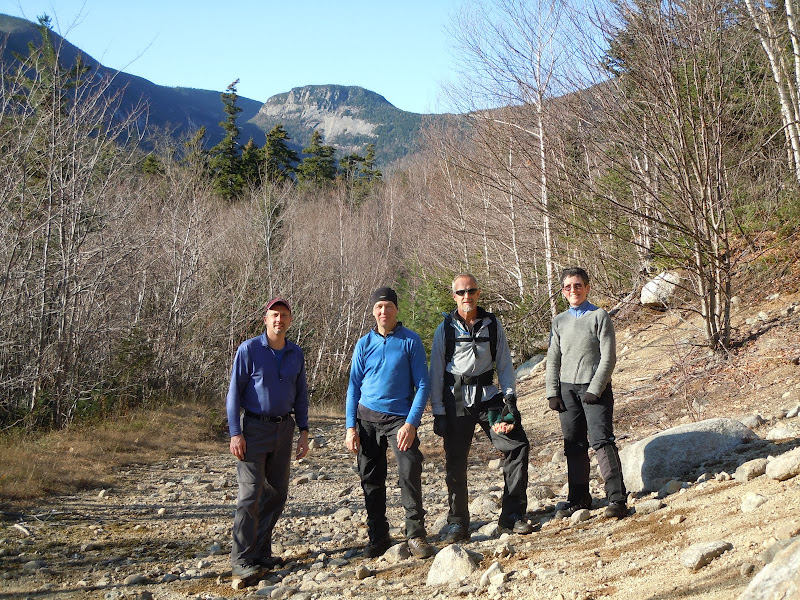
Mike LaRoss, Lew Dow, Bill Magyar and I hiked The Captain yesterday.
Certainly, the Sawyer River Road closure added to our day. But we all needed the Captain, particularly Mike and I, who are closing in on the NHHH. So with headlamps and resolve for a long day, off we went. Heads down... conversation passes time... and you're there before you know it.
From the Sawyer River Pond parking area, we passed through the gate onto what maps call Livermore Road. Stay straight as you pass a bridge on your left; and at the fork, take a sharp right onto FR 86. (There was a snomo sign up: "North Fork Trail, 2 miles to end.") This well-maintained forest service road ended at the 2-mile mark at somewhat of a "turn-around" area. There was a footbridge on the left, and we continued straight - still on Livermore Road, only now, on a portion not maintained. Our first surprise of the day was how open this unmaintained road was. Open in spots, narrow in spots, and Xmas trees growing up in spots... but clearly a road, and no bushwhacking involved. So we were making time!
We crossed the first of two large, flat open grassy areas that have served as camping spots. Lovely areas with water nearby, views of The Captain and surrounding peaks. (Wish we had backpacked in and camped after all!) Eventually the road ends at a major brook crossing. We continued to follow the brook up towards The Captain, sometimes walking in the stream bed (sometimes dry, sometimes full of water).. or just off to the side, following the foot path rock climbers use to access the region. We passed the second large open grassy area... still following the rockclimber's foot path and direction of the mostly dry stream bed. Eventually we came what I think folks refer to as the base of the slide - a large open rocky area that likely serves as the rock-climber's base area (complete with stone chair and fire ring).
This is where the whack really started. We followed a drainage line up the steep slope, staying just to it's right. We hoped to thread between the cliff faces we could see on our approach. The going was thick, but navigable...and it was very, very steep. (From the climber's camp to the summit, it would require over 1200' of gain in .6-.7 miles as the crow flies.) The steepness of the pitch through thick woods made this a very physical climb. Nearing the lip of the col, we came right up to a sheer smooth slab of cliff face... the one on the far right, that we had hoped to avoid. Lew, who has some rock & ice climbing skills, traveled left about 50 or more feet, and found a "seam" that we could get through. It was still cold, with water and black ice on the cliff... so no one wanted any mistakes on such a steep pitch. But the "seam" had strong root holds, and even my 5'2" self was able to climb this.
As we continued, we passed an old rotten tent just below the lip of the col (referred to in other reports). And finally, we passed up onto the col itself. Phew. What an incredibly physical climb. We marked this spot with a blaze orange scarf so that we could descend from the same spot (descending via the 'devil we knew').
The col was thick as others have described. But we plowed through. There was 2+ inches of crusty snow on the ground. We climbed the E / NE side of the Captain. We hit some ledgy / cliffy spots, but managed to find routes around these. Finally, two hours after leaving the rock-climber's camp, we were at the summit.
For our descent, we took aim for the pond, hoping to avoid the ledge and cliffs. But we hit cliffs with large drop-offs. At this spot we got some views of the pond through the trees. We walked around the contour back to our original snow tracks, and followed our ascent trail down the Capt, back through the col, and back to the lip of the descent and our orange scarf.
Going downhill through thick woods is a heck of a lot faster due to gravity! We had a much better line going downhill. We did descend through out "seam" and root holds, but otherwise, didn't hit any trouble cliff spots. We all agreed that our line down would certainly be a better line to ascend by. An hour after leaving the summit, we were back at the rock climber's base area. We sunned like lizards for a while.. and I went off to the woods to rid myself of all the pine needles and sticks that found their way into my clothing.
We had a long walk out in front of us, but it was sunny and beautiful.. and we were elated that we had safely climbed The Captain.
On the long walk... Mike and I talked about our NHHH finish. We each only have Lowell & Anderson in common. So over the next few weeks, we'll each finish our last stragglers, and re-join forces for our NHHH finish on L&A. Stay tuned....
Question: does anyone know how Carrigain Pond Peak got it's nickname, "The Captain?"
Beth Zimmer
btzimr at gmail dot com
Last edited:
") I wonder if they borrowed the name from Walt Whitman's poem.
I wonder if they borrowed the name from Walt Whitman's poem.