11/3/11 Moose Mountain....ALL OF IT

vftt.org

Help Support vftt.org:

This site may earn a commission from merchant affiliate links, including eBay, Amazon, and others.

grouseking

Well-known member
Joined
Feb 20, 2005
Messages
2,023
Reaction score
272
Location
Lebanon, NH Avatar: Philosopher?
Picture-096-L.jpg


The normal trek across Moose Mtn in Hanover is to take the AT from Three Mile Rd and head north (or from Goose Pond Rd to go south). I wanted more than that.

Earlier this year, I checked the topo maps extensively, and did some research on the mountain in general, and found out there used to be a maintained trail that came across the ridge, which started down in Enfield, then headed north, for almost 6 miles, then met the AT below the summit of South Moose. "Game on", I thought!! In May a friend and I attempted to hike it, to see if it was passable, which it was...but we turned around due to the 100's of ticks sticking to our bodies. I wanted another crack at it, so off I went, and had quite an adventure.

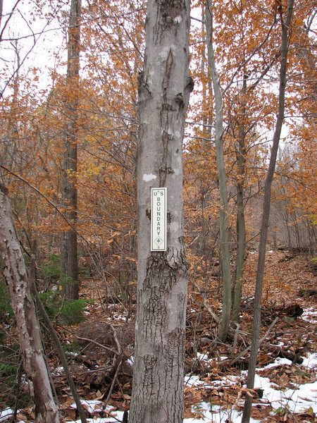
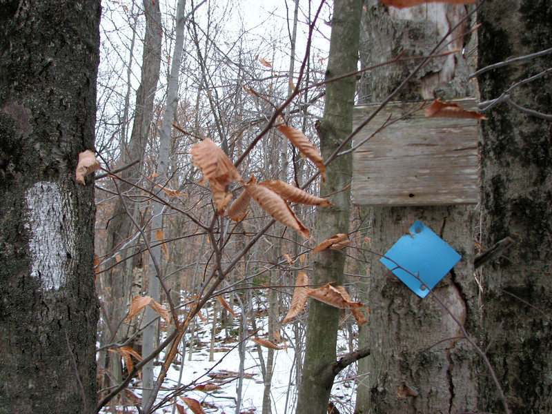
The trail is (or was called) the Orange Diamond trail, and over time there were some orange pieces of tape to help lead the way, just to remind you that...yes, believe it or not, you are on the correct path. There were also blue pieces of tape too, which confused me at first, but I theorize that the blue means it is a trail that leads to the AT. Anyways, some pics...

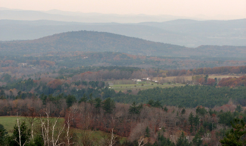
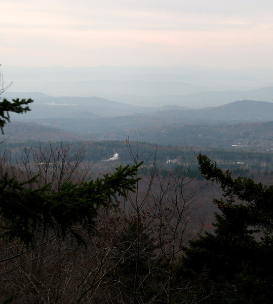
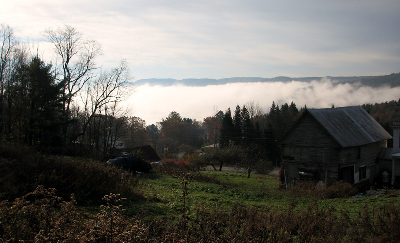
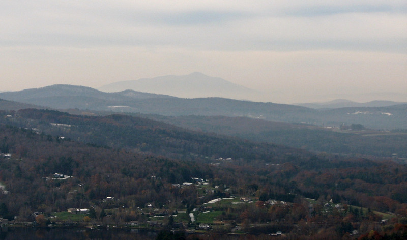
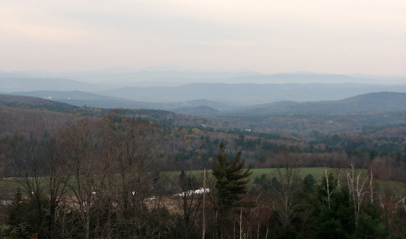
There was a big temperature inversion this day, which led to crappy views, except earliest in the day, with some neat undercast shots, like this one, Mascoma Lake is under the fog.
Picture-002-L.jpg


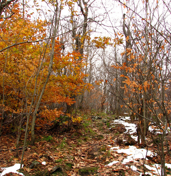
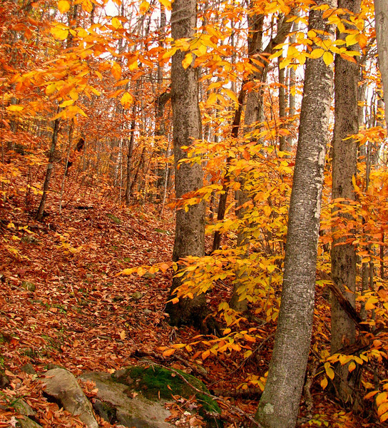
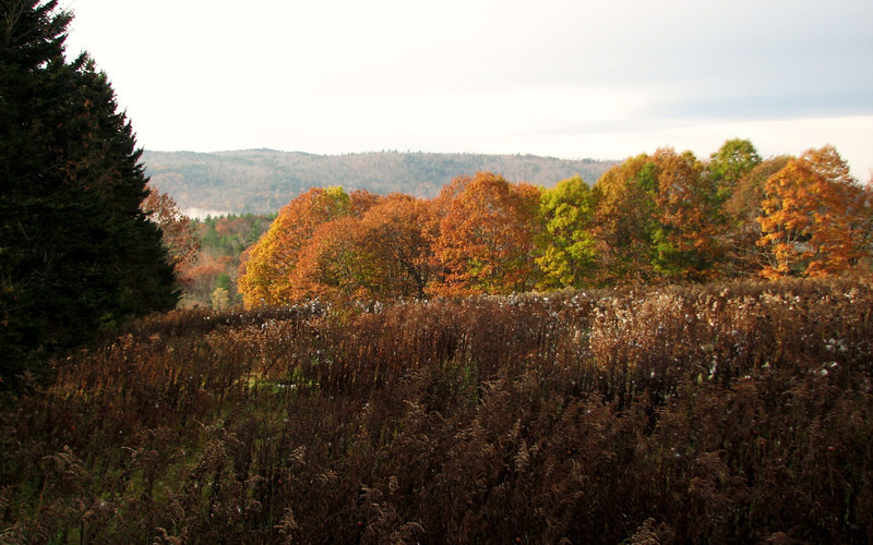
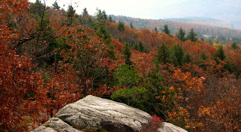
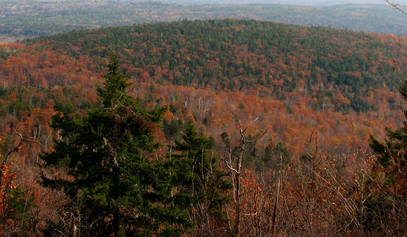
Foliage is really hanging tough this year
Picture-004-L.jpg


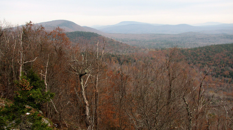
About a mile in (estimation) there is a nice view of Mascoma Lake and the nearby hills, and also Ascutney
Picture-022-L.jpg


views would have been so much sweeter with sunshine and good visibility
Picture-020-L.jpg


more leftover foliage
Picture-029-L.jpg


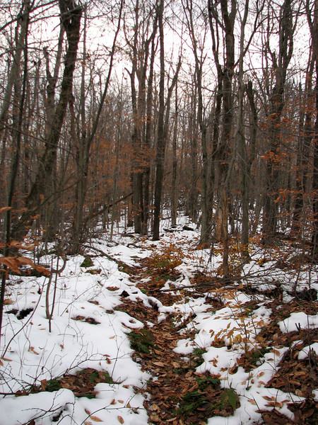
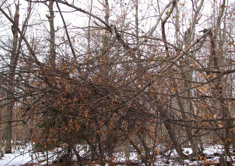
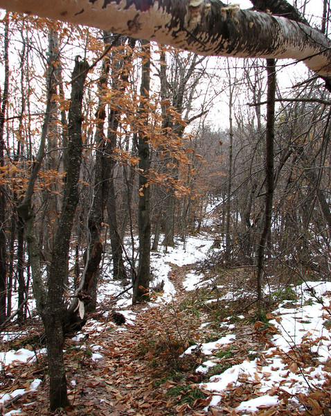
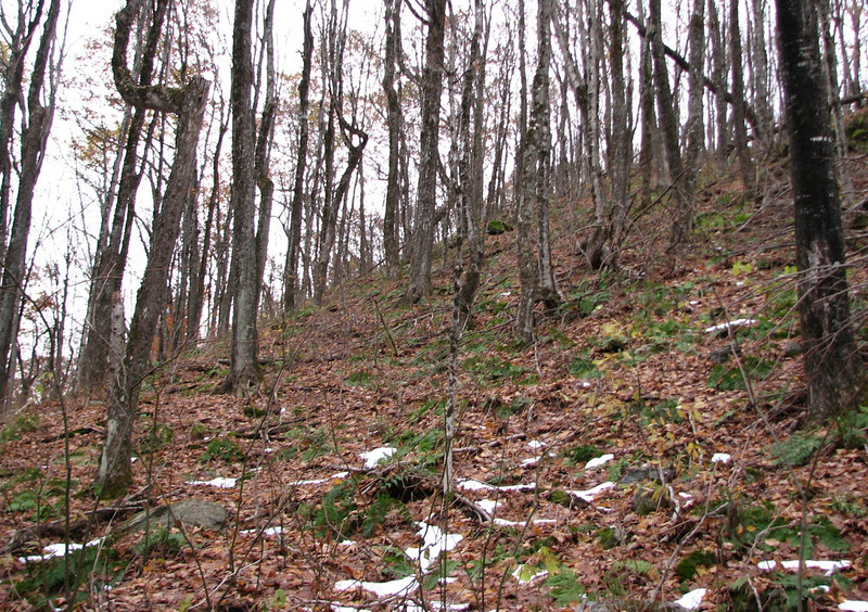
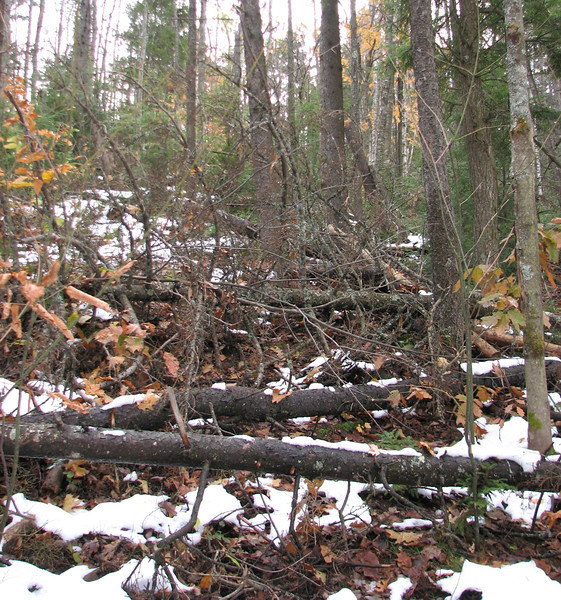
The trail was kind of...off and on. Most areas it was fairly easy to follow, other areas, not so much. Then there were the blowdowns, which were easy enough to negotiate, but still, a PITA. The following pic...is the trail.
Picture-054-L.jpg


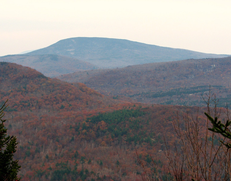
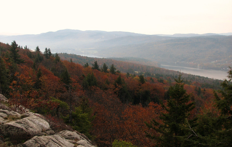
Past this nasty blowdown section, I came to some nice ledges that led to a great view towards the east, and northeast. Again, the conditions were not good long distance, but good nonetheless.

South Moose mtn is on the left, then Smarts is in the distance
Picture-064-L.jpg


more late foliage
Picture-075-L.jpg


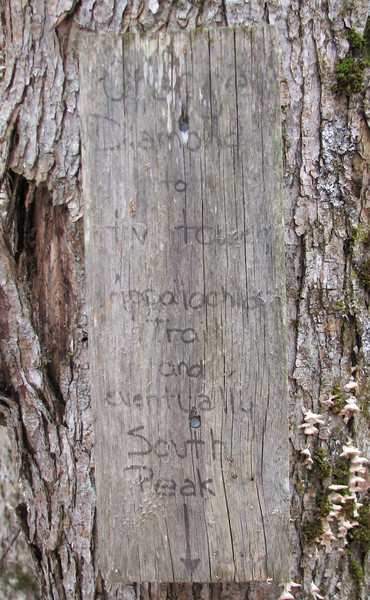
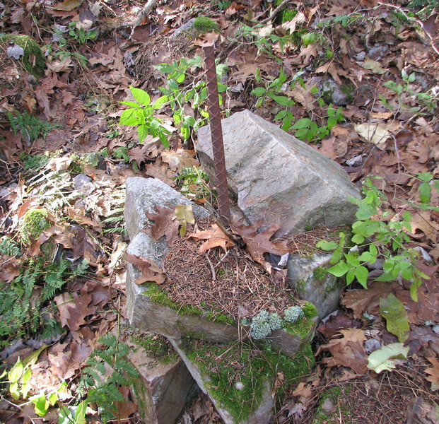
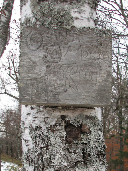
After quite some time, I came to a crossroads in trails, and the conditions of them improved dramatically..I figured I was near the Moose Mtn Lodge and its system of paths. Still, I carefully followed the way that thought was the correct path, and was rewarded by the sign below...a sign of the trail I should be on!! Thank god for maps!
Picture-092-L.jpg


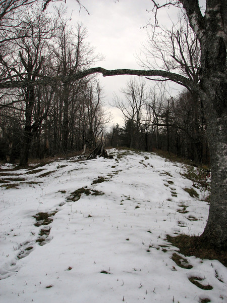
Now the trail really widened and crossed an interesting section that was definitely cleared by the Moose Mtn lodge people. Thanks to the dark clouds, it made for an interesting mood...
Picture-094-L.jpg


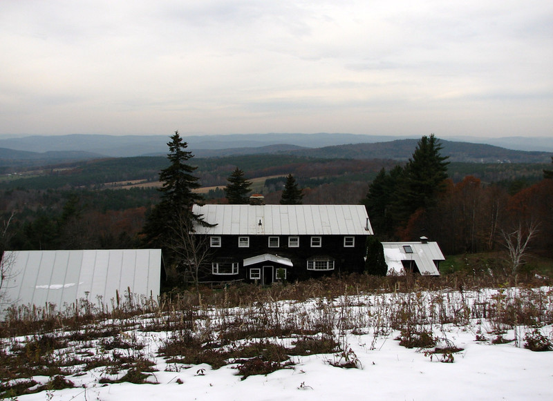
Before long, I could see the lodge in the distance, and I made a bee line for a wooden seat, which ended up being a great place for lunch.

Again, temp inversion killed any chance of good, clear views.
Picture-095-L.jpg


Cont in a min
 
Last edited:
Cool stuff. This is only 20-30 minutes from me and is on my list of things to check out. Thanks for the report.
 
part two

One more of the Smoky...err western NH and eastern VT mtns
Picture-099-L.jpg


I was now headed for a section where I was not sure where to go next. But thanks to the topo maps I printed, I came across another sign, knowing I was going the right way.
Picture-102-L.jpg


The trail was easy to follow the rest of the way to the AT, and I thought I was making amazing time when I hit a sort of junction with another trail...at first I thought it was the AT, and was very excited. I soon realized though...too many small trail debris...and no white blazes. See below....
Picture-108-L.jpg


Oh well...I wasn't sure which way to go here, but I told myself, that as long as I was traveling north along the mtn, to go right. Going left would almost certainly mean going down the mountain. So I turned right, and continued to travel up and all around the ridge. This was a tougher area to figure out, because the mountain was wider, and no where near as narrow as what could be described as an old, narrow knife like ridge further south.

After awhile, I came across a dirt road, which ticked me off greatly, because I suddenly didn't know where I was...was I down by Three Mile Rd??? Did I end up going over the wrong side of the mtn after all?? After looking around for a min, I realized..DUH, I was by the radio tower, which means I was moving along just fine, though I was behind where I thought I should have been. Another trail sign helped to calm my nerves. Then, I saw the forest service boundary signs...which means the AT is right around the corner!

Happy Day!
Picture-106-L.jpg


The trail decided to swing right, up a somewhat steep hill, and then back left briefly, then right one more time, and it popped out along the AT, probably a little under a mile before the summit of South Moose Mtn. I made it!!!

Interesting shot...an AT blaze, a sign for the Orange Diamond Tr, and a blue blaze for that trail as well..I also want to say that the Orange Diamond trail is now called the Ridge trail, but the old signs remain....
Picture-110-L.jpg


The positives about hiking on the trail I was on before was the mud and snow were really non issues. I hiked thru it, but it didn't bother me. On the other hand, the AT was a muddy, sloppy, snowy mess. But at least it was easy to follow!!! I hit the AT around 1:45pm, and slowly made my way to the summit, which I hit around 2:10pm.

More foliage below the summit...crazy
Picture-113-L.jpg


After a 10 min break, it was time to continue north, and take a longer break at the Moose Mtn shelter, prob another 3/4 mile from South Moose (just an estimation..I don't have the distances with me right now). There were quite a few sticks and branches down on this section of trail, but all were easy enough to get around. This was the one area I had to duck a little...but I am 6 foot 2.
Picture-117-L.jpg


Before long, I was at the shelter, takin' a break, eating some food, and swatting away mosquitoes (really??? yes...really). They must hang tough where humans hang out. By now, it was around 3pm, and I wanted to get down to the road before dark, so off I went. My legs were pretty rubbery at this point, so even the easy section of trail in between the two peaks, I was trudging along quite slowly.

Picture-131-L.jpg


One of the views near the summit of North Moose Mtn, again, vistas were kind of gray.
Picture-141-L.jpg


After that view, it was time to head down the mountain, which ended up being quite a bit steeper than I remembered from last time I came up it. Maybe it was the slick snow and deep mud, but that section of trail had my undivided attention! I didn't slip or fall, so job well done...

Oh, one more very nice view north to Smarts and Cube, and possibly a side of Moosilauke, but since the views were so hazy, its tough to tell.
This is a zoom to Smarts and Holts Ledge area
Picture-154-L.jpg


Again, quite a steep section of mountain.
Picture-160-L.jpg


And finally, how about one more foliage picture...probably the final one of the season.
Picture-164-L.jpg


I came out to the car around 4:45pm, so there was plenty of time to spare before complete darkness. I've been pushing my hiking limits with new, different and exciting treks, and this hike was no exception. I hope to do more things like this in the future. The white mtns will always be my home, but trips like this really spice things up. Hope you enjoyed!!

Special thanks to my girlfriend who carted my arse to the trailhead and picked me up at the end of the day! No that she will read this...but still. haha

http://grouseking.smugmug.com/New-H...orth-11311/19900734_kC7wsc#1566008770_KzW9zQC
 
Last edited:
You didn't say where you started, I assume that is deliberate

You also apparently didn't find the old survey marker
 
You didn't say where you started, I assume that is deliberate

You also apparently didn't find the old survey marker

That is correct, didn't want to give it away. If you live nearby and are knowledgeable with the area, you prob know...or if you want to know, I can tell you in a PM.

And no, I didn't really have time to find any survey markers. But, I did come across something interesting, right along the trail...what is it?

Picture-073-L.jpg
 
Nice trip, Phil! I've never done the entire mountain like that in a day. Isn't the south Ridge cool?

The last picture is a piece of rebar set in stones. It is likely a boundary marker. Usually, if it is set by a surveyor, it has a plastic cap with the surveyor's name and license #. Usually the plastic cap has rodent chew marks all over the top!
 
Nice report and pictures, Phil. It's hard to believe that there is still foilage up north hanging on; here in MD the leaves have been off the trees for a few weeks.
You need some cold temperatures and snow!

Donna:)
 
Top