
Becca M
Active member
December 10, 2011. I wasn’t sure what I wanted to hike today. I had considered a bunch of options but finally decided I wanted to spend a little more time in the Pemi Wilderness at some lower elevations and do some trail running. And I thought I might have a window of opportunity to loop around Owl’s Head to Thirteen Falls via Lincoln Brook Trail and out via Franconia Brook Trail. If I had extra time (HAH!!!!) I would go back to Redrock Brook and explore. I also wanted to avoid as much snow as possible and move light and fast. SOOOOOO I moved my pack contents back from my winter pack to my trailrunning pack and went for it. At least I had gaitors for the trailrunners…..
Well, I got a late start after a late night trying to attend a local live nativity that just would not end. I finally got on the trail at 8:30am after greeting a few familiar faces in the Lincoln Woods lot. I passed a couple people on the Lincoln Woods Trail and took my turn up to Black Pond. The footprints I was following ended at Black Pond. I was kind of hoping I wouldn’t ACTUALLY need to find my own way with the compass and all, but, it’s never a big deal to just take a north bearing and go for it. When the snow squalls waned, I could follow the direction of the shadows.
I made pretty good time and found some old green flagging (ARG!) and the usual skidder path that heads towards the river. What was originally just a dusting of snow was now a crusty inch or two, which made the going slippery and tricky in the trailrunners—I wasn’t sure what was under the snow and leaves. At one point I hit a large browse area and followed an old moose track. Other than that, there were few prints in the snow.
On the Lincoln Brook Trail, I was amazed at how much the hurricane had gutted the trail. There seemed to be a few sections near the river completely eaten away as well as some very large mud pits higher up. The second-to-last river crossing was somewhat icy. At this point I realized I was taking a LOT longer than I wanted: the footings were tough on the Lincoln Brook Trail and river crossings were tedious.
Finally, the last crossing was the biggest challenge. I knew I didn’t want to dunk my shoes and I didn’t have poles. I FINALLY found a sturdy staff after breaking half a dozen but I had to pick my way around a lot of downed trees from bank erosion. Then I found a crossing, but I had lost SO much time and still got my feet wetter, though they had already taken on water steadily in the snow and mud pits. I was getting more than a little worried about the time and my feet. The trail drainage continued to worsen. But, I finally got to the Owl’s Head Spur Path. I kept heading north: new trail for me! I was excited to be on the part of the Lincoln Brook Trail I had never been on before!
At first the way was obvious—straight shot north. But, a few more turns and I found myself at a dead end. Did the trail go straight up the hill? I followed it. Then, trees. No corridor. Turn and look for the next most obvious path. A few hundred feet later a wall of fir. Another big blowdown? I pulled out my map. NO—the trail should loosely follow the river. But, the riverbank was eaten away. The map didn’t show the trail right NEXT to the river there… I couldn’t imagine the trail extending beyond the washout, but, I was running out of options. I followed the riverbank a ways but found no corridor. I backtracked. No blazes anywhere. No corridor. No treadway or worn rocks under the snow. Feet getting colder. Finally I found what looked like a 1” cut stump. Nah—no corridor past it?
Turning around was looking better and better. I kept thinking if I made bigger circles I’d find my way past the lost area. No dice. Just woods. Wilderness. I did not pre-load the trail into my GPS so I didn’t bother to fire it up. Then I was thinking, “I’m getting cold and I won’t have time to finish safely in anywhere near enough daylight if I continue… a warm car seat is looking awfully good!”
Backtracking, backtracking, backtracking…. Following that big critter known as my earlier self by following my own tracks… it’s kind of comforting. I found a better upper river crossing and took it. Once across the bank I headed south. I figured I’d find my former self’s footprints any second. The seconds ticked away. And away. And away. Nothing. No dice. Go up the embankment – must be up there? No dice. Starting to get nervous. Those footprints should have been RIGHT THERE? Feeling panicky! Still enough time to get out. Feeling flush. Mind racing. Follow the river. OK, now look at the GPS – waiting, waiting to fire up and lock on the satellites. Pull up an old Owl’s Head track (not today’s). Intersect the old track. DANG that was a bushwhack track and not the trail, but, the trail was in the same direction. YAY!!!!
Just a jog back now… a LONG jog back. Back along Lincoln Brook, back on the Black Pond Bushwhack, back around the pond. I can breathe and take a few pics, now. Exploring the crazy huge glacial erratics, exploring the Black Pond skidder path parallel to the trail, glad for the 2.6 mile jog back along the Lincoln Woods Trail. Finally, glad for the view of the suspension bridge near the parking lot. All in all, a great day!!!!
Here are a few highlights:
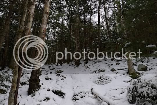
Looking around for the northern part of Lincoln Brook Trail. Not this way, not that way!
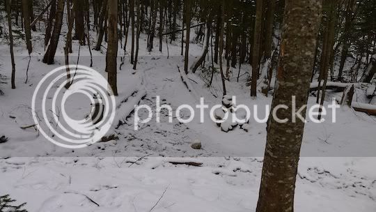
Entrance to Owl’s Head Path. The cairns make it look like a gate. Cool!
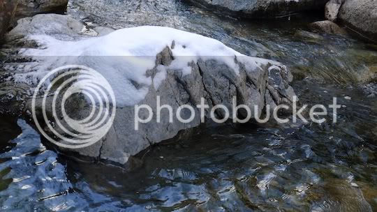
Interesting rock in Lincoln Brook:
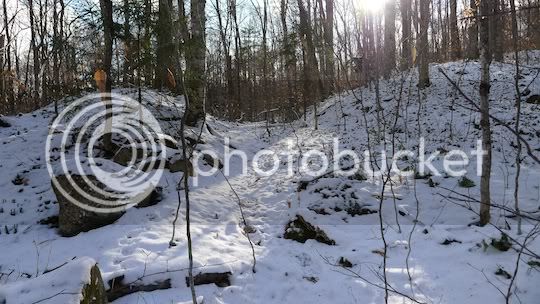
End of Owl’s Head from Lincoln Brook Trail. One of the “ears.”

These rest are from the Black Pond Bushwhack.
Clearly obvious skidder path:
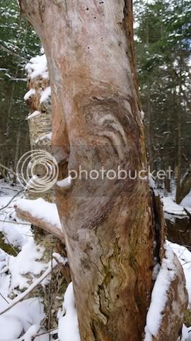
Weathering trunk:
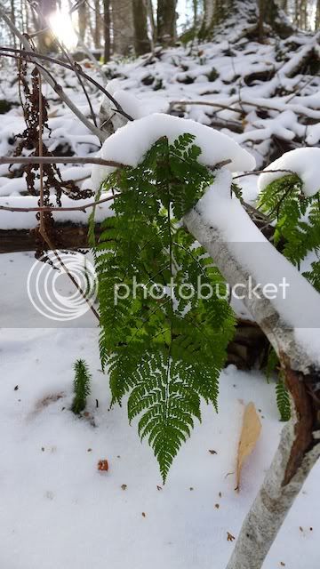
Snowy fern:
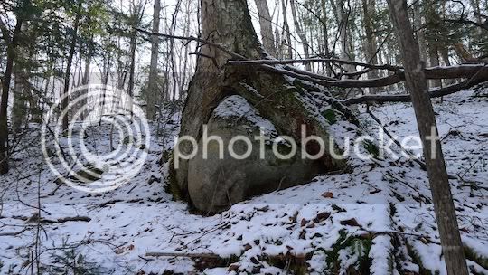
Classic tree on rock that reminds me somehow of an octopus:
All in all, a great day to be in the woods. An even better day to get out!!!! ☺
Well, I got a late start after a late night trying to attend a local live nativity that just would not end. I finally got on the trail at 8:30am after greeting a few familiar faces in the Lincoln Woods lot. I passed a couple people on the Lincoln Woods Trail and took my turn up to Black Pond. The footprints I was following ended at Black Pond. I was kind of hoping I wouldn’t ACTUALLY need to find my own way with the compass and all, but, it’s never a big deal to just take a north bearing and go for it. When the snow squalls waned, I could follow the direction of the shadows.
I made pretty good time and found some old green flagging (ARG!) and the usual skidder path that heads towards the river. What was originally just a dusting of snow was now a crusty inch or two, which made the going slippery and tricky in the trailrunners—I wasn’t sure what was under the snow and leaves. At one point I hit a large browse area and followed an old moose track. Other than that, there were few prints in the snow.
On the Lincoln Brook Trail, I was amazed at how much the hurricane had gutted the trail. There seemed to be a few sections near the river completely eaten away as well as some very large mud pits higher up. The second-to-last river crossing was somewhat icy. At this point I realized I was taking a LOT longer than I wanted: the footings were tough on the Lincoln Brook Trail and river crossings were tedious.
Finally, the last crossing was the biggest challenge. I knew I didn’t want to dunk my shoes and I didn’t have poles. I FINALLY found a sturdy staff after breaking half a dozen but I had to pick my way around a lot of downed trees from bank erosion. Then I found a crossing, but I had lost SO much time and still got my feet wetter, though they had already taken on water steadily in the snow and mud pits. I was getting more than a little worried about the time and my feet. The trail drainage continued to worsen. But, I finally got to the Owl’s Head Spur Path. I kept heading north: new trail for me! I was excited to be on the part of the Lincoln Brook Trail I had never been on before!
At first the way was obvious—straight shot north. But, a few more turns and I found myself at a dead end. Did the trail go straight up the hill? I followed it. Then, trees. No corridor. Turn and look for the next most obvious path. A few hundred feet later a wall of fir. Another big blowdown? I pulled out my map. NO—the trail should loosely follow the river. But, the riverbank was eaten away. The map didn’t show the trail right NEXT to the river there… I couldn’t imagine the trail extending beyond the washout, but, I was running out of options. I followed the riverbank a ways but found no corridor. I backtracked. No blazes anywhere. No corridor. No treadway or worn rocks under the snow. Feet getting colder. Finally I found what looked like a 1” cut stump. Nah—no corridor past it?
Turning around was looking better and better. I kept thinking if I made bigger circles I’d find my way past the lost area. No dice. Just woods. Wilderness. I did not pre-load the trail into my GPS so I didn’t bother to fire it up. Then I was thinking, “I’m getting cold and I won’t have time to finish safely in anywhere near enough daylight if I continue… a warm car seat is looking awfully good!”
Backtracking, backtracking, backtracking…. Following that big critter known as my earlier self by following my own tracks… it’s kind of comforting. I found a better upper river crossing and took it. Once across the bank I headed south. I figured I’d find my former self’s footprints any second. The seconds ticked away. And away. And away. Nothing. No dice. Go up the embankment – must be up there? No dice. Starting to get nervous. Those footprints should have been RIGHT THERE? Feeling panicky! Still enough time to get out. Feeling flush. Mind racing. Follow the river. OK, now look at the GPS – waiting, waiting to fire up and lock on the satellites. Pull up an old Owl’s Head track (not today’s). Intersect the old track. DANG that was a bushwhack track and not the trail, but, the trail was in the same direction. YAY!!!!
Just a jog back now… a LONG jog back. Back along Lincoln Brook, back on the Black Pond Bushwhack, back around the pond. I can breathe and take a few pics, now. Exploring the crazy huge glacial erratics, exploring the Black Pond skidder path parallel to the trail, glad for the 2.6 mile jog back along the Lincoln Woods Trail. Finally, glad for the view of the suspension bridge near the parking lot. All in all, a great day!!!!
Here are a few highlights:
Looking around for the northern part of Lincoln Brook Trail. Not this way, not that way!
Entrance to Owl’s Head Path. The cairns make it look like a gate. Cool!
Interesting rock in Lincoln Brook:
End of Owl’s Head from Lincoln Brook Trail. One of the “ears.”
These rest are from the Black Pond Bushwhack.
Clearly obvious skidder path:
Weathering trunk:
Snowy fern:
Classic tree on rock that reminds me somehow of an octopus:
All in all, a great day to be in the woods. An even better day to get out!!!! ☺
Last edited:
 Is there still a large blow down at head height right there as well?