Rock Rimmon Hill - Danville-Kingston Area - 12-27-11

vftt.org

Help Support vftt.org:

This site may earn a commission from merchant affiliate links, including eBay, Amazon, and others.

ksearl

Active member
Joined
Jan 19, 2011
Messages
261
Reaction score
31
Location
New Hampshire
Hi Everyone,

Hope everyone had a great holiday season. I have the week off, so I'm hoping to get out a bunch. I started off yesterday by visiting a few local locations to me (seacoast are of NH). I explored the Rock Rimmon Hill area in Danville-Kingston, entering from the Danville side. I couldn't find a whole lot of info on the hike itself so I ended up winging it a bit.

It was clouded, but it was evident that if the sky was clear, the view would have been great. The area has been quite littered with glass and graffiti. There used to be a fire tower up there too, and the support pillars are still up there.

Check out my full trip report and pictures on my blog, which also includes access information (or the best I can provide anyhow): http://www.livefreeandhikenh.blogspot.com/2011/12/exploring-rock-rimmon-hill.html

Here are some of my favorite pics from the short hike:

IMG_4556.JPG

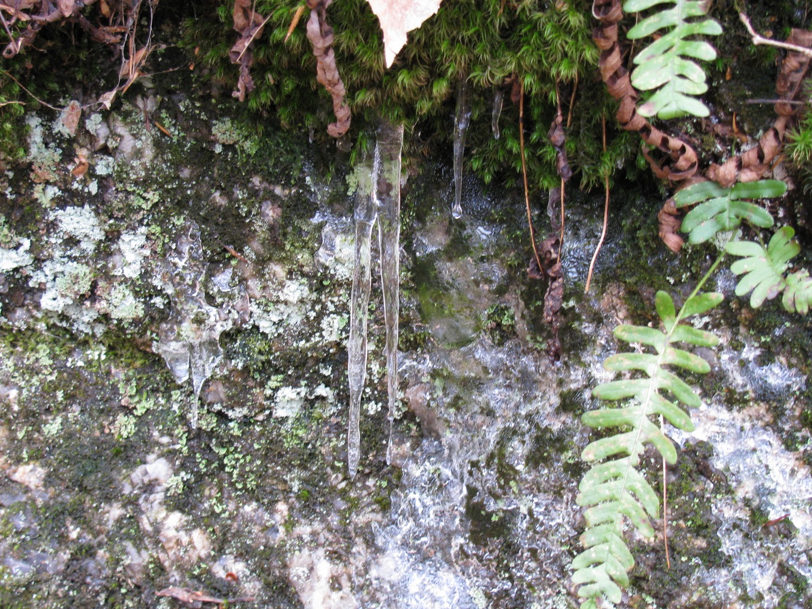
Small icicles starting on a boulder on the banking of the trail

IMG_4565.JPG

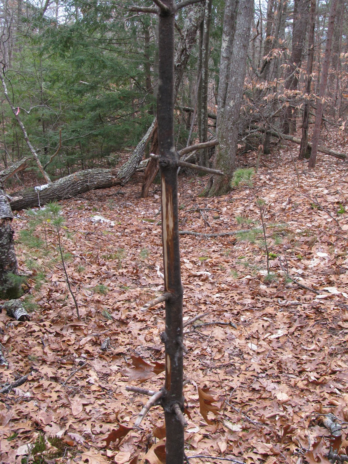
A fresh buck rub, most likely from this past rutting season

IMG_4570.JPG

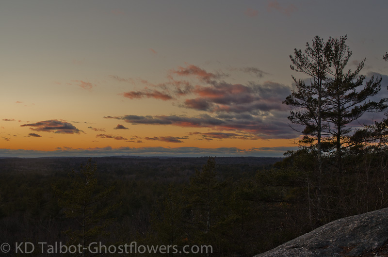
Making my way onto the 345' summit!

IMG_4572.JPG

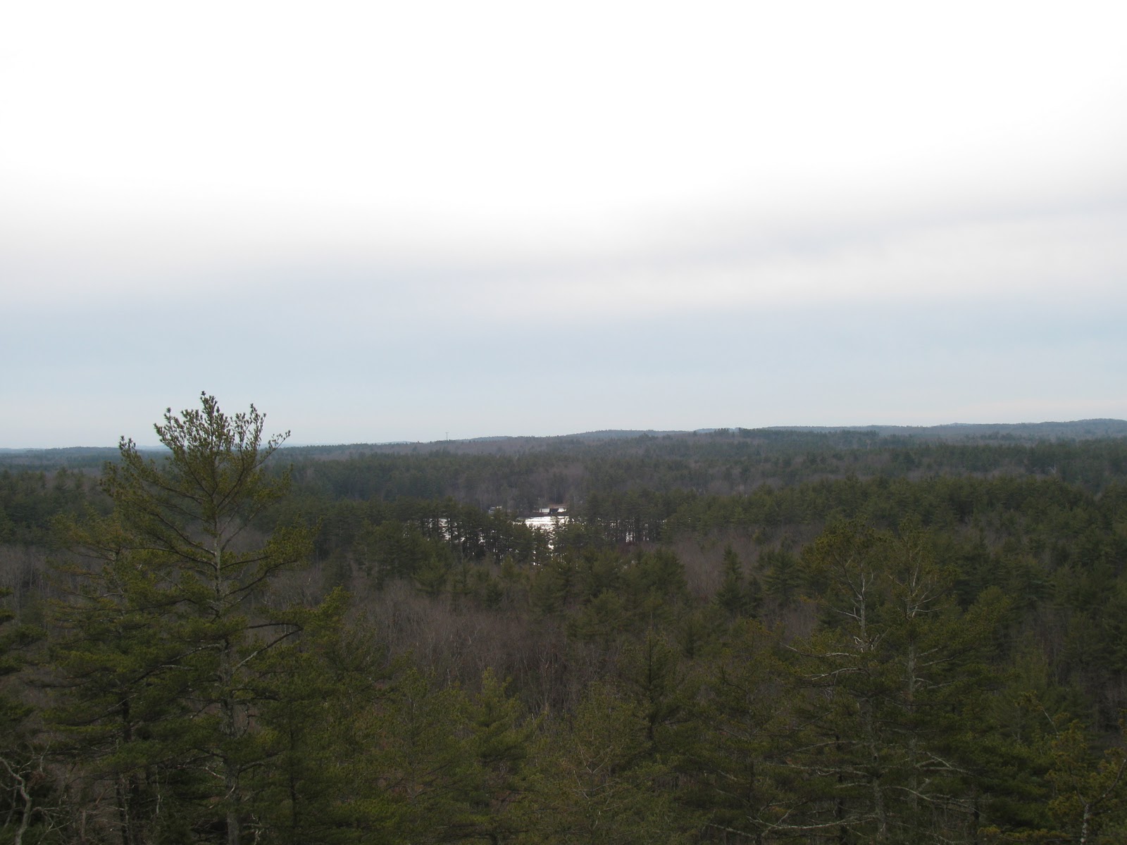
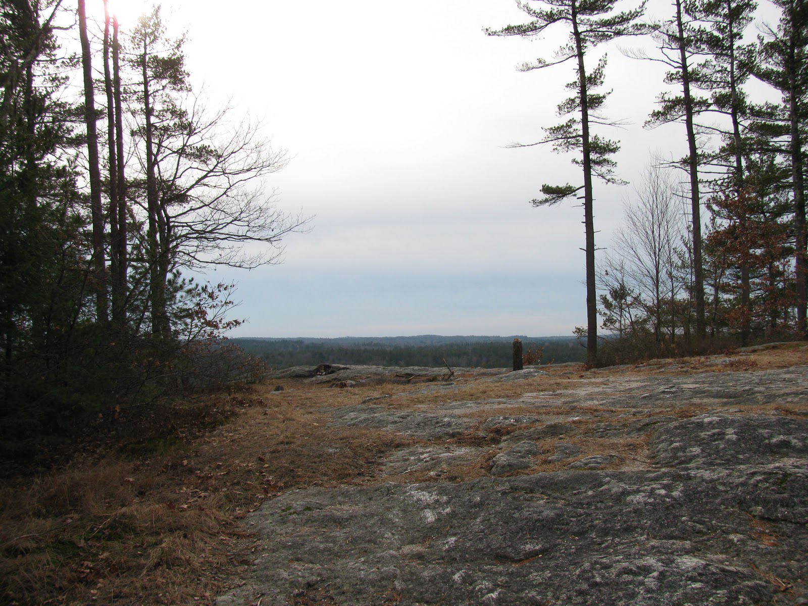
View to the south with Long Pond in view

IMG_4582.JPG

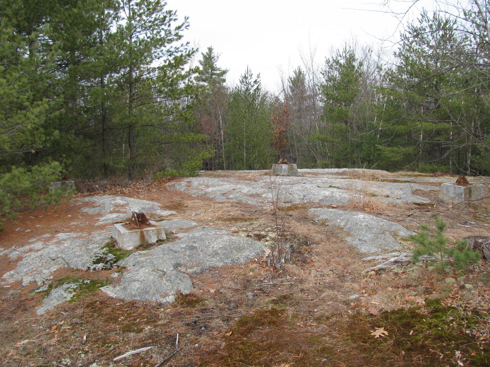
Fire tower location with leg securing flanges still in tact

IMG_4591.JPG

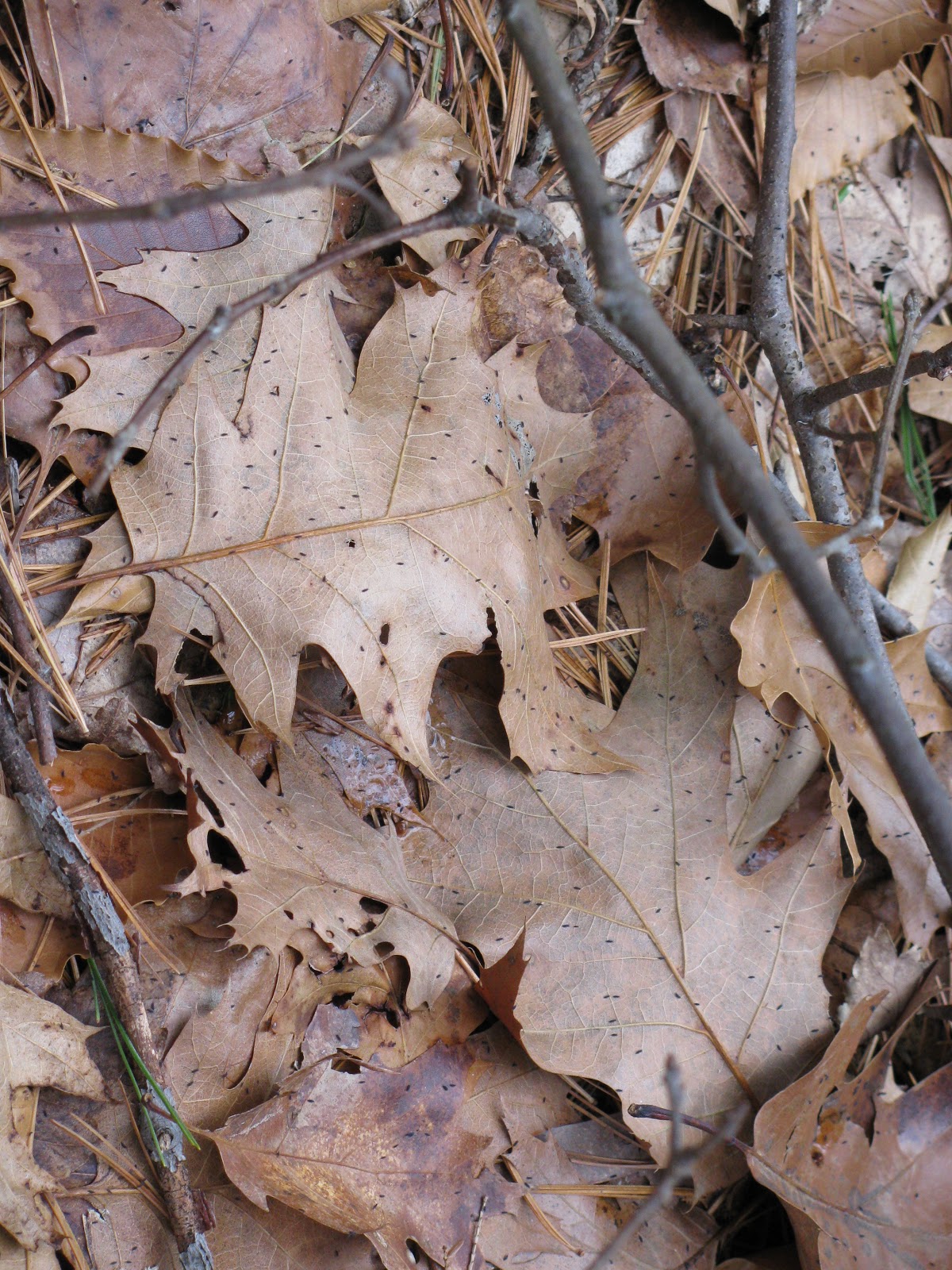
Tons of snow fleas migrating!

IMG_4605.JPG

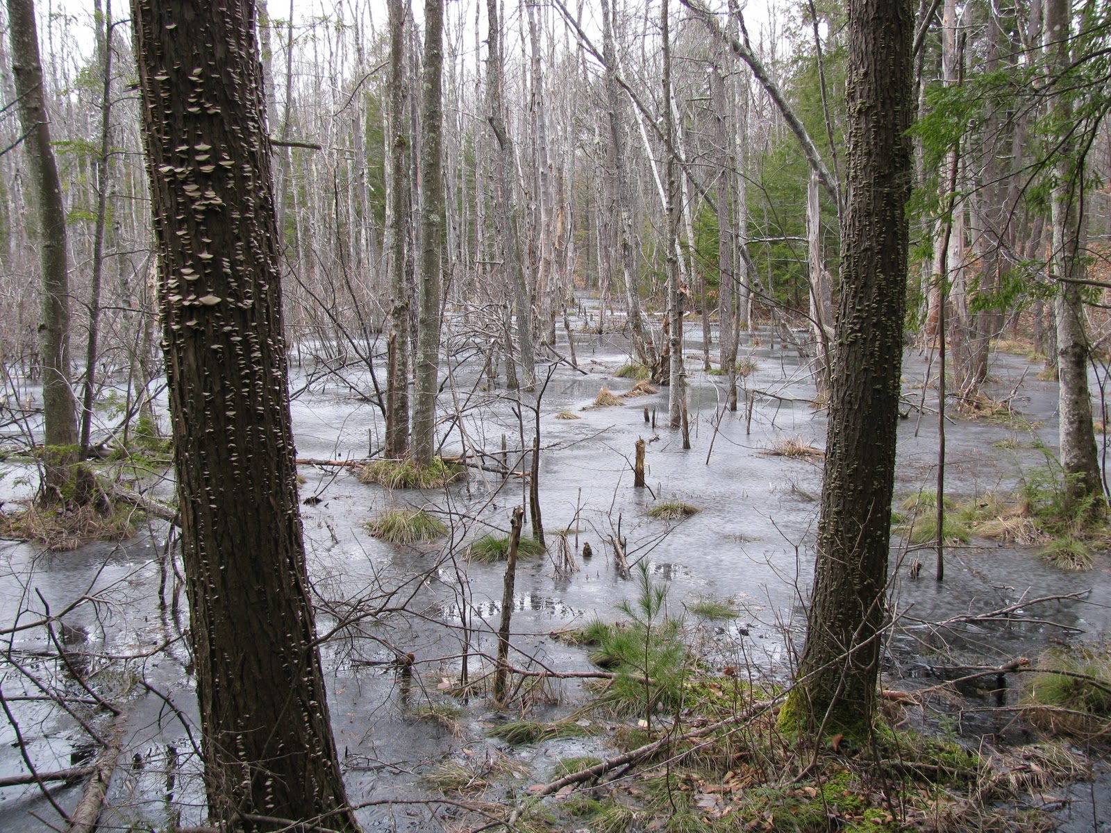
My favorite shot of the day, a peaceful maple swamp

IMG_4609.JPG

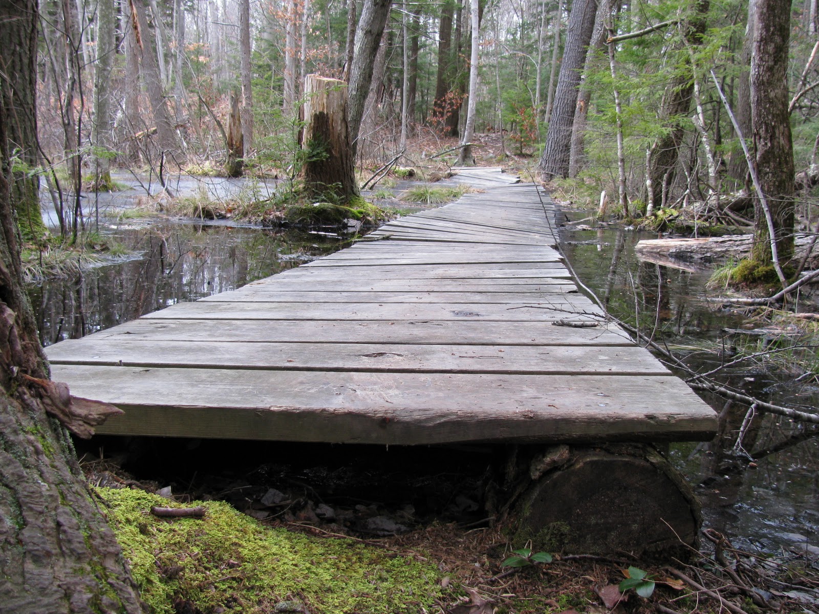
Boots view of the bridge through the swamp!

Karl
 
The current (3d) Edition of the AMC Southern New Hampshire Trail Guide has indeed dropped Rock Rimmon Hill and three other short hikes that appeared in the Southeastern NH section of the first two Editions. Coincidentally, I hiked to three of those, including Rock Rimmon from the same trailhead as you, just a few weeks ago. I link my TR because it includes my GPS track for Rock Rimmon, which some may find useful, as well as information on Stonehouse Pond in Barrington (the high-point of which is just a half-mile from Bumfagging Hill) and Garrison Hill in Dover. I had hiked the fourth deletion - Stratham Hill - two days before that.

I don't believe there are property issues for any of these hikes, so I assume the editors dropped them because they are too short or on aesthetic grounds. I wouldn't say any of them are worth a long drive, but if you are going to be in the general vicinity anyway, each has its points of interest. (Teneriffe Mtn., which appeared in that section of the 1st Ed. only, offers excellent views but does have property issues.)

Incidentally, your photos as embedded in the above TR were too big - I could only view them piecemeal. Maybe drop down a size for future TRs?
 
Last edited:
Excellent adventure, Karl!

One of my favorite adages states that given the choice, I'd rather fail at an attempt of doing something new rather than succeed in repeating something I've already done.

I love doing new things and reading about new things done by others.

Thanks for sharing!
 
Nice!

Glad you finally got out there, Karl! Worth the effort. When I started going there the tower was intact. I wish they had left it as it offered views from the mountains to the sea. It's a shame the condition of the place now. Can't quite figure out the mindset that says, "This would be better with some broken glass and graffiti."

Hope you don't mind, here's tonight's sunset view from there:

20111228-_DSC0080.jpg


KDT
 
I don't believe there are property issues for any of these hikes, so I assume the editors dropped them because they are too short or on aesthetic grounds.
As Mr. A is well aware, there are far too many hikes in southern NH to fit in a single book. Unfortunately one of the guys who worked on the first edition had a bias in favor of state properties over town/land trust properties hence the book was full of muddy logging roads going nowhere which were officially multi-use trails but actually snowmobile trails used by mountain bikes which weren't very appealing to hikers.

I feel that the book should offer a wide geographic coverage such that if Stratham Hill is the best hike in the area it should be included and delete some of the fluff from Bear Brook but that is only one opinion.
 
As Mr. A is well aware, there are far too many hikes in southern NH to fit in a single book.

For that reason, I think I should refrain from kibitzing the editorial choices of the editors of the current Edition of the AMC So. NH Trail Guide. Still, the space devoted to the unspectacular woods roads/trails of Bear Brook State Park, while some very interesting Town properties now go unmentioned, might make one wonder.

I can well understand the deletion of Garrison Hill. The observation tower is wonderful - built just for viewing, with no cellphone paraphernalia or other electronic detritus obstructing or defacing it. You can drive to it, however, and it is more a destination than a hike. Even if you choose to hike the two old ski runs up and town, that entails just a half-mile. You'll get an extra kick from that, however, if you fancy old ski areas. There are some wonderful photos on the NELSAP site of an impressive ski jump that occupied one of these runs in the 1930s.

Rock Rimmon Hill, also, should not be greatly deplored. The westward view is terrific, as Kevin's photo beautifully captures, but the "hike" from Emerald Drive is less than a half-mile, on a woods road. As to the broken glass, beer cans and graffiti that have been reported, I was pleasantly surprised how relatively little of that I encountered on my Thanksgiving Sunday hike. Perhaps the irresponsible merry-makers have been holding court in the interim, or it may be that my sensibilities have been coarsened by too many hikes in eastern Mass.

Stratham Hill's disappearance from the Guide is harder to fathom. It features another spectacular tower for views only, with the added attraction of the "view-wheel" near its base - an impressive bit of vintage ironwork that shows some man-made horizon features that are long gone. Moreover, there are nearly 5 miles of well-maintained trails attached.

Stonehouse Pond also seems worth a mention. While barely exceeding a mile, the herd-paths circle a scenic pond and culminate at cliffs that tower directly above the south end.

There is certainly more to Southern NH than a hiker will ever know from any one book.
 
Thanks everyone!

@Amicus - Your TR's a great. Thanks for linking them. I agree that I think these hikes shouldn't have been excluded. Even though they are short, they still provide a good hiking alternative to people who don't have a whole day to hit the trail...Stratham Hill especially. Also, on the picture size, I agree. I just downloaded Picasa. I'm hoping to use this tool for future trip reports to shrink the sizes.

@Becca - Thanks! I agree with you completely!

@1HappyHiker - I couldn't agree with you more. I always like trying new things and exploring roads less traveled!

@Kevin - I wish they left the tower in tact as well. That sunset photo is awesome!!! Thanks very much for sharing it on this thread! Much better than the pictures I have posted!

@RoySwkr - I agree with your opinion!

Thanks everyone!

Karl
 
Top