
Becca M
Active member
July 14, 2012: My final weekend of being restricted to, in the ortho dr’s words: “no uphill or downhill when hiking or running” due to a soft tissue injury in my right knee. So, some redlining in the Sawyer River/Pond area “kind” of fit the bill. Perfect chance to finish off the eastern parts of the Hancock Notch Trail, also. I have mountain biked these trails before but of course, had to walk them for redlining credit.
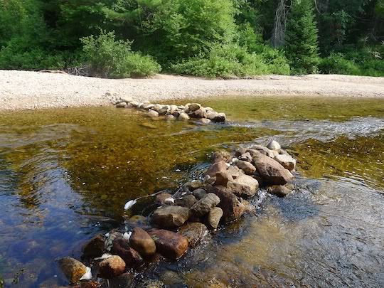
Got a nice lazy start after 9am dropping off my bike at the Sawyer River Trailhead and headed for the Sawyer Pond Trailhead. Eh, looked to be a scorcher, so, I was happy the sun wasn’t out yet. “Forded” this crossing at the south end of the Sawyer Pond Trail – up to my knee strap! Still, the water looked appealing!
Based on doctor’s orders and the relatively flat trail, I was able to jog most of the way to Sawyer Pond – a little slow because I was carrying a lot of water (for me!!!)
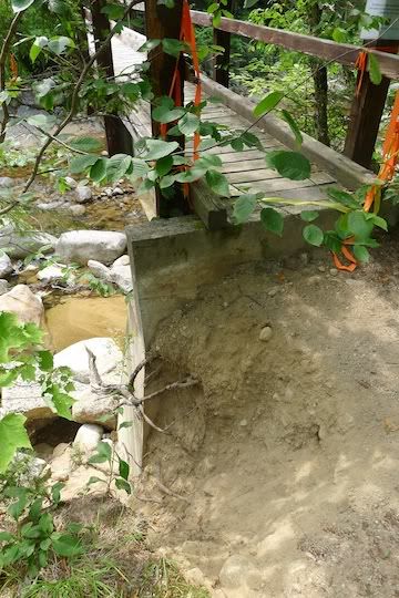
I made pretty good time out to the footbridge west of the Sawyer Pond Trail. It was signed as closed due the undermined footings from Hurricane Irene. I didn’t have much chocolate on this hike because it was supposed to be hot so I didn’t feel too fat to use the bridge. Looked a little dicey at the far end, however:
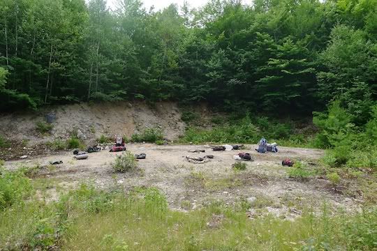
Then, there are several skimobile trails and logging roads intersecting south of the bridge. I missed the turn southbound (as I have in the past). I stayed on the logging road and came across this site with backpacks and nobody around. It was like a set from the show “Lost.” – kind of weird.
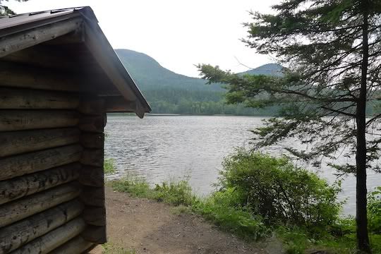
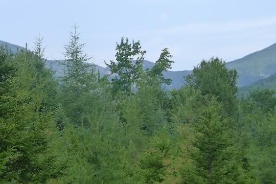
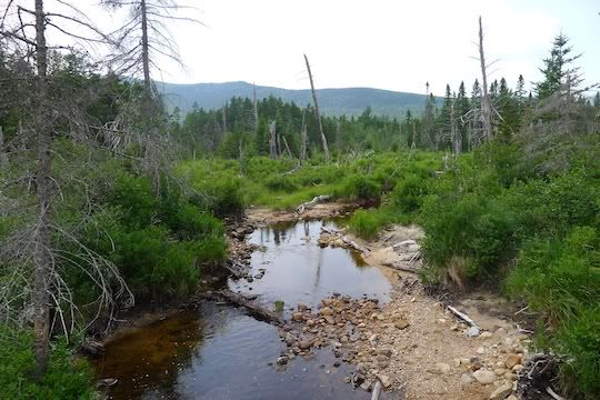
And then I came to this viewpoint of The Captain (straight across, hidden by tree). Just a nice spot (and a fun peak, by the way!!!).
But, I knew I wasn’t on the right trail so I turned around. Within a few minutes I heard loud voices and came upon a large group of campers asking if Sawyer Pond were close. Ah, so, those were the owners of all the packs!! They were WAY too happy for my directions and threatened to hug me. They were pretty sweaty so I picked up the pace and booked it out of there once I was pretty sure I had explained to at least 5 of them individually where to head. Not clear they had a map. Hope they made it out OK!!!
Next it was on to Hancock Notch Trail to take care of some unfinished business. Several years ago several of us were on a rather LONG bushwhack off the Hancocks (my idea – a bad idea, I admit) and ended up intersecting the Hancock Notch Trail late in the night…. I needed to get to that intersection from the east side to finish hiking that trail. So, several Irene-damaged river crossings later, I was at that fateful spot – crazy how different it looked in the summer without the snow!!!
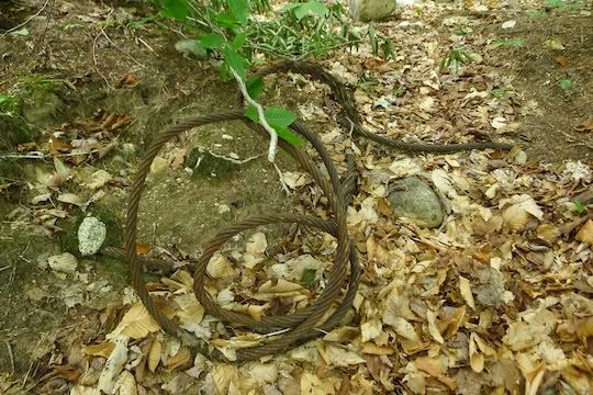
But, along the way, this time, this end of the trail, I found this RR spike – so cool since I’ve never seen a RR spike on this trail before:

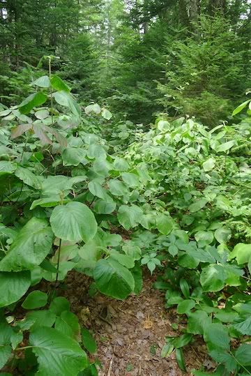
Some crazy-thick hobblebush on the Hancock Notch Trail:
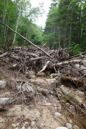
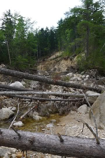
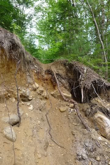
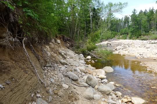
AND, the amazing river crossings since Hurricane Irene passed through. These pictures do not really show the amazing force of the water, but, the erosion is CRAZY!!!!
This is THE trail:
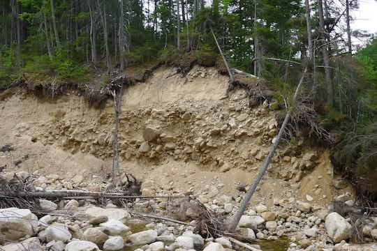
And this, too. The bank is eaten away to a depth of maybe 25’:
Another view of one of the three major crossings I traveled:
More of the trail:
And this:
continued...
Got a nice lazy start after 9am dropping off my bike at the Sawyer River Trailhead and headed for the Sawyer Pond Trailhead. Eh, looked to be a scorcher, so, I was happy the sun wasn’t out yet. “Forded” this crossing at the south end of the Sawyer Pond Trail – up to my knee strap! Still, the water looked appealing!
Based on doctor’s orders and the relatively flat trail, I was able to jog most of the way to Sawyer Pond – a little slow because I was carrying a lot of water (for me!!!)
I made pretty good time out to the footbridge west of the Sawyer Pond Trail. It was signed as closed due the undermined footings from Hurricane Irene. I didn’t have much chocolate on this hike because it was supposed to be hot so I didn’t feel too fat to use the bridge. Looked a little dicey at the far end, however:
Then, there are several skimobile trails and logging roads intersecting south of the bridge. I missed the turn southbound (as I have in the past). I stayed on the logging road and came across this site with backpacks and nobody around. It was like a set from the show “Lost.” – kind of weird.
And then I came to this viewpoint of The Captain (straight across, hidden by tree). Just a nice spot (and a fun peak, by the way!!!).
But, I knew I wasn’t on the right trail so I turned around. Within a few minutes I heard loud voices and came upon a large group of campers asking if Sawyer Pond were close. Ah, so, those were the owners of all the packs!! They were WAY too happy for my directions and threatened to hug me. They were pretty sweaty so I picked up the pace and booked it out of there once I was pretty sure I had explained to at least 5 of them individually where to head. Not clear they had a map. Hope they made it out OK!!!
Next it was on to Hancock Notch Trail to take care of some unfinished business. Several years ago several of us were on a rather LONG bushwhack off the Hancocks (my idea – a bad idea, I admit) and ended up intersecting the Hancock Notch Trail late in the night…. I needed to get to that intersection from the east side to finish hiking that trail. So, several Irene-damaged river crossings later, I was at that fateful spot – crazy how different it looked in the summer without the snow!!!
But, along the way, this time, this end of the trail, I found this RR spike – so cool since I’ve never seen a RR spike on this trail before:
Some crazy-thick hobblebush on the Hancock Notch Trail:
AND, the amazing river crossings since Hurricane Irene passed through. These pictures do not really show the amazing force of the water, but, the erosion is CRAZY!!!!
This is THE trail:
And this, too. The bank is eaten away to a depth of maybe 25’:
Another view of one of the three major crossings I traveled:
More of the trail:
And this:
continued...
")