
PETCH
New member
Date: July 21, 2012
Trails/Peaks: North Twin, South Twin, Guyot, Zealand, and Hale via North Twin, North Twin Spur, Twinway, Lend a Hand, and Fire Wardens Trails
Trail Conditions: Everything was fairly dry, all trails in good shape
Cast of Characters: Ken and I
Stats: 18 miles, 5800 ft of gain; 9 hours 15 min.
Pedometer count: 54,039 steps
Commentary:
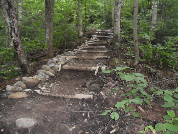
I had hiked this loop along with the Bonds last summer during a backpack trip. But, wanted to attempt a "Bondless" (Sorry James) version as a day trip. Well, I knew I wouldn't get many takers. 18 miles tends to make many look the other way. A few of the usual suspects were out West doing Rainier. So, it was just me and Ken who began up the North Twin Trail at 8:10am. There has been some recent trail work diverting the trail away from the water before the third crossing. (pic)
Nice trail work on the North Twin trail
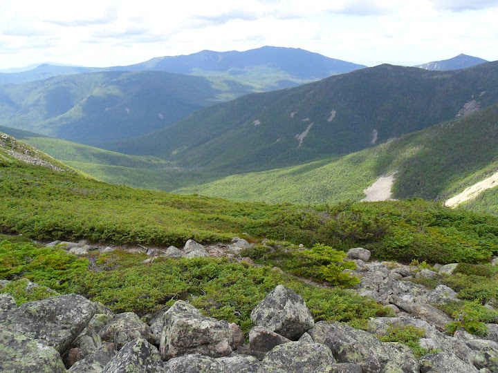
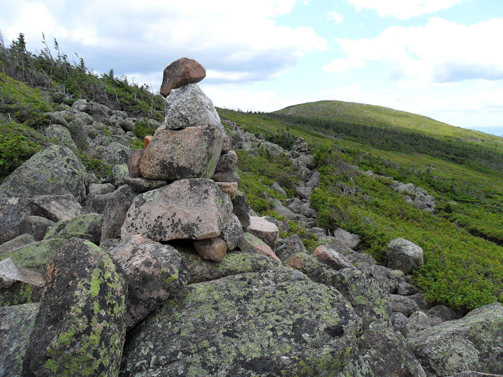
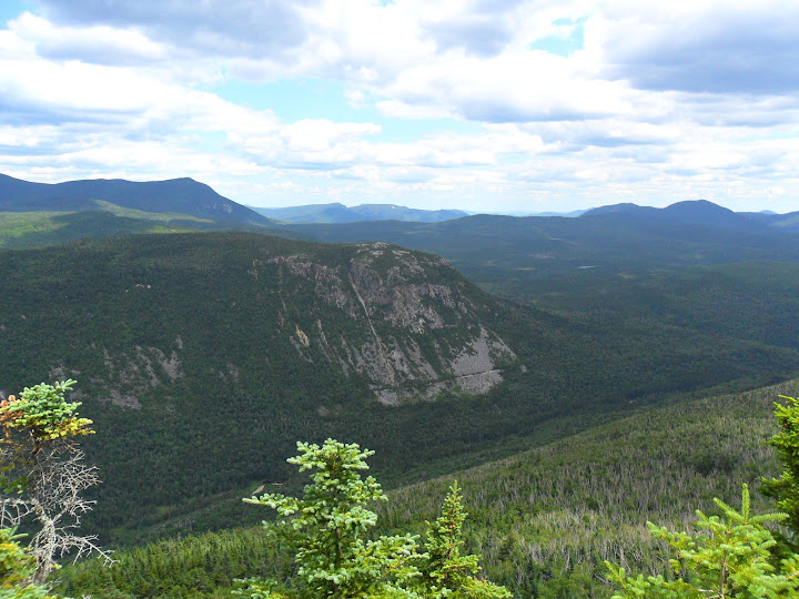
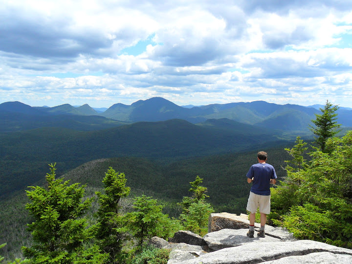
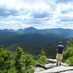
Water levels were relatively low, and the third crossing was easy using the downed trees for support. As the first couple miles were fairly flat, it was time to pay the piper and hit the steeps. Up and up we climbed getting a big part of the elevation gain for the hike over in a hurry. We stopped at the North Twin outlook for Ken's #23rd NH48 peak. Then off to South Twin for #24. The views from South Twin are always enjoyable. I'd have to say that peak is in my Top 5 favorites. Time to hit the AT for a while and see how many thru-hikers were in the hills. Off down the Twinway towards the next destination: Mt Guyot. The Twinway is really a neat trail with a lot of varied terrain. The best part of the trail in this area is where you break from the trees and get an unrestricted view of the Pemi Wilderness. It's really quite spectacular.
Pemi Wilderness
Twinway near Bondcliff Intersection
Looking back at South Twin
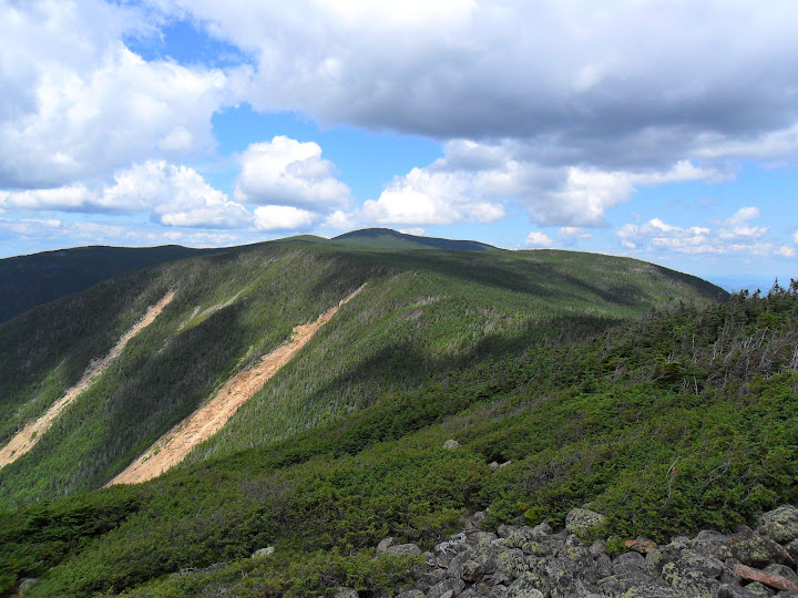
We took a break not far from the Bondcliff trail intersection and just soaked it in. Then up the Twinway to Guyot. The Bonds could be seen off to the South, but we were making the turn in our grand loop and heading East. Back down into the trees and up towards Zealand. Along this section, I had expected to have some sort of encounter with the "Black Chicken of the Whites" (Spruce Grouse), but the little devils were nowhere to be seen. We made the turn on the Zealand spur trail and tagged one of the most unappreciated NH4k peaks. Then off down the Twinway again with a lunch stop at Zeacliff. Awesome views, some food, no cell service.......Nothing else needed.
Zealand Notch and Whitewall
"If I could just build a house here....just a small one"
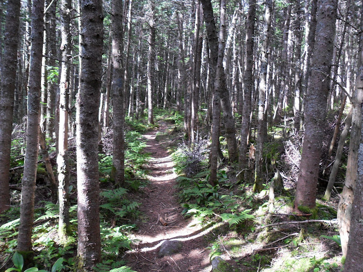
We kept passing the same family of hikers over and over as we stopped at Zealand, Zeacliff, etc; while they were going straight. I'm sure after the 4th time they were sick of seeing us again. The next stop was Zealand Hut to refill with water. Down, down we traveled on the final section of the Twinway. In total, we ran across only 6 or so thru-hikers. Once we were at the falls, we did a water check. We had enough to make it back to the vehicle, so we decided to avoid the hut, and start our final climb of the day up the Lend a Hand trail to Mt Hale. We did stop to check out the new electric water pump near the hut. I wonder what happened with the old one. I don't believe the Lend a Hand trail gets the traffic of the Hale Brook trail, but I find it more enjoyable as it has quite a mix of trail surfaces.
On the Lend a Hand trail near Hale
This area had our only wildlife sighting: a ruffed grouse with youngins. This 2.7 mile trail seem to go on forever. Mostly because it's the last climb. I remember having the same experience last summer. Finally we hit Mt Hale at 8hours into the hike. #25 for Ken. It's all downhill from here. Well, almost. Heading out down the Fire Wardens trail, there is one small col where there is some wreckage of the old Fire Wardens Cabin (I think). Some old steel drums are located trailside in the col.
Fire Wardens Trail
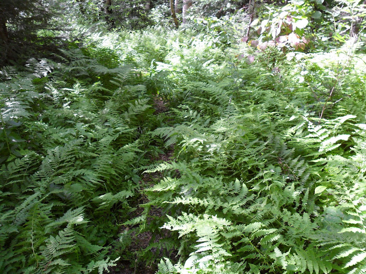
I don't remember this trail being so grown in. The sunny sections were thick with ferns masking the trail. But the corridor was still obvious. The soft footing at the end of the day was a welcome touch. Back down at the North Twin trail, I dunked my head in the water a couple times, then we made short order of the final section. We completed the 18 mile hike in 9hrs and 15min and capped it off with an ice cold Moosehead! It's all good.
Slideshow from this trip
Petch
Trails/Peaks: North Twin, South Twin, Guyot, Zealand, and Hale via North Twin, North Twin Spur, Twinway, Lend a Hand, and Fire Wardens Trails
Trail Conditions: Everything was fairly dry, all trails in good shape
Cast of Characters: Ken and I
Stats: 18 miles, 5800 ft of gain; 9 hours 15 min.
Pedometer count: 54,039 steps
Commentary:
I had hiked this loop along with the Bonds last summer during a backpack trip. But, wanted to attempt a "Bondless" (Sorry James) version as a day trip. Well, I knew I wouldn't get many takers. 18 miles tends to make many look the other way. A few of the usual suspects were out West doing Rainier. So, it was just me and Ken who began up the North Twin Trail at 8:10am. There has been some recent trail work diverting the trail away from the water before the third crossing. (pic)
Nice trail work on the North Twin trail
Water levels were relatively low, and the third crossing was easy using the downed trees for support. As the first couple miles were fairly flat, it was time to pay the piper and hit the steeps. Up and up we climbed getting a big part of the elevation gain for the hike over in a hurry. We stopped at the North Twin outlook for Ken's #23rd NH48 peak. Then off to South Twin for #24. The views from South Twin are always enjoyable. I'd have to say that peak is in my Top 5 favorites. Time to hit the AT for a while and see how many thru-hikers were in the hills. Off down the Twinway towards the next destination: Mt Guyot. The Twinway is really a neat trail with a lot of varied terrain. The best part of the trail in this area is where you break from the trees and get an unrestricted view of the Pemi Wilderness. It's really quite spectacular.
Pemi Wilderness
Twinway near Bondcliff Intersection
Looking back at South Twin
We took a break not far from the Bondcliff trail intersection and just soaked it in. Then up the Twinway to Guyot. The Bonds could be seen off to the South, but we were making the turn in our grand loop and heading East. Back down into the trees and up towards Zealand. Along this section, I had expected to have some sort of encounter with the "Black Chicken of the Whites" (Spruce Grouse), but the little devils were nowhere to be seen. We made the turn on the Zealand spur trail and tagged one of the most unappreciated NH4k peaks. Then off down the Twinway again with a lunch stop at Zeacliff. Awesome views, some food, no cell service.......Nothing else needed.
Zealand Notch and Whitewall
"If I could just build a house here....just a small one"
We kept passing the same family of hikers over and over as we stopped at Zealand, Zeacliff, etc; while they were going straight. I'm sure after the 4th time they were sick of seeing us again. The next stop was Zealand Hut to refill with water. Down, down we traveled on the final section of the Twinway. In total, we ran across only 6 or so thru-hikers. Once we were at the falls, we did a water check. We had enough to make it back to the vehicle, so we decided to avoid the hut, and start our final climb of the day up the Lend a Hand trail to Mt Hale. We did stop to check out the new electric water pump near the hut. I wonder what happened with the old one. I don't believe the Lend a Hand trail gets the traffic of the Hale Brook trail, but I find it more enjoyable as it has quite a mix of trail surfaces.
On the Lend a Hand trail near Hale
This area had our only wildlife sighting: a ruffed grouse with youngins. This 2.7 mile trail seem to go on forever. Mostly because it's the last climb. I remember having the same experience last summer. Finally we hit Mt Hale at 8hours into the hike. #25 for Ken. It's all downhill from here. Well, almost. Heading out down the Fire Wardens trail, there is one small col where there is some wreckage of the old Fire Wardens Cabin (I think). Some old steel drums are located trailside in the col.
Fire Wardens Trail
I don't remember this trail being so grown in. The sunny sections were thick with ferns masking the trail. But the corridor was still obvious. The soft footing at the end of the day was a welcome touch. Back down at the North Twin trail, I dunked my head in the water a couple times, then we made short order of the final section. We completed the 18 mile hike in 9hrs and 15min and capped it off with an ice cold Moosehead! It's all good.
Slideshow from this trip
Petch
Last edited:
