Jeff&Henry
New member
Route: York Pond Trail > Bunnell Notch Trail > Kilkenny Ridge Trail > Unknown Pond Trail (loop)
Full Photo Album: http://jcwheel.smugmug.com/Hikes/Cabot (Note: captions under the photos)
---------------
We had been reluctant to climb Mount Cabot due to it's remote location, and now, after bagging it, I wonder why we waited so long. ;-)
First off, how cool to start a hike at a fish hatchery? I never knew such places existed. It's quite an operation, and the "raceway" near the York Pond trail head is fascinating.
The hike up York Pond Trail begins quite easily, with the trail passing through delightful open fields, then shoulder-high golden rod and wildflowers and quickly gets damp, then wet, and stays wet.
Due to our rather late 11 AM start (we underestimated how long it would take to get to Berlin from the South Shore of Boston) we began to pass hikers coming down from the summit, and a father/son duo joked that we'd just begun to enjoy the wet trail.
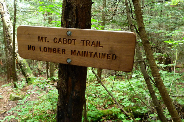
The Bunnell Notch Trail follows along a river which appears to be on large sections relocated new trail. We joined Kilkenny Ridge after about 90 minutes, and about 1.5 miles from the summit, the real climb begins (shortly after passing the Mt. Cabot Trail -- which is sadly, no longer maintained, although we passed a hiker going down who had come up the MCT. The made me smile. And except for one very fine overlook about a mile from the summit, our views were fairly limited, except for glances between the trees. About two and a half hours into the hike, we passed Cabot Cabin and plowed on the summit -- the REAL summit (stick on the tree) NOT the summit sign.
Note: Does anyone know why in the world is the summit sign is placed where it is, when it's quite obvious there's a higher piece of land about 100 yards away? Thank goodness I had seen other VFTT posts, so we KNEW where to look for the real summit.
We spent only enough time on the summit for a few photos (to chronicle our 41st summit!) then continued on towards the Bulge, and the trail got wet again. Just after the Bulge we stopped for our lunch and I called the fish hatchery to let them know we wouldn't be down until about 6 PM, and, thankfully, the gentleman I spoke with said the gate would be staying open until at least 10:30 PM. That took the pressure off -- we could take our time.
Unknown Pond was lovely, although we were watching our beautiful day quickly turn dark, so we started down Unknown Pond trail. I commented to Henry I could almost use a headlamp -- it's amazing how dark the woods can be. Looking at the map, I thought we might have a nice gradual descent to the trail head, but UPT began by passing through completely grown in trails (sometimes over Henry's head), then rocky, soaked trail along a river and finally a rather nice old rail bed.
About 2 miles from the end of hike, it POURED on us, although after 6 hours of hard hiking in high humidity, the rain cooled us down nicely.
At about 6:30 PM, we exited the woods into the parking lot at Unknown Pond trail head -- our car was the last one in the lot, but the sky had cleared to show us Mount Cabot. This was a long day, especially due to the humidity, but we enjoyed the solitude. I look forward to doing Cabot in the Spring (with more views) or fall (where the foliage I'm sure will be brilliant).
---------------
Some other photos:
> Was there some confusion where the summit was? They had to replace the arrow?
> I call this "Onion Tree"
> I think yellow blaze impedes us more than helps us
Photo Album: http://jcwheel.smugmug.com/Hikes/Cabot
Jeff & Henry
41/48
[email protected]
Full Photo Album: http://jcwheel.smugmug.com/Hikes/Cabot (Note: captions under the photos)
---------------
We had been reluctant to climb Mount Cabot due to it's remote location, and now, after bagging it, I wonder why we waited so long. ;-)
First off, how cool to start a hike at a fish hatchery? I never knew such places existed. It's quite an operation, and the "raceway" near the York Pond trail head is fascinating.
The hike up York Pond Trail begins quite easily, with the trail passing through delightful open fields, then shoulder-high golden rod and wildflowers and quickly gets damp, then wet, and stays wet.
Due to our rather late 11 AM start (we underestimated how long it would take to get to Berlin from the South Shore of Boston) we began to pass hikers coming down from the summit, and a father/son duo joked that we'd just begun to enjoy the wet trail.
The Bunnell Notch Trail follows along a river which appears to be on large sections relocated new trail. We joined Kilkenny Ridge after about 90 minutes, and about 1.5 miles from the summit, the real climb begins (shortly after passing the Mt. Cabot Trail -- which is sadly, no longer maintained, although we passed a hiker going down who had come up the MCT. The made me smile. And except for one very fine overlook about a mile from the summit, our views were fairly limited, except for glances between the trees. About two and a half hours into the hike, we passed Cabot Cabin and plowed on the summit -- the REAL summit (stick on the tree) NOT the summit sign.
Note: Does anyone know why in the world is the summit sign is placed where it is, when it's quite obvious there's a higher piece of land about 100 yards away? Thank goodness I had seen other VFTT posts, so we KNEW where to look for the real summit.
We spent only enough time on the summit for a few photos (to chronicle our 41st summit!) then continued on towards the Bulge, and the trail got wet again. Just after the Bulge we stopped for our lunch and I called the fish hatchery to let them know we wouldn't be down until about 6 PM, and, thankfully, the gentleman I spoke with said the gate would be staying open until at least 10:30 PM. That took the pressure off -- we could take our time.
Unknown Pond was lovely, although we were watching our beautiful day quickly turn dark, so we started down Unknown Pond trail. I commented to Henry I could almost use a headlamp -- it's amazing how dark the woods can be. Looking at the map, I thought we might have a nice gradual descent to the trail head, but UPT began by passing through completely grown in trails (sometimes over Henry's head), then rocky, soaked trail along a river and finally a rather nice old rail bed.
About 2 miles from the end of hike, it POURED on us, although after 6 hours of hard hiking in high humidity, the rain cooled us down nicely.
At about 6:30 PM, we exited the woods into the parking lot at Unknown Pond trail head -- our car was the last one in the lot, but the sky had cleared to show us Mount Cabot. This was a long day, especially due to the humidity, but we enjoyed the solitude. I look forward to doing Cabot in the Spring (with more views) or fall (where the foliage I'm sure will be brilliant).
---------------
Some other photos:
> Was there some confusion where the summit was? They had to replace the arrow?
> I call this "Onion Tree"
> I think yellow blaze impedes us more than helps us
Photo Album: http://jcwheel.smugmug.com/Hikes/Cabot
Jeff & Henry
41/48
[email protected]
Last edited: