
Ed'n Lauky
Well-known member
- Joined
- Feb 15, 2007
- Messages
- 1,802
- Reaction score
- 168
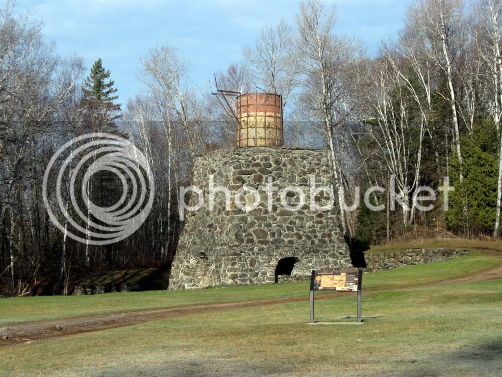
I had for some time wanted to get up into the 100 Mile Wilderness. We decided to pay a Visit by going up to the Katahdin Iron works and hiking up White Cap mountain.
As with so many hikes in northern Maine the big adventure, at least for someone without a truck or jeep is the ride in on the logging roads. The initial drive in from the highway to the gate house is very good the gravel road is as good as a paved road. Once past the gatehouse you cross the bridge and turn right. The quality of the road drops off a bit but it is still fairly good. You come to a fork where the road goes left to Gulf Hagus and to the right to High Bridge. The Road to High Bridge drops off some more but still is easily passible with reduced speed. After You cross High Bridge the road is very bad. It is four miles from High Bridge to the proposed parking area. I made it about three miles by going very slow and carefully picking my spots. At roughly 3 miles a road goes off to the left. This is a good spot for a car to stop as there is plenty of place to turn around and park. I actually parked a short distance farther ahead just before the flooded area. A car might get through the washed out area but keep in mind that if you get stopped and can’t go forward you will have to back up. If it’s hard to pick your spots going forward, the difficulty is compounded exponentially when you start backing up. If you have a truck with high clearance you will be able to go all the way to the staging area. If you’re into mountain biking this would be the ideal hike for a bike. With the bike you could go all the way from High Bridge to the White Brook trail. Where I left the car was about 1 mile from the proposed parking area. That adds two miles to the hike but saves six miles of walking to and from High Bridge.
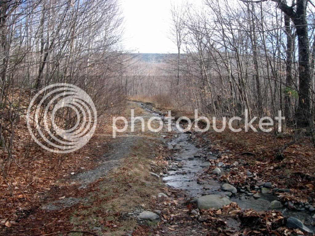
Shortly beyond the parking area you come to the first stream crossing. This crossing I predict will stop all the trucks.
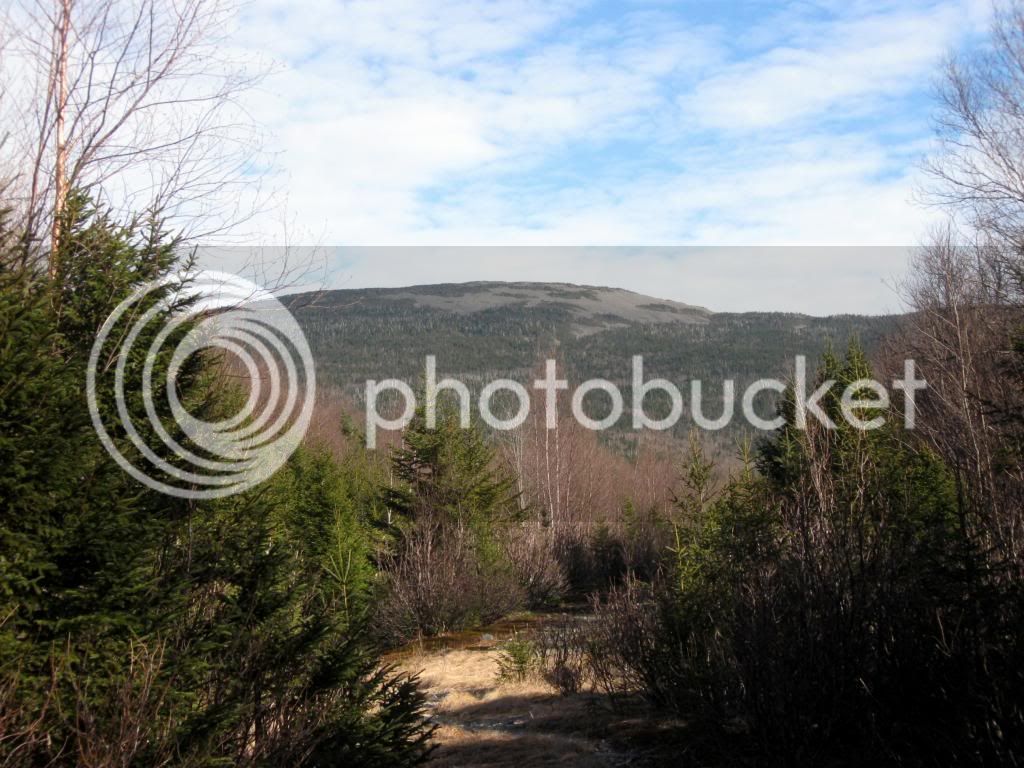
A short distance beyond the second stream crossing you get your first view of White Cap Mt.
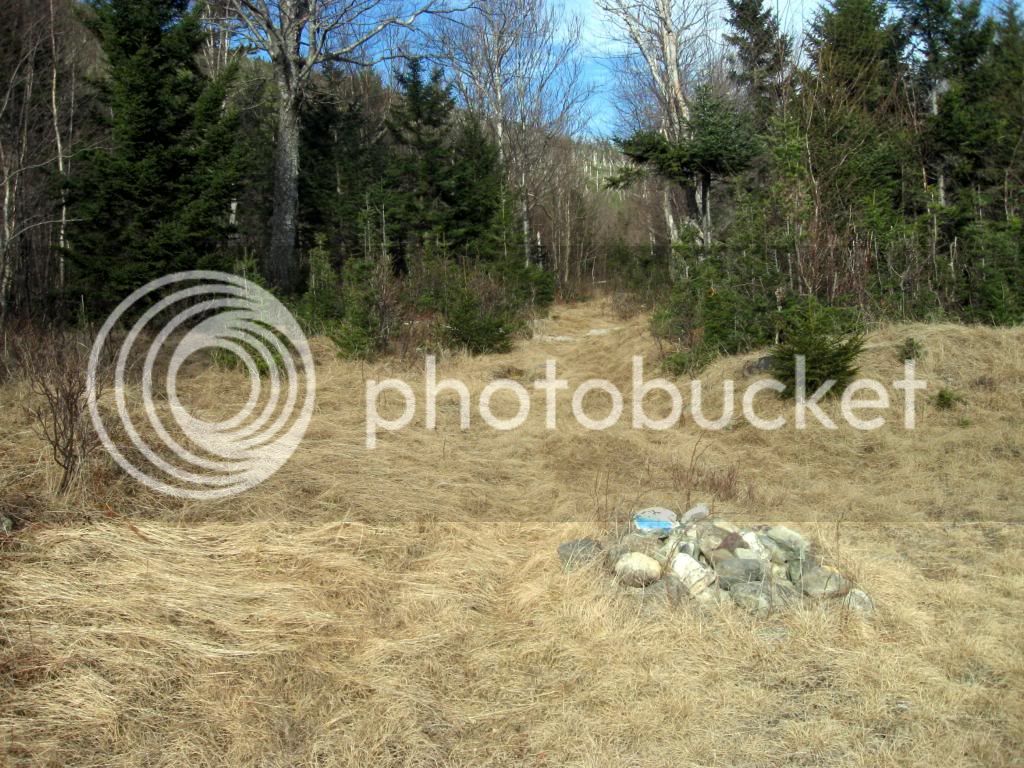
After about a mile’s walk from the staging area, you come to a large open field. The White Brook trail begins at the end of the left side of this field.
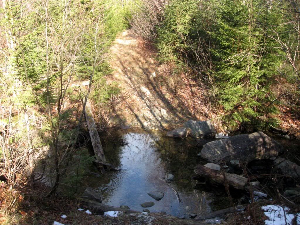
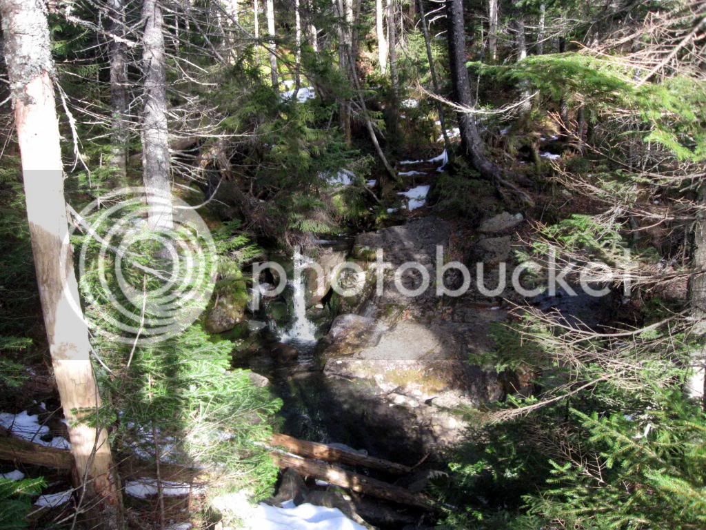
About four tenths of a mile into the hike and you cross the White Brook. A short distance later you come to a split in the trail. The road to the right I understand is the old Fire Warden’s trail. It is not maintained and looks to be a bit of a bush whack. We followed the White Cap trail to the left. It’s a fairly steep half mile to the top.
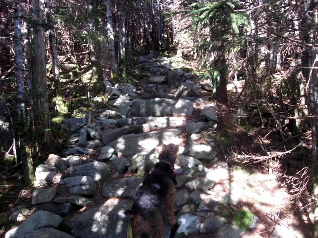
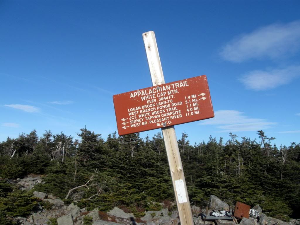
It’s not really a Stairway to Heaven but it is a well maintained trail up to the AT trail. Once you hit the ridge you pick up the AT trail. Turn right and it’s just over a mile to the summit.
The summit is not completely open but it does have magnificent views.
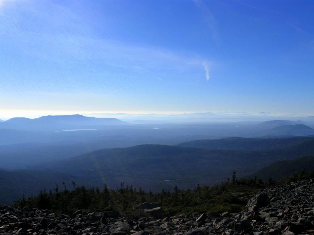
Your first views are off to the South
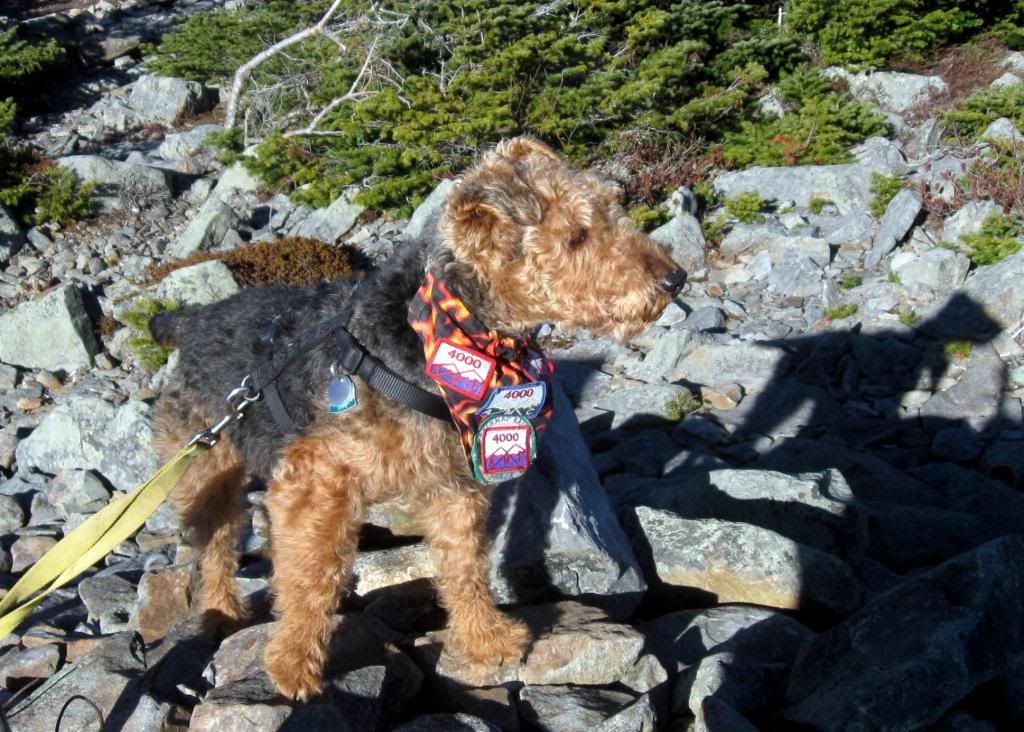
Lauky was less interested in the views than in laying claim to the old Fire Tower site
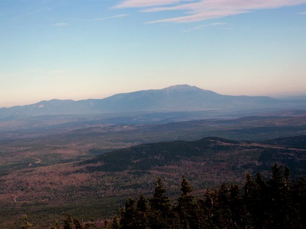
A short trail leads through some trees where you are treated to some views of what would be for many the end of the rainbow for you can see off in the distance Mt. Katahdin which would be the end of the hike for the through hiker. There must be many mixed emotions in seeing that.
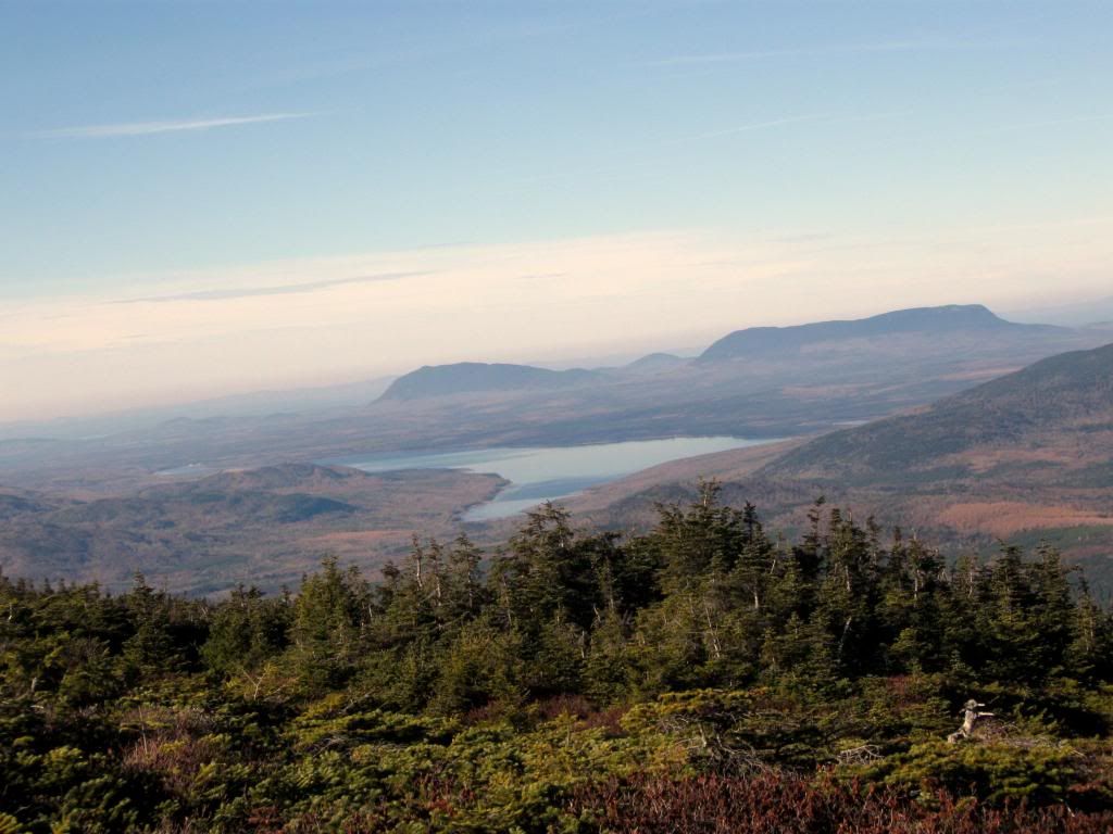
We took in some of the other great views to the north, then headed back down, took the long drive home where we were treated to a great Thanksgiving dinner that my wife had prepared. It was one of the greatest Thanksgivings I ever had. It was my wife who had suggested that we have our Thanksgiving dinner in the evening rather than at noon so I could do the hike. That’s pretty special.
As with so many hikes in northern Maine the big adventure, at least for someone without a truck or jeep is the ride in on the logging roads. The initial drive in from the highway to the gate house is very good the gravel road is as good as a paved road. Once past the gatehouse you cross the bridge and turn right. The quality of the road drops off a bit but it is still fairly good. You come to a fork where the road goes left to Gulf Hagus and to the right to High Bridge. The Road to High Bridge drops off some more but still is easily passible with reduced speed. After You cross High Bridge the road is very bad. It is four miles from High Bridge to the proposed parking area. I made it about three miles by going very slow and carefully picking my spots. At roughly 3 miles a road goes off to the left. This is a good spot for a car to stop as there is plenty of place to turn around and park. I actually parked a short distance farther ahead just before the flooded area. A car might get through the washed out area but keep in mind that if you get stopped and can’t go forward you will have to back up. If it’s hard to pick your spots going forward, the difficulty is compounded exponentially when you start backing up. If you have a truck with high clearance you will be able to go all the way to the staging area. If you’re into mountain biking this would be the ideal hike for a bike. With the bike you could go all the way from High Bridge to the White Brook trail. Where I left the car was about 1 mile from the proposed parking area. That adds two miles to the hike but saves six miles of walking to and from High Bridge.
Shortly beyond the parking area you come to the first stream crossing. This crossing I predict will stop all the trucks.
A short distance beyond the second stream crossing you get your first view of White Cap Mt.
After about a mile’s walk from the staging area, you come to a large open field. The White Brook trail begins at the end of the left side of this field.
About four tenths of a mile into the hike and you cross the White Brook. A short distance later you come to a split in the trail. The road to the right I understand is the old Fire Warden’s trail. It is not maintained and looks to be a bit of a bush whack. We followed the White Cap trail to the left. It’s a fairly steep half mile to the top.
It’s not really a Stairway to Heaven but it is a well maintained trail up to the AT trail. Once you hit the ridge you pick up the AT trail. Turn right and it’s just over a mile to the summit.
The summit is not completely open but it does have magnificent views.
Your first views are off to the South
Lauky was less interested in the views than in laying claim to the old Fire Tower site
A short trail leads through some trees where you are treated to some views of what would be for many the end of the rainbow for you can see off in the distance Mt. Katahdin which would be the end of the hike for the through hiker. There must be many mixed emotions in seeing that.
We took in some of the other great views to the north, then headed back down, took the long drive home where we were treated to a great Thanksgiving dinner that my wife had prepared. It was one of the greatest Thanksgivings I ever had. It was my wife who had suggested that we have our Thanksgiving dinner in the evening rather than at noon so I could do the hike. That’s pretty special.
Last edited:

")