
Kevin Judy and Emma
Well-known member
Silver Glass
Mount Roberts 2582' and Faraway Mountain 2782'
8.5 miles 1800'Elevation gain
Mount Roberts Trail / High Ridge Trail / Faraway Mountain Trail
Kevin, Judy and Emma
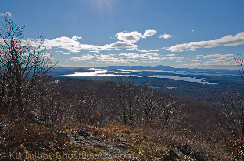
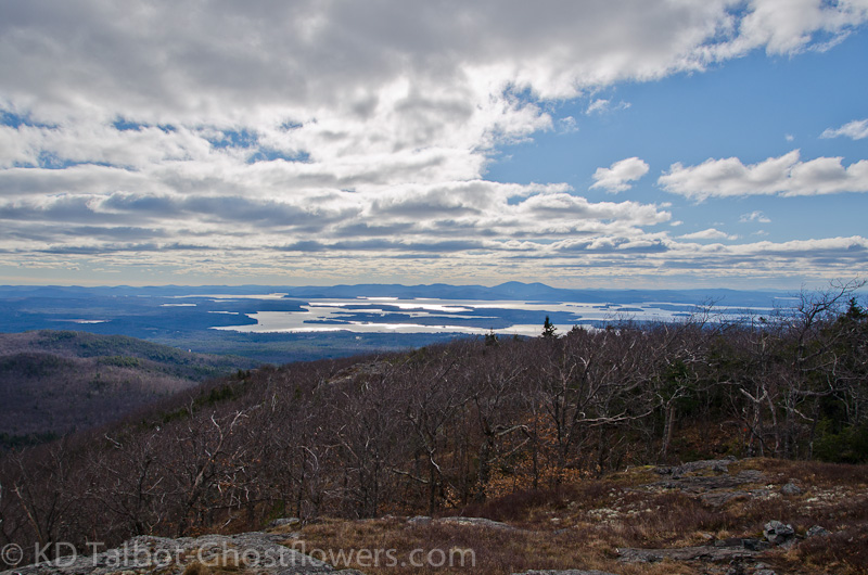
We love the Ossipees. We've had many a good hike there. It's another place where we can always explore new territory, or visit some old favorites. As Emma's hiking career is winding down the lower elevations and good footing help to keep her going. Once she is in the woods she puts away her "Old Dog" clothes and moves like a puppy again. In November with the trees all bare there are astounding views of Lake Winnepesaukee. From the many outlooks we could watch as the sun and the clouds played a magic game of dancing light on the waters.

We had taken a similar route on our last trip to Mount Roberts. Taking the Mount Roberts Trail from the parking area near the Bottling Company we wound our way along the carriage road and up along the easy grades to the first outlook. There are many opportunities to stop along the ledges and take in the magnificent scene of sunlight and water below us. Though Winnepesaukee is miles away its enormity takes up most of the view to the west. Across the lake the Belknap Range rises on the far shore.
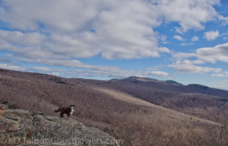
Emma was in high spirits and trotted along at a good pace. The brisk November air sure beats the heat and humidity when you wear a fur coat while hiking. When we had made this hike before we had gone past Mount Roberts in search of Faraway Mountain. With everything so well marked we were surprised to find that the trail to Faraway was not signed. On our first trip we walked right by and never made it to the summit. The trail to the summit is quite obvious, but not signed. This time we followed the trail to the radio tower that is marked on the maps as Faraway Mountain. There may be a higher point to the south of this, but we didn't bushwhack to it.
From Roberts to Faraway the High Ridge Trail is a carriage road, so very easy hiking. To return we made a loop taking the High Ridge Trail to the junction with the Cold Spring Trail back to Shannon Pond and the parking area. From Mount Roberts on we followed carriage roads which made for very easy hiking, though we cut off some of the mileage as we soon tired of the round about switchbacks along the road. With the leaves gone and the woods open it was easy to bushwhack down and pick up the road again in many places, thereby cutting off a good deal of mileage wasted on switchbacks.
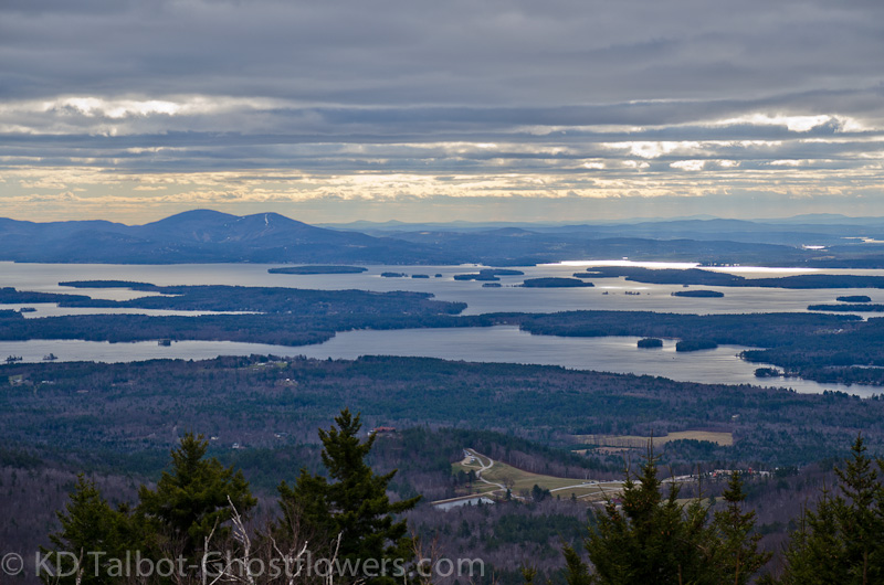
It was a great day to be out walking in November woods. The "silver glass" reflected sunlight on Lake Winnepesaukee reminded me of a favorite scene from "The Lord of the Rings":
Pippin: I didn't think it would end this way.
Gandalf: End? No, the journey doesn't end here. Death is just another path... One that we all must take. The grey rain-curtain of this world rolls back, and all turns to silver glass... And then you see it.
Pippin: What? Gandalf?... See what?
Gandalf: White shores... and beyond, a far green country under a swift sunrise.
Pippin: [smiling] Well, that isn't so bad.
Gandalf: [softly] No... No it isn't.
Full set of pics HERE:
KDT
Last edited:
") ). I rarely do the loop because I find the old carriage roads boring ... love the suggestion of cutting switchbacks, though a quick look at my GPS traces suggests little saving in distance (but less boring!). May give it a try soon.
). I rarely do the loop because I find the old carriage roads boring ... love the suggestion of cutting switchbacks, though a quick look at my GPS traces suggests little saving in distance (but less boring!). May give it a try soon.