Recent Abe/Ellen & Sugarbush Intel?

vftt.org

Help Support vftt.org:

This site may earn a commission from merchant affiliate links, including eBay, Amazon, and others.

mtruman

New member
Joined
Feb 6, 2009
Messages
494
Reaction score
106
Location
Rhode Island
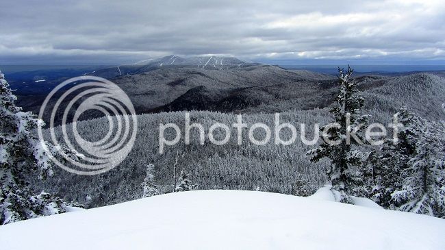
We're heading back to Vermont this weekend to try to finish what we missed in our January trip. I'm wondering if anyone has any recent intel on trail conditions for Abe/Ellen (AT on the ridge and Battell in particular) and on the current hiking policy at Sugarbush.

Last time I talked to someone at Sugarbush in guest services who told me we could hike up in the ski area as long as we checked in. We parked at the Lincoln Peak lodge and took the shuttle to Ellen base. Checked in at the desk and after a little confusion on what our plans were they said we were fine and didn't need any kind of pass. They told us to go up Lower F.I.S. (which was closed that day) to Upper F.I.S. to Rim Run and then to check with ski patrol at Lincoln Peak for the suggested trails down. We wound up backing out before we were half way up as the winds were already knocking us off our feet and were predicted to be really bad up top (which turned out not to be the case). So...

Ideally our plans would be the same this time, but I just noticed a Winter Trail Use Policy on the Sugarbush site that I don't think was there in January: http://www.sugarbush.com/snow-trails-conditions/winter-trail-use-policy If you believe this, there's no uphill travel permitted by any means. We're going to call today to ask about it, but wanted to see if anyone here had first-hand experience.

If that doesn't work, plan B would be an out-and-back via Battell. Any idea about the parking situation for that trailhead (and any fairly recent trail conditions)? Haven't seen anything posted here or on any of the other forums or trail conditions sites for any of the Abe/Ellen trails since beginning of last month. Also, we'll be coming from Stockbridge and I'm curious about the road conditions to get to the west side. I know Lincoln Gap is closed. Is cutting across on 125 and then basically a direct route up the "back roads" to Battell the best option?

Thanks for the input
 
i don't have current info, but can give you an idea of what i encountered last year doing an out and back via battell trail. as far as driving i cut across appalachian gap (lincoln gap is closed) which on that snowy day was quite interesting in my two wheel drive. parking for battell trail was about .25 back from the summer parking where the plowed way ended. battell trail looked to get a lot of travel up to the shelter. the long trail was well travelled to abraham as well. i was concerned the long trail beyond might be difficult to follow and untravelled to ellen. this was the case to lincoln peak, but after that the long trail was travelled pretty heavily by skiers all the way to ellen. this ski route did not always follow the long trail proper and was a bit confusing where it came in and out of the ski trails, but was well packed. i would assume this is the case most years. if untracked the long trail could be hard to follow across the ridge. i don't recall seeing much in the way of blazes and some areas were pretty brushy. a great hike.
have fun.

bryan
It is definitely true that the LT lacks good blazing in this area, at least in the Winter. And even though we did the trail last summer, there were a few places where we got confused, especially around the ski slopes. We did Abe first from the Battell Trail, the parking was not a problem. But we did a thru hike, exiting on the Jerusalem trail. But don't assume your tracks will be easy to follow back, as the skiers may cover them over. This is a place where a GPS and a tracklog may be quite valuable.
 
Thanks Bryan and Tom. Seems like every account of the Monroe Skyline in winter that I've seen has been filled with descriptions of "interesting" route finding. I've got the GPS and track log, so hopefully that helps. Then there are the spruce traps :eek: Hopefully we avoid those

My wife called Sugarbush today and talked to guest services. They told her that we'd need to get final confirmation from the ski patrol, but that she didn't think we'd have a problem getting approval to hike up (and down) the ski trails. She was appreciative of the fact that Nat said we would be sure to stay out of the way of skiiers and be as unobtrusive as possible. So far so good...

We also found out that the Mad Bus (shuttle) runs from 6pm to 1am and does a loop that includes the resorts (Lincoln Peak base area included) and at least the entrance to Ellen base with flexibility based on the driver. That leaves the option to park at Ellen base and get an early start (will suggest this to the ski patrol) and get to the top by the time the lifts are running. If for any reason we're REALLY slow and miss the last regular 4:30 shuttle we can get a beer and then grab the later bus (hmmm, sounds like a good idea anyway).

Will let you know how this all turns out on Monday
 
OK, looks like we're all set! Nat talked to the head of the ski patrol at Sugarbush and we got permission to use the ski trails. She said he was very nice and appreciate our asking. His suggestion was to start as early as possible and get up high before too many skiiers are out. Recommended taking Lower F.I.S. again since it gets minimal traffic. Apparently their reason for making the rules more strict and publishing on the website is that they've had some recent incidents with clueless people not only hiking on the ski trails, but doing so with unleashed dogs. Not cool. Nice to know that there's still an option for us law-abidin' citizens :)
 
Just coming back to close off this thread. Everything went perfectly this weekend. The weather was as good as it possibly gets in winter. We got to the trailhead at 7am and had the place to ourselves (lifts open at 9). We met 4 ski patrol members on the way up. Each stopped and talked to us about our plans. They were all very friendly. One asked about whether we had a pass, but when I told her we'd gotten clearance from the ski patrol director she just said "OK, great. Have a good hike".

We got to the top of the ski area about 9:25 so the first skiers were just getting off the lift and heading down. No issues with dodging downhill moving objects on the hike up. :)

The hike across the ridge went well. We had two skiers that had skinned up at the same time as us ahead of us on the ridge to Castlerock so everything was well broken and easy to follow (I think it would have been OK anyway). Between Castlerock and Lincoln Peak there were lots of skiers booting over in the other direction, so again trail was easy to follow. From Lincoln Peak to Abraham there had been no recent traffic, but there was still a faint showshoe track that was generally visible. Blazes were not easy to find here but we managed to stay on track all the way over. Conditions were getting soft and spruce traps were definitely in play for anyone that wasn't on the middle of the packed trail. We managed to avoid any real issues other than a couple of minor punch throughs.

The experience going down the ski trails was the same as going up - except for lots of skiers to avoid. We were heading down around 1:30 so it was peak afternoon traffic. Several skiers stopped to chat with us and and a few ski patrol as well, who just wanted to ask if we'd had a good day and about our hike. No hassling whatsoever.

We were down by 3pm with plenty of time to grab the shuttle back to the Ellen base area to get the car. All in all a fantastic day on the mountains. Will post pics and a full trip report shortly...
 
Nice trip report! I'm looking forward to your pictures and longer trip report.

I hiked Burnt Rock Mt earlier last week and we had some amazing views of right where you were hiking. Thought you might enjoy this one, since it shows right around where you were hiking.

Sugar650_zpsdc183a60.jpg

View from Burnt Rock Mt, Vermont on March 6, 2013
 
Which trails did you use?

We hiked up Lower F.I.S. and Rim Run on Ellen and came down Jester and Snowball from Lincoln. More details in the full trip report (link below)

Nice trip report! I'm looking forward to your pictures and longer trip report.

I hiked Burnt Rock Mt earlier last week and we had some amazing views of right where you were hiking. Thought you might enjoy this one, since it shows right around where you were hiking.

Nice view!! Thanks for sharing the pic. The full trip report is posted here: http://www.vftt.org/forums/showthread.php?48442-If-at-First-You-Don-t-Succeed-Mt-Abraham-and-Ellen-3-9-13 or you can just go right to my blog post: http://theramblingsblog.blogspot.com/2013/03/if-at-first-you-dont-succeed-mt-ellen.html
 
Top