IQuest
New member
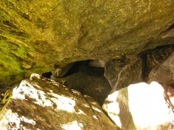
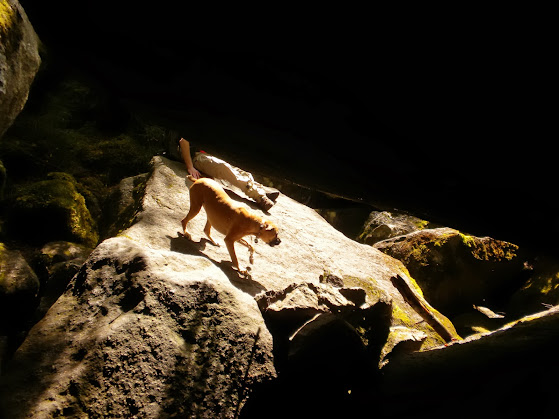
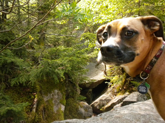
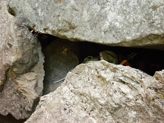
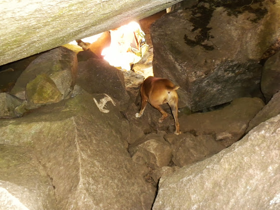
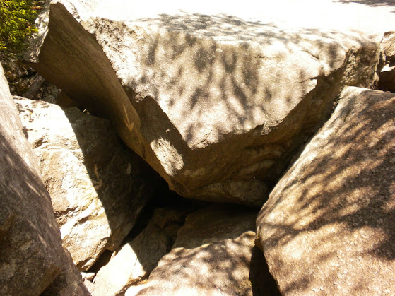
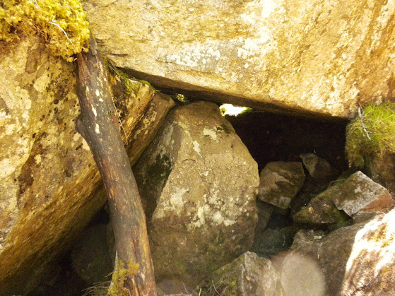
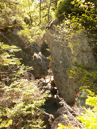
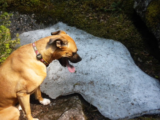
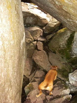
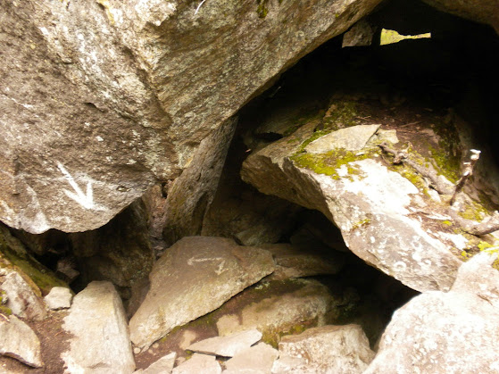
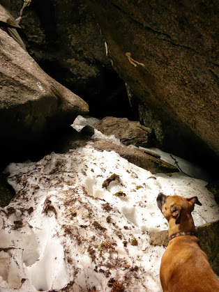
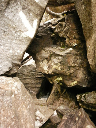
Now that summer is almost here and the trails are almost snow free it was time for me to explore some new terrain. Mahoosuc Notch has been on my mind for a few years now and I decided that including Old Speck and Mahoosuc Arm (twice) would make a good warm up before tackling the Notch. Marlie as coming along for this adventure so it was sure to be interesting. The WMG says that the section of trail through Mahoosuc Notch is not recommended for dogs and for good reason. Aside from the boulder caves and uneven surfaces, there are several deep holes where a slip could cause a serious injury or even some sort of technical rescue. With that said, I had an idea what we might be in for and Marlie does have a fair amount of boulder hopping experience and a little canyoneering under her collar.
After unexpectedly meeting at McDonald's on Gorham, madmattd and headed to Berlin to drive Success Pond Rd to the trailheads and spot the vehicles. We had 11.5 mi to the Notch TH, then 1.9 more to the Speck Pond TH. This took us almost an hour due to the roughness of the road. It was passable for sure. Wide and firm, but with thousands of pot holes and many large rocks that could damage a low clearance car if the driver is not paying attention. With my truck I had no issues, it was just too rough to go fast. I probably averaged about 12 mph with a max speed of about 20. The road did improve slightly once we crossed into Maine, but not much. Matt was able to drive his car in with care. We did get to follow a moose a short distance up the road. Of course both cameras were in the way back of Matt's car.
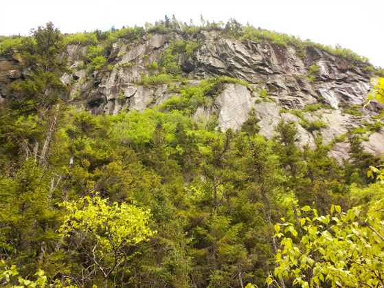
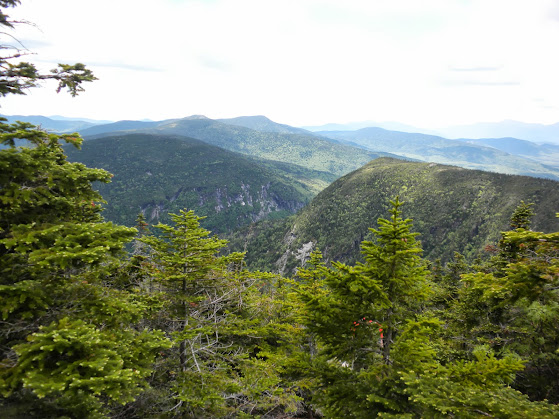
Once we were headed up Speck Pond Tr we chatted away, gaining elevation easily and quickly. As we crossed an area of recent logging, we were given nice views to the west and north. The broad ridge of Kilkenny Range could be seen as well as Percy Peaks in the distance and lots of green. Before we knew it we reached the junction of the May Cutoff, just below the summit of Mahoosuc Arm. We figured that while we were here we wanted to be sure to redline everything we could so we could either do an out and back of the May Cutoff or make two passes. We decided to make two passes. The summit of Mahoosuc Arm is somewhat broad with a few minor bumps. One of which along the May Cutoff is supposed to be the summit. The views are excellent of Old Speck and the eastern end of Mahoosuc Notch can be seen from the summit ledges. Be careful though as there are some hidden bog bridges just below the surface of the mud. If you miss them the mud is almost shin deep.
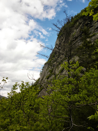
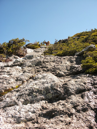
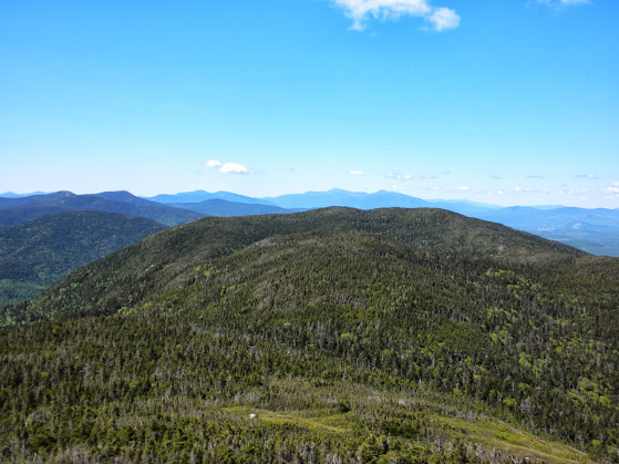
Once we reached the Mahoosuc Tr we headed north, dropping down to Speck Pond. We crossed the outlet at met the caretaker near the shelter. After a brief visit, we started our climb up Old Speck. The climb was not bad and went by much quicker than expected. Probably because the majority of the climb is along an open ridge with excellent views to the south, west, and northwest.
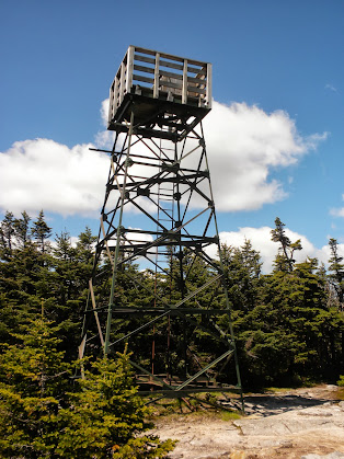
Once we hit the trees at the top it was only about a half mile to the fire tower and the summit. The tower doesn't have steep steps, it has a nearly vertical ladder. :shock: Marlie had to wait at the bottom while Matt and I checked out the views.
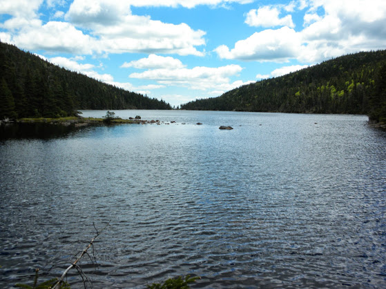
We spent about 40 minutes at the summit before returning to Speck Pond Campsite. Now it was time to climb Mahoosuc Arm again and finish redlining the Speck Pond Tr. Shortly after leaving the campsite we crossed the inlet and the western shore of Speck Pond.
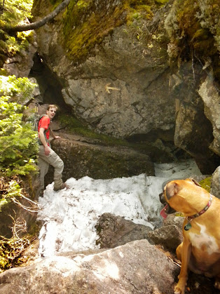
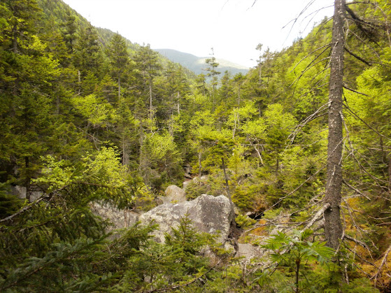
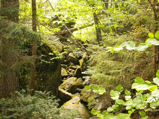
After a short climb we were back at the May Cutoff for our second pass. There were footprints from two sets of boots and four paws that we were following. :roll: This time once we reached the Mahoosuc Tr we turned south and made the long steep descent down Mahoosuc Arm and to the eastern end of the Notch. After crossing a small stream, I assume it is the runoff from Notch 2, and removing the only blowdown of the day we reach the Notch's entrance.
After unexpectedly meeting at McDonald's on Gorham, madmattd and headed to Berlin to drive Success Pond Rd to the trailheads and spot the vehicles. We had 11.5 mi to the Notch TH, then 1.9 more to the Speck Pond TH. This took us almost an hour due to the roughness of the road. It was passable for sure. Wide and firm, but with thousands of pot holes and many large rocks that could damage a low clearance car if the driver is not paying attention. With my truck I had no issues, it was just too rough to go fast. I probably averaged about 12 mph with a max speed of about 20. The road did improve slightly once we crossed into Maine, but not much. Matt was able to drive his car in with care. We did get to follow a moose a short distance up the road. Of course both cameras were in the way back of Matt's car.
Once we were headed up Speck Pond Tr we chatted away, gaining elevation easily and quickly. As we crossed an area of recent logging, we were given nice views to the west and north. The broad ridge of Kilkenny Range could be seen as well as Percy Peaks in the distance and lots of green.
Before we knew it we reached the junction of the May Cutoff, just below the summit of Mahoosuc Arm. We figured that while we were here we wanted to be sure to redline everything we could so we could either do an out and back of the May Cutoff or make two passes. We decided to make two passes. The summit of Mahoosuc Arm is somewhat broad with a few minor bumps. One of which along the May Cutoff is supposed to be the summit. The views are excellent of Old Speck and the eastern end of Mahoosuc Notch can be seen from the summit ledges. Be careful though as there are some hidden bog bridges just below the surface of the mud. If you miss them the mud is almost shin deep.
Once we reached the Mahoosuc Tr we headed north, dropping down to Speck Pond. We crossed the outlet at met the caretaker near the shelter. After a brief visit, we started our climb up Old Speck. The climb was not bad and went by much quicker than expected. Probably because the majority of the climb is along an open ridge with excellent views to the south, west, and northwest.
Once we hit the trees at the top it was only about a half mile to the fire tower and the summit. The tower doesn't have steep steps, it has a nearly vertical ladder. :shock: Marlie had to wait at the bottom while Matt and I checked out the views.
We spent about 40 minutes at the summit before returning to Speck Pond Campsite. Now it was time to climb Mahoosuc Arm again and finish redlining the Speck Pond Tr. Shortly after leaving the campsite we crossed the inlet and the western shore of Speck Pond.
After a short climb we were back at the May Cutoff for our second pass. There were footprints from two sets of boots and four paws that we were following. :roll: This time once we reached the Mahoosuc Tr we turned south and made the long steep descent down Mahoosuc Arm and to the eastern end of the Notch. After crossing a small stream, I assume it is the runoff from Notch 2, and removing the only blowdown of the day we reach the Notch's entrance.