
Ed'n Lauky
Well-known member
- Joined
- Feb 15, 2007
- Messages
- 1,802
- Reaction score
- 168
Leaving the house in the early morning gloom, Lauky and I headed off on our next venture which was to hike what I had read was arguably the country’s most expensive trail. Called the Wagon Trail it runs from the town of Young Harris GA to the Georgia high point at Brasstown Bald.
We left our Georgia home and drove north for two miles into North Carolina then turned east and drove for a number of miles until we reached the Young Harris highway. We turned south and headed back to Georgia. When we crossed the Georgia line the name of the highway changed to GA route 66. We followed that road all the way to Young Harris where route 66 now abruptly ends at the gates of Young Harris College. That drive in was of particular significance because the trail we would take would follow the roadbed of what was originally intended to be a continuation of route 66 up and over Brasstown Bald continuing on south towards Cleveland GA.
We drove up through the College campus and found the red gate that indicated the beginning of the trail and parked our car in a college parking lot.
The first part of the road is now called Bald Mt. road and while generally closed to traffic it does serve as an access road to a College broadcast antenna located higher up.
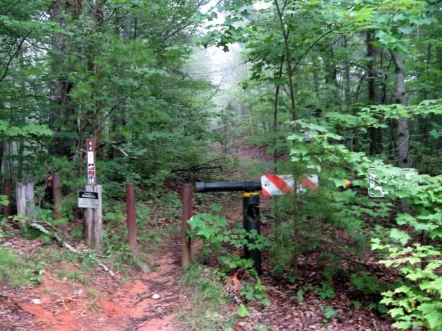
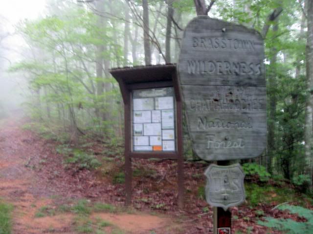
After a moderate climb of a half hour or so you come to a second gate. This marks the entrance into the Brasstown Wilderness area which continues almost all the way to the summit.
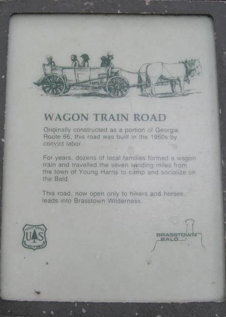
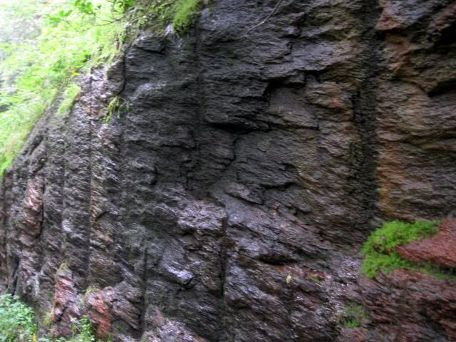
The roadbed was constructed in the 1950’s with the use of convict labor. Miles of ledge were blasted away to make the roadbed. All that work making it arguably one of the most expensive “trails” mile for mile ever built in the US.
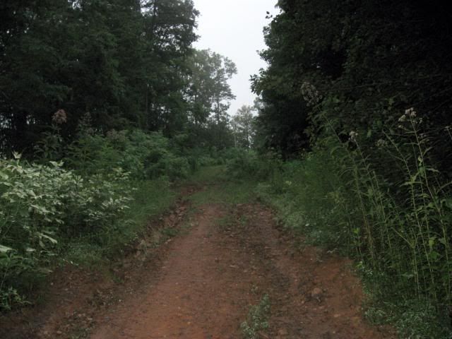
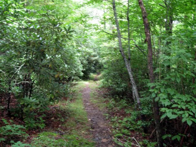
The initial unpaved roadbed was used for many years by locals who went up with wagons pulled by horses. It’s what gave the road its name. For many years the state intended to pave the road but it was never done and in the 1980s the entire area was designated as the Brasstown wilderness and the road was abandoned to all but foot traffic. The trail follows the old roadbed all the way to the summit generally following the outer edge of the roadbed. Because it is an engineered trail it just makes a steady climb up. It does not go up and down over the ridges following the path of least resistance as do the other two trails going up. There is all most no elevation loss at all on the entire hike up.
There is an expression I have seen over and over in the trail books down here. It’s “winter views.” Apparently from late fall to early spring there are many areas with great views that you just don’t get in the summer. There are, however, from time to time certain areas where you do get good views even at this time of year.
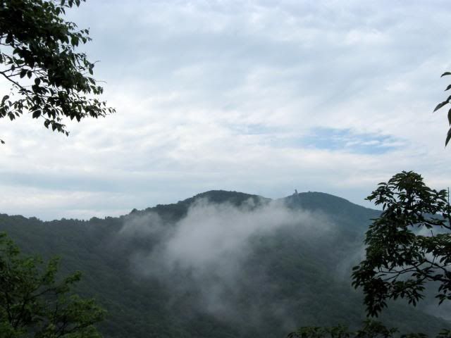
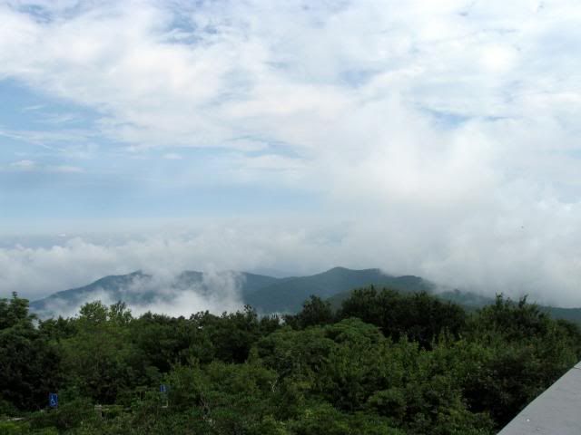
The summit, of course, does have great views.
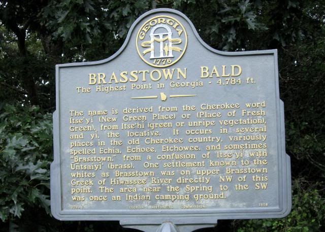
The mountain itself is also of great significance to the Cherokees. This entire area of North Georgia was once part of the Cherokee nation. Cherokee legend tells of a great flood that swept over the land. Everyone that inhabited the land died except a few Cherokee families that sought refuge in a giant canoe. The canoe ran aground at the summit of the mountain. Having no wild game to hunt and no place to plant vegetation, the Great Spirit killed all of the trees on the top of the mountain so the surviving people could plant their crops. They continued planting until the water subsided. The Cherokees referred to the place as “The New Green Place”. Early settlers misunderstood the Cherokee word and thought they were saying “The Brass Place.” From that evolved the strange name for a mountain “Brasstown Bald.”
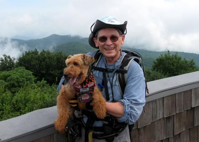
We spent about an hour at the summit, mostly talking with a ranger who was also from New England, the former dean of (I believe he said) Newberry College, then we headed back to Young Harris a 14 mile round trip.
I’ve heard that every year the graduating students at Young Harris College walk to the top. It is also said to have been the favorite trail of former Georgia Governor and US Senator Zell Miller. We’ll be back in a few months to take advantage of those winter views.
We left our Georgia home and drove north for two miles into North Carolina then turned east and drove for a number of miles until we reached the Young Harris highway. We turned south and headed back to Georgia. When we crossed the Georgia line the name of the highway changed to GA route 66. We followed that road all the way to Young Harris where route 66 now abruptly ends at the gates of Young Harris College. That drive in was of particular significance because the trail we would take would follow the roadbed of what was originally intended to be a continuation of route 66 up and over Brasstown Bald continuing on south towards Cleveland GA.

We drove up through the College campus and found the red gate that indicated the beginning of the trail and parked our car in a college parking lot.
The first part of the road is now called Bald Mt. road and while generally closed to traffic it does serve as an access road to a College broadcast antenna located higher up.

After a moderate climb of a half hour or so you come to a second gate. This marks the entrance into the Brasstown Wilderness area which continues almost all the way to the summit.


The roadbed was constructed in the 1950’s with the use of convict labor. Miles of ledge were blasted away to make the roadbed. All that work making it arguably one of the most expensive “trails” mile for mile ever built in the US.

The initial unpaved roadbed was used for many years by locals who went up with wagons pulled by horses. It’s what gave the road its name. For many years the state intended to pave the road but it was never done and in the 1980s the entire area was designated as the Brasstown wilderness and the road was abandoned to all but foot traffic. The trail follows the old roadbed all the way to the summit generally following the outer edge of the roadbed. Because it is an engineered trail it just makes a steady climb up. It does not go up and down over the ridges following the path of least resistance as do the other two trails going up. There is all most no elevation loss at all on the entire hike up.

There is an expression I have seen over and over in the trail books down here. It’s “winter views.” Apparently from late fall to early spring there are many areas with great views that you just don’t get in the summer. There are, however, from time to time certain areas where you do get good views even at this time of year.

The summit, of course, does have great views.

The mountain itself is also of great significance to the Cherokees. This entire area of North Georgia was once part of the Cherokee nation. Cherokee legend tells of a great flood that swept over the land. Everyone that inhabited the land died except a few Cherokee families that sought refuge in a giant canoe. The canoe ran aground at the summit of the mountain. Having no wild game to hunt and no place to plant vegetation, the Great Spirit killed all of the trees on the top of the mountain so the surviving people could plant their crops. They continued planting until the water subsided. The Cherokees referred to the place as “The New Green Place”. Early settlers misunderstood the Cherokee word and thought they were saying “The Brass Place.” From that evolved the strange name for a mountain “Brasstown Bald.”

We spent about an hour at the summit, mostly talking with a ranger who was also from New England, the former dean of (I believe he said) Newberry College, then we headed back to Young Harris a 14 mile round trip.

I’ve heard that every year the graduating students at Young Harris College walk to the top. It is also said to have been the favorite trail of former Georgia Governor and US Senator Zell Miller. We’ll be back in a few months to take advantage of those winter views.