
Kevin Judy and Emma
Well-known member
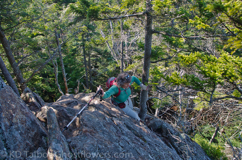
"Fairly Difficult Rock Scramble"
Sandwich Dome 3980'
Algonquin Trail/Sandwich Mountain Trail
9 Miles 2700' Elevation gain
Kevin and Judy
We decided to hike a different approach to Sandwich Dome than the trails we had previously hiked there, this time choosing the Algonquin Trail. We had waited for a good day to hike, and we got it. Ironically, it fell on Saturday, a day we no longer have to limit our hiking to, free to hike whenever we want now. So, we parked in a pull-off fifty yards down the road from the inadequate trailhead parking area and shared the trail with a few other hikers, though each encounter was a brief passing. If I had read the trail description when I picked the trail I would have had foreknowledge of what the book describes as, "steep and rough in parts, with one fairly difficult rock scramble." To say the least, I was a little intimidated by this "fairly difficult rock scramble", not the least of my worries was the thirty foot drop directly behind it if I slipped.
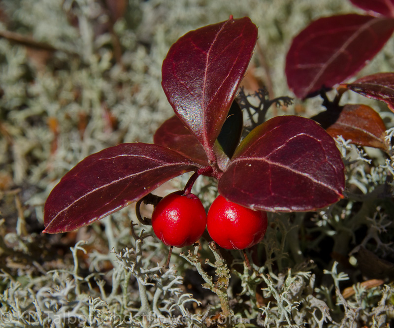
Lots of Wintergreen "Checkerberry, Teaberry" (Gaultheria procumbens) and Reindeer Lichen (Cladonia rangiferina)
No iron rungs to hold here, just a shuffle along a narrow crack in smooth ledge, where thankfully, an incredibly strong miracle of nature spruce somehow maintains a living in the same crack on the side of a small cliff out in the Sandwich Range Wilderness. With the help of this fortuitously placed small spruce we were able to scramble up the smooth ledge and away from harm, but not without a much quickened pulse. Would not like it in rain or snow, forget ice, and wouldn't bring a dog this way unless I could put it in my pack. I'm sure many dogs have survived this part of the trail, but knowing what it is like, I would not be comfortable bringing one through there now. Of the four and a half miles of trail, I would say that about a half mile, maybe a little more, is difficult in that it becomes quite steep and has several tricky rock scrambles that would be scary if icy, though the one I just described was by far the worst.
Flat Mountain Pond
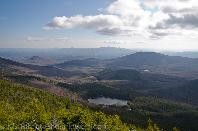
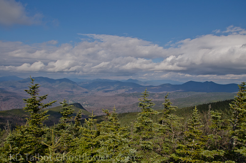
Along the rock scrambles there are several spots where we came out onto open ledge with nothing but krummholz growing around, and often it took a bit of looking to guess which way best led away and along the trail. There were some small cairns which would probably suffice in winter on these western facing, wind-blown ledges, but we discussed how difficult this area might be to find your way if snow-covered. Above the ledges we came to the junction with the Black Mountain Pond Trail. From here the trail became an easy ridge walk, though it did dip deeply into a col before the final ascent to the Sandwich Mountain Trail which it joins just below the summit. Views from Sandwich Dome were good, though some higher summits were in the clouds. Although we could see Franconia Ridge and Carrigain, Moosilauke and Washington had their heads in the clouds.
View Towards Mount Carrigain
We ate our sandwiches quickly, talking a bit to two other hikers, and we were relieved when we checked the time to see that we had plenty of it left to get back out before dark. It had seemed like a long hike in, and we had a bit of a late start, so, not that we were unprepared, but we would always prefer to be out before dark if possible, especially this time of year as the temperatures drop fast as soon as the sun begins to dip towards the horizon. The trip back went well, though neither of us looked forward to climbing back down that rock scramble, and had wished there was an alternate route, which there isn't without going miles out of the way. The scramble back down seemed much easier than coming up, and we soon had that part of the trip behind us. Before long we were back down to the first part of the trail which is much like a jeep trail and provided a nice, smooth walk back to the car, well before dark. It was a good nine miles and waiting for Saturday had given us a beautiful, Indian Summer day to make the hike. My leg felt good, I feel I'll be able to hike whatever I want to again, soon.
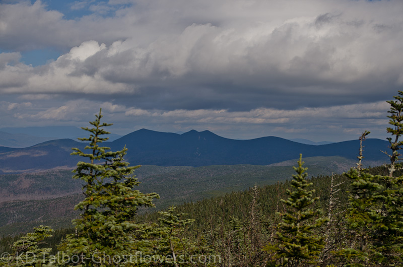
Towards the Tripyramids
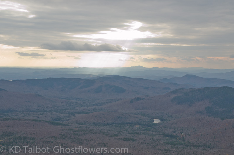
Crepuscular Rays
Complete set of pics HERE:
KDT
")