
Mudrat
Member
Disclaimer or "Avoiding Death by Slide Climbing"
Duration: 11 hours
Mileage/Elevation Gain: 11.5 miles/3,900 feet
Temps: 15-25F
Partner: NP
Link to Satellite Imagery
PHOTOGRAPHS
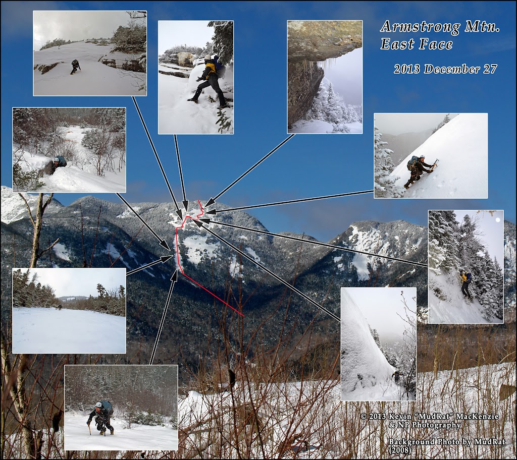
What a day we had on the 27th! I knew conditions would be a mixed bag and hoped for the best. NP picked a target we’ve been eyeing for a couple years…Armstrong’s East Face. Drew Haas’ Slide Guide collectively labels all the exposures the “Strong Arm”. Ron Konowitz, however, skied this slide track in 1993 and named it "Howard's Pleasure". I bushwhacked the nearby ledges to the north in 2009 and knew the complexity of the area. We’d begin on the southern-most slide until reaching the ‘crown’ of Armstrong where the slope increases dramatically. Multiple exposures in this area would complicate route finding if there was no way up our intended target, the southernmost headwall.
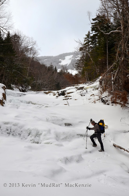
Once we crossed on to state land, we exited the trail and began the bushwhack through several inches of crusty snow to the runout from the Beaver Brook Slide.
The warm conditions during last week’s ice storm destroyed much of the snowpack. Portions of the stream were open water and the ice was thin; each of us stepped through on occasion. Let the “balling” begin! My Grivel 10’s have an anti balling plate, so it wasn’t an issue.
NP walking up the ice on a section of underlying slab in the drainage.
We followed the gully and enjoyed the stretches of ice coating the underlying slab until reaching a small (5 foot wide) brook (at 3,200 feet in elevation) entering from the left. The new streambed was steep and narrow; we followed it for about 300 of elevation gain to the slide bottom at 3,500 feet. Even in “mild” winter conditions, it had taken us 4.5 hours of steady climbing. The fun began as we stared up at the top of the headwall some 800 vertical feet higher.
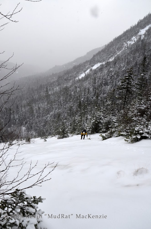
It was time to take out the ice tools, don a helmet and change into more BD Sabretooth 14-point crampons. The slide bottom was about 30-35 degrees with a thin layer of consolidated granular snow—safe easy climbing. The snowfall over the morning added about three inches of powder. Its beauty, however, added another problem to the mix; it obscured the underlying details. The consolidated snow underfoot changed to verglas with some un-iced rock thrown into the mix.
NP climbing up the middle section of the slide.
It’s a decades old exposure so alders and small pines added the occasional bit of natural protection. Gentle kicks kept the front-points firmly embedded—until they suddenly weren’t. I felt my right foot give way, fell to a knee and embedded the ax tip into ¼ inch of ice. It held me fast. I continued on to the top. NP worked his way up and said, “So you slipped, huh?!” “Yup,” I replied (Darn…he noticed, I thought! ). Thick ice is so much easier to maneuver on.
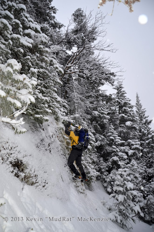
Climbing toward a gully in the headwall.
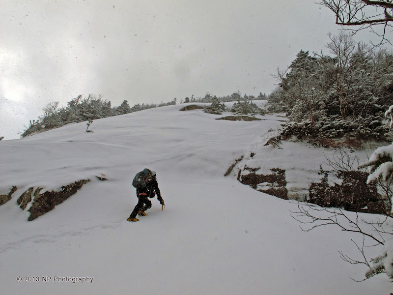
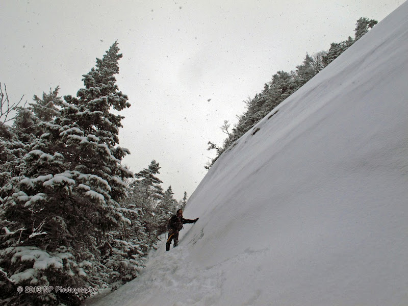
The most difficult climbing began at the steep headwall. Only its edges were climbable since the center was un-iced rock with a dusting of powder snow. The 250 foot high obstacle approached about 70 or more degrees in some sections. We were able to climb about 225 ground feet of that before choosing a safer path to the right at the base of a near vertical cliff.
The climb then became a game of making the right choices to avoid the maze of smaller slides riddling the eastern flank of the mountain. I failed to bring a reference photo, so we assessed each decision carefully so as not to box ourselves into a corner so to speak.
Up there?
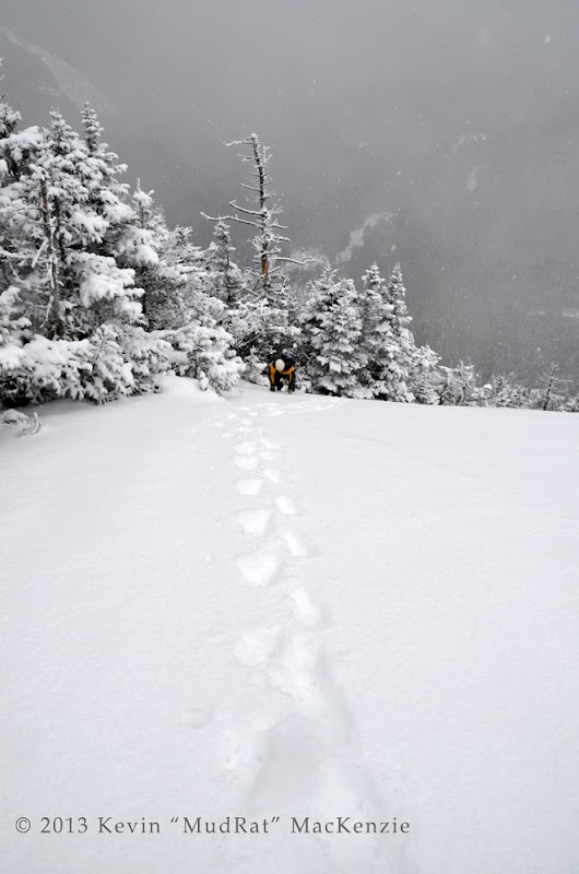
The traverse led to a tempting climb up a short section of thick vertical ice into the trees. This, in turn, led to another slide, the last exposure of the day. It was a pleasant climb up another 150 feet of elevation gain to a monstrous overhanging ledge decorated with icicles. Views of Upper Wolfjaw’s Beaver Brook and Sabre Tooth Slides were astounding--with a light breeze and weather in the upper teens we sat down to enjoy them. Above, it was a mere twenty minutes of bushwhacking through thick spruce to reach the summit. Surprisingly, we walked directly to it without intersecting the path first.
Dusk settled upon the area as we left the summit. As with most of my outings, we spent much of the descent under cover of darkness and arrived back at the parking lot at 7:30 p.m., 11 hours after starting.
NP climbing to the uppermost section of slab (reference red line in first photo).
NP on the upper slab.
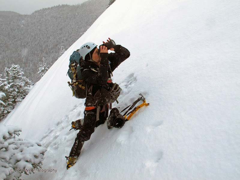
Ever the photographer.
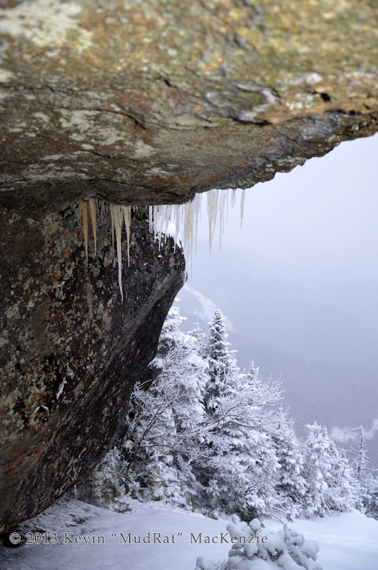
Overhang at the top.
Duration: 11 hours
Mileage/Elevation Gain: 11.5 miles/3,900 feet
Temps: 15-25F
Partner: NP
Link to Satellite Imagery
PHOTOGRAPHS
What a day we had on the 27th! I knew conditions would be a mixed bag and hoped for the best. NP picked a target we’ve been eyeing for a couple years…Armstrong’s East Face. Drew Haas’ Slide Guide collectively labels all the exposures the “Strong Arm”. Ron Konowitz, however, skied this slide track in 1993 and named it "Howard's Pleasure". I bushwhacked the nearby ledges to the north in 2009 and knew the complexity of the area. We’d begin on the southern-most slide until reaching the ‘crown’ of Armstrong where the slope increases dramatically. Multiple exposures in this area would complicate route finding if there was no way up our intended target, the southernmost headwall.
Once we crossed on to state land, we exited the trail and began the bushwhack through several inches of crusty snow to the runout from the Beaver Brook Slide.
The warm conditions during last week’s ice storm destroyed much of the snowpack. Portions of the stream were open water and the ice was thin; each of us stepped through on occasion. Let the “balling” begin! My Grivel 10’s have an anti balling plate, so it wasn’t an issue.
NP walking up the ice on a section of underlying slab in the drainage.
We followed the gully and enjoyed the stretches of ice coating the underlying slab until reaching a small (5 foot wide) brook (at 3,200 feet in elevation) entering from the left. The new streambed was steep and narrow; we followed it for about 300 of elevation gain to the slide bottom at 3,500 feet. Even in “mild” winter conditions, it had taken us 4.5 hours of steady climbing. The fun began as we stared up at the top of the headwall some 800 vertical feet higher.
It was time to take out the ice tools, don a helmet and change into more BD Sabretooth 14-point crampons. The slide bottom was about 30-35 degrees with a thin layer of consolidated granular snow—safe easy climbing. The snowfall over the morning added about three inches of powder. Its beauty, however, added another problem to the mix; it obscured the underlying details. The consolidated snow underfoot changed to verglas with some un-iced rock thrown into the mix.
NP climbing up the middle section of the slide.
It’s a decades old exposure so alders and small pines added the occasional bit of natural protection. Gentle kicks kept the front-points firmly embedded—until they suddenly weren’t. I felt my right foot give way, fell to a knee and embedded the ax tip into ¼ inch of ice. It held me fast. I continued on to the top. NP worked his way up and said, “So you slipped, huh?!” “Yup,” I replied (Darn…he noticed, I thought!
). Thick ice is so much easier to maneuver on.
Climbing toward a gully in the headwall.
The most difficult climbing began at the steep headwall. Only its edges were climbable since the center was un-iced rock with a dusting of powder snow. The 250 foot high obstacle approached about 70 or more degrees in some sections. We were able to climb about 225 ground feet of that before choosing a safer path to the right at the base of a near vertical cliff.
The climb then became a game of making the right choices to avoid the maze of smaller slides riddling the eastern flank of the mountain. I failed to bring a reference photo, so we assessed each decision carefully so as not to box ourselves into a corner so to speak.
Up there?
The traverse led to a tempting climb up a short section of thick vertical ice into the trees. This, in turn, led to another slide, the last exposure of the day. It was a pleasant climb up another 150 feet of elevation gain to a monstrous overhanging ledge decorated with icicles. Views of Upper Wolfjaw’s Beaver Brook and Sabre Tooth Slides were astounding--with a light breeze and weather in the upper teens we sat down to enjoy them. Above, it was a mere twenty minutes of bushwhacking through thick spruce to reach the summit. Surprisingly, we walked directly to it without intersecting the path first.
Dusk settled upon the area as we left the summit. As with most of my outings, we spent much of the descent under cover of darkness and arrived back at the parking lot at 7:30 p.m., 11 hours after starting.
NP climbing to the uppermost section of slab (reference red line in first photo).
NP on the upper slab.
Ever the photographer.
Overhang at the top.
Last edited: