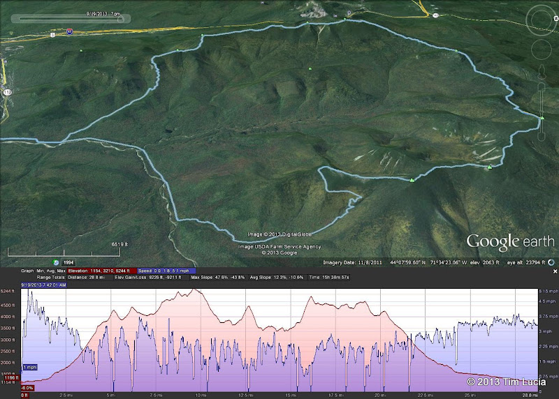
The Twin Brook trail that leaves from the hut along with the Frost Trail which goes up Galehead is a nice option for bailing out. (I used it on both of my attempts back in 2006)
Yes, dropping down from the hut to the Franconia Brook trail is a common bailout route. It's pretty well traveled so I don't think route finding would be a problem in summer. The bailout routes to the north are probably easier but you'll need a car drop.
So either trail is well traveled? Did you mean Twin Brook Dave? Now that I have a map in front of me I see that the Franconia Brook Trail actually leaves the ridge approx 2 miles before the Galehead Hut and the Twin Brook Trail actually leaves from the hut. Are there any pluses or minuses to one over the other (other than the obvious added 2 mile slog if you stick it out to the hut before throwing in the towel? Twin Brook looks quite a bit steeper leaving ridge but Franconia Brook sounds rougher, muddier and harder to follow according to AMC Guide).