Damselfly
New member
It was difficult to decide whether to approach SW Twin from the north (Twins) or the south... but after a number of folks weighed in, it was decided that we would approach SW Twin from the south / Franconia Brook Trail.
Tim Lucia, Lew Dow, Barb Audin and I met at 6am and began hiking the Lincoln Woods Trail in headlamps. As morning light approached, and as we neared one of the Camp 9 Brook beaver ponds, a female moose and her yearling came out of the pond, looked down the tunnel of trail at us, and tramped off into the woods. Moose... I almost always take that as a good omen.
Brook crossings went well... especially when Tim (who has a good 13" on me) extended his hands to help me rock hop!
We hiked a few tenths north of Red Rock Brook and took a short break before launching into the woods. (2:20 to here)
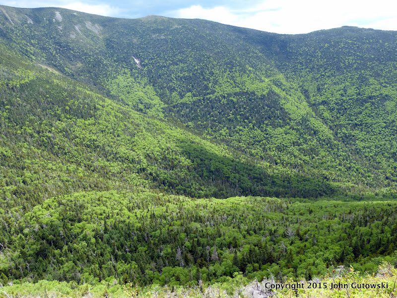
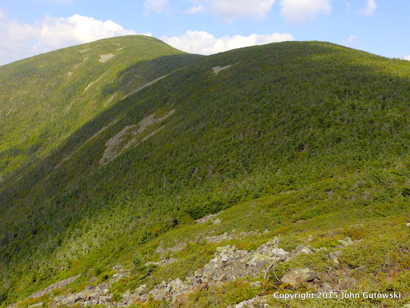
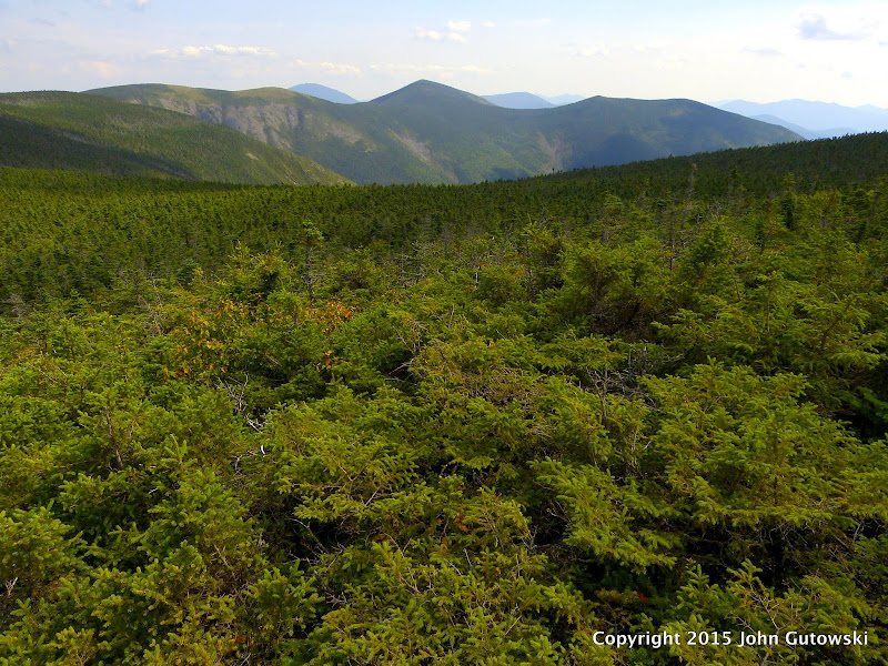
Our plan was to try to follow the spine of the ridge up to the summit. The lower third was through fairly easy / open woods. it got steep, but the woods were not hard. About 2800' we hit a tall cliff. Lew found a line up through some steep woods (Lew is good at that), and as we kicked our feet into the dirt and grabbed roots, we knew that we could not descend this way. At the top of the cliff we were happy to find a skid road, which we would use on the descent. We continued climbing. Woods contained lots of fractured rock. Sometimes the woods were easy, sometimes we "swam" through 10' spruce saplings. But progress was made. About 3900' we hit the ubiquitous and dreaded, mossy, seemingly impenetrable spruce band, complete with tangled blowdowns. Yuck. So we all got our game face on and Lew led us through the band. (This is one of those times that being short comes in handy.) Once through the tough band, we caught a glimpse of the summit cone, now only bout a 1/4 mile a way.
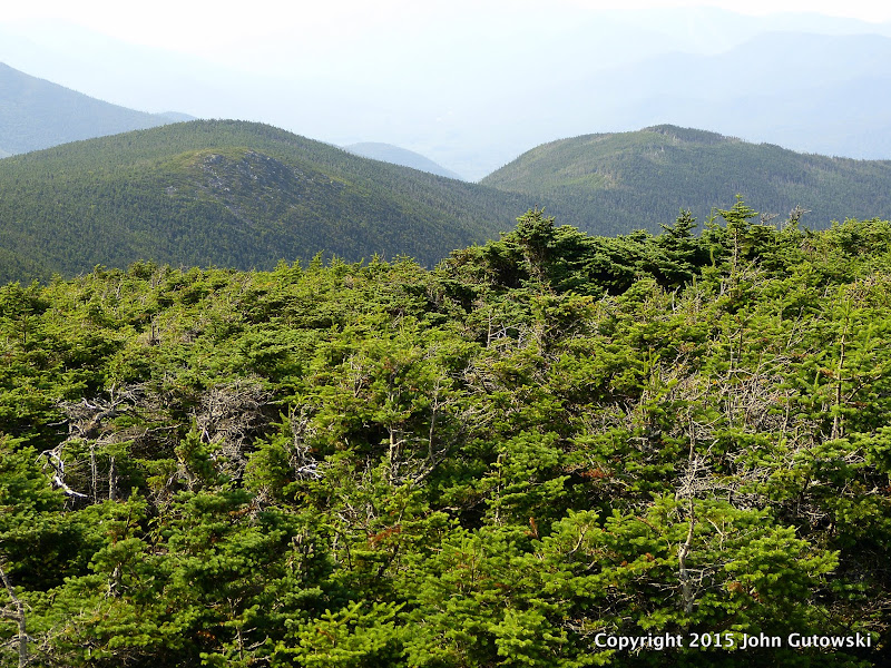
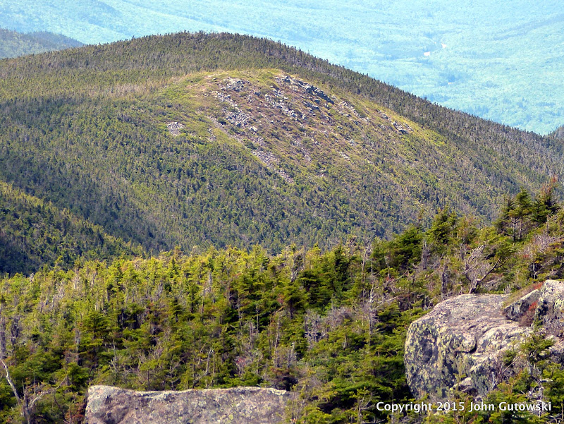
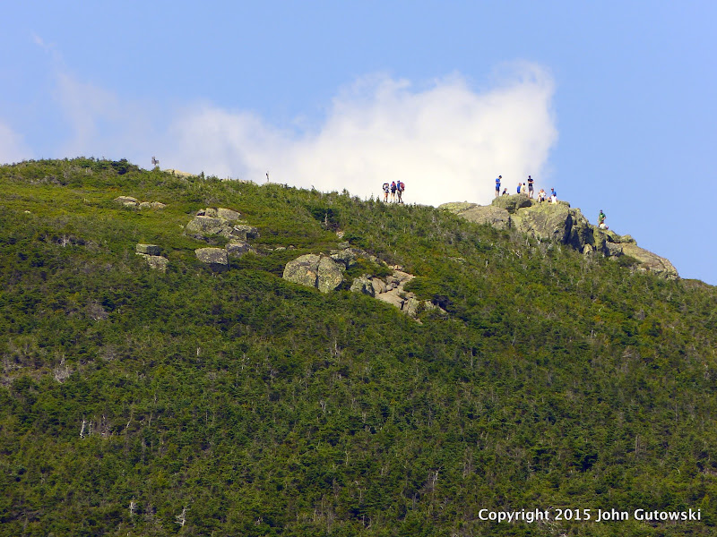
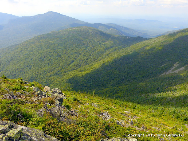
As we approached the summit, Lew found that the summit jar had fallen and rolled down hill; we re-hung it. The last visitors there were almost a year ago. There were tiny amounts of snow and ice on summit. There were some stunning views to be had of Garfield, Galehead, the Twins, Bonds.... the slides of Redrock Cirque... by standing on rocks or by being tall like Tim!")
On the descent I led us through some open woods on the west, but I took us too far off our southerly line... which I had to regain by contouring. (The open woods on the west did make me wonder if a whack up from 13 Falls Campsite might afford good woods. And certainly, folks coming from the Twins would find a good entrance to the final summit cone on the west side.)
On the way back down we came upon a skid road that paralleled our ascent line... then lost it and continued descending through steep and rocky woods. We took a break when we hit the skid road above the cliff band. The road went sloped downhill by heading north. We knew that the loggers would know what they were doing, and followed the road. It snaked us through the cliff band in elegant fashion, eventually disappearing under a rock slide. We continued downhill and hit another skid road. Eventually we crossed the old Camp 14 RR bed. And a few tenths later, we were back on the Franconia Brook Trail shaking out copious amounts of pine needles.
The bushwhack portion was about 3:15 for the ascent; :30 break to enjoy the views and re-energize; and 2:45 for the bushwhack descent.
The walk out was a walk out. Glad to be done well before needing headlamps! Tire feet. And dreams of cold beverages in the cooler.
Stats: 19.5 - 20 miles; 11.5 hours.
This was a big hike and whack... and with Good-natured hikers, great navigators, and perfect fall weather... couldn't have asked for a better day.
Beth Zimmer
Tim Lucia, Lew Dow, Barb Audin and I met at 6am and began hiking the Lincoln Woods Trail in headlamps. As morning light approached, and as we neared one of the Camp 9 Brook beaver ponds, a female moose and her yearling came out of the pond, looked down the tunnel of trail at us, and tramped off into the woods. Moose... I almost always take that as a good omen.
Brook crossings went well... especially when Tim (who has a good 13" on me) extended his hands to help me rock hop!
We hiked a few tenths north of Red Rock Brook and took a short break before launching into the woods. (2:20 to here)
Our plan was to try to follow the spine of the ridge up to the summit. The lower third was through fairly easy / open woods. it got steep, but the woods were not hard. About 2800' we hit a tall cliff. Lew found a line up through some steep woods (Lew is good at that), and as we kicked our feet into the dirt and grabbed roots, we knew that we could not descend this way. At the top of the cliff we were happy to find a skid road, which we would use on the descent. We continued climbing. Woods contained lots of fractured rock. Sometimes the woods were easy, sometimes we "swam" through 10' spruce saplings. But progress was made. About 3900' we hit the ubiquitous and dreaded, mossy, seemingly impenetrable spruce band, complete with tangled blowdowns. Yuck. So we all got our game face on and Lew led us through the band. (This is one of those times that being short comes in handy.) Once through the tough band, we caught a glimpse of the summit cone, now only bout a 1/4 mile a way.
As we approached the summit, Lew found that the summit jar had fallen and rolled down hill; we re-hung it. The last visitors there were almost a year ago. There were tiny amounts of snow and ice on summit. There were some stunning views to be had of Garfield, Galehead, the Twins, Bonds.... the slides of Redrock Cirque... by standing on rocks or by being tall like Tim!
On the descent I led us through some open woods on the west, but I took us too far off our southerly line... which I had to regain by contouring. (The open woods on the west did make me wonder if a whack up from 13 Falls Campsite might afford good woods. And certainly, folks coming from the Twins would find a good entrance to the final summit cone on the west side.)
On the way back down we came upon a skid road that paralleled our ascent line... then lost it and continued descending through steep and rocky woods. We took a break when we hit the skid road above the cliff band. The road went sloped downhill by heading north. We knew that the loggers would know what they were doing, and followed the road. It snaked us through the cliff band in elegant fashion, eventually disappearing under a rock slide. We continued downhill and hit another skid road. Eventually we crossed the old Camp 14 RR bed. And a few tenths later, we were back on the Franconia Brook Trail shaking out copious amounts of pine needles.
The bushwhack portion was about 3:15 for the ascent; :30 break to enjoy the views and re-energize; and 2:45 for the bushwhack descent.
The walk out was a walk out. Glad to be done well before needing headlamps! Tire feet. And dreams of cold beverages in the cooler.
Stats: 19.5 - 20 miles; 11.5 hours.
This was a big hike and whack... and with Good-natured hikers, great navigators, and perfect fall weather... couldn't have asked for a better day.
Beth Zimmer