I'm planning my August trip to NH and the Baldfaces are my #1 goal this year. I've actually been thinking about this one for awhile but I felt compelled to finish off the 48 4K peaks first. Finished that up in 2015 so now I guess I'll start checking out some of these attractive 3K hikes I've read so much about. I'll be around for a week so I'm going to save this one for a fair day with blue skies.
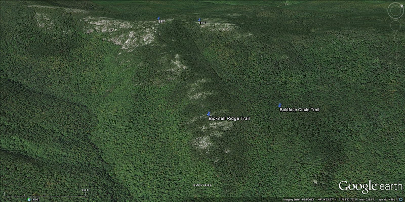
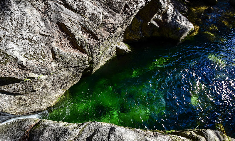
I'll be ascending via Slippery Brook Trail, not so much to avoid the ledges as simply to extend the loop to include Baldface Knob 3025' without having to backtrack. I also want to bag Eagle Crag 3030' on the other side after descending North Baldface, then backtracking a little and descending via Bicknell Ridge Trail. Someone here (JustJoe I think) recommended BRT over the Baldface Circle Trail for descent. I will also stop at the Emerald Pool on the way out to cool down. Hope its nice as the name implies. Any feedback on this route, or something I'm missing, is most welcome. I have this pegged at 11.7 miles and 3700 feet of elevation gain. Looks like a full day at my pace, especially taking photos, so I 'll try to hit the trail by 7 am.
I'll be ascending via Slippery Brook Trail, not so much to avoid the ledges as simply to extend the loop to include Baldface Knob 3025' without having to backtrack. I also want to bag Eagle Crag 3030' on the other side after descending North Baldface, then backtracking a little and descending via Bicknell Ridge Trail. Someone here (JustJoe I think) recommended BRT over the Baldface Circle Trail for descent. I will also stop at the Emerald Pool on the way out to cool down. Hope its nice as the name implies. Any feedback on this route, or something I'm missing, is most welcome. I have this pegged at 11.7 miles and 3700 feet of elevation gain. Looks like a full day at my pace, especially taking photos, so I 'll try to hit the trail by 7 am.