Gray Marcy and Skylight question

vftt.org

Help Support vftt.org:

This site may earn a commission from merchant affiliate links, including eBay, Amazon, and others.

The Sikes

Member
Joined
Sep 16, 2003
Messages
330
Reaction score
21
Location
New Boston NH
I have been reading about flooding and possible trail closings...and just wondered if anyone had or knew where to get the most updated info. Is the flooded trail officially closed and what is the best way to do these three as a day hike. Also, can you still bushwhack from Gray to Marcy? (P.S. I know it is a long day)
 
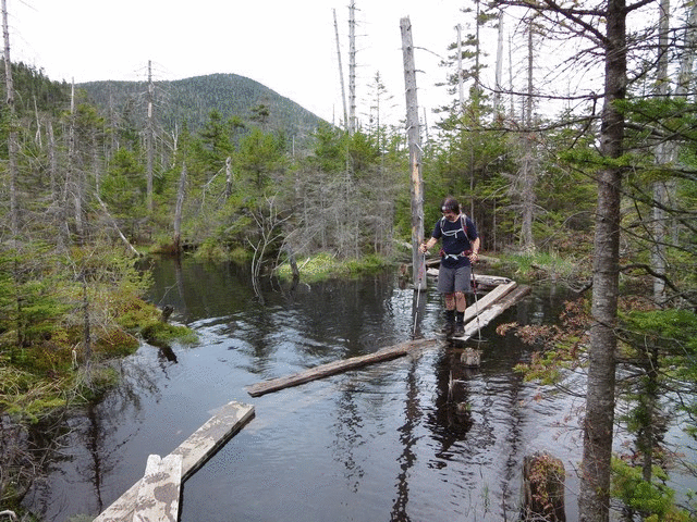
I'm guessing it's the Lake Arnold Trail to Feldspar that you are asking about? If so, it's not closed. But do expect to get wet feet, even in this dry year. And also expect to get VERY wet if you are not alert to the "flipping bridge" booby trap - one of the plank bridges there will flip over when you step on it, and dump you wholesale into deep water, if you are not very alert. (This trail follows an old route right through the middle of a deep swamp, and badly needs to be rerouted; but it is open for use.)

The bushwhack between Marcy and Gray should not be used. It's not a great route in the first place, but more importantly DEC has asked that it not be used because of the damage it causes to high elevation vegetation. There is (was?) a sign on Gray asking people not to use that route.

If you don't mind a little extra vertical, the cleanest way to do these three together is to go in and out over Marcy.

Don't be spooked by the swamp plank bridge but its as dry now as it will get. I'd go that way. The bushwhack from Gray to Marcy is effectively "closed" but isn't worth the costs anyway, both time or dermatologically speaking.
 
It's no longer like this:

WxSaQpF.gif


Trails/lean-to's/campsites/toilets/viewpoints/trail-registers/bridges/etc can be found on OpenStreetMap (OSM). FWIW, I've been updating it over the past three months.
https://www.openstreetmap.org/#map=17/44.10833/-73.93302

Caltopo's "TF Outdoors" map layer draws its information from OSM and combines it with a shaded contour map.
http://caltopo.com/map.html#ll=44.10826,-73.92638&z=16&b=oo

OpenCycleMap does the same thing but drops a few landmarks like viewpoints, trail-registers, campsites, etc.
https://www.openstreetmap.org/#map=17/44.10833/-73.93302&layers=C


Here are a few pics to whet your appetite. All begin from the Loj and ascend Marcy first via the Van Hoevenberg Trail.
MSG and out via Lake Arnold: https://www.flickr.com/photos/94811196@N08/albums/72157671319407165
MSG and back over Marcy: https://www.flickr.com/photos/94811196@N08/albums/72157659913507810
Same as above but in winter: https://1drv.ms/f/s!At2A5gDBcUN4oDBRKtTSG1KMZJEF


Have fun!
 
Last edited:
Top